Bryn yr Hyrddod

Hill, Mountain in Cardiganshire

Wales

Bryn yr Hyrddod

Moorland and drainage lines
Moorland and drainage lines Credit: David Medcalf

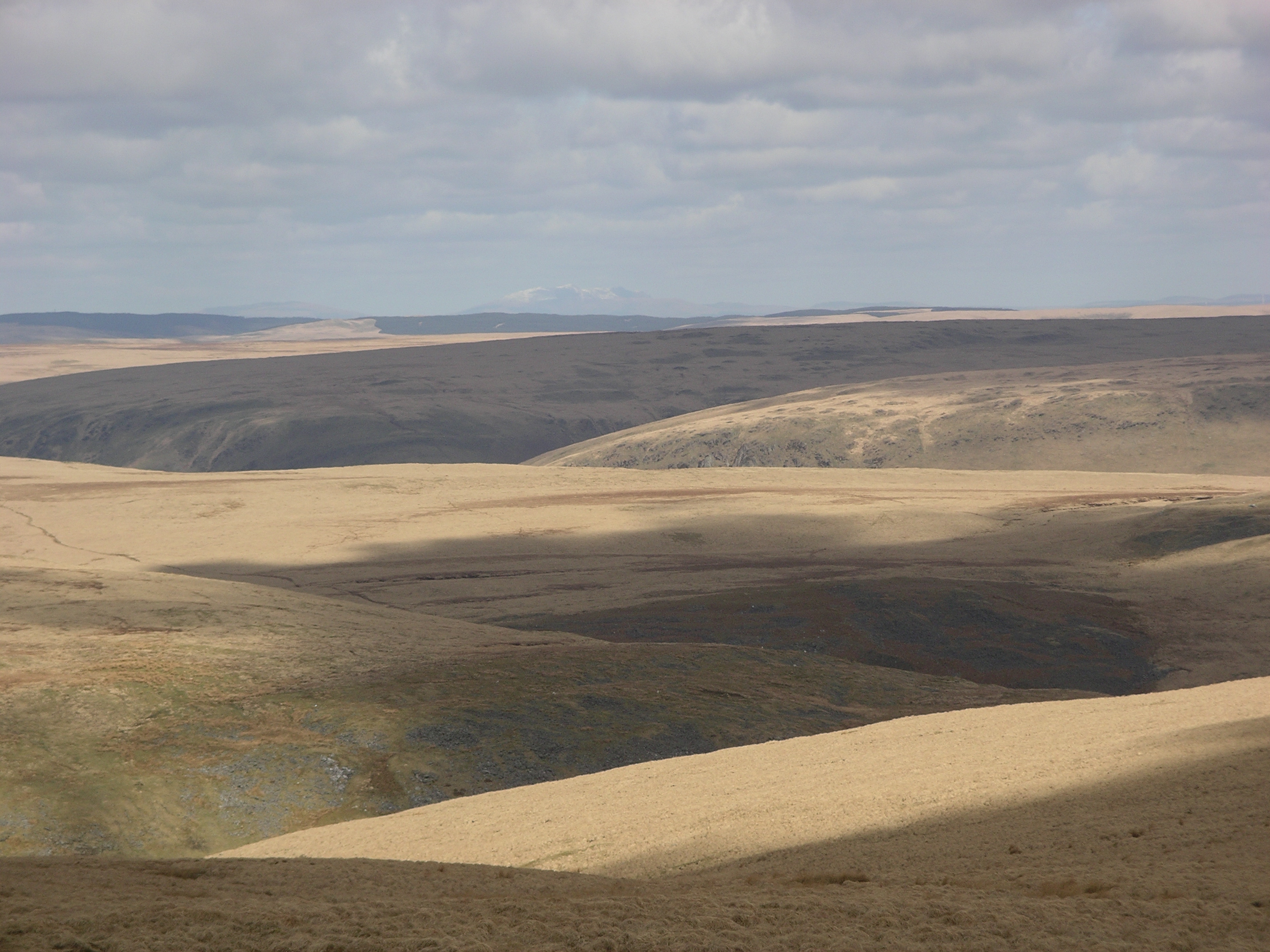
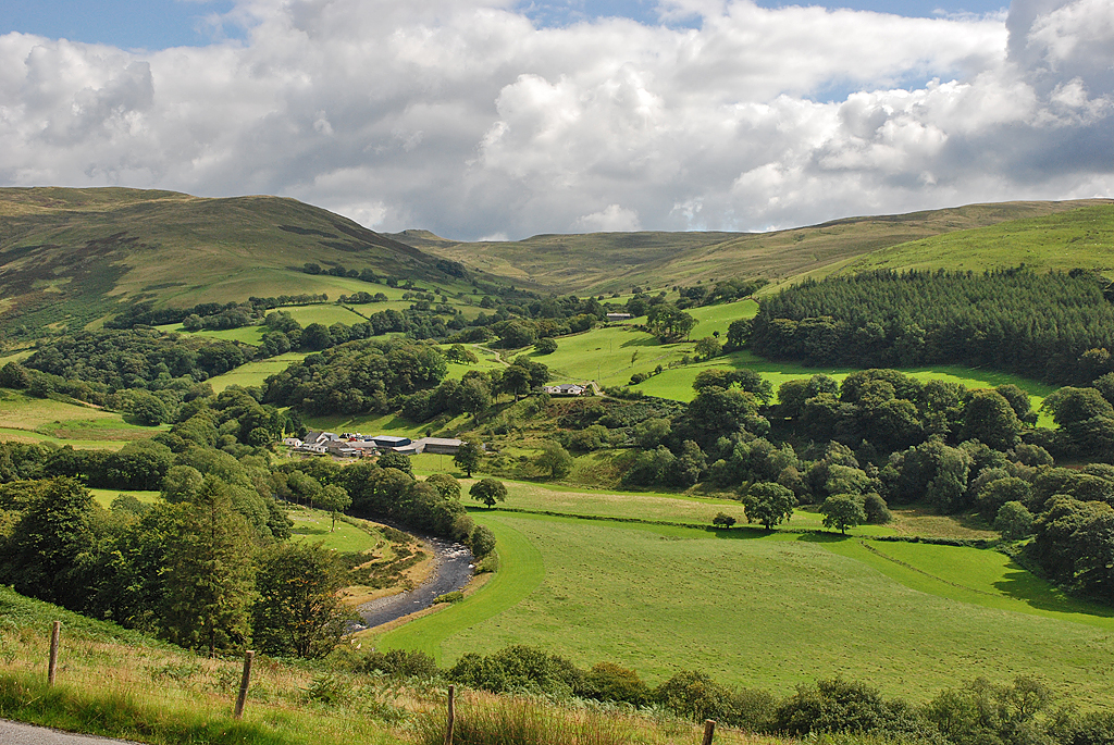
Bryn yr Hyrddod is a prominent hill located in the county of Cardiganshire, Wales. Situated in the beautiful countryside, this hill offers stunning panoramic views of the surrounding area. It is known for its picturesque landscapes and natural beauty, making it a popular destination for nature enthusiasts and hikers.

Standing at an elevation of approximately 500 meters (1,640 feet), Bryn yr Hyrddod is not only a scenic spot but also a significant landmark in the region. Its distinctive shape and sloping sides make it easily recognizable from afar. The hill is covered in lush green vegetation, including grasses, shrubs, and some trees, providing a habitat for a variety of wildlife.

The hill is accessible via several walking trails that wind their way through the countryside, allowing visitors to explore the area and enjoy the breathtaking scenery. The paths are well-maintained and suitable for both leisurely walks and more challenging hikes. Along the way, visitors may encounter streams, rock formations, and perhaps even spot some local wildlife such as birds or small mammals.

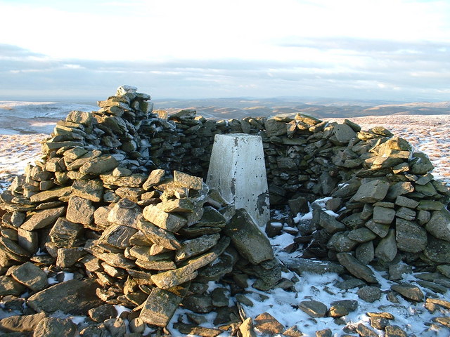
Bryn yr Hyrddod is not only a natural attraction but also holds historical and cultural significance. In the past, it was used as a meeting point for locals and served as a landmark for navigation. Today, it continues to be a place where locals and tourists alike can appreciate the beauty of the Welsh countryside and immerse themselves in its tranquility.

Overall, Bryn yr Hyrddod is a captivating hill in Cardiganshire, offering visitors a chance to connect with nature, enjoy outdoor activities, and experience the rich history and culture of the region.

If you have any feedback on the listing, please let us know in the comments section below.

Bryn yr Hyrddod Images

Images are sourced within 2km of 52.309206/-3.7448093 or Grid Reference SN8169. Thanks to Geograph Open Source API. All images are credited.

Moorland and drainage lines
The road across Banc Gorweddfa 'Gorwedd' means 'to lie down' and 'Gorweddfa' means 'a lying down place'. Perhaps an ancient staging post across the moors?
The road across Banc Gorweddfa
'Gorwedd' means 'to lie down' and 'Gorweddfa' means 'a lying down place'. Perhaps an ancient staging post across the moors?
Llyn Fyrddon Fawr Llyn Fyrddon Fawr and its outflow, high in the western Elenydd.  The lake here is contained by a rather elderly-looking low stone dam.  It's flanked on the eastern shore by the Cambrian Way, often just a line on the map in these parts but here a reasonably discernible path.
Llyn Fyrddon Fawr
Llyn Fyrddon Fawr and its outflow, high in the western Elenydd. The lake here is contained by a rather elderly-looking low stone dam. It's flanked on the eastern shore by the Cambrian Way, often just a line on the map in these parts but here a reasonably discernible path.
Ford across the Afon Claerddu in Ceredigion North-east of Llyn Egnant, this ancient road from Ffair-Rhos is sometimes referred to as the Monks' Trod, and was also used by cattle drovers in the 18th and 19th centuries. Four hundred metres ahead it splits, then the track also leads down the wide Claerddu valley towards the Claerwen Reservoir.
Ford across the Afon Claerddu in Ceredigion
North-east of Llyn Egnant, this ancient road from Ffair-Rhos is sometimes referred to as the Monks' Trod, and was also used by cattle drovers in the 18th and 19th centuries. Four hundred metres ahead it splits, then the track also leads down the wide Claerddu valley towards the Claerwen Reservoir.
A broken sign on the ground The remains of a sign which is shown fully in <a href="https://www.geograph.org.uk/photo/3968121">SN8067 : Road sign on the Monks' Trod east of Llyn Teifi, Ceredigion</a>.
A broken sign on the ground
The remains of a sign which is shown fully in SN8067 : Road sign on the Monks' Trod east of Llyn Teifi, Ceredigion.
Flooded Afon Claerddu The crossing here is marked as a ford on the map but after much rain over the last few days, it had become a major obstacle for walkers. Nothing for it but to wade across, with the water reaching knee height.
Flooded Afon Claerddu
The crossing here is marked as a ford on the map but after much rain over the last few days, it had become a major obstacle for walkers. Nothing for it but to wade across, with the water reaching knee height.
Banc Gorweddfa viewed from Craig Ddu Fach The old route known as the 'Monks' Trod' can be seen winding around the hillside. The route was used by monks travelling between Abbeys at Strata Florida in Ceredigion and Cwm Hir in Radnorshire, although it is said that the route may date from pre-Christian times. The OS has chosen not to name the route, just showing it as an 'ancient road' on the 1:50000 map. The section from here to Bryn Glas <a href="https://www.geograph.org.uk/gridref/SN80826761">SN80826761</a> appears to have no restrictions for motor vehicles, but beyond that is closed to all motors.
Banc Gorweddfa viewed from Craig Ddu Fach
The old route known as the 'Monks' Trod' can be seen winding around the hillside. The route was used by monks travelling between Abbeys at Strata Florida in Ceredigion and Cwm Hir in Radnorshire, although it is said that the route may date from pre-Christian times. The OS has chosen not to name the route, just showing it as an 'ancient road' on the 1:50000 map. The section from here to Bryn Glas SN80826761 appears to have no restrictions for motor vehicles, but beyond that is closed to all motors.
On the Monks' Trod Rounding Banc Dafadbeddol.
On the Monks' Trod
Rounding Banc Dafadbeddol.
Scraggy sheep beside the Monks' Trod Approaching sheering time but given the very cold temperatures of late, they're probably glad that they still have their winter coats!
Scraggy sheep beside the Monks' Trod
Approaching sheering time but given the very cold temperatures of late, they're probably glad that they still have their winter coats!
Road junction at Bryn Glas To the left for the continuation of the Monks' Trod across the Claerwen National Nature Reserve towards Pont ar Elan. To the right for the track to the Claerwen Reservoir and thence the public road to Rhayader. This route (to the right) was apparently open to motor vehicles when photographed in 2012, <a href="https://www.geograph.org.uk/photo/3967171">SN8067 : Junction east of Llyn Teifi, Ceredigion</a>, but that is no longer the case. Access to the Monks' Trod has been a contentious issue over the years. 

Cars and 4WD drive vehicles were banned in 1990 and then motorcycles in 2002. In 2011 there was even a ridiculous suggestion that the Trod would also be closed to pedestrians. That proposal appears to have been  abandoned. The authorities probably realised that such a ban would be totally unenforceable, particularly as the whole area is CROW land. 

What is interesting is that the road signs in 2012, and currently, imply that the access restriction across The Trod applies only to cars - the standard 'low-flying motorcycle' sign is not used, seemingly allowing motorcycles to use it. Indeed, a group of motorcycles passed me as I walked across the moor. I wonder about the legality of using a non-standard prohibition sign and the possibility of a court challenge.
Road junction at Bryn Glas
To the left for the continuation of the Monks' Trod across the Claerwen National Nature Reserve towards Pont ar Elan. To the right for the track to the Claerwen Reservoir and thence the public road to Rhayader. This route (to the right) was apparently open to motor vehicles when photographed in 2012, SN8067 : Junction east of Llyn Teifi, Ceredigion, but that is no longer the case. Access to the Monks' Trod has been a contentious issue over the years. Cars and 4WD drive vehicles were banned in 1990 and then motorcycles in 2002. In 2011 there was even a ridiculous suggestion that the Trod would also be closed to pedestrians. That proposal appears to have been abandoned. The authorities probably realised that such a ban would be totally unenforceable, particularly as the whole area is CROW land. What is interesting is that the road signs in 2012, and currently, imply that the access restriction across The Trod applies only to cars - the standard 'low-flying motorcycle' sign is not used, seemingly allowing motorcycles to use it. Indeed, a group of motorcycles passed me as I walked across the moor. I wonder about the legality of using a non-standard prohibition sign and the possibility of a court challenge.
The moors of Banc Dafadbeddol Another interesting name - 'dafad' means 'sheep' and 'bedd' means 'grave'. There is some history here.
The moors of Banc Dafadbeddol
Another interesting name - 'dafad' means 'sheep' and 'bedd' means 'grave'. There is some history here.
The valley of the Afon Claerddu
The Afon Claerddu
The Afon Claerddu
A ford on the mountain road Where the Afon Claerddu heads south across the road.
A ford on the mountain road
Where the Afon Claerddu heads south across the road.
No public vehicles beyond this point The sign is no doubt intended to deter 4x4 drivers.
No public vehicles beyond this point
The sign is no doubt intended to deter 4x4 drivers.
A road junction on the moors And another sign banning motorised vehicles.
A road junction on the moors
And another sign banning motorised vehicles.
A remote place to park a manure spreader In a shallow quarry that was probably used for road stone.  Claerwen farm is in the distance.
A remote place to park a manure spreader
In a shallow quarry that was probably used for road stone. Claerwen farm is in the distance.
NNE from the summit of Groes Bryn-llwyd A substantial lump in itself at 506m, Groes Bryn-llwyd is however just another part of the extensive boggy grassland typical of this area; hard to get to, hard to walk in any direction away from.
NNE from the summit of Groes Bryn-llwyd
A substantial lump in itself at 506m, Groes Bryn-llwyd is however just another part of the extensive boggy grassland typical of this area; hard to get to, hard to walk in any direction away from.
Show me another place!

Bryn yr Hyrddod is located at Grid Ref: SN8169 (Lat: 52.309206, Lng: -3.7448093)

Unitary Authority: Ceredigion

Police Authority: Dyfed Powys

What 3 Words

///walking.encrusted.pushing. Near Cwmystwyth, Ceredigion

Nearby Locations

Bryn yr Hyrddod

Related Wikis

Desert of Wales

The Desert of Wales, or Green Desert of Wales, is an archaic term for an area in central Wales, so called for its lack of roads and towns, and its inaccessibility...

Llan Ddu Fawr

Llan Ddu Fawr or Waun Claerddu is a hill located in Ceredigion, Wales, at 594 metres (1,949 ft) above sea level. It is located about 10 miles south of...

Banc Tynddol sun-disc

The Banc Tynddol sun-disc (Welsh: Disc Haul Banc Tynddol) is a small, decorated, gold ornament discovered at Cwmystwyth, Ceredigion, Wales. It most likely...

Cwmystwyth

Cwmystwyth (also Cwm Ystwyth, Welsh pronunciation: [kʊmˈəstʊɨθ]; English: "valley of the River Ystwyth") is a village in Ceredigion, Wales near Devil's...

Mwyngloddfa Cwmystwyth

Mwyngloddfa Cwmystwyth is a Site of Special Scientific Interest in Ceredigion, west Wales. It comprises old mine workings located in the upper Ystwyth...

Cwmystwyth Mines

Cwmystwyth mines are located in Cwmystwyth, Ceredigion, Wales and exploited a part of the Central Wales Orefield. Cwm Ystwyth is a scheduled monument,...

Elenydd

Elenydd (Welsh: [ɛˈlɛnɨð]) is an upland area of Mid Wales, extending across parts of northern and eastern Ceredigion and Powys between Aberystwyth and...

Claerwen

The Claerwen reservoir and dam in Powys, Wales, were the last additions to the Elan Valley Reservoirs system built to provide water for the increasing...

Related Videos

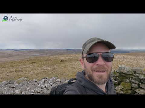
Gone Walkabout - Walk 1,000 Miles - Day Sixty-One - 474 Miles To Go - Tim Climbs A Mountain

Sixty-First day of the Walk 1000 Miles 2021 Challenge. Today's walk took me to the middle of nowhere in Wales near the little ...

13. Strata Florida Abbey. The Cambrian Way. Pontrhydfendigaid village. Llyn Egnant Llyn Fyrddon Fawr

Filmed 28th June 2021 Day Seven and Eight on the The Cambrian Way mountain trail 479 km (298 miles) with a total ascent of ...

Have you been to Bryn yr Hyrddod?

Leave your review of Bryn yr Hyrddod below (or comments, questions and feedback).