Cefn Ty'n-y-graig

Hill, Mountain in Brecknockshire

Wales

Cefn Ty'n-y-graig

The Tywi Forest The Tywi Forest above Llyn Brianne reservoir.
The Tywi Forest Credit: Philip Halling

Cefn Ty'n-y-graig is a prominent hill located in the county of Brecknockshire, Wales. It is situated in the southern part of the county, near the town of Brecon. With an elevation of approximately 456 meters (1,496 feet), it stands as an impressive landmark in the region.

The hill is characterized by its rolling slopes and rocky outcrops, which provide stunning panoramic views of the surrounding countryside. Its location within the Brecon Beacons National Park further adds to its allure, attracting hikers, nature enthusiasts, and tourists alike.

Cefn Ty'n-y-graig is known for its unique biodiversity, hosting a variety of plant and animal species. The hill is covered in lush grasslands, dotted with heather and gorse bushes, providing a habitat for numerous bird species, including the red kite, peregrine falcon, and raven. Small mammals such as rabbits, voles, and shrews can also be found in the area.

The hill offers several walking trails and paths, allowing visitors to explore its natural beauty and take in the breathtaking scenery. These routes cater to a range of abilities, from leisurely strolls to more challenging hikes. The summit of Cefn Ty'n-y-graig provides panoramic views of the surrounding mountains, valleys, and the Usk Valley.

With its natural beauty, diverse wildlife, and stunning vistas, Cefn Ty'n-y-graig is a popular destination for outdoor enthusiasts and nature lovers seeking to immerse themselves in the tranquility and splendor of the Welsh countryside.

If you have any feedback on the listing, please let us know in the comments section below.

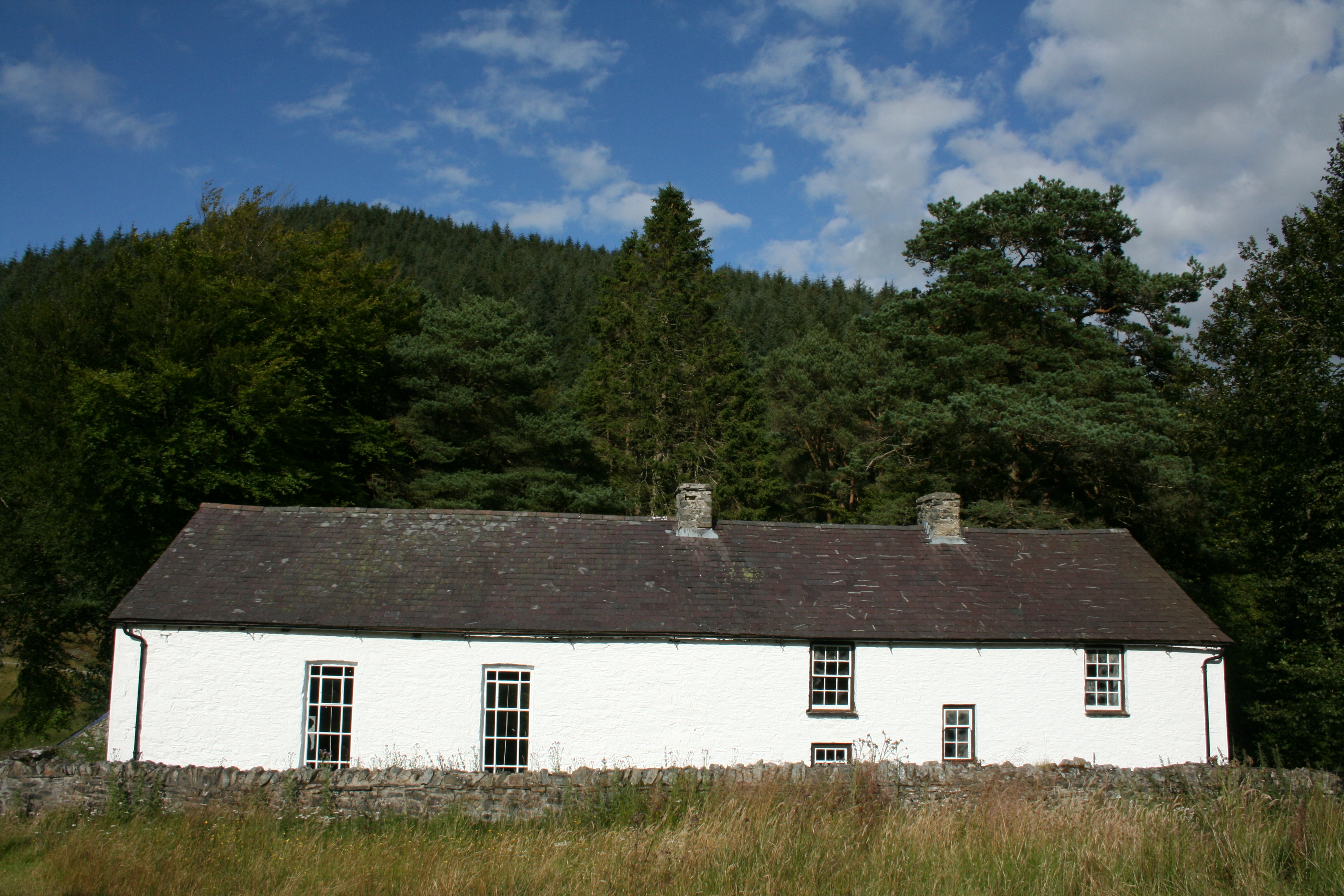
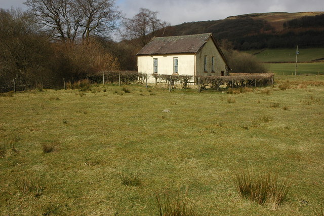
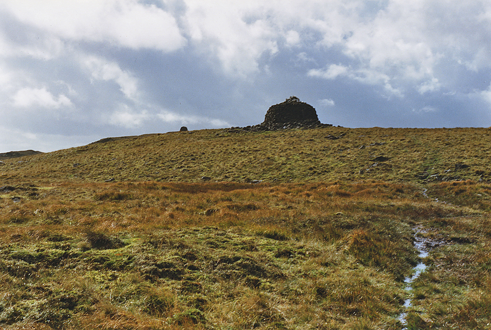
Cefn Ty'n-y-graig Images

Images are sourced within 2km of 52.158253/-3.7390882 or Grid Reference SN8152. Thanks to Geograph Open Source API. All images are credited.

The Tywi Forest The Tywi Forest above Llyn Brianne reservoir.
The Tywi Forest
The Tywi Forest above Llyn Brianne reservoir.
Low water levels As the water recedes in the upper levels of Llyn Briane after a relatively dry summer, an old foot bridge over the River Tywi, which is normally submerged is revealed once more.
Low water levels
As the water recedes in the upper levels of Llyn Briane after a relatively dry summer, an old foot bridge over the River Tywi, which is normally submerged is revealed once more.
Derelict footbridge revealed by low waters When the waters in the upper reaches of Llyn Briane reservoir are low, a small footbridge is revealed that once crossed the river Towy.   Once the foot access route to a nearby farm (possibly Fanog Farm, also submerged by the reservoir).

The bridge also marks the county boundary between Carmarthenshire and Powys.
Derelict footbridge revealed by low waters
When the waters in the upper reaches of Llyn Briane reservoir are low, a small footbridge is revealed that once crossed the river Towy. Once the foot access route to a nearby farm (possibly Fanog Farm, also submerged by the reservoir). The bridge also marks the county boundary between Carmarthenshire and Powys.
Ffarm y Fannog / Fannog Farm Completely submerged when the Llyn Brianne Reservoir was constructed in the early 1970s, this old farm building can now rarely be seen unless in times of drought.  Some people who were there when I visited told me they visited during the 1976 drought and the roof was still in place then and you could walk in - but it had only been submerged for a year or so then.  The reservoir has since had 1 metre added to its wall and takes a lot longer to drop even to this level.

Its upper structures occasionally make an appearance during low water levels, but rarely this much of the building can be observed.

The sawn off tree stumps in the foreground were trees that were cut down shortly before the original flooding of the valley.
Ffarm y Fannog / Fannog Farm
Completely submerged when the Llyn Brianne Reservoir was constructed in the early 1970s, this old farm building can now rarely be seen unless in times of drought. Some people who were there when I visited told me they visited during the 1976 drought and the roof was still in place then and you could walk in - but it had only been submerged for a year or so then. The reservoir has since had 1 metre added to its wall and takes a lot longer to drop even to this level. Its upper structures occasionally make an appearance during low water levels, but rarely this much of the building can be observed. The sawn off tree stumps in the foreground were trees that were cut down shortly before the original flooding of the valley.
Lost farm briefly rediscovered Ffarm Y Fannog (Fannog farm) was lost during the flooding of the Llyn Brianne reservoir in the early 1970s and has only made brief appearances since - usually just the very top of the upper floor and very rarely as much as this has been revealed by drought levels.

The island in the background is also usually submerged and doesn't appear on any maps.
Lost farm briefly rediscovered
Ffarm Y Fannog (Fannog farm) was lost during the flooding of the Llyn Brianne reservoir in the early 1970s and has only made brief appearances since - usually just the very top of the upper floor and very rarely as much as this has been revealed by drought levels. The island in the background is also usually submerged and doesn't appear on any maps.
Submerged bridge revealed once again Almost always now submerged in the upper reaches of the Llyn Brianne reservoir, this small footbridge and the underlying river bed's path have once again been revealed by very low drought levels of the reservoir.   Note that the iron hand rails are now in an advanced state of rust, but the concrete floor and pillars are still in good condition.
Submerged bridge revealed once again
Almost always now submerged in the upper reaches of the Llyn Brianne reservoir, this small footbridge and the underlying river bed's path have once again been revealed by very low drought levels of the reservoir. Note that the iron hand rails are now in an advanced state of rust, but the concrete floor and pillars are still in good condition.
Bridge and river structure revealed by drought Taken just over a year after <a href="https://www.geograph.org.uk/photo/7088196">SN8052 : Derelict footbridge revealed by low waters</a>, you can see how much the water level has dropped even further here in the upper reaches of the Llyn Brianne reservoir - indeed, back then the backwaters of the reservoir reached here and the bridge wasn't accessible by foot. However, it's now temporarily no longer a reservoir here with the original river being revealed for the first time in many years along with the small foot bridge seen in <a href="https://www.geograph.org.uk/photo/7293649">SN8052 : Submerged bridge revealed once again</a>, which can now be visited and crossed for the first time since 1984.
Bridge and river structure revealed by drought
Taken just over a year after SN8052 : Derelict footbridge revealed by low waters, you can see how much the water level has dropped even further here in the upper reaches of the Llyn Brianne reservoir - indeed, back then the backwaters of the reservoir reached here and the bridge wasn't accessible by foot. However, it's now temporarily no longer a reservoir here with the original river being revealed for the first time in many years along with the small foot bridge seen in SN8052 : Submerged bridge revealed once again, which can now be visited and crossed for the first time since 1984.
Inside the submerged farmhouse Fferm Y Fannog (Fannog Farm) was submerged in the early 1970s when Llyn Brianne reservoir was created, sinking most of the upper Towy valley, a small footbridge and this farm house under its watery, inevitable death-grip.

In current drought conditions, you can now see inside once again...  Gone is the roof as with all other non-stone structures such as interior walls and the floor for the upper level, revealing both the upper bedroom fireplace and the ground level large fire range from its original kitchen area.
Inside the submerged farmhouse
Fferm Y Fannog (Fannog Farm) was submerged in the early 1970s when Llyn Brianne reservoir was created, sinking most of the upper Towy valley, a small footbridge and this farm house under its watery, inevitable death-grip. In current drought conditions, you can now see inside once again... Gone is the roof as with all other non-stone structures such as interior walls and the floor for the upper level, revealing both the upper bedroom fireplace and the ground level large fire range from its original kitchen area.
A small waterfall now visible for the first time in decades Taken off a small foot bridge that was submerged when Llyn Brianne reservoir was built in the early '70s - the river bed of the river Towy here has rarely been observed for many decades now (last seen in 1984) but this year's drought conditions have changed that - and for a small time period at least, this small waterfall and upper river's eroded rock structures can once more be observed (until rain once more submerges this tranquil water bed under at least 5 metres of water, as can be seen by the higher banks on each side).
A small waterfall now visible for the first time in decades
Taken off a small foot bridge that was submerged when Llyn Brianne reservoir was built in the early '70s - the river bed of the river Towy here has rarely been observed for many decades now (last seen in 1984) but this year's drought conditions have changed that - and for a small time period at least, this small waterfall and upper river's eroded rock structures can once more be observed (until rain once more submerges this tranquil water bed under at least 5 metres of water, as can be seen by the higher banks on each side).
Riverbed off forgotten bridge The bridge was submerged in the early '70s when the Llyn Brianne reservoir was created.

Now in 2022 you can see the course of the original Towy river and the sad state of the bridge's rusted out handrails (after about 4 decades of being under water)!
Riverbed off forgotten bridge
The bridge was submerged in the early '70s when the Llyn Brianne reservoir was created. Now in 2022 you can see the course of the original Towy river and the sad state of the bridge's rusted out handrails (after about 4 decades of being under water)!
Llyn Brianne Reservoir View across the Afon Tywi towards the Tywi Forest.
Llyn Brianne Reservoir
View across the Afon Tywi towards the Tywi Forest.
Mackerel sky above Llyn Brianne
A band of altocumulus over Llyn Brianne
Old bridge over Afon Tywi The bridge is usually submerged by the reservoir but is here exposed during the drought of 2022.
Old bridge over Afon Tywi
The bridge is usually submerged by the reservoir but is here exposed during the drought of 2022.
Water flow monitoring station
Much needed rain approaching Llyn Brianne
Esgair Ganol and Esgair Gors View up and across the upper Tywi valley.
Esgair Ganol and Esgair Gors
View up and across the upper Tywi valley.
Cwm Camddwr Cwm Camddwr above Llyn Brianne reservoir.
Cwm Camddwr
Cwm Camddwr above Llyn Brianne reservoir.
Show me another place!

Cefn Ty'n-y-graig is located at Grid Ref: SN8152 (Lat: 52.158253, Lng: -3.7390882)

Unitary Authority: Powys

Police Authority: Dyfed Powys

What 3 Words

///piano.enforced.sideboard. Near Abergwesyn, Powys

Nearby Locations

Cefn Ty'n-y-graig

Related Wikis

Soar y mynydd

Soar-y-mynydd or Soar y mynydd is a Calvinist Methodist chapel near the eastern extremity of the large parish of Llanddewi Brefi, Ceredigion. It is claimed...

Llyn Brianne

Llyn Brianne is a man-made lake or reservoir in the headwaters of the River Towy in Wales. == Construction == The reservoir was constructed by Wimpey Construction...

Nant Irfon National Nature Reserve

Nant Irfon National Nature Reserve is a national nature reserve located high in the hills above the Afon Irfon valley near the village of Abergwesyn in...

Vicarage Meadows

Vicarage Meadows is a Site of Special Scientific Interest near Abergwesyn, Powys, Wales. The 3.6 hectares (8.9 acres) site, located close to the Nant Irfon...

Abergwesyn

Abergwesyn is a village in the Welsh county of Powys, in mid-Wales, at the start of the Abergwesyn valley and at the confluence of the Afon Irfon and the...

Camddwr

For the tributary of the River Wye, see Camddwr, Wye and for the tributary of the River Teifi, see Camddwr, Teifi.The Camddwr is a significant right-bank...

Llanwrtyd

Llanwrtyd is a small settlement in Powys, mid-Wales, giving its name to a community, in the historic county of Brecknockshire (Breconshire), through which...

Drygarn Fawr

Drygarn Fawr is a mountain in the county of Powys, Wales. It is one of the highest summits in Mid Wales at 645 metres (2,116 ft) above sea level. It lies...

Have you been to Cefn Ty'n-y-graig?

Leave your review of Cefn Ty'n-y-graig below (or comments, questions and feedback).