Bads Knowe

Hill, Mountain in Kirkcudbrightshire

Scotland

Bads Knowe

Covenanters' Monument The Covenanters' Monument on Bads Knowe.
This photo was taken on the 10th.September,2022.
Covenanters' Monument Credit: Rab McMurdo

Bads Knowe is a prominent hill located in Kirkcudbrightshire, a historical county in the southwest of Scotland. Standing at a height of approximately 286 meters (938 feet), it offers stunning panoramic views of the surrounding countryside.

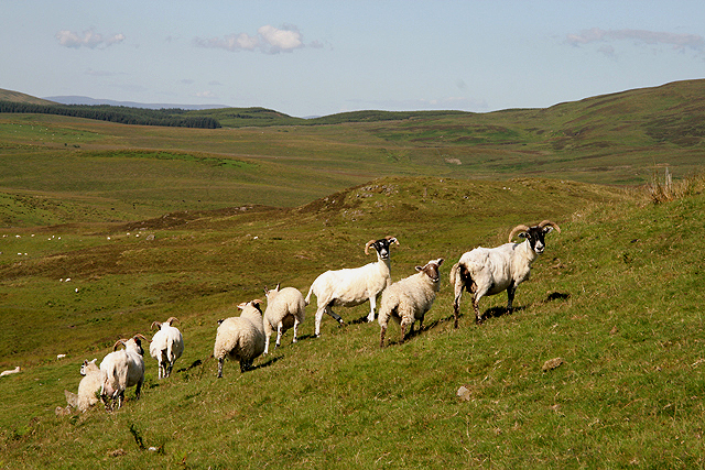
The hill is characterized by its gentle slopes covered in a patchwork of vibrant green grass and heather, which blooms with purple flowers during the summer months. Bads Knowe is primarily composed of granite, giving it a rugged and weathered appearance.

The area surrounding the hill is rich in flora and fauna, making it a popular spot for nature enthusiasts and hikers. It is home to a variety of bird species, including buzzards, kestrels, and peregrine falcons, which can often be spotted soaring overhead. Wildflowers such as primroses and bluebells dot the landscape, adding bursts of color to the scenery.

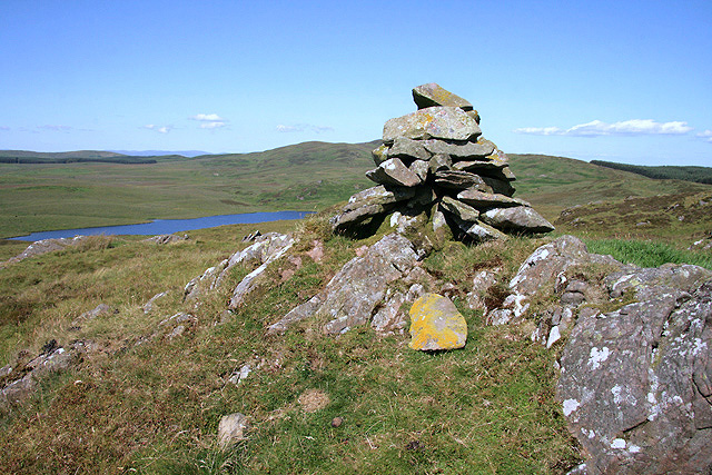
At the summit of Bads Knowe, visitors are rewarded with breathtaking views of the surrounding countryside. On a clear day, the Solway Firth and the Galloway Hills can be seen in the distance, creating a picturesque backdrop. The hill is also known for its panoramic view of Kirkcudbright, a charming town nestled on the banks of the River Dee.

Overall, Bads Knowe offers a serene and picturesque setting for outdoor enthusiasts, providing both a challenging hike and a tranquil escape into nature.

If you have any feedback on the listing, please let us know in the comments section below.

Bads Knowe Images

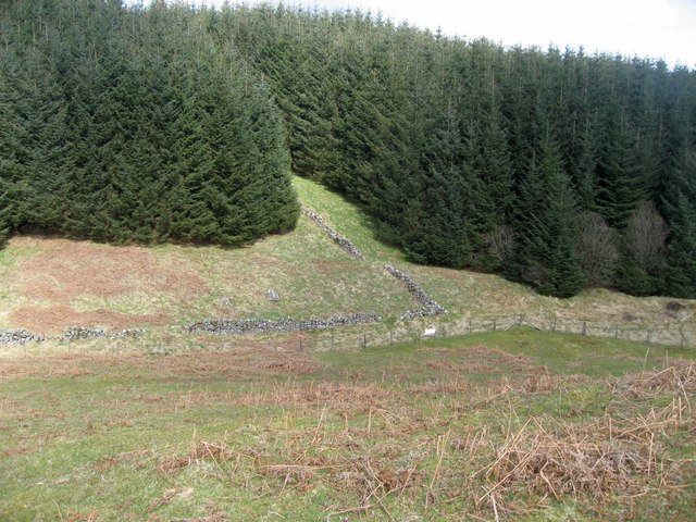
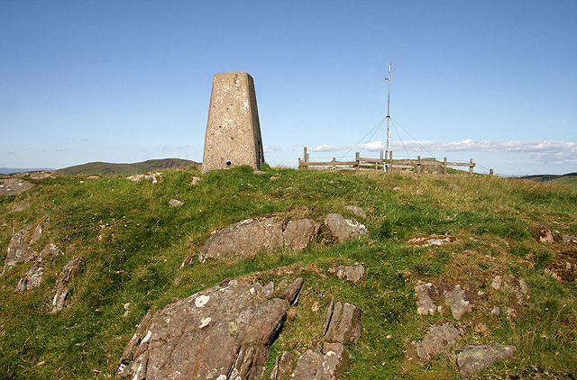
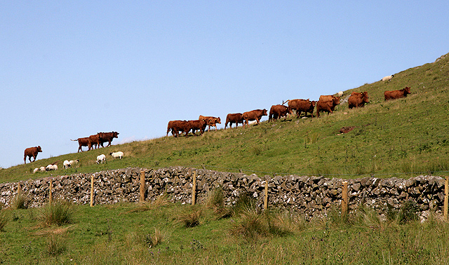
Images are sourced within 2km of 55.055916/-3.8643804 or Grid Reference NX8175. Thanks to Geograph Open Source API. All images are credited.

Covenanters' Monument The Covenanters' Monument on Bads Knowe.
This photo was taken on the 10th.September,2022.
Covenanters' Monument
The Covenanters' Monument on Bads Knowe. This photo was taken on the 10th.September,2022.
Covenanters' Grave The Covenanters' grave near Bads Knowe.
This photo was taken on the 10th September 2022.
Covenanters' Grave
The Covenanters' grave near Bads Knowe. This photo was taken on the 10th September 2022.
Small Lochan near Glenkiln A small overgrown man-made lochan near Glenkiln.
Small Lochan near Glenkiln
A small overgrown man-made lochan near Glenkiln.
Ruined Wall A ruined drystone wall disappearing into forestry.
Ruined Wall
A ruined drystone wall disappearing into forestry.
Forest Road
Forest Road
Yonder Lie The view from the Martyrs' monument <a href="https://www.geograph.org.uk/photo/797253">NX8175 : Larg Hill Martyrs' Monument Inscription</a> to their tomb <a href="https://www.geograph.org.uk/photo/797211">NX8175 : Bads Knowe: Martyrs' Tomb and Monument</a>.  The tomb is in the walled enclosure just visible in the distance in the centre of the photo.
Yonder Lie
The view from the Martyrs' monument NX8175 : Larg Hill Martyrs' Monument Inscription to their tomb NX8175 : Bads Knowe: Martyrs' Tomb and Monument. The tomb is in the walled enclosure just visible in the distance in the centre of the photo.
Entrance to Craigadam Woodlands
A cairn overlooking Lochenkit Loch This small cairn is to the north of Milharay Hill. Lochenkit Loch Reservoir is in the background to the left.
A cairn overlooking Lochenkit Loch
This small cairn is to the north of Milharay Hill. Lochenkit Loch Reservoir is in the background to the left.
The triangulation pillar on Milharay Hill Trig point S7975 is at 296m with an automatic weather station nearby.
The triangulation pillar on Milharay Hill
Trig point S7975 is at 296m with an automatic weather station nearby.
Cattle at Maiden's Craig Sheep also occupy this hill farming area.
Cattle at Maiden's Craig
Sheep also occupy this hill farming area.
Sheep at Maiden's Craig This hill farming area is grazed by sheep and cattle.
Sheep at Maiden's Craig
This hill farming area is grazed by sheep and cattle.
Memorial Inscription in "Kings Chair" The inscription in the "Kings Chair". 
The motto is "I dare" and the inscription:
Adam Gray Dalziel 1910 - 1961

Adam is apparently buried in Tinwald Churchyard <span class="nowrap"><a title="http://homepages.rootsweb.ancestry.com/~scottish/indextinwaldchrh.html" rel="nofollow ugc noopener" href="http://homepages.rootsweb.ancestry.com/~scottish/indextinwaldchrh.html">Link</a><img style="margin-left:2px;" alt="External link" title="External link - shift click to open in new window" src="https://s1.geograph.org.uk/img/external.png" width="10" height="10"/></span>
Memorial Inscription in "Kings Chair"
The inscription in the "Kings Chair". The motto is "I dare" and the inscription: Adam Gray Dalziel 1910 - 1961 Adam is apparently buried in Tinwald Churchyard LinkExternal link
Kings Chair Kings Chair memorial. It offers a seat and a magnificent outlook. The inscription is shown in <a href="https://www.geograph.org.uk/photo/2900283">NX7973 : Memorial Inscription in "Kings Chair"</a>
Kings Chair
Kings Chair memorial. It offers a seat and a magnificent outlook. The inscription is shown in NX7973 : Memorial Inscription in "Kings Chair"
Burn which passes under the road to Lochenkit water treatment works
Lochenkit Water Treatment Works
Field of sheep with Lochenkit Loch in the distance
Grazing land near Lochenkit
Edge of the forest
Edge of the forest
Show me another place!

Bads Knowe is located at Grid Ref: NX8175 (Lat: 55.055916, Lng: -3.8643804)

Unitary Authority: Dumfries and Galloway

Police Authority: Dumfries and Galloway

What 3 Words

///segregate.footsteps.dispensed. Near Castle Douglas, Dumfries & Galloway

Nearby Locations

Bads Knowe

Related Wikis

Crocketford

Crocketford (/ˈkrɒkɪtfɔːd/, also frequently /ˈkrɒkɪtfəd/) also known as Ninemile Bar (Scottish Gaelic: Ath Crogaid), as it is approximately equidistant...

Glenkiln Sculpture Park

Glenkiln Sculpture Park was a sculpture landscape in the historic county of Kirkcudbrightshire in Dumfries and Galloway, south-west Scotland. After one...

Milton Loch

Milton Loch is an alkaline freshwater loch located in Dumfries and Galloway, Scotland. In the loch and nearby are archaeological sites including three...

Springholm

Springholm is a village in the historical county of Kirkcudbrightshire in Dumfries and Galloway, Scotland. It is located 14 miles (23 km) west of Dumfries...

Nearby Amenities

Located within 500m of 55.055916,-3.8643804
Martyr's Monument
Historic: monument
Lat/Long: 55.0559463/-3.8643394
Grave Yard
Religion: martyr's_grave
Lat/Long: 55.0569495/-3.8618326
The data included in this document is from www.openstreetmap.org. The data is made available under ODbL.

Have you been to Bads Knowe?

Leave your review of Bads Knowe below (or comments, questions and feedback).