Tod Fell
Hill, Mountain in Kirkcudbrightshire
Scotland
Tod Fell

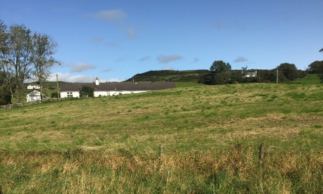
Tod Fell is a prominent hill situated in the region of Kirkcudbrightshire, Scotland. It is known for its picturesque landscape and breathtaking views, attracting both locals and tourists alike. With an elevation of approximately 450 meters (1,476 feet), it stands as one of the notable peaks in the area.
The hill is characterized by its gentle slopes and lush greenery, making it an ideal spot for outdoor enthusiasts and nature lovers. Hikers and walkers often flock to Tod Fell to explore its well-maintained trails, which offer a range of difficulty levels suitable for all abilities. The paths meander through heather-covered moorlands and dense forests, providing a diverse and captivating experience.
At the summit of Tod Fell, visitors are rewarded with panoramic vistas that extend across Kirkcudbrightshire and beyond. On clear days, one can admire the stunning views of the surrounding landscapes, including the rolling hills, sparkling lochs, and charming villages that dot the region. The serene atmosphere at the top offers a peaceful retreat from the hustle and bustle of everyday life.
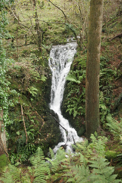
Tod Fell is also home to a variety of plant and animal species, adding to its natural charm. Birdwatchers can spot a range of avian species, including peregrine falcons, buzzards, and red kites. The hill's rich biodiversity makes it an important ecological site within Kirkcudbrightshire.
Overall, Tod Fell is a captivating destination that combines natural beauty, outdoor recreation, and wildlife observation. Whether seeking a challenging hike or simply a serene escape, this hill offers an unforgettable experience for all who venture to its summit.
If you have any feedback on the listing, please let us know in the comments section below.
Tod Fell Images
Images are sourced within 2km of 54.915899/-3.8822081 or Grid Reference NX7959. Thanks to Geograph Open Source API. All images are credited.


Tod Fell is located at Grid Ref: NX7959 (Lat: 54.915899, Lng: -3.8822081)
Unitary Authority: Dumfries and Galloway
Police Authority: Dumfries and Galloway
What 3 Words
///reverses.refuses.finely. Near Castle Douglas, Dumfries & Galloway
Nearby Locations
Related Wikis

Gelston Castle
Gelston Castle, located near Castle Douglas in Kirkcudbrightshire in Dumfries and Galloway, Scotland, was built by Sir William Douglas of Castle Douglas...

Buittle Bridge
Buittle Bridge, also known as Craignair Bridge is a bridge over the Urr Water just outside Dalbeattie in Dumfries and Galloway, Scotland. Completed in...

Buittle
Buittle is an ecclesiastical and civil parish in Dumfries and Galloway, southwest Scotland, in the traditional county of Kirkcudbrightshire. It lies to...

Buittle Castle
Buittle Castle, also known historically as Botle or Botel Castle, is a Motte and Bailey site in Galloway, south-west Scotland with significant early and...

Carlingwark Loch
Carlingwark Loch is a small freshwater loch in the historical county of Kirkcudbrightshire, Dumfries and Galloway, Scotland lying just south of Castle...

Palnackie
Palnackie is a village in the parish of Buittle in the historical county of Kirkcudbrightshire in Dumfries and Galloway, Scotland. It has a population...

Castle Douglas Hospital
Castle Douglas Hospital is a health facility in Academy Street, Castle Douglas, Dumfries and Galloway, Scotland. It is managed by NHS Dumfries and Galloway...

Dalbeattie High School
Dalbeattie High School is a small rural secondary school on the edge of Dalbeattie in the historical county of Kirkcudbrightshire in the local council...
Nearby Amenities
Located within 500m of 54.915899,-3.8822081Have you been to Tod Fell?
Leave your review of Tod Fell below (or comments, questions and feedback).