Bryn Dafydd

Hill, Mountain in Cardiganshire

Wales

Bryn Dafydd

Snow-dusted Domen Milwyn Domen Milwyn is a small but distinctive hill which hardly stands out on the map, but nevertheless is instantly recognisable when seen from the Cwm Ystwyth side. Here it shows the first dusting of snow of the coming winter.
Snow-dusted Domen Milwyn Credit: Nigel Brown

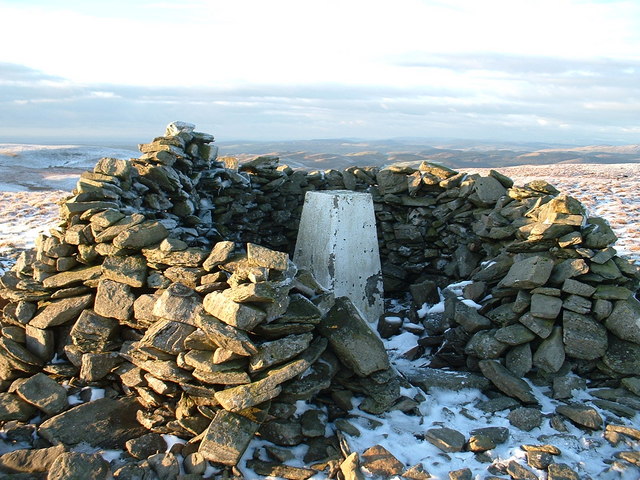
Bryn Dafydd is a prominent hill/mountain located in the county of Cardiganshire in Wales, United Kingdom. Standing at an elevation of approximately 1,325 feet (404 meters), it offers breathtaking panoramic views of the surrounding countryside.

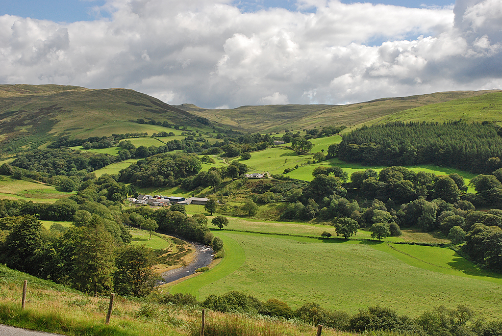
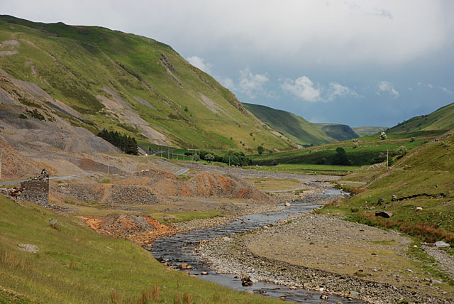
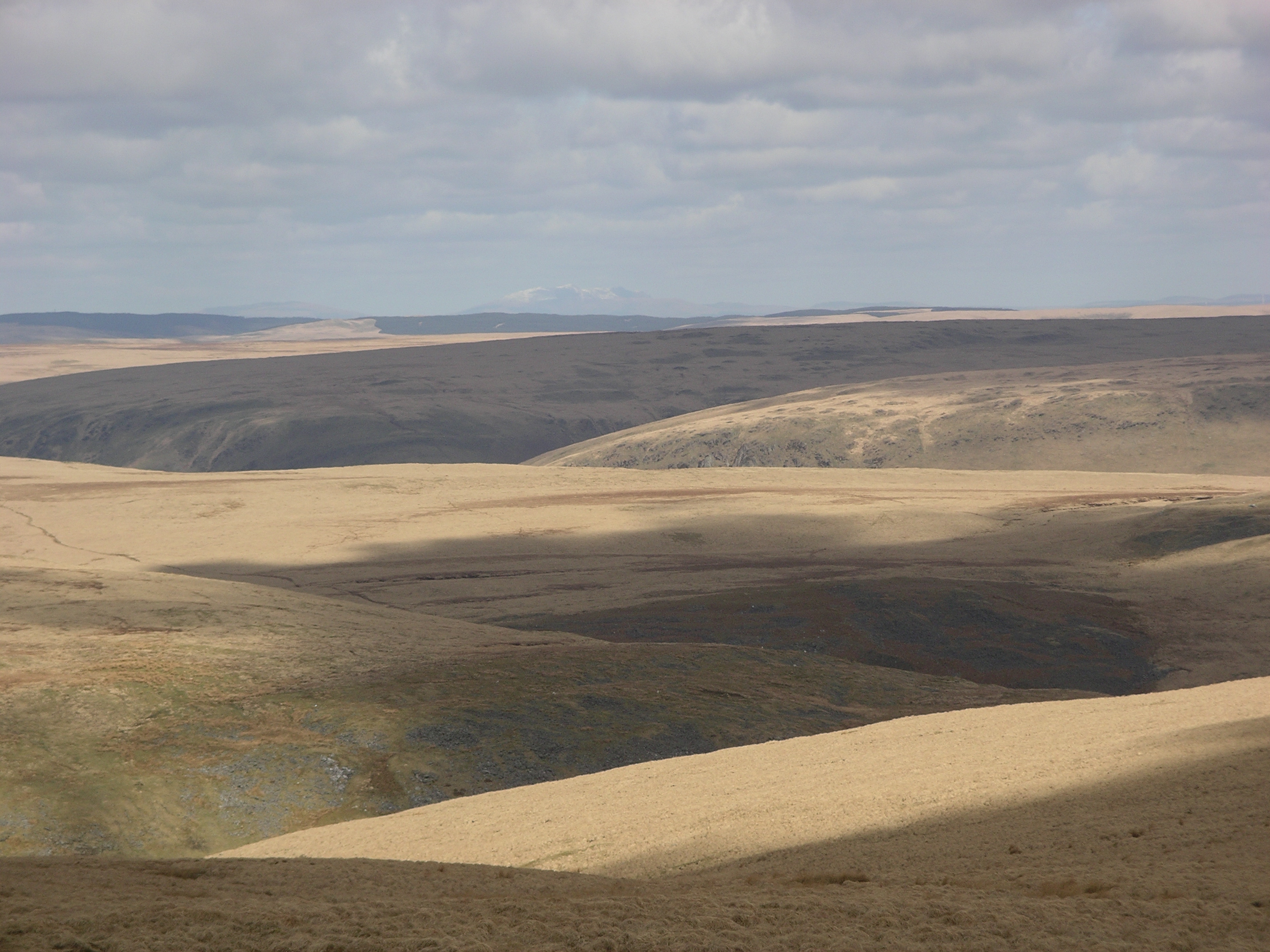
The hill/mountain is situated within the Cambrian Mountains range and is a popular destination for hikers, nature enthusiasts, and photographers. Its diverse and unspoiled landscape showcases an array of natural wonders, including heather-covered moorlands, rocky outcrops, and lush green valleys.

Bryn Dafydd is known for its rich biodiversity, hosting a variety of flora and fauna. The hill/mountain is home to several species of birds, such as red kites, peregrine falcons, and buzzards, making it a haven for birdwatchers. The surrounding area also supports a range of mammals, including foxes, badgers, and rabbits.

The hill/mountain can be accessed via several well-marked footpaths and trails, catering to all levels of fitness and experience. The most popular route starts from the nearby village of Tregaron, winding its way up through the countryside, offering stunning views along the way. At the summit, visitors are rewarded with breathtaking panoramic views of Cardiganshire and beyond.

Bryn Dafydd's natural beauty and tranquility make it a perfect escape from the hustle and bustle of daily life. Whether you seek adventure, relaxation, or simply a connection with nature, this hill/mountain is a must-visit destination for nature lovers and outdoor enthusiasts alike.

If you have any feedback on the listing, please let us know in the comments section below.

Bryn Dafydd Images

Images are sourced within 2km of 52.327129/-3.7753197 or Grid Reference SN7971. Thanks to Geograph Open Source API. All images are credited.

Snow-dusted Domen Milwyn Domen Milwyn is a small but distinctive hill which hardly stands out on the map, but nevertheless is instantly recognisable when seen from the Cwm Ystwyth side. Here it shows the first dusting of snow of the coming winter.
Snow-dusted Domen Milwyn
Domen Milwyn is a small but distinctive hill which hardly stands out on the map, but nevertheless is instantly recognisable when seen from the Cwm Ystwyth side. Here it shows the first dusting of snow of the coming winter.
Llyn Fyrddon Fawr Llyn Fyrddon Fawr and its outflow, high in the western Elenydd.  The lake here is contained by a rather elderly-looking low stone dam.  It's flanked on the eastern shore by the Cambrian Way, often just a line on the map in these parts but here a reasonably discernible path.
Llyn Fyrddon Fawr
Llyn Fyrddon Fawr and its outflow, high in the western Elenydd. The lake here is contained by a rather elderly-looking low stone dam. It's flanked on the eastern shore by the Cambrian Way, often just a line on the map in these parts but here a reasonably discernible path.
Cwm Nant-llyn-y-fign Gweundir eang gyda Thomen Milwyn yn y pellter / Extensive moorland with Domen Milwyn in the distance.
Cwm Nant-llyn-y-fign
Gweundir eang gyda Thomen Milwyn yn y pellter / Extensive moorland with Domen Milwyn in the distance.
Domen Milwyn Un o'r bryniau mwya siapus yn yr ardal yma / One of hills with most shape in this area.
Domen Milwyn
Un o'r bryniau mwya siapus yn yr ardal yma / One of hills with most shape in this area.
Domen Milwyn Carnedd gopa Domen Milwyn / Summit cairn Domen Milwyn.
Domen Milwyn
Carnedd gopa Domen Milwyn / Summit cairn Domen Milwyn.
Domen Milwyn Y rhan ogleddol o Domen Milwyn / The northern bit of Domen Milwyn.
Domen Milwyn
Y rhan ogleddol o Domen Milwyn / The northern bit of Domen Milwyn.
Domen Milwyn Domen Milwyn, the only noticeable summit in an otherwise rather featureless landscape with a distinctly remote feel to it.  The summit cairn is in the NE corner; photo taken from the SW sector of the square.
Domen Milwyn
Domen Milwyn, the only noticeable summit in an otherwise rather featureless landscape with a distinctly remote feel to it. The summit cairn is in the NE corner; photo taken from the SW sector of the square.
Stile marking stream fording point This flashy stile in otherwise pathless terrain marks a point where it is safe to ford the Nant Milwyn even at high water.  The whole square is open moorland, with the shallow valley of Nant Milwyn separating the high points of Domen Milwyn <a href="https://www.geograph.org.uk/gridref/SN8071">SN8071</a> and Banc Hir.
Stile marking stream fording point
This flashy stile in otherwise pathless terrain marks a point where it is safe to ford the Nant Milwyn even at high water. The whole square is open moorland, with the shallow valley of Nant Milwyn separating the high points of Domen Milwyn SN8071 and Banc Hir.
Outflow of Llyn Fyrddon Fawr Llyn Fyrddon Fawr is a natural lake that has been extended into a reservoir in the mid-19th century.  The dam is made of earth with stone reinforcement.  The water just spills over a small depression in the crown of the dam.  Water from this outflow used to be diverted in a ditch dug 180 degrees clockwise around the hill and then down to the Esgair Mwyn lead mine near Ffair Rhos (source: <span class="nowrap"><a title="http://www.penbanc.net/history/esgair/hist.html" rel="nofollow ugc noopener" href="http://www.penbanc.net/history/esgair/hist.html">Link</a><img style="margin-left:2px;" alt="External link" title="External link - shift click to open in new window" src="https://s1.geograph.org.uk/img/external.png" width="10" height="10"/></span> ).
Outflow of Llyn Fyrddon Fawr
Llyn Fyrddon Fawr is a natural lake that has been extended into a reservoir in the mid-19th century. The dam is made of earth with stone reinforcement. The water just spills over a small depression in the crown of the dam. Water from this outflow used to be diverted in a ditch dug 180 degrees clockwise around the hill and then down to the Esgair Mwyn lead mine near Ffair Rhos (source: LinkExternal link ).
Llyn Fyrddon Fawr Llyn Fyrddon Fawr straddles the western edge of this square.  The far end is in the adjacent square to the north.  There is a small strip of relatively dry land immediately east of the lake.  The ret of the square is rather wet moorland.
Llyn Fyrddon Fawr
Llyn Fyrddon Fawr straddles the western edge of this square. The far end is in the adjacent square to the north. There is a small strip of relatively dry land immediately east of the lake. The ret of the square is rather wet moorland.
View South from Domen Milwyn
Carreg Ddiddos from Domen Milwyn
Domen Milwyn At 554 metres this small peak is one of the few distinctive features in this rather bleak, remote area.
Domen Milwyn
At 554 metres this small peak is one of the few distinctive features in this rather bleak, remote area.
Llyn Fyrddon Fawr Dwr yn llifo o Lyn Fyrddon Fawr i Nant y Fign - Water flowing from Llyn Fyrddon Fawr into Nant y Fign.
Llyn Fyrddon Fawr
Dwr yn llifo o Lyn Fyrddon Fawr i Nant y Fign - Water flowing from Llyn Fyrddon Fawr into Nant y Fign.
Llyn Fyrddon Fawr Ar ymyl Llyn Fyrddon Fawr - Beside Llyn Fyrddon Fawr.
Llyn Fyrddon Fawr
Ar ymyl Llyn Fyrddon Fawr - Beside Llyn Fyrddon Fawr.
Geifas Hill, topped with cairn.
Geifas
Hill, topped with cairn.
Llyn Du
Llyn Du
Hagiau Mawn / Peat Hags Hagiau Mawn gyda Chronfa Ddŵr Claerwen y tu ol / Peat Hags with Claerwen Reservoir behind.
Hagiau Mawn / Peat Hags
Hagiau Mawn gyda Chronfa Ddŵr Claerwen y tu ol / Peat Hags with Claerwen Reservoir behind.
Show me another place!

Bryn Dafydd is located at Grid Ref: SN7971 (Lat: 52.327129, Lng: -3.7753197)

Unitary Authority: Ceredigion

Police Authority: Dyfed Powys

What 3 Words

///unsettled.lined.marketing. Near Cwmystwyth, Ceredigion

Related Wikis

Llan Ddu Fawr

Llan Ddu Fawr or Waun Claerddu is a hill located in Ceredigion, Wales, at 594 metres (1,949 ft) above sea level. It is located about 10 miles south of...

Cwmystwyth

Cwmystwyth (also Cwm Ystwyth, Welsh pronunciation: [kʊmˈəstʊɨθ]; English: "valley of the River Ystwyth") is a village in Ceredigion, Wales near Devil's...

Banc Tynddol sun-disc

The Banc Tynddol sun-disc (Welsh: Disc Haul Banc Tynddol) is a small, decorated, gold ornament discovered at Cwmystwyth, Ceredigion, Wales. It most likely...

Cwmystwyth Mines

Cwmystwyth mines are located in Cwmystwyth, Ceredigion, Wales and exploited a part of the Central Wales Orefield. Cwm Ystwyth is a scheduled monument,...

Eglwys Newydd Church

Eglwys Newydd Church (also known as St Michael's Church, Hafod) is an early 19th-century church which replaced a previous chapel of ease. The chapel of...

Mwyngloddfa Cwmystwyth

Mwyngloddfa Cwmystwyth is a Site of Special Scientific Interest in Ceredigion, west Wales. It comprises old mine workings located in the upper Ystwyth...

Hafod Uchtryd

Hafod Uchtryd (English: Uchtryd summer mansion) is a wooded and landscaped estate in the Ystwyth valley in Ceredigion, Wales. Near Devil's Bridge, Cwmystwyth...

Desert of Wales

The Desert of Wales, or Green Desert of Wales, is an archaic term for an area in central Wales, so called for its lack of roads and towns, and its inaccessibility...

Nearby Amenities

Located within 500m of 52.327129,-3.7753197
Bryn Dafydd
Natural: peak
Wikidata: Q106709619
Lat/Long: 52.3279659/-3.7752737
The data included in this document is from www.openstreetmap.org. The data is made available under ODbL.

Have you been to Bryn Dafydd?

Leave your review of Bryn Dafydd below (or comments, questions and feedback).