Beinn Dubh

Hill, Mountain in Perthshire

Scotland

Beinn Dubh

Field, Glentarf The Auchingarrich woodlands in the background have suffered a lot of wind damage.
Field, Glentarf Credit: Richard Webb

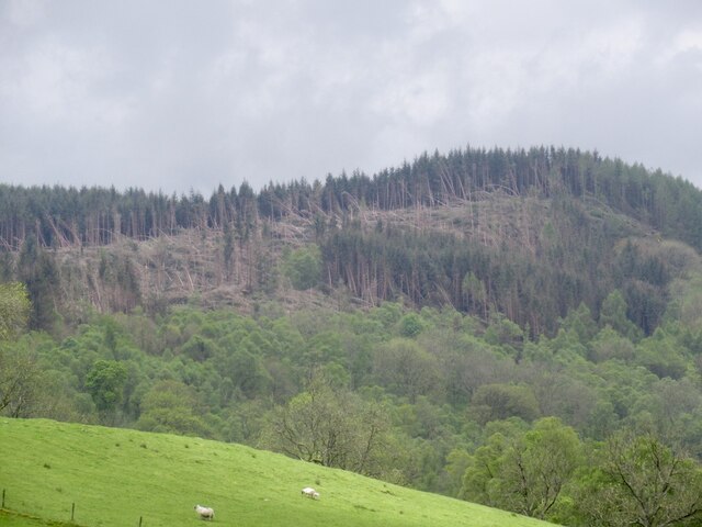
Beinn Dubh is a prominent hill located in Perthshire, Scotland. It is part of the Southern Highlands range and stands at an elevation of approximately 642 meters (2,106 feet). The hill offers breathtaking panoramic views of the surrounding landscape, making it a popular destination for hikers and nature enthusiasts.

The ascent to Beinn Dubh can be challenging, with steep slopes and rocky terrain, but it is a rewarding experience for those who make the journey. The hill is covered with heather and scattered with boulders, creating a rugged and picturesque setting. As hikers ascend, they may come across small streams and waterfalls cascading down the hillside.

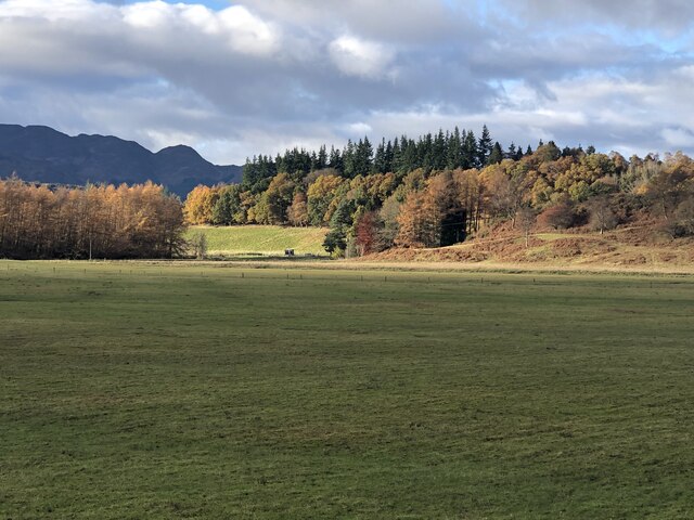
At the summit of Beinn Dubh, visitors are treated to stunning vistas of the surrounding Perthshire countryside. On clear days, one can see the rolling hills and valleys stretching out into the distance, with the River Tay winding its way through the landscape. The hill is particularly famous for its views during sunrise and sunset, when the sky is painted with vibrant hues of orange and purple.

Beinn Dubh is also home to a variety of wildlife, including red deer, mountain hares, and a wide range of bird species. Nature enthusiasts can spot these animals while exploring the hillside, adding to the allure of the area.

Overall, Beinn Dubh in Perthshire offers a challenging yet rewarding hiking experience, with stunning views and an opportunity to immerse oneself in the natural beauty of the Scottish Highlands.

If you have any feedback on the listing, please let us know in the comments section below.

Beinn Dubh Images

Images are sourced within 2km of 56.342504/-3.9670627 or Grid Reference NN7818. Thanks to Geograph Open Source API. All images are credited.

Field, Glentarf The Auchingarrich woodlands in the background have suffered a lot of wind damage.
Field, Glentarf
The Auchingarrich woodlands in the background have suffered a lot of wind damage.
Windthrow, Auchingarrich Probably flattened by the storm on 26th November 2021.
Windthrow, Auchingarrich
Probably flattened by the storm on 26th November 2021.
Drumchork Wood
Drumchork Wood
Edge of Cowden Wood Cowden Wood is mostly coniferous, but there is evidence of previous oak coppicing. There were cattle grazing the adjacent field.
Edge of Cowden Wood
Cowden Wood is mostly coniferous, but there is evidence of previous oak coppicing. There were cattle grazing the adjacent field.
Summit area, Cowden Wood Windthrow to the east of the summit.
Summit area, Cowden Wood
Windthrow to the east of the summit.
Minor road at Glentarf Looking north-eastward.
Minor road at Glentarf
Looking north-eastward.
Minor road at Auchingarrich Looking north-westward.
Minor road at Auchingarrich
Looking north-westward.
Ordnance Survey Cut Mark This mark can be found on the wall of a barn at Glentarf.
The recorded details give a height of 138.745 metres above sea level.
For more detail see : <span class="nowrap"><a title="https://www.bench-marks.org.uk/bm102655" rel="nofollow ugc noopener" href="https://www.bench-marks.org.uk/bm102655">Link</a><img style="margin-left:2px;" alt="External link" title="External link - shift click to open in new window" src="https://s1.geograph.org.uk/img/external.png" width="10" height="10"/></span>
Ordnance Survey Cut Mark
This mark can be found on the wall of a barn at Glentarf. The recorded details give a height of 138.745 metres above sea level. For more detail see : LinkExternal link
Ordnance Survey Cut Mark with Rivet This mark and rivet can be found on the top of the parapet wall of a bridge spanning Auchingarrich Burn,
The recorded details give a height of 112.2548 metres above sea level.
For more detail see : <span class="nowrap"><a title="https://www.bench-marks.org.uk/bm179765" rel="nofollow ugc noopener" href="https://www.bench-marks.org.uk/bm179765">Link</a><img style="margin-left:2px;" alt="External link" title="External link - shift click to open in new window" src="https://s1.geograph.org.uk/img/external.png" width="10" height="10"/></span>
Ordnance Survey Cut Mark with Rivet
This mark and rivet can be found on the top of the parapet wall of a bridge spanning Auchingarrich Burn, The recorded details give a height of 112.2548 metres above sea level. For more detail see : LinkExternal link
B827 beneath Cowden Wood A long gentle climb out of Strath Earn.
B827 beneath Cowden Wood
A long gentle climb out of Strath Earn.
Duck pond, Auchingarich On the outside of a bend on the B827.
Duck pond, Auchingarich
On the outside of a bend on the B827.
Drumchork Very flat fields amongst hills. Former loch bed?
Drumchork
Very flat fields amongst hills. Former loch bed?
Farmland, Coilcambus Rough moorland.
Farmland, Coilcambus
Rough moorland.
Yellow road, Culloch About 10km to Muthill, all of which is scenic.
Yellow road, Culloch
About 10km to Muthill, all of which is scenic.
Yellow road, Culloch About 9km to Muthill, all of which is scenic.
Yellow road, Culloch
About 9km to Muthill, all of which is scenic.
Standing stone, Craigneich
Craigneich
Craigneich
Muthill to Glen Artney road
Show me another place!

Beinn Dubh is located at Grid Ref: NN7818 (Lat: 56.342504, Lng: -3.9670627)

Unitary Authority: Perth and Kinross

Police Authority: Tayside

What 3 Words

///payer.dozens.shimmered. Near Comrie, Perth & Kinross

Nearby Locations

Beinn Dubh

Related Wikis

Cultybraggan Camp

Cultybraggan Camp lies close to the village of Comrie, in west Perthshire, Scotland. It was first used as a prisoner of war (PoW) camp during World War...

1 Dunira Street

1 Dunira Street is an historic building in Comrie, Perth and Kinross, Scotland. It is a Category A listed building dating to 1904. Its architect was Charles...

Comrie, Perth and Kinross

Comrie (; Gaelic: Cuimridh; Pictish: Aberlednock; Latin: Victoria) is a village and parish in the southern Highlands of Scotland, towards the western end...
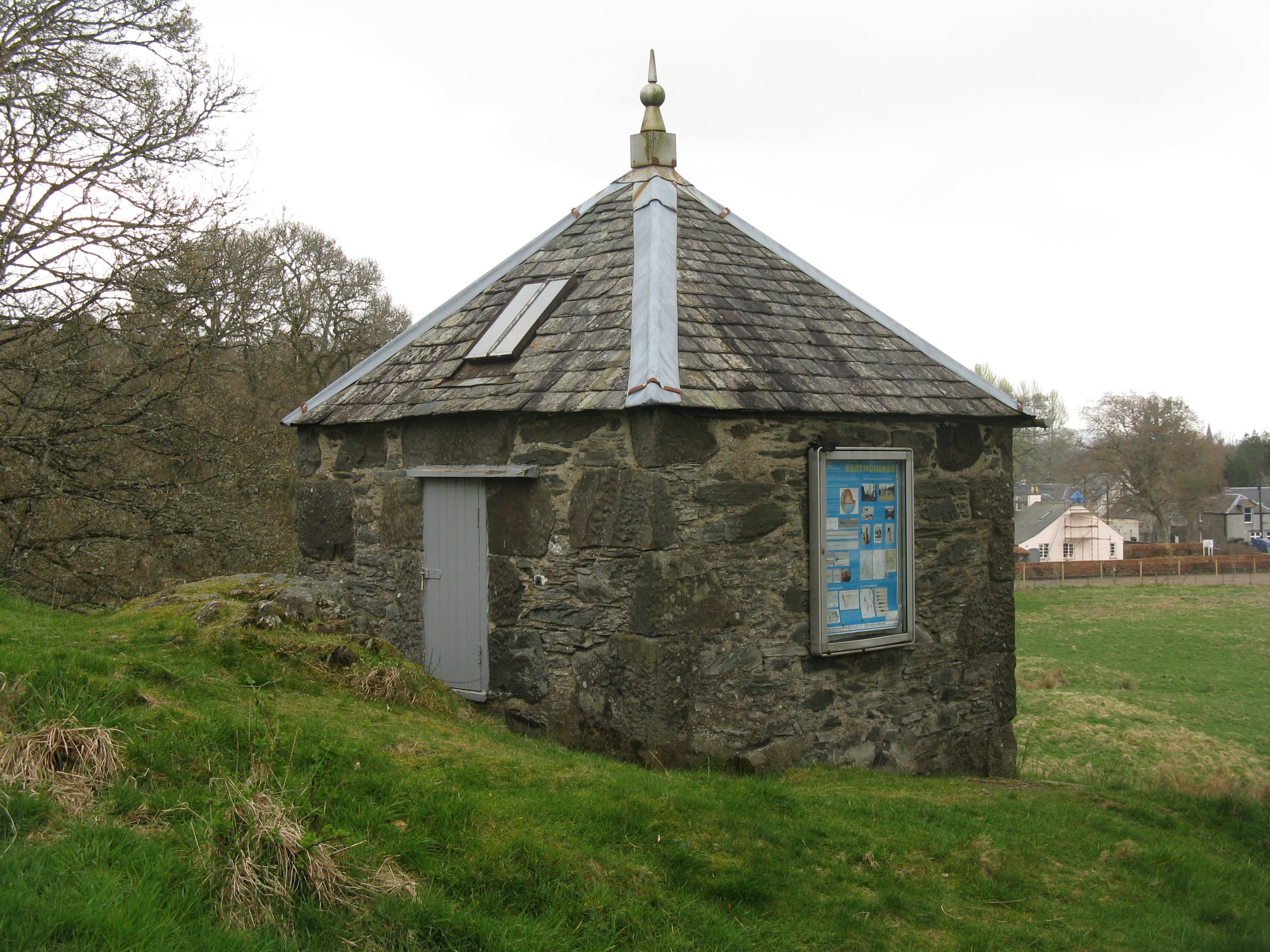
Earthquake House

The Earthquake House, on the outskirts of the village of Comrie, in Perth and Kinross, Scotland, was the first dedicated earthquake observatory in the...

Nearby Amenities

Located within 500m of 56.342504,-3.9670627
Ele: 267
Natural: peak
Lat/Long: 56.3425683/-3.9671845
The data included in this document is from www.openstreetmap.org. The data is made available under ODbL.

Have you been to Beinn Dubh?

Leave your review of Beinn Dubh below (or comments, questions and feedback).