A' Bhuidheanaich

Hill, Mountain in Inverness-shire

Scotland

A' Bhuidheanaich

Snow remnant at Ruighe Chreagain
Snow remnant at Ruighe Chreagain Credit: Alan Reid

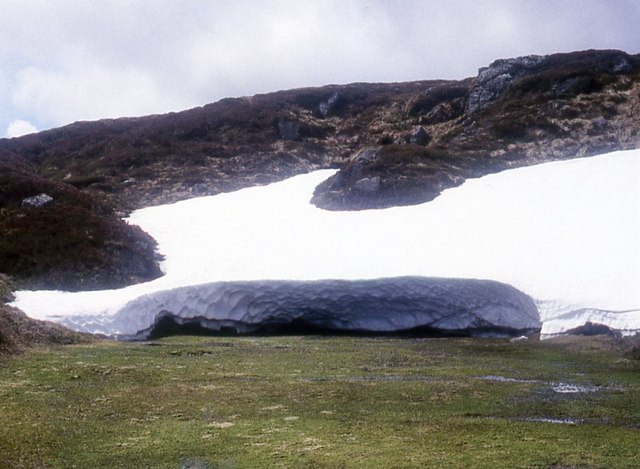
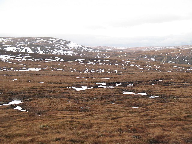
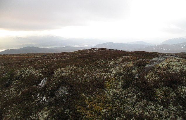
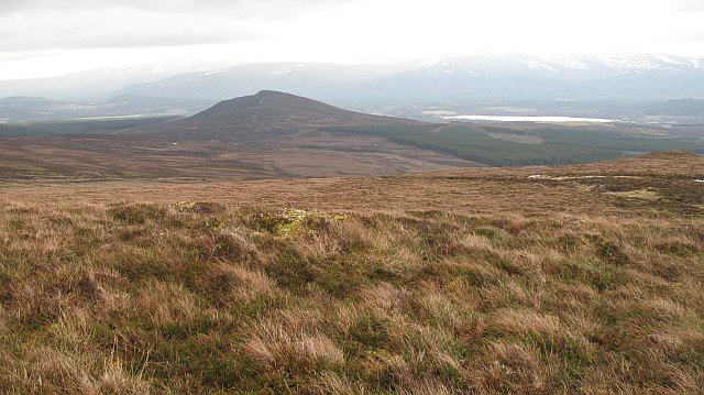
A' Bhuidheanaich is a distinctive hill located in Inverness-shire, Scotland. With an elevation of 936 meters (3,071 feet), it is classified as a Corbett, which means it falls just short of qualifying as a Munro (a Scottish mountain with a summit of at least 3,000 feet). Despite this, A' Bhuidheanaich offers breathtaking views and is a popular destination for hikers and nature enthusiasts.

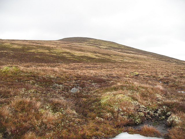
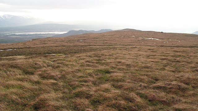
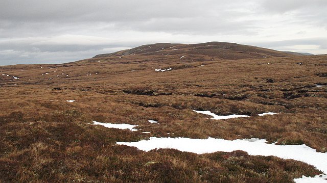
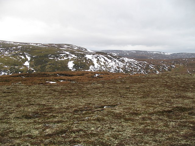
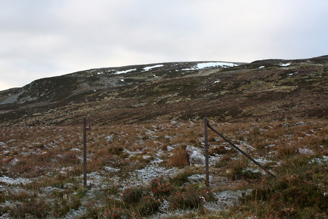
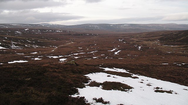
Situated in the Grampian Mountains, A' Bhuidheanaich is part of a range known as the Drumochter Hills. It is easily accessible, with a well-marked path leading to the summit, making it suitable for both experienced climbers and those new to hill walking.

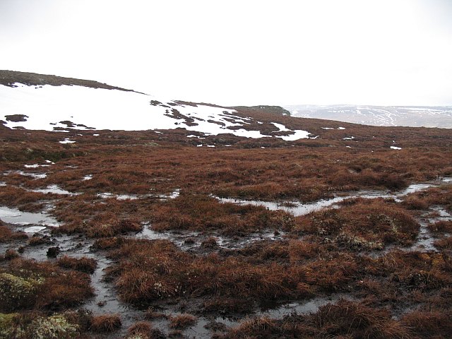
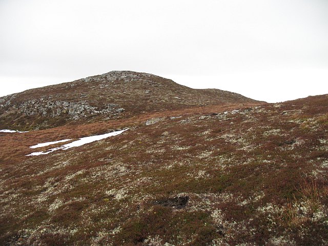
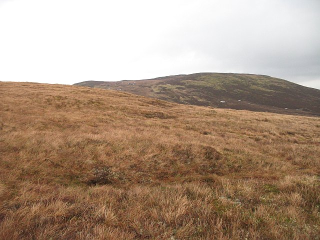
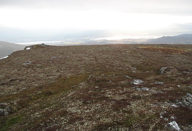
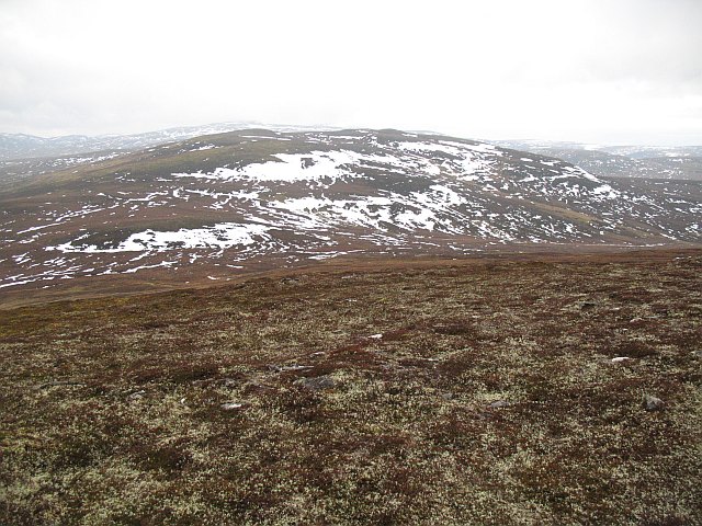
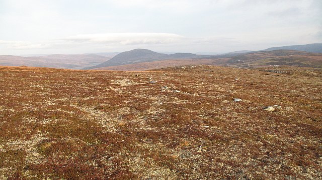
The ascent to A' Bhuidheanaich begins at the Balsporran Cottages, where a path gradually leads up the hillside. As hikers ascend, they are treated to stunning vistas of the surrounding landscape, including the neighboring peaks of Carn na Caim and Geal-charn.

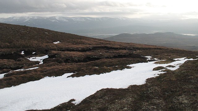
The summit of A' Bhuidheanaich offers panoramic views of the surrounding area, including Loch Ericht to the north and the Cairngorms National Park to the east. On clear days, it is even possible to see as far as Ben Nevis, the highest peak in the British Isles.

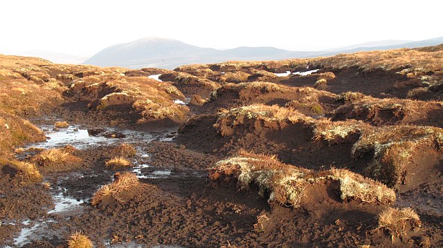
A' Bhuidheanaich is a haven for wildlife, with red deer, mountain hares, and various bird species inhabiting the area. It is also home to a diverse range of plant life, including heather, mosses, and wildflowers.

In summary, A' Bhuidheanaich is a captivating hill in Inverness-shire, Scotland, offering stunning views, easily accessible trails, and a chance to immerse oneself in the natural beauty of the Scottish Highlands.

If you have any feedback on the listing, please let us know in the comments section below.

A' Bhuidheanaich Images

Images are sourced within 2km of 57.150189/-4.0292709 or Grid Reference NH7708. Thanks to Geograph Open Source API. All images are credited.

Snow remnant at Ruighe Chreagain
Bogs, Cnoc an Tiumpain A boggy hollow just below the summit of Cnoc an Tiumpain. Most of the square is covered in heather and peat sloping down towards the headwaters of River Dulnain.
Bogs, Cnoc an Tiumpain
A boggy hollow just below the summit of Cnoc an Tiumpain. Most of the square is covered in heather and peat sloping down towards the headwaters of River Dulnain.
One of the summit bumps, Cnoc an Tiumpain Not the actual summit,  but a dry part of the watershed ridge.
One of the summit bumps, Cnoc an Tiumpain
Not the actual summit, but a dry part of the watershed ridge.
A' Bhuidheanaich: Cnoc an Tiumpain Looking up the western slopes of Cnoc an Tiumpain from the low point of the ridge on A' Bhuidheanaich.
The slopes were not boggy, but still very wet from recently melted snow.
A' Bhuidheanaich: Cnoc an Tiumpain
Looking up the western slopes of Cnoc an Tiumpain from the low point of the ridge on A' Bhuidheanaich. The slopes were not boggy, but still very wet from recently melted snow.
Garbh-mheall A level and boggy section of a spur running south from A' Bhuidheanaich. Loch Insh in the background.
Garbh-mheall
A level and boggy section of a spur running south from A' Bhuidheanaich. Loch Insh in the background.
Cnoc an Tiumpain View across  the peatlands of A' Bhuidheanaich towards Cnoc an Tiumpain. There were a lot of grouse about.
Cnoc an Tiumpain
View across the peatlands of A' Bhuidheanaich towards Cnoc an Tiumpain. There were a lot of grouse about.
Dissected bog, A' Bhuidheanaich A very sticky bit of bog just below the summit. Cnoc Fraing in the distance.
Dissected bog, A' Bhuidheanaich
A very sticky bit of bog just below the summit. Cnoc Fraing in the distance.
Southeast ridge,  A' Bhuidheanaich A boggy section of the ridge with a very good view of the hills above Glen Feshie across the Spey. The snow is even melting from the 1200m hills of the Monadh Ruadh, but it felt cold in the wind here at 700m.
Southeast ridge, A' Bhuidheanaich
A boggy section of the ridge with a very good view of the hills above Glen Feshie across the Spey. The snow is even melting from the 1200m hills of the Monadh Ruadh, but it felt cold in the wind here at 700m.
Bogs northwest of A' Bhuidheanaich A section of the boggy plateau around the headwaters of the Dulnain.  This bit of moorland drains into the Allt Mòr.
The watershed area is not too hard to walk on, but head north and the bogs soon appear.
Bogs northwest of A' Bhuidheanaich
A section of the boggy plateau around the headwaters of the Dulnain. This bit of moorland drains into the Allt Mòr. The watershed area is not too hard to walk on, but head north and the bogs soon appear.
Bogs northwest of A' Bhuidheanaich The boggy plateau between A' Bhuidheanaich and Meall a' Chòcaire. It is eventually drained by the Allt Mòr which flows into the River Dulnain. A' Bhuidheanaich in the background.
Bogs northwest of A' Bhuidheanaich
The boggy plateau between A' Bhuidheanaich and Meall a' Chòcaire. It is eventually drained by the Allt Mòr which flows into the River Dulnain. A' Bhuidheanaich in the background.
Summit, Meall a' Chòcaire View across the glen of the Allt Ruighe na Roig towards Beinn Bhreac. 
Crisp upland heath by the summit of Meall a' Chòcaire.
Summit, Meall a' Chòcaire
View across the glen of the Allt Ruighe na Roig towards Beinn Bhreac. Crisp upland heath by the summit of Meall a' Chòcaire.
Garbh-mheall The eastern side of the hill seen through a pair of old iron gateposts.
Garbh-mheall
The eastern side of the hill seen through a pair of old iron gateposts.
Cnoc an Tiumpain summit Mossy summit area of Cnoc an Tiumpain.
Cnoc an Tiumpain summit
Mossy summit area of Cnoc an Tiumpain.
Summit area, Cnoc an Tiumpain Dry mossy ground near the summit.
Summit area, Cnoc an Tiumpain
Dry mossy ground near the summit.
A' Bhuidheanaich Looking down to the col between the two main A'Bhuidheanaich tops.
A' Bhuidheanaich
Looking down to the col between the two main A'Bhuidheanaich tops.
A' Bhuidheanaich View into the wild interior of the Monadhliath from A' Bhuidheanaich.
A' Bhuidheanaich
View into the wild interior of the Monadhliath from A' Bhuidheanaich.
Southern slopes of A'Bhuidheanaich Looking over moors towards An Suidhe above Kincraig.
Southern slopes of A'Bhuidheanaich
Looking over moors towards An Suidhe above Kincraig.
A' Bhuidheanaich Crisp tundra moss on the higher parts of A'Bhuidheanaich. The unusually positioned granite hill, Cnoc na Fraing in the distance above the Dulnain.
A' Bhuidheanaich
Crisp tundra moss on the higher parts of A'Bhuidheanaich. The unusually positioned granite hill, Cnoc na Fraing in the distance above the Dulnain.
Show me another place!

A' Bhuidheanaich is located at Grid Ref: NH7708 (Lat: 57.150189, Lng: -4.0292709)

Unitary Authority: Highland

Police Authority: Highlands and Islands

What 3 Words

///merely.lamenting.mercy. Near Kingussie, Highland

Nearby Locations

A' Bhuidheanaich

Related Wikis

Monadhliath Mountains

The Monadhliath Mountains , or Monadh Liath, are a range of mountains in Scotland. Monadh Liath is Scottish Gaelic, and means "grey mountain range". Running...

Highland Wildlife Park

The Highland Wildlife Park is a 105-hectare (260-acre) safari park and zoo near Kingussie, Highland, Scotland. The park is located within the Cairngorms...

Dunachton

Dunachton (Scottish Gaelic: Dùn Neachdain) is an estate on the north-west shore of Loch Insh in Badenoch and Strathspey, in the Highlands of Scotland....

Kincraig

Kincraig (Scottish Gaelic: Ceann na Creige) is a village located north of Kingussie and south of Aviemore in Highland, Scotland. Its original name was...

Nearby Amenities

Located within 500m of 57.150189,-4.0292709
Ele: 727
Natural: peak
Source: OS7
Lat/Long: 57.1503468/-4.0288922
The data included in this document is from www.openstreetmap.org. The data is made available under ODbL.

Have you been to A' Bhuidheanaich?

Leave your review of A' Bhuidheanaich below (or comments, questions and feedback).