Leigh Hill

Hill, Mountain in Devon South Hams

England

Leigh Hill

Pine and other trees, Dundridge Looking left from the lane where <a href="https://www.geograph.org.uk/photo/7028709">SX7858 : Field near Dundridge Lodge</a> was taken, towards Fordbarn Cross.
Pine and other trees, Dundridge Credit: Derek Harper

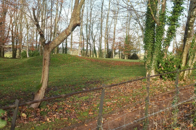
Leigh Hill, located in Devon, England, is a stunning hill that offers breathtaking views of the surrounding countryside. Situated near the village of Leigh, it stands at an elevation of approximately 175 meters (574 feet) above sea level. With its prominent position, it provides visitors with panoramic vistas of the rolling hills, lush green fields, and the picturesque coastline.

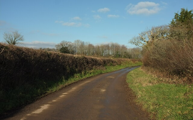
Leigh Hill is a popular destination for hikers and nature enthusiasts due to its tranquil and natural setting. The hill is known for its diverse flora and fauna, including a variety of wildflowers, birds, and small animals. It is also home to several walking trails that wind through the countryside, allowing visitors to explore the area's natural beauty.

At the summit of Leigh Hill, there is a viewpoint that offers unparalleled views of the surrounding landscape. On a clear day, it is possible to see as far as the English Channel, providing a stunning backdrop to the already breathtaking scenery. The viewpoint is an ideal spot for picnics or simply to relax and take in the peaceful atmosphere.

Additionally, Leigh Hill has historical significance as it is believed to have been used as a site for Iron Age settlements. Archaeological excavations have uncovered evidence of human habitation, including pottery fragments and ancient tools.

Overall, Leigh Hill in Devon is a captivating natural landmark, offering visitors the chance to immerse themselves in the beauty of the English countryside, enjoy scenic walks, and gain insight into the area's rich history.

If you have any feedback on the listing, please let us know in the comments section below.
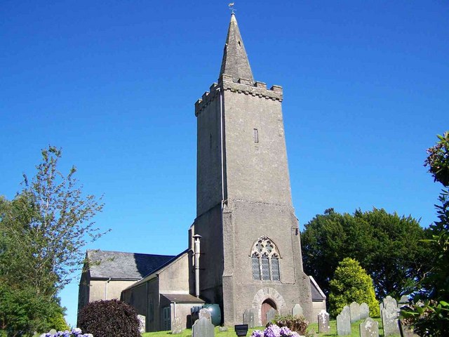
Leigh Hill Images

Images are sourced within 2km of 50.411781/-3.7391242 or Grid Reference SX7658. Thanks to Geograph Open Source API. All images are credited.

Pine and other trees, Dundridge Looking left from the lane where <a href="https://www.geograph.org.uk/photo/7028709">SX7858 : Field near Dundridge Lodge</a> was taken, towards Fordbarn Cross.
Pine and other trees, Dundridge
Looking left from the lane where SX7858 : Field near Dundridge Lodge was taken, towards Fordbarn Cross.
Golf at Dundridge The belt of trees shown in <a href="https://www.geograph.org.uk/photo/7028709">SX7858 : Field near Dundridge Lodge</a> contains not only the drive between house and lodge, but also two putting greens (more, maybe) and this bit of landscaping.
Golf at Dundridge
The belt of trees shown in SX7858 : Field near Dundridge Lodge contains not only the drive between house and lodge, but also two putting greens (more, maybe) and this bit of landscaping.
Harberton Stream Looking across the Harberton Stream valley from the green lane between the village of Harberton and Key's Englebourne.
Harberton Stream
Looking across the Harberton Stream valley from the green lane between the village of Harberton and Key's Englebourne.
Farmland near Key's Englebourne A mixed field of cattle and sheep seen from the green lane from Harberton.
Farmland near Key's Englebourne
A mixed field of cattle and sheep seen from the green lane from Harberton.
Key's Englebourne Some change in the roofing since <a href="https://www.geograph.org.uk/photo/5577112">SX7757 : Barn, Key's Englebourne</a>.
Key's Englebourne
Some change in the roofing since SX7757 : Barn, Key's Englebourne.
Lane to East Leigh A different angle and season for the scene in <a href="https://www.geograph.org.uk/photo/5433247">SX7657 : Lane to East Leigh</a>.
Lane to East Leigh
A different angle and season for the scene in SX7657 : Lane to East Leigh.
Lane approaching East Leigh Taken 170 metres along the lane shown in <a href="https://www.geograph.org.uk/photo/7386942">SX7657 : Lane to East Leigh</a>.
Lane approaching East Leigh
Taken 170 metres along the lane shown in SX7657 : Lane to East Leigh.
Lane to Harbourne valley Approaching a bend with trees and a view down the valley.
Lane to Harbourne valley
Approaching a bend with trees and a view down the valley.
Harbourne River valley From the gate seen in <a href="https://www.geograph.org.uk/photo/7391249">SX7657 : Lane to Harbourne valley</a>.
Harbourne River valley
From the gate seen in SX7657 : Lane to Harbourne valley.
Hillside, Hill Mill Looking down the lane just to the right of <a href="https://www.geograph.org.uk/photo/7391250">SX7657 : Harbourne River valley</a>.
Hillside, Hill Mill
Looking down the lane just to the right of SX7657 : Harbourne River valley.
Carving by Harbourne River The tree stump shown in <a href="https://www.geograph.org.uk/photo/6187439">SX7658 : Stump by Harbourne River</a> now sports an impressive carving of a bearded goat,
Carving by Harbourne River
The tree stump shown in SX7658 : Stump by Harbourne River now sports an impressive carving of a bearded goat,
Cottage, Harberton A cottage we once looked round whilst house-hunting, but that was decades ago.
Cottage, Harberton
A cottage we once looked round whilst house-hunting, but that was decades ago.
Harberton - St Andrew's Church A view of  St Andrew's Church, Harberton from just inside the western gate into its churchyard.
See shared description below.
Harberton - St Andrew's Church
A view of St Andrew's Church, Harberton from just inside the western gate into its churchyard. See shared description below.
Harberton - Church House Inn The Church House Inn, not too surprisingly in the shadow of <a href="https://www.geograph.org.uk/photo/7587338">SX7758 : Harberton - St Andrew's Church</a> is a fine hostelry serving "good food and local ales" - see their own website here: <span class="nowrap"><a title="https://www.churchhouseharberton.co.uk" rel="nofollow ugc noopener" href="https://www.churchhouseharberton.co.uk">Link</a><img style="margin-left:2px;" alt="External link" title="External link - shift click to open in new window" src="https://s1.geograph.org.uk/img/external.png" width="10" height="10"/></span>
According to EH it dates from the C16th though other sources on the web suggest it dates back to the C13th. Whichever is correct it is certainly an old building with exposed beams. It is Grade II* listed: <span class="nowrap"><a title="https://historicengland.org.uk/listing/the-list/list-entry/1108225?section=official-list-entry" rel="nofollow ugc noopener" href="https://historicengland.org.uk/listing/the-list/list-entry/1108225?section=official-list-entry">Link</a><img style="margin-left:2px;" alt="External link" title="External link - shift click to open in new window" src="https://s1.geograph.org.uk/img/external.png" width="10" height="10"/></span> 
See also <a href="https://www.geograph.org.uk/photo/7598504">SX7758 : Harberton - Church House Inn - Ancient doorway</a>
Harberton - Church House Inn
The Church House Inn, not too surprisingly in the shadow of SX7758 : Harberton - St Andrew's Church is a fine hostelry serving "good food and local ales" - see their own website here: LinkExternal link According to EH it dates from the C16th though other sources on the web suggest it dates back to the C13th. Whichever is correct it is certainly an old building with exposed beams. It is Grade II* listed: LinkExternal link See also SX7758 : Harberton - Church House Inn - Ancient doorway
Harberton - Church House Inn - Ancient doorway This very old - and not terribly straight - doorway is towards the western end of the southern frontage of <a href="https://www.geograph.org.uk/photo/7598500">SX7758 : Harberton - Church House Inn</a>.
Harberton - Church House Inn - Ancient doorway
This very old - and not terribly straight - doorway is towards the western end of the southern frontage of SX7758 : Harberton - Church House Inn.
Harberton - Southern gateway to St Andrew's Church This lychgate and associated building allows access to the churchyard of <a href="https://www.geograph.org.uk/photo/7587338">SX7758 : Harberton - St Andrew's Church</a> from the south. Entry is also possible from the west adjacent to <a href="https://www.geograph.org.uk/photo/7598500">SX7758 : Harberton - Church House Inn</a>
The lychgate dates only from the early C19th according to its EH Grade II listing <span class="nowrap"><a title="https://historicengland.org.uk/listing/the-list/list-entry/1215700?section=official-list-entry" rel="nofollow ugc noopener" href="https://historicengland.org.uk/listing/the-list/list-entry/1215700?section=official-list-entry">Link</a><img style="margin-left:2px;" alt="External link" title="External link - shift click to open in new window" src="https://s1.geograph.org.uk/img/external.png" width="10" height="10"/></span> - I think that the buildings either side of it may be older; it perhaps replaced an earlier gateway on the same site.
Harberton - Southern gateway to St Andrew's Church
This lychgate and associated building allows access to the churchyard of SX7758 : Harberton - St Andrew's Church from the south. Entry is also possible from the west adjacent to SX7758 : Harberton - Church House Inn The lychgate dates only from the early C19th according to its EH Grade II listing LinkExternal link - I think that the buildings either side of it may be older; it perhaps replaced an earlier gateway on the same site.
Harberton - St Andrew's Church - South porch entrance This is the main entrance to <a href="https://www.geograph.org.uk/photo/7587338">SX7758 : Harberton - St Andrew's Church</a> and is situated in the double height south porch of the church. Note the little piscina-like niche to the left of the door and the old sundial above it.
Harberton - St Andrew's Church - South porch entrance
This is the main entrance to SX7758 : Harberton - St Andrew's Church and is situated in the double height south porch of the church. Note the little piscina-like niche to the left of the door and the old sundial above it.
Harberton - St Andrew's Church - Nave & Rood Screen Looking along the nave of <a href="https://www.geograph.org.uk/photo/7587338">SX7758 : Harberton - St Andrew's Church</a> to the rood screen which spans the width of the church and separates it from eastern end of the church containing (in the middle) the chancel. For a closer view of the central section of this screen, see <a href="https://www.geograph.org.uk/photo/7598529">SX7758 : Harberton - St Andrew's Church - Rood Screen</a>
Notice the ornate pulpit right-of-centre, for a close view of this, see <a href="https://www.geograph.org.uk/photo/7598996">SX7758 : Harberton - St Andrew's Church - Pulpit</a>
Harberton - St Andrew's Church - Nave & Rood Screen
Looking along the nave of SX7758 : Harberton - St Andrew's Church to the rood screen which spans the width of the church and separates it from eastern end of the church containing (in the middle) the chancel. For a closer view of the central section of this screen, see SX7758 : Harberton - St Andrew's Church - Rood Screen Notice the ornate pulpit right-of-centre, for a close view of this, see SX7758 : Harberton - St Andrew's Church - Pulpit
Show me another place!

Leigh Hill is located at Grid Ref: SX7658 (Lat: 50.411781, Lng: -3.7391242)

Administrative County: Devon

District: South Hams

Police Authority: Devon and Cornwall

What 3 Words

///including.executive.fussy. Near Totnes, Devon

Nearby Locations

Leigh Hill

Related Wikis

Belsford

Belsford is a village in Devon, England. == External links == Media related to Belsford at Wikimedia Commons

Harberton

Harberton is a village, civil parish and former manor 3 miles south west of Totnes, in the South Hams District of Devon, England. The parish includes...

Rattery

Rattery is a village and civil parish in the South Hams district, in the county of Devon, England, a few miles from the villages Buckfastleigh and neighbouring...

Bowden, Ashprington

Bowden is an historic estate in Ashprington parish near Totnes in Devon, England. The present structure, known as "Bowden House", is a grade I listed building...

Nearby Amenities

Located within 500m of 50.411781,-3.7391242
East Leigh Cross
Place: locality
Lat/Long: 50.4117612/-3.7389419
Barrier: stile
Lat/Long: 50.412247/-3.7344407
Natural: spring
Lat/Long: 50.4100695/-3.738023
Natural: spring
Lat/Long: 50.4125549/-3.7338954
Post Box
Brand: Royal Mail
Brand Wikidata: Q638098
Brand Wikipedia: en:Royal Mail
Collection Times: Mo-Fr 16:00; Sa 11:30; Su off
Operator: Royal Mail
Operator Wikidata: Q638098
Post Box Design: type_c
Post Box Mounting: stone_wall
Post Box Type: wall
Ref: TQ9 8
Royal Cypher: VR
Royal Cypher Wikidata: Q33102356
Source: survey;streetlevel imagery;aerial imagery
Lat/Long: 50.4118712/-3.7380407
Barrier: stile
Lat/Long: 50.4157879/-3.7363753
Generator Method: photovoltaic
Generator Output Electricity: yes
Generator Source: solar
Generator Type: solar_photovoltaic_panel
Location: roof
Power: generator
Lat/Long: 50.4089457/-3.7374276
Generator Method: photovoltaic
Generator Output Electricity: yes
Generator Source: solar
Generator Type: solar_photovoltaic_panel
Location: roof
Power: generator
Lat/Long: 50.4090047/-3.7374705
Generator Method: photovoltaic
Generator Output Electricity: yes
Generator Source: solar
Generator Type: solar_photovoltaic_panel
Location: roof
Power: generator
Lat/Long: 50.4078936/-3.7397625
The data included in this document is from www.openstreetmap.org. The data is made available under ODbL.

Have you been to Leigh Hill?

Leave your review of Leigh Hill below (or comments, questions and feedback).