Banbury

Settlement in Oxfordshire Cherwell

England

Banbury

Oxford Road, Banbury
Oxford Road, Banbury Credit: David Howard

Banbury is a historic market town located in the Cherwell district of Oxfordshire, England. Situated on the River Cherwell, it lies approximately halfway between Birmingham and London, making it a significant transportation hub. With a population of around 47,000, Banbury is the largest town in the Cherwell district and serves as a commercial and retail center for the surrounding area.

The town has a rich history dating back to the Anglo-Saxon era, and it was mentioned in the Domesday Book of 1086. Banbury became famous for its wool trade during the medieval period and later developed into an important center for the manufacturing industry, particularly in the sectors of leather goods, carpets, and automotive components.

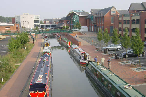
One of Banbury's most iconic landmarks is the Banbury Cross, which was built in 1859 to commemorate the marriage of Queen Victoria's eldest daughter. The town is also known for its picturesque canal, the Oxford Canal, which passes through Banbury and offers scenic walks and boat trips.

Banbury has a vibrant town center, featuring a mix of modern shopping centers and traditional independent stores. The town also boasts a variety of dining options, ranging from quaint cafes and pubs to international cuisine. Additionally, Banbury is home to several cultural attractions, including the Banbury Museum, which showcases the history of the town and its surroundings.

With its strategic location, thriving economy, and historical charm, Banbury continues to be a popular destination for residents, businesses, and tourists alike.

If you have any feedback on the listing, please let us know in the comments section below.
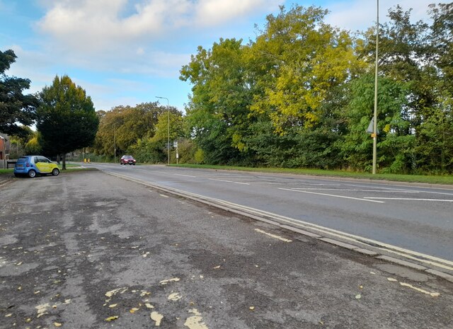
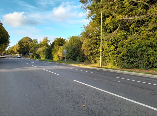
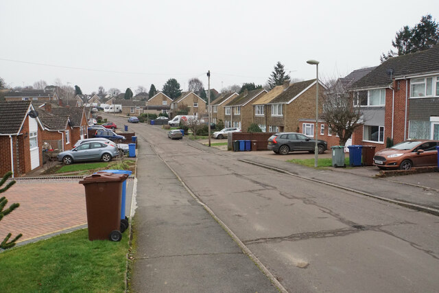
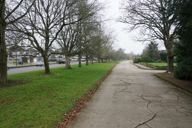
Banbury Images

Images are sourced within 2km of 52.061411/-1.334826 or Grid Reference SP4540. Thanks to Geograph Open Source API. All images are credited.

Oxford Road, Banbury
Bus stop on Oxford Road, Banbury
Oxford Road, Banbury My last visit <a title="https://www.geograph.org.uk/photo/6923307" href="https://www.geograph.org.uk/photo/6923307">Link</a>
Oxford Road, Banbury
My last visit Link
Hightown Road, Banbury By the New Foscote Hospital
Hightown Road, Banbury
By the New Foscote Hospital
Hightown Road, Banbury
Wesley Drive, Banbury I am following a public footpath which existed as a right of way before any of these houses were built. It has come up Kingsway and will cut between the houses to the right.
Wesley Drive, Banbury
I am following a public footpath which existed as a right of way before any of these houses were built. It has come up Kingsway and will cut between the houses to the right.
Queensway, Banbury A broad dual carriageway around the south western side of Banbury, opening up the residential suburbs. It acts a bit like a ring road though the lack of traffic lights where it meets the A361 undermines that.
Queensway, Banbury
A broad dual carriageway around the south western side of Banbury, opening up the residential suburbs. It acts a bit like a ring road though the lack of traffic lights where it meets the A361 undermines that.
Springfield Avenue, Banbury At the corner of Ruskin Road where there is a corner shop which appears to be permanently closed.
Springfield Avenue, Banbury
At the corner of Ruskin Road where there is a corner shop which appears to be permanently closed.
St Hugh's Parish Church A 1930s building from the time of Banbury's housing expansion into this area.
St Hugh's Parish Church
A 1930s building from the time of Banbury's housing expansion into this area.
Bloxham Road A concrete access road services the large houses to the right and they are well set back from the main road. The concrete road is also the route of a public footpath.
Bloxham Road
A concrete access road services the large houses to the right and they are well set back from the main road. The concrete road is also the route of a public footpath.
Road works on Bloxham Road These road works can cause quite long delays at peak times. They are here for the enhancement of a new roundabout to service the Bloxham Vale housing development off to the right.
Road works on Bloxham Road
These road works can cause quite long delays at peak times. They are here for the enhancement of a new roundabout to service the Bloxham Vale housing development off to the right.
Ashlea guest house, Oxford Road, Banbury A traditional bed and breakfast guest house. I stayed here for four nights and can recommend it.
Ashlea guest house, Oxford Road, Banbury
A traditional bed and breakfast guest house. I stayed here for four nights and can recommend it.
Houses on Oxford Road, Banbury Several older properties in the area are grade II listed, but not these.
Houses on Oxford Road, Banbury
Several older properties in the area are grade II listed, but not these.
Oxford Road, Banbury Looking towards the town centre. I thought the regrading of the main road (formerly the A41, now the B4100) that has left the houses stranded on a higher level would be relatively recent, but even the 1882 OS map appears to show this arrangement.
Oxford Road, Banbury
Looking towards the town centre. I thought the regrading of the main road (formerly the A41, now the B4100) that has left the houses stranded on a higher level would be relatively recent, but even the 1882 OS map appears to show this arrangement.
Transmitter at Horton General Hospital
Entrance to Horton General Hospital The hospital is the main one for North Oxfordshire.
Entrance to Horton General Hospital
The hospital is the main one for North Oxfordshire.
Hightown Road, Banbury The road just cuts across the north-west corner of this grid square.
Hightown Road, Banbury
The road just cuts across the north-west corner of this grid square.
Rocking it down Upper Windsor Street A flatbed truck carrying three large boulders, weighing perhaps twenty tonnes altogether, descends the Banbury inner relief road.
Rocking it down Upper Windsor Street
A flatbed truck carrying three large boulders, weighing perhaps twenty tonnes altogether, descends the Banbury inner relief road.
Show me another place!

Banbury is located at Grid Ref: SP4540 (Lat: 52.061411, Lng: -1.334826)

Administrative County: Oxfordshire

District: Cherwell

Police Authority: Thames Valley

What 3 Words

///scenes.gender.safe. Near Banbury, Oxfordshire

Nearby Locations

Banbury Banbury

Related Wikis

Banbury

Banbury is a historic market town on the River Cherwell in Oxfordshire, South East England. It had a population of 54,335 at the 2021 Census.Banbury is...

Banbury Town Hall

Banbury Town Hall is a municipal facility in the High Street in Banbury, Oxfordshire, England. The town hall, which was the headquarters of Banbury Borough...
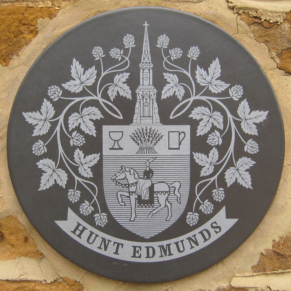
Hunt Edmunds

Hunt Edmunds was a brewery in Banbury, Oxfordshire, England. == History == The brewery was founded by John Hunt in 1840, but it was Thomas Hunt who went...

Castle Quay Shopping Centre

Castle Quay Shopping Centre is a shopping centre in the town of Banbury, North Oxfordshire, England. The shopping centre is located in the centre of Banbury...

Nearby Amenities

Located within 500m of 52.061411,-1.334826
Traffic Signals
Traffic Signals Direction: forward
Lat/Long: 52.0617756/-1.3314614
Traffic Signals
Lat/Long: 52.0622021/-1.3279542
Traffic Signals
Traffic Signals: traffic_lights
Traffic Signals Direction: both
Lat/Long: 52.0602648/-1.3316439
Traffic Signals
Lat/Long: 52.0635822/-1.3397494
Crossing
Lat/Long: 52.0636252/-1.3400731
Banbury
Is In: Oxfordshire, England, UK
Note: Population updated from https://www.oxford.gov.uk/districtdata/downloads/file/1198/2020_banbury_parish_report
Place: town
Population: 48,681
Wikidata: Q806160
Wikipedia: en:Banbury
Lat/Long: 52.0601807/-1.3402795
Crossing
Crossing: unmarked
Crossing Island: no
Kerb: flush
Tactile Paving: yes
Lat/Long: 52.0649063/-1.3363159
Traffic Signals
Lat/Long: 52.0580598/-1.3328937
Traffic Signals
Traffic Signals: traffic_lights
Traffic Signals Direction: both
Lat/Long: 52.0580295/-1.3328039
Traffic Signals
Traffic Signals: signal
Traffic Signals Direction: both
Lat/Long: 52.061772/-1.3308019
Banbury Cross
Historic: monument
Wikidata: Q17548116
Lat/Long: 52.0601356/-1.340332
Bus Stop
Bus Station
Bench: no
Bus: yes
Fixme: position needs checking
Naptan AtcoCode: 340000001730
Naptan CommonName: Bus Station
Naptan Indicator: Arrivals
Naptan NaptanCode: oxfgpjmp
Naptan PlusbusZoneRef: BNBR
Naptan Street: Bridge Street
Naptan Verified: no
Public Transport: platform
Shelter: no
Source: naptan_import
Lat/Long: 52.0623144/-1.331919
Bus Stop
Bus Station
Bench: no
Bus: yes
Local Ref: 1
Naptan AtcoCode: 3400000721
Naptan CommonName: Bus Station
Naptan Indicator: Bay 1
Naptan Landmark: Bay 1
Naptan NaptanCode: oxfamgaj
Naptan PlusbusZoneRef: BNBR
Naptan Street: Bus Station
Naptan Verified: no
Public Transport: platform
Shelter: yes
Source: naptan_import
Lat/Long: 52.0626059/-1.3317168
Bus Stop
Bus Station
Bench: yes
Bus: yes
Local Ref: 2
Naptan AtcoCode: 3400000722
Naptan CommonName: Bus Station
Naptan Indicator: Bay 2
Naptan Landmark: Bay 2
Naptan NaptanCode: oxfamgag
Naptan PlusbusZoneRef: BNBR
Naptan Street: Bus Station
Naptan Verified: no
Public Transport: platform
Shelter: yes
Source: naptan_import
Lat/Long: 52.0625968/-1.331647
Bus Stop
Bus Station
Bench: no
Bus: yes
Local Ref: 3
Naptan AtcoCode: 3400000723
Naptan CommonName: Bus Station
Naptan Indicator: Bay 3
Naptan Landmark: Bay 3
Naptan NaptanCode: oxfamgad
Naptan PlusbusZoneRef: BNBR
Naptan Street: Bus Station
Naptan Verified: no
Public Transport: platform
Shelter: yes
Source: naptan_import
Lat/Long: 52.0625803/-1.3315973
Bus Stop
Bus Station
Bench: yes
Bin: yes
Bus: yes
Lit: yes
Local Ref: 4
Naptan AtcoCode: 3400000724
Naptan CommonName: Bus Station
Naptan Indicator: Bay 4
Naptan Landmark: Bay 4
Naptan NaptanCode: oxfamdwt
Naptan PlusbusZoneRef: BNBR
Naptan Street: Bus Station
Naptan Verified: no
Public Transport: platform
Shelter: yes
Source: naptan_import
Tactile Paving: no
Lat/Long: 52.0623759/-1.3314258
Bus Stop
Bus Station
Bench: yes
Bin: no
Bus: yes
Lit: yes
Local Ref: 5
Naptan AtcoCode: 3400000725
Naptan CommonName: Bus Station
Naptan Indicator: Bay 5
Naptan Landmark: Bay 5
Naptan NaptanCode: oxfampda
Naptan PlusbusZoneRef: BNBR
Naptan Street: Bus Station
Naptan Verified: no
Public Transport: platform
Shelter: yes
Source: naptan_import
Tactile Paving: no
Lat/Long: 52.0623355/-1.3314513
Bus Stop
Bus Station
Bench: yes
Bin: no
Bus: yes
Lit: yes
Local Ref: 6
Naptan AtcoCode: 3400000726
Naptan CommonName: Bus Station
Naptan Indicator: Bay 6
Naptan Landmark: Bay 6
Naptan NaptanCode: oxfamdwg
Naptan PlusbusZoneRef: BNBR
Naptan Street: Bus Station
Naptan Verified: no
Public Transport: platform
Shelter: yes
Source: naptan_import
Tactile Paving: no
Lat/Long: 52.0622942/-1.3314606
Bus Stop
Bus Station
Bench: yes
Bin: yes
Bus: yes
Lit: yes
Local Ref: 8
Naptan AtcoCode: 3400000728
Naptan CommonName: Bus Station
Naptan Indicator: Bay 8
Naptan Landmark: Bay 8
Naptan NaptanCode: oxfamjpd
Naptan PlusbusZoneRef: BNBR
Naptan Street: Bus Station
Naptan Verified: no
Public Transport: platform
Shelter: yes
Source: naptan_import
Tactile Paving: no
Lat/Long: 52.0622136/-1.3315076
Bus Stop
Bus Station
Bench: yes
Bin: no
Bus: yes
Lit: yes
Local Ref: 9
Naptan AtcoCode: 3400000729
Naptan CommonName: Bus Station
Naptan Indicator: Bay 9
Naptan Landmark: Bay 9
Naptan NaptanCode: oxfatmja
Naptan PlusbusZoneRef: BNBR
Naptan Street: Bus Station
Naptan Verified: no
Public Transport: platform
Shelter: yes
Source: naptan_import
Tactile Paving: no
Lat/Long: 52.0621663/-1.3315306
Bus Stop
Bus Station
Bench: yes
Bin: no
Bus: yes
Lit: yes
Local Ref: 7
Naptan AtcoCode: 340000072BS
Naptan CommonName: Bus Station
Naptan Indicator: Bay 7
Naptan Landmark: Bay 7
Naptan NaptanCode: oxfamtdw
Naptan PlusbusZoneRef: BNBR
Naptan Street: Bus Station
Naptan Verified: no
Public Transport: platform
Shelter: yes
Source: naptan_import
Tactile Paving: no
Lat/Long: 52.062252/-1.3314844
Bus Stop
Bridge Street
Bus: yes
Local Ref: 1
Naptan AtcoCode: 340000879A
Naptan Bearing: E
Naptan CommonName: Bridge Street
Naptan Indicator: Stop 1
Naptan Landmark: Debenhams
Naptan NaptanCode: oxfapdjm
Naptan PlusbusZoneRef: BNBR
Naptan Street: Bridge Street
Naptan Verified: no
Public Transport: platform
Source: naptan_import
Lat/Long: 52.0620391/-1.3324353
Bus Stop
Bridge Street
Bus: yes
Local Ref: 2
Naptan AtcoCode: 340000879B
Naptan Bearing: E
Naptan CommonName: Bridge Street
Naptan Indicator: Stop 2
Naptan Landmark: Debenhams
Naptan NaptanCode: oxfapdpa
Naptan PlusbusZoneRef: BNBR
Naptan Street: Bridge Street
Naptan Verified: no
Public Transport: platform
Source: naptan_import
Lat/Long: 52.0620643/-1.3325678
Bus Stop
Bridge Street
Bench: yes
Bin: no
Bus: yes
Local Ref: 3
Naptan AtcoCode: 340000879C
Naptan Bearing: E
Naptan CommonName: Bridge Street
Naptan Indicator: Stop 3
Naptan Landmark: Debenhams
Naptan NaptanCode: oxfapdmw
Naptan PlusbusZoneRef: BNBR
Naptan Street: Bridge Street
Naptan Verified: no
Public Transport: platform
Shelter: yes
Source: naptan_import
Tactile Paving: no
Lat/Long: 52.0620834/-1.3327717
Bus Stop
Bridge Street
Bench: yes
Bin: no
Bus: yes
Lit: no
Local Ref: 4
Naptan AtcoCode: 340000879D
Naptan Bearing: W
Naptan CommonName: Bridge Street
Naptan Indicator: Stop 4
Naptan Landmark: Littlewoods
Naptan NaptanCode: oxfapgmg
Naptan PlusbusZoneRef: BNBR
Naptan Street: Bridge Street
Naptan Verified: no
Public Transport: platform
Shelter: yes
Source: naptan_import
Tactile Paving: no
Lat/Long: 52.0619488/-1.3328997
Bus Stop
Bridge Street
Bench: yes
Bin: no
Bus: yes
Lit: no
Local Ref: 5
Naptan AtcoCode: 340000879E
Naptan Bearing: W
Naptan CommonName: Bridge Street
Naptan Indicator: Stop 5
Naptan Landmark: Littlewoods
Naptan NaptanCode: oxfapdpd
Naptan PlusbusZoneRef: BNBR
Naptan Street: Bridge Street
Naptan Verified: no
Public Transport: platform
Shelter: yes
Source: naptan_import
Tactile Paving: no
Lat/Long: 52.0619307/-1.3326971
Bus Stop
Banbury Station
Bus: yes
Naptan AtcoCode: 340000880STN
Naptan Bearing: N
Naptan CommonName: Banbury Station
Naptan Indicator: Forecourt
Naptan Landmark: Banbury Rail Station
Naptan NaptanCode: oxfapdmt
Naptan PlusbusZoneRef: BNBR
Naptan Street: Forecourt
Naptan Verified: no
Public Transport: platform
Source: naptan_import
Lat/Long: 52.0605374/-1.3280979
Bus Stop
Morrisons
Bench: yes
Bin: no
Bus: yes
Naptan AtcoCode: 340001399ENT
Naptan Bearing: NW
Naptan CommonName: Morrisons
Naptan Indicator: Entrance
Naptan Landmark: Morrisons
Naptan NaptanCode: oxfagjgd
Naptan PlusbusZoneRef: BNBR
Naptan Street: Swan Close Road
Naptan Verified: no
Public Transport: platform
Shelter: yes
Source: naptan_import
Lat/Long: 52.0576937/-1.3321402
Bus Stop
Morrisons
Bus: yes
Naptan AtcoCode: 340001399OPP
Naptan Bearing: SE
Naptan CommonName: Morrisons
Naptan Indicator: Opposite
Naptan Landmark: Morrisons
Naptan NaptanCode: oxfagjga
Naptan PlusbusZoneRef: BNBR
Naptan Street: Swan Close Road
Naptan Verified: no
Public Transport: platform
Source: naptan_import
Lat/Long: 52.0577536/-1.331859
Bus Stop
Calthorpe Street
Bench: yes
Bin: yes
Bus: yes
Lit: no
Naptan AtcoCode: 340001456OPP
Naptan Bearing: S
Naptan CommonName: Calthorpe Street
Naptan Indicator: Opp 62
Naptan Landmark: Opp 62
Naptan NaptanCode: oxfagwat
Naptan PlusbusZoneRef: BNBR
Naptan Street: Calthorpe Street
Naptan Verified: no
Public Transport: platform
Shelter: yes
Source: naptan_import
Tactile Paving: no
Lat/Long: 52.0599932/-1.3383748
Bus Stop
George Street
Bench: no
Bin: no
Bus: yes
Departures Board: timetable
Lit: yes
Naptan AtcoCode: 340001457CCC
Naptan Bearing: E
Naptan CommonName: George Street
Naptan Indicator: Christchurch Court corner
Naptan Landmark: George Street
Naptan NaptanCode: oxfagwda
Naptan PlusbusZoneRef: BNBR
Naptan Street: George Street
Naptan Verified: no
Public Transport: platform
Shelter: no
Source: naptan_import
Tactile Paving: no
Lat/Long: 52.0606543/-1.3344413
Bus Stop
Horse Fair
Bench: yes
Bin: yes
Bus: yes
Departures Board: timetable
Lit: no
Naptan AtcoCode: 340001458HOR
Naptan Bearing: S
Naptan CommonName: Horse Fair
Naptan Indicator: Horsefair
Naptan Landmark: Banbury Cross
Naptan NaptanCode: oxfagtmd
Naptan PlusbusZoneRef: BNBR
Naptan Street: Horse Fair
Naptan Verified: no
Network: Stagecoach
Operator: StageCoach
Public Transport: platform
Shelter: yes
Source: naptan_import
Tactile Paving: no
Lat/Long: 52.0610359/-1.3399493
Bus Stop
High Street
Bench: no
Bin: no
Bus: yes
Lit: no
Naptan AtcoCode: 340001460PO
Naptan Bearing: E
Naptan CommonName: High Street
Naptan Indicator: Outside Post Office
Naptan Landmark: Post Office
Naptan NaptanCode: oxfagwgm
Naptan PlusbusZoneRef: BNBR
Naptan Street: High Street
Naptan Verified: no
Public Transport: platform
Shelter: no
Source: naptan_import
Tactile Paving: no
Lat/Long: 52.0607863/-1.3376812
Bus Stop
Bolton Road
Bus: yes
Naptan AtcoCode: 340003069BRC
Naptan Bearing: W
Naptan CommonName: Bolton Road
Naptan Indicator: Corner
Naptan Landmark: Car Park
Naptan NaptanCode: oxfatatw
Naptan PlusbusZoneRef: BNBR
Naptan Street: Castle Street
Naptan Verified: no
Public Transport: platform
Source: naptan_import
Lat/Long: 52.0633854/-1.3372452
Bus Stop
Horse Fair
Bench: no
Bin: no
Bus: yes
Lit: no
Naptan AtcoCode: 340003159HAL
Naptan Bearing: N
Naptan CommonName: Horse Fair
Naptan Indicator: Outside
Naptan Landmark: Whately Hall
Naptan NaptanCode: oxfatjwg
Naptan PlusbusZoneRef: BNBR
Naptan Street: Horse Fair
Naptan Verified: no
Public Transport: platform
Shelter: yes
Source: naptan_import
Tactile Paving: no
Lat/Long: 52.0611899/-1.3401513
Crossing
Check Date Crossing: 2021-07-06
Crossing: traffic_signals
Crossing Island: no
Crossing Ref: pelican
Traffic Signals Sound: yes
Lat/Long: 52.0618753/-1.3297329
Fuel
Shell
Addr Postcode: OX16 5AQ
Brand: Shell
Brand Wikidata: Q110716465
Compressed Air: yes
Contact Phone: +44 1295 369 081
Fuel HGV Diesel: no
Fuel Diesel: yes
Fuel Octane 95: yes
Fuel Octane 98: yes
Opening Hours: 24/7
Ref Navads: NVDS353_12594535
Website: https://find.shell.com/gb/fuel/12594535-hks-banbury
Lat/Long: 52.058106/-1.3323051
Turning Circle
Lat/Long: 52.0616752/-1.3308886
Bench
Backrest: yes
Colour: red
Material: metal
Seats: 3
Lat/Long: 52.0606251/-1.3284095
Bicycle Parking
Capacity: 52
Covered: no
Lat/Long: 52.0608193/-1.3285766
Seamark Type: gate
Waterway: lock_gate
Lat/Long: 52.0628603/-1.3321647
Material: wood
Ref: Lock 29
Seamark Type: gate
Waterway: lock_gate
Lat/Long: 52.0627762/-1.3318151
Fine Lady on a White Horse
Artist Name: Artcycle Ltd
Artwork Type: sculpture
Image: https://www.banbury.gov.uk/_UserFiles/Images/_Services/Fine%20Lady%20Front.jpg
Material: bronze
Source: local knowledge
Tourism: artwork
Website: https://www.banbury.gov.uk/Fine_Lady_Statue_16402.aspx
Wikidata: Q117849017
Wikimedia Commons: File:Finelady.jpg
Lat/Long: 52.0600028/-1.3406297
Crossing
Button Operated: yes
Crossing: traffic_signals
Crossing Ref: pelican
Tactile Paving: yes
Traffic Signals: pedestrian_crossing
Traffic Signals Direction: forward
Traffic Signals Sound: yes
Traffic Signals Vibration: yes
Lat/Long: 52.0604568/-1.3402929
Crossing
Button Operated: yes
Crossing: traffic_signals
Crossing Ref: pelican
Tactile Paving: yes
Traffic Signals: signal
Traffic Signals Direction: both
Traffic Signals Sound: yes
Traffic Signals Vibration: yes
Lat/Long: 52.060494/-1.3401517
Crossing Island: yes
Direction: both
Surface: concrete
Tactile Paving: yes
Traffic Calming: table
Lat/Long: 52.06223/-1.3345146
Barrier: bollard
Lat/Long: 52.0652625/-1.334722
Pub
Three Pigeons
Opening Hours: Mo-Sa 12:00-23:00; Su 12:00-22:30
Lat/Long: 52.0636893/-1.3394879
Bank
Lloyds Bank
Addr Country: GB
Atm: yes
Brand: Lloyds Bank
Brand Wikidata: Q1152847
Brand Wikipedia: en:Lloyds Bank
Contact Website: https://branches.lloydsbank.com/banbury/12-high-street
Lat/Long: 52.0613827/-1.3362033
Entrance: yes
Lat/Long: 52.0613552/-1.3348264
HMV
Brand: HMV
Brand Wikidata: Q10854572
Brand Wikipedia: en:HMV
Check Date: 2019-11-11
Shop: music
Lat/Long: 52.0623822/-1.3332516
Banbury Tourist Information Centre
Information: office
Opening Hours: Mo-Fr 09:00-17:15; We 10:00-17:15; Sa 10:00-17:00; Su 11:00-15:00
Tourism: information
Lat/Long: 52.063349/-1.3336318
Banbury
Local Ref: 2
Operator: Chiltern Rail
Public Transport: stop_position
Railway: stop
Train: yes
Lat/Long: 52.0613252/-1.3284489
Banbury North Junction
Historic Railway: junction
Railway: site
Ref Tiploc: BNBRNJ
Lat/Long: 52.0634056/-1.3297632
Parking
Access: yes
Capacity: 4
Fee: yes
Maxstay: 15 minutes
Parking: surface
Lat/Long: 52.0618821/-1.3325845
Taxi
Capacity: 8
Lat/Long: 52.061831/-1.333027
Crossing
Crossing: unmarked
Tactile Paving: yes
Lat/Long: 52.0618526/-1.3331666
Post Box
Brand: Royal Mail
Brand Wikidata: Q638098
Brand Wikipedia: en:Royal Mail
Collection Times: Mo-Fr 09:00; Sa 07:00
Last Checked: 2021-08-20
Operator: Royal Mail
Operator Wikidata: Q638098
Post Box Design: fluted
Post Box Type: pillar
Ref: OX16 1012
Royal Cypher: VR
Royal Cypher Wikidata: Q33102356
Source: survey
Wikidata: Q26299068
Lat/Long: 52.0619901/-1.3338289
Parking Space
Bridge Street Car Park
Access: permit
Capacity: 3
Capacity Disabled: 3
Maxstay: Mo-Sa 4h
Operator: Cherwell District Council
Operator Type: government
Parking: surface
Parking Space: disabled
Ref: BBRB
Surface: asphalt
Lat/Long: 52.0618548/-1.3335956
Vending Machine
Operator: NCP
Payment Coins: yes
Payment Credit Cards: yes
Payment Notes: yes
Vending: parking_tickets
Lat/Long: 52.061098/-1.3332335
Atm
Check Date: 2019-11-11
Fee: no
Operator: National Westminster Bank Plc
Website: https://locator.natwest.com/Branch/600135-Banbury.html
Lat/Long: 52.0621352/-1.3340597
Atm
Operator: Barclays Bank PLC
Lat/Long: 52.0605152/-1.3396382
Telephone
Booth: KX100
Covered: booth
Lat/Long: 52.060373/-1.3397187
Crossing
Crossing: marked
Crossing Ref: zebra
Tactile Paving: yes
Lat/Long: 52.0605755/-1.337865
Crossing
Crossing: marked
Crossing Island: no
Crossing Ref: zebra
Tactile Paving: yes
Lat/Long: 52.0602082/-1.3397769
Crossing
Crossing: marked
Crossing Island: no
Crossing Ref: zebra
Lat/Long: 52.0602687/-1.3397975
Crossing
Crossing: marked
Crossing Island: no
Crossing Ref: zebra
Tactile Paving: yes
Lat/Long: 52.0601369/-1.340707
Crossing
Crossing: marked
Crossing Island: no
Crossing Ref: zebra
Tactile Paving: yes
Lat/Long: 52.059953/-1.340453
Crossing
Crossing: uncontrolled
Crossing Island: no
Crossing Ref: zebra
Tactile Paving: yes
Lat/Long: 52.0605619/-1.3383968
Taxi
Lat/Long: 52.0604819/-1.3398894
Crossing
Crossing: marked
Crossing Island: no
Crossing Ref: zebra
Tactile Paving: yes
Lat/Long: 52.0599372/-1.3403342
Crossing
Crossing: zebra
Tactile Paving: no
Lat/Long: 52.0598644/-1.337751
Farmfoods
Addr Country: GB
Addr Housename: Calthorpe Centre
Addr Postcode: OX16 5EX
Addr Street: Calthorpe Street
Addr Unit: 1B
Alt Name: Farmfoods Banbury
Brand: Farmfoods
Brand Wikidata: Q5435841
Brand Wikipedia: en:Farmfoods
Contact Website: https://www.farmfoods.co.uk/store-finder.php?branch_code=645
Opening Hours: Mo-Sa 08:00-20:00; Su 10:00-16:00
Opening Hours Url: https://www.farmfoods.co.uk/store-finder.php?branch_code=645
Shop: frozen_food
Lat/Long: 52.0591101/-1.3378948
Traffic Signals
Button Operated: yes
Crossing: traffic_signals
Crossing Ref: pelican
Tactile Paving: yes
Traffic Signals: pedestrian_crossing
Traffic Signals Direction: forward
Traffic Signals Sound: yes
Traffic Signals Vibration: no
Lat/Long: 52.0608347/-1.3373785
Crossing
Crossing: marked
Crossing Ref: zebra
Tactile Paving: yes
Lat/Long: 52.060556/-1.3379535
Vending Machine
Currency GBP: yes
Operator: Cherwell District Council
Payment Coins: yes
Payment Debit Cards: yes
Vending: parking_tickets
Lat/Long: 52.0649352/-1.3359834
Parking Entrance
Lat/Long: 52.0641157/-1.3358644
Parking Entrance
Lat/Long: 52.0638466/-1.3354304
Traffic Signals
Button Operated: yes
Crossing: traffic_signals
Crossing Ref: pelican
Tactile Paving: yes
Traffic Signals: signal
Traffic Signals Direction: both
Traffic Signals Sound: yes
Traffic Signals Vibration: yes
Lat/Long: 52.0634097/-1.3365138
Entrance: yes
Lat/Long: 52.0625954/-1.3359357
Entrance: yes
Lat/Long: 52.062287/-1.3331881
Entrance: yes
Lat/Long: 52.0624242/-1.3345811
H&M
Brand: H&M
Brand Wikidata: Q188326
Brand Wikipedia: en:H&M
Last Check: 2020-03-05
Shop: clothes
Lat/Long: 52.0626556/-1.3327856
Direction: both
Surface: asphalt
Traffic Calming: table
Lat/Long: 52.0620593/-1.3331637
Entrance: yes
Lat/Long: 52.0628963/-1.3326767
Bridge Court
Lat/Long: 52.0627331/-1.3330377
Entrance: yes
Lat/Long: 52.0638616/-1.3341797
Tootleys
Addr City: Banbury
Addr Housename: Lock 29
Addr Postcode: OX16 5UN
Addr Street: Oxford Canal
Operator: Tooleys Boat Yard
Waterway: boatyard
Lat/Long: 52.063513/-1.3334224
Traffic Signals
Traffic Signals: signal
Traffic Signals Direction: forward
Lat/Long: 52.0579238/-1.3327499
Car Wash
Check Date: 2019-11-04
Lat/Long: 52.0581875/-1.3320762
Traffic Signals
Crossing: traffic_signals
Crossing Ref: pelican
Traffic Signals: pedestrian_crossing
Traffic Signals Direction: both
Traffic Signals Sound: yes
Lat/Long: 52.0645749/-1.339718
Crossing
Crossing: marked
Crossing Island: yes
Tactile Paving: yes
Lat/Long: 52.0623435/-1.3395396
Crossing
Lat/Long: 52.063699/-1.3397598
Crossing
Lat/Long: 52.0620976/-1.3277407
Barrier: bollard
Bollard: fixed
Lat/Long: 52.0644234/-1.3377012
Turning Circle
Lat/Long: 52.0653288/-1.3372593
Recycling
Recycling Cans: yes
Recycling Clothes: yes
Recycling Glass: no
Recycling Glass Bottles: yes
Recycling Shoes: yes
Recycling Type: container
Lat/Long: 52.0574747/-1.3325331
Recycling
Location: overground
Recycling Glass Bottles: yes
Recycling Type: container
Source: Bing
Lat/Long: 52.0655436/-1.3338153
Noexit: yes
Lat/Long: 52.062382/-1.3314604
Noexit: yes
Lat/Long: 52.0623045/-1.3315033
Noexit: yes
Lat/Long: 52.0622617/-1.3315315
Noexit: yes
Lat/Long: 52.0622254/-1.3315395
Bus Stop
Bench: no
Bus: yes
Public Transport: platform
Shelter: yes
Lat/Long: 52.0625944/-1.3317249
Noexit: yes
Lat/Long: 52.0623425/-1.3314805
Crossing
Lat/Long: 52.0621751/-1.3276977
Crossing
Lat/Long: 52.0619112/-1.3316448
Crossing
Crossing: traffic_signals
Lat/Long: 52.0619432/-1.3312771
Crossing
Crossing: traffic_signals
Lat/Long: 52.0617139/-1.331467
Crossing
Crossing: traffic_signals
Lat/Long: 52.0616849/-1.3313223
Crossing
Crossing: traffic_signals
Lat/Long: 52.0619915/-1.3314122
Crossing
Lat/Long: 52.0618512/-1.3316669
Crossing
Lat/Long: 52.0618369/-1.3311266
Crossing
Lat/Long: 52.0617497/-1.3310835
Crossing
Lat/Long: 52.0635659/-1.3393213
Traffic Signals
Lat/Long: 52.0635394/-1.3398857
Traffic Signals
Lat/Long: 52.0636289/-1.3399203
Crossing
Lat/Long: 52.0637072/-1.3398767
Traffic Signals
Lat/Long: 52.0635035/-1.3397081
Crossing
Lat/Long: 52.063504/-1.3394278
Crossing
Lat/Long: 52.0635633/-1.3400566
Crossing
Lat/Long: 52.0634267/-1.339843
Crossing
Lat/Long: 52.0633889/-1.339693
Entrance: yes
Lat/Long: 52.0645258/-1.3318373
Entrance: yes
Lat/Long: 52.0618688/-1.3320378
Addr Housenumber: 10
Lat/Long: 52.0624365/-1.328551
Addr Housenumber: 11
Addr Street: Waterloo Drive
Lat/Long: 52.0629569/-1.328388
Addr Housenumber: 31
Addr Street: Waterloo Drive
Lat/Long: 52.0634515/-1.3289122
Addr Housenumber: 28
Addr Street: Waterloo Drive
Lat/Long: 52.0642059/-1.3290901
Addr Housenumber: 3
Lat/Long: 52.0628142/-1.3287904
Addr Housenumber: 39
Addr Street: Waterloo Drive
Lat/Long: 52.0637545/-1.329163
Addr Housenumber: 4
Lat/Long: 52.0628604/-1.3286674
Addr Housenumber: 61
Addr Street: Waterloo Drive
Lat/Long: 52.0641742/-1.3292251
Addr Housenumber: 73-74
Addr Street: Bridge Street
Lat/Long: 52.0618156/-1.3306605
Addr Housenumber: 9
Lat/Long: 52.0624454/-1.328465
Waste Basket
Check Date: 2019-11-26
Lat/Long: 52.0619444/-1.3297127
Waste Basket
Lat/Long: 52.0619544/-1.3296613
Entrance: yes
Lat/Long: 52.0618573/-1.3319375
Addr Housenumber: 17
Addr Street: Waterloo Drive
Lat/Long: 52.0629928/-1.3285789
Addr Housenumber: 19
Addr Street: Waterloo Drive
Lat/Long: 52.0630304/-1.3286997
Addr Housenumber: 21
Addr Street: Waterloo Drive
Lat/Long: 52.0630785/-1.328784
Addr Housenumber: 23
Addr Street: Waterloo Drive
Lat/Long: 52.0631412/-1.3288316
Addr Housenumber: 25
Addr Street: Waterloo Drive
Lat/Long: 52.0631982/-1.3288578
Addr Housenumber: 27
Addr Street: Waterloo Drive
Lat/Long: 52.0632301/-1.328865
Addr Housenumber: 29
Addr Street: Waterloo Drive
Lat/Long: 52.0633023/-1.3288765
Addr Housenumber: 33
Addr Street: Waterloo Drive
Lat/Long: 52.0635132/-1.3289466
Addr Housenumber: 37
Addr Street: Waterloo Drive
Lat/Long: 52.0636714/-1.3290814
Addr Housenumber: 41
Addr Street: Waterloo Drive
Lat/Long: 52.0638153/-1.3291948
Addr Housenumber: 63
Addr Street: Waterloo Drive
Lat/Long: 52.064253/-1.3292139
Post Box
Brand: Royal Mail
Brand Wikidata: Q638098
Brand Wikipedia: en:Royal Mail
Collection Plate: CP1
Collection Times: Mo-Fr 16:00; Sa 08:30
Indoor: yes
Operator: Royal Mail
Operator Wikidata: Q638098
Post Box Type: pillar
Ref: OX16 569
Royal Cypher: EIIR
Royal Cypher Wikidata: Q33102113
Source: survey
Lat/Long: 52.0603431/-1.3279803
Disused Shop: yes
Lat/Long: 52.0591313/-1.3381238
Restaurant
Voujon
Addr City: Banbury
Addr Housename: 22
Addr Postcode: OX16 9AF
Addr Street: South Bar Street
Cuisine: indian
Opening Hours: Mo-Su 18:00-22:30
Lat/Long: 52.0583835/-1.3399915
Caféxpresshop
Addr City: Banbury
Addr Housename: Banbury Railway Station
Addr Postcode: OX16 5AB
Addr Street: Station Road
Opening Hours: Mo-Fr 05:30-19:00; PH,Sa,Su 08:00-19:00
Operator: Cafeleisure Services Ltd
Phone: +44 1295 709531
Shop: newsagent
Lat/Long: 52.0603699/-1.3277771
Access: yes
Waterway: water_point
Lat/Long: 52.0630765/-1.3328045
Waterway: water_point
Lat/Long: 52.0626139/-1.3313429
Entrance: yes
Lat/Long: 52.059864/-1.3409908
WHSmith
Addr City: Banbury
Addr Housename: Banbury Railway Station
Addr Street: Station Road
Brand: WHSmith
Brand Wikidata: Q1548712
Brand Wikipedia: en:WHSmith
Note: This shop has a seating area outside the store inside the station building.
Opening Hours: Mo-Sa 05:30-19:00; Su 09:00-19:00
Shop: newsagent
Lat/Long: 52.0603007/-1.3280346
Banbury
Naptan AtcoCode: 9100BNBR
Network: National Rail
Network Website: https://www.nationalrail.co.uk/stations/ban/
Network Wikidata: Q26334
Public Transport: station
Railway: station
Ref Crs: BAN
Source: NPE
Wheelchair: yes
Wikidata: Q2092204
Wikipedia: en:Banbury railway station
Lat/Long: 52.0605712/-1.3277563
Atm
Lat/Long: 52.0581806/-1.332233
Recycling
Recycling Clothes: yes
Recycling Shoes: yes
Recycling Type: container
Lat/Long: 52.0578103/-1.3319059
Atm
Cash In: no
Check Date: 2022-10-08
Operator: Note Machine
Lat/Long: 52.0572274/-1.332579
Atm
Cash In: no
Check Date: 2022-10-08
Operator: Note Machine
Lat/Long: 52.0572372/-1.3326099
Atm
Cash In: no
Check Date: 2022-10-08
Operator: Note Machine
Lat/Long: 52.0572469/-1.3326403
Atm
Cash In: no
Check Date: 2022-09-27
Operator: Cashzone
Lat/Long: 52.0607636/-1.3347755
Atm
Operator: Barclays Bank PLC
Lat/Long: 52.0616415/-1.3346846
Bicycle Parking
Bicycle Parking: stands
Capacity: 6
Covered: no
Lat/Long: 52.060757/-1.3348854
The Salvation Army
Brand: The Salvation Army
Brand Wikidata: Q188307
Brand Wikipedia: en:The Salvation Army
Shop: charity
Lat/Long: 52.061741/-1.3330901
Bicycle Parking
Bicycle Parking: stands
Capacity: 11
Covered: no
Lat/Long: 52.0610971/-1.3333123
Bar
The Waterside Bar
Lat/Long: 52.0640731/-1.333627
Covered: no
Leisure: picnic_table
Lat/Long: 52.0658703/-1.3348561
Covered: no
Leisure: picnic_table
Lat/Long: 52.0658116/-1.3348154
Covered: no
Leisure: picnic_table
Lat/Long: 52.0658562/-1.3347517
Covered: no
Leisure: picnic_table
Lat/Long: 52.0658627/-1.3345677
Covered: no
Leisure: picnic_table
Lat/Long: 52.0658649/-1.3344385
Covered: no
Leisure: picnic_table
Lat/Long: 52.0653334/-1.3355066
Traffic Sign: Restricted_Access
Traffic Sign Direction: backward
Lat/Long: 52.0593437/-1.3366622
Traffic Sign: One_Way
Traffic Sign Direction: backward
Lat/Long: 52.0582088/-1.336479
Access: private
Door: automatic
Entrance: service
Ref: SMBB
Wheelchair: limited
Lat/Long: 52.0643439/-1.3369842
Parcel Locker
Amazon Locker
Brand: Amazon Locker
Brand Wikidata: Q16974764
Brand Wikipedia: en:Amazon Locker
Covered: yes
Description: Inside Castle Quay Near Lock29 and the Toilets
Indoor: yes
Level: 1
Operator: Amazon - Zayan
Lat/Long: 52.0634832/-1.3346771
Parcel Locker
Brand: Amazon Hub Locker
Brand Wikidata: Q16974764
Indoor: yes
Operator: Amazon
Operator Wikidata: Q3884
Operator Wikipedia: en:Amazon (company)
Parcel Locker Type: cabinet
Parcel Mail In: returns_only
Parcel Pickup: yes
Ref: iam
Lat/Long: 52.0605713/-1.3327815
Barrier: height_restrictor
Lat/Long: 52.0634224/-1.3405726
Barrier: height_restrictor
Lat/Long: 52.0598347/-1.3374236
Give Way
Direction: forward
Lat/Long: 52.0594566/-1.336607
Parking
Access: yes
Fee: yes
Parking: surface
Lat/Long: 52.0589259/-1.3392356
Access: yes
Door: sliding
Entrance: shop
Level: 0
Ref: Lock 29
Wheelchair: yes
Lat/Long: 52.0639636/-1.3349259
O2
Addr City: Banbury
Addr Housename: O2 - Castle Quay
Addr Postcode: OX16 5UN
Addr Street: Quay Mall
Brand: O2
Brand Wikidata: Q1759255
Brand Wikipedia: en:O2 (brand)
Opening Hours: Mo-Fr 09:00-17:00
Opening Hours Covid19: closed
Operator: Telefonica UK
Shop: mobile_phone
Website: https://stores.o2.co.uk/o2-store-banbury
Lat/Long: 52.0631334/-1.3333961
Ramzan Halal Butchers Ltd
Addr Housenumber: 53
Addr Postcode: OX16 5BT
Addr Street: Broad Street
Opening Hours: Mo-Sa 10:00-18:00; Su 10:30-16:30
Shop: butcher
Lat/Long: 52.0606543/-1.3350553
Turning Circle
Lat/Long: 52.0585475/-1.335796
Turning Circle
Lat/Long: 52.0619091/-1.3344975
Traffic Signals
Traffic Signals: pedestrian_crossing
Traffic Signals Direction: forward
Lat/Long: 52.0588631/-1.3404207
Barrier: lift_gate
Lat/Long: 52.0616211/-1.3278741
Traffic Sign: Access_Only
Traffic Sign Direction: forward
Lat/Long: 52.058692/-1.3370343
Cafe
Costa
Addr Housenumber: 67
Addr Postcode: OX16 5UW
Addr Street: Castle Quay
Brand: Costa
Brand Wikidata: Q608845
Brand Wikipedia: en:Costa Coffee
Cuisine: coffee_shop
Fhrs Id: 1355066
Takeaway: yes
Lat/Long: 52.0632305/-1.3338338
Polling Station
Polling Station: yes
Lat/Long: 52.05806/-1.3394824
Barrier: kerb
Kerb: flush
Tactile Paving: yes
Wheelchair: yes
Lat/Long: 52.0601725/-1.3407122
Barrier: kerb
Kerb: flush
Tactile Paving: yes
Wheelchair: yes
Lat/Long: 52.0600942/-1.3407012
Barrier: kerb
Kerb: flush
Tactile Paving: yes
Wheelchair: yes
Lat/Long: 52.059959/-1.3404977
Barrier: height_restrictor
Maxheight: 2.7
Lat/Long: 52.060252/-1.3324081
Barrier: height_restrictor
Maxheight: 2.5 m
Lat/Long: 52.0594884/-1.3332051
Entrance: yes
Lat/Long: 52.0588475/-1.3339262
Turning Circle
Lat/Long: 52.0597594/-1.3346558
Traffic Signals
Traffic Signals: pedestrian_crossing
Traffic Signals Direction: backward
Lat/Long: 52.0589551/-1.3404284
Access: permissive
Entrance: yes
Ref: 7-14
Lat/Long: 52.0591856/-1.3360451
Addr City: Banbury
Addr Housename: 7-14 Marlborough House
Addr Street: Marlborough Road
Lat/Long: 52.0591681/-1.3360613
Entrance: yes
Lat/Long: 52.0592403/-1.3362566
Addr City: Banbury
Addr Housename: 1-6 Marlborough House
Addr Street: Marlborough Road
Lat/Long: 52.0592278/-1.3362692
Entrance: yes
Lat/Long: 52.0589886/-1.3359571
Addr City: Banbury
Addr Housename: 15 - 21 Marlborough House
Addr Street: Marlborough Road
Lat/Long: 52.0589949/-1.3359849
Direction: 200
Traffic Sign: No_Entry
Lat/Long: 52.0592369/-1.3357602
Entrance: yes
Lat/Long: 52.0640985/-1.3384439
Entrance: yes
Lat/Long: 52.0640788/-1.3393285
Entrance: main
Lat/Long: 52.0607485/-1.3387526
Entrance: main
Lat/Long: 52.0607296/-1.3388417
Entrance: exit
Lat/Long: 52.0606679/-1.3388416
The White Lion
Artwork Type: statue
Level: 3
Material: stone
Tourism: artwork
Lat/Long: 52.0610804/-1.3372236
Entrance: yes
Lat/Long: 52.0599507/-1.3401333
Crossing
Crossing: unmarked
Tactile Paving: no
Lat/Long: 52.06122/-1.3399081
Crossing
Crossing: marked
Crossing Island: yes
Tactile Paving: yes
Traffic Calming: table
Lat/Long: 52.0621856/-1.3336962
Traffic Signals
Traffic Signals: signal
Traffic Signals Direction: forward
Lat/Long: 52.061921/-1.3312787
Bicycle Repair Station
Service Bicycle Pump: yes
Service Bicycle Repair: yes
Source: survey
Lat/Long: 52.0606823/-1.3285208
Crossing
Crossing: zebra
Lat/Long: 52.0593056/-1.33803
Crossing
Crossing: zebra
Tactile Paving: no
Lat/Long: 52.0593093/-1.3383921
Entrance: yes
Lat/Long: 52.059215/-1.3314441
Entrance: yes
Lat/Long: 52.0614788/-1.3311586
Entrance: yes
Lat/Long: 52.0612544/-1.3361407
Barrier: height_restrictor
Maxheight: 2.5 m
Lat/Long: 52.0608582/-1.335731
Entrance: yes
Lat/Long: 52.0585692/-1.3327976
Entrance: yes
Lat/Long: 52.0592506/-1.3330598
Direction: 200
Traffic Sign: No_Entry
Lat/Long: 52.0607333/-1.3349034
Direction: 180
Traffic Sign: No_Entry
Lat/Long: 52.06073/-1.3348069
Direction: 0
Traffic Sign: stop
Lat/Long: 52.0607427/-1.3348062
Shop: car_repair
Lat/Long: 52.0608191/-1.3306832
Access: destination
Barrier: swing_gate
Wheelchair: no
Lat/Long: 52.0573848/-1.3327048
Crossing
Crossing: unmarked
Crossing Island: no
Kerb: flush
Tactile Paving: no
Lat/Long: 52.0604883/-1.3382289
Bicycle Parking
Source: survey
Lat/Long: 52.0632094/-1.336015
Atm
NoteMachine
Brand: NoteMachine
Brand Wikidata: Q104368525
Fee: no
Indoor: yes
Opening Hours: Railway station opening hours.
Operator: NoteMachine
Operator Wikidata: Q104368525
Short Name: NMATM
Lat/Long: 52.06017/-1.3278207
Entrance: yes
Lat/Long: 52.0600986/-1.3327459
Entrance: yes
Lat/Long: 52.060209/-1.3326487
Grit Bin
Lat/Long: 52.0602273/-1.3328851
Waste Disposal
Lat/Long: 52.0602315/-1.3328698
Crossing
Lat/Long: 52.0602761/-1.3324008
Crossing
Crossing: unmarked
Tactile Paving: no
Lat/Long: 52.060315/-1.3327239
Crossing
Crossing: unmarked
Tactile Paving: yes
Lat/Long: 52.0590886/-1.3321981
Bench
Backrest: yes
Lat/Long: 52.0599834/-1.340704
Bench
Lat/Long: 52.0600224/-1.3407091
Advertising: board
Lat/Long: 52.0600068/-1.3407065
Waste Basket
Lat/Long: 52.0599701/-1.3407002
Barrier: bollard
Lat/Long: 52.0626841/-1.3391562
Post Box
Brand: Royal Mail
Brand Wikidata: Q638098
Mapillary: 259943982848816
Operator: Royal Mail
Operator Wikidata: Q638098
Post Box Type: pillar
Survey Date: 2021-07-31
Lat/Long: 52.0630564/-1.3398629
Traffic Signals
Button Operated: yes
Crossing: traffic_signals
Crossing Ref: pelican
Tactile Paving: yes
Traffic Signals: signal
Traffic Signals Direction: both
Traffic Signals Sound: yes
Traffic Signals Vibration: yes
Lat/Long: 52.0615945/-1.3398805
Atm
Cash In: no
Indoor: no
Operator: Tesco Bank
Lat/Long: 52.0607945/-1.3371812
Bench
Backrest: yes
Lat/Long: 52.0611324/-1.337075
Waste Basket
Lat/Long: 52.061108/-1.3371097
Waste Basket
Colour: black
Material: metal
Lat/Long: 52.0587429/-1.3405418
Barrier: kerb
Kerb: flush
Wheelchair: yes
Lat/Long: 52.0602882/-1.3398042
Barrier: kerb
Kerb: flush
Tactile Paving: yes
Wheelchair: yes
Lat/Long: 52.0601922/-1.3397715
Barrier: kerb
Kerb: flush
Tactile Paving: yes
Wheelchair: yes
Lat/Long: 52.0599324/-1.340298
William Green Architects
Addr City: Banbury
Addr Housenumber: 18a
Addr Postcode: OX16 9AF
Addr Street: South Bar Street
Level: 2
Office: architect
Website: https://www.williamgreenarchitects.co.uk/
Lat/Long: 52.0586805/-1.3400034
Brethertons LLP Solicitors
Addr City: Banbury
Addr Housenumber: 19
Addr Postcode: OX16 9AF
Addr Street: South Bar Street
Level: 0
Office: lawyer
Website: https://www.brethertons.co.uk/
Lat/Long: 52.0586783/-1.340075
Entrance: yes
Lat/Long: 52.0589136/-1.3390993
Post Box
Brand: Royal Mail
Brand Wikidata: Q638098
Brand Wikipedia: en:Royal Mail
Collection Plate: CP1
Collection Times: Mo-Fr 17:30; Sa 11:00
Last Checked: 2021-08-20
Operator: Royal Mail
Operator Wikidata: Q638098
Post Box Type: pillar
Ref: OX16 1017
Royal Cypher: GR
Royal Cypher Wikidata: Q33102273
Source: survey
Lat/Long: 52.0621063/-1.3353873
Defibrillator
Defibrillator Location: outside toilets by Banbury Cross
Emergency: defibrillator
Indoor: no
Lat/Long: 52.0603931/-1.3397755
Bridge Street Food And Wine
Shop: convenience
Lat/Long: 52.061784/-1.3324284
Shop: mobile_phone
Lat/Long: 52.062151/-1.3327051
Bar
Veeno
Addr City: Banbury
Addr Housenumber: 11
Addr Postcode: OX16 5EE
Addr Street: High Street
Website: https://www.veenobars.com/banbury
Lat/Long: 52.0615117/-1.3361582
Information: guidepost
Tourism: information
Lat/Long: 52.0617625/-1.335434
Ecigwizard
Addr City: Banbury
Addr Housenumber: 73-74
Addr Postcode: OX16 5JG
Addr Street: High Street
Brand Wikidata: Q112666726
Opening Hours: Mo-Sa 09:00-18:00; Su 10:00-16:00
Shop: e-cigarette
Website: https://www.ecigwizard.com/pages/ecigwizard-banbury
Lat/Long: 52.0615468/-1.3363912
Waste Basket
Lat/Long: 52.0615442/-1.3363372
Bench
Backrest: no
Lat/Long: 52.0615419/-1.3363482
Bench
Backrest: yes
Lat/Long: 52.061551/-1.3363301
New Recruits
Addr City: Banbury
Addr Housenumber: 11
Addr Postcode: OX16 5LR
Addr Street: Church Lane
Office: employment_agency
Website: https://www.new-recruits.co.uk/contact/banbury/
Lat/Long: 52.0614585/-1.3371051
Juicy Vapes
Addr City: Banbury
Addr Housenumber: 5
Addr Postcode: OX16 5LR
Addr Street: Church Lane
Shop: e-cigarette
Website: https://juicyvapes.co.uk/
Lat/Long: 52.0617088/-1.3373993
Kris Hair Design
Addr City: Banbury
Addr Housenumber: 5a
Addr Postcode: OX16 5LR
Addr Street: Church Lane
Shop: hairdresser
Lat/Long: 52.0616876/-1.3373706
Waste Basket
Lat/Long: 52.0616737/-1.3374422
Pulse Tattoo & Piercing
Addr City: Banbury
Addr Housenumber: 8
Addr Postcode: OX16 5LR
Addr Street: Church Lane
Shop: tattoo
Website: https://pulse-tattoo.co.uk/contact-us/
Lat/Long: 52.0615821/-1.3372724
Entrance: yes
Lat/Long: 52.0588986/-1.3340686
Entrance: yes
Lat/Long: 52.0591595/-1.3338743
Social Facility
Banbury Foodbank
Addr City: Banbury
Addr Housename: The People's Church The Church Centre
Addr Postcode: OX16 0AH
Addr Street: Horse Fair
Address: The People's Church The Church Centre Horsefair Banbury OX16 0AH
Email: info@banbury.foodbank.org.uk
Network: Trussell Trust
Parliamentary Constituency: Banbury
Phone: 01295661304
Social Facility: food_bank
Social Facility For: underprivileged
Source: give_food
Url: https://www.givefood.org.uk/needs/at/banbury/
Lat/Long: 52.0613823/-1.3408779
Grit Bin
Lat/Long: 52.0647981/-1.3365203
Waste Basket
Lat/Long: 52.064754/-1.3365072
Bench
Backrest: yes
Lat/Long: 52.0604231/-1.3404813
Bench
Backrest: yes
Lat/Long: 52.0604349/-1.3404591
The Haven
Shop: religion
Website: https://thehavenbanbury.co.uk/
Lat/Long: 52.059994/-1.3385477
Fast Food
Banbury Pizza House
Cuisine: pizza
Lat/Long: 52.0600866/-1.3384999
Fast Food
Fat Jacks Kebab and Pizza
Cuisine: kebab
Lat/Long: 52.0601326/-1.3384719
Taxi
Lat/Long: 52.0601755/-1.3384511
Access: yes
Door: automatic
Entrance: main
Level: 0
Wheelchair: yes
Lat/Long: 52.0604277/-1.3281706
Fuel
Brand: Morrisons
Brand Wikidata: Q922344
Fuel Diesel: yes
Fuel Octane 95: yes
Opening Hours: Mo-Su 06:00-24:00
Operator: Wm Morrison Supermarkets plc
Self Service: yes
Website: https://my.morrisons.com/storefinder/106/banbury
Lat/Long: 52.0610937/-1.3319193
Toilets
Lat/Long: 52.0635613/-1.3347817
Entrance: yes
Lat/Long: 52.0632038/-1.333467
Charging Station
Capacity: 10
Fee: yes
Operator: Park & Charge Oxfordshire
Lat/Long: 52.059255/-1.3321491
Motorcycle Parking
Lat/Long: 52.0625536/-1.3394212
MCC Body Repair
Addr City: Banbury
Addr Housenumber: Unit 2, Foundry Industrial Estate
Addr Postcode: OX16 5AL
Addr Street: Swan Close Road
Shop: car_repair
Website: https://www.facebook.com/mccbodyrepair/
Lat/Long: 52.0580111/-1.331233
Damo's Vehicle Repair Centre
Addr City: Banbury
Addr Housenumber: Unit , Foundry Industrial Estate3
Addr Postcode: OX16 5AL
Addr Street: Swan Close Road
Shop: car_repair
Lat/Long: 52.058197/-1.3311551
Atm
Halifax
Brand: Halifax
Brand Wikidata: Q3310164
Drive Through: no
Operator: Halifax
Operator Wikidata: Q3310164
Lat/Long: 52.0623552/-1.3352791
Vending Machine
Blind: yes
Currency GBP: yes
Operator: Cherwell District Council
Payment Coins: yes
Payment Credit Cards: yes
Payment Debit Cards: yes
Vending: parking_tickets
Website: https://www.cherwell.gov.uk/directory-record/5545/market-place
Lat/Long: 52.0623929/-1.334783
Atm
Lat/Long: 52.0623889/-1.3348335
Waste Basket
Lat/Long: 52.062249/-1.3356513
Bench
Backrest: yes
Lat/Long: 52.0622259/-1.3356803
Bench
Backrest: yes
Lat/Long: 52.0622675/-1.335691
Bench
Lat/Long: 52.0615175/-1.3385158
Bench
Lat/Long: 52.0614756/-1.3384719
Disused Shop: yes
Lat/Long: 52.0610371/-1.3372171
Motorcycle Parking
Covered: no
Lat/Long: 52.0592286/-1.3403333
Motorcycle Parking
Capacity: 2
Covered: no
Lat/Long: 52.0590833/-1.340299
Reception Desk
Lat/Long: 52.0635342/-1.3345427
Entrance: main
Lat/Long: 52.0639647/-1.3345375
Barrier: cycle_barrier
Bicycle: no
Cycle Barrier: double
Cycle Barrier Installation: fixed
Lat/Long: 52.0589179/-1.3345777
Recycling
Recycling Clothes: yes
Recycling Glass Bottles: yes
Recycling Type: container
Lat/Long: 52.0593757/-1.3336024
Sam the Flower Man
Shop: florist
Website: https://www.samtheflowerman.com/
Lat/Long: 52.0615814/-1.3307856
Restaurant
Uprise Pizza
Cuisine: pizza
Website: https://www.uprisepizza.co.uk/
Lat/Long: 52.0623592/-1.3370361
Bench
Lat/Long: 52.0614522/-1.3378035
Entrance: yes
Lat/Long: 52.0638398/-1.3322323
Atm
Halifax
Brand: Halifax
Brand Wikidata: Q3310164
Operator: Halifax
Operator Wikidata: Q3310164
Lat/Long: 52.0626329/-1.3351592
Pub
Tap Social
Website: https://www.tapsocialmovement.com/pages/lock29
Lat/Long: 52.063778/-1.3344038
Defibrillator
Emergency: defibrillator
Indoor: no
Lat/Long: 52.0623929/-1.3337839
Fast Food
Smash Cow Burgers
Cuisine: burger
Website: https://www.lock29.co.uk/traders/smash-cow-burgers
Lat/Long: 52.0639477/-1.334766
Cafe
Muffin Break
Brand: Muffin Break
Brand Wikidata: Q16964876
Cuisine: coffee_shop
Takeaway: yes
Lat/Long: 52.0627048/-1.3340909
Glamour Forever
Shop: beauty
Website: https://www.glamourforever.uk/locations/1-banbury
Lat/Long: 52.0628492/-1.3340733
Crossing
Lat/Long: 52.0645691/-1.3330454
Crossing
Lat/Long: 52.0645571/-1.3327154
Newtons
Addr City: Banbury
Addr Country: GB
Addr Housenumber: 72
Addr Street: High Street
Male: yes
Shop: hairdresser
Lat/Long: 52.0615076/-1.3365173
Razor King
Addr City: Banbury
Addr Country: GB
Addr Housenumber: 71
Addr Street: High Street
Male: yes
Shop: hairdresser
Lat/Long: 52.0614891/-1.3365629
Restaurant
PizzaExpress
Brand: PizzaExpress
Brand Wikidata: Q662845
Cuisine: pizza
Website: https://www.pizzaexpress.com/banbury-castle-quay-shopping-centre
Lat/Long: 52.0643346/-1.3342824
Restaurant
Nando's
Brand: Nando's
Brand Wikidata: Q3472954
Cuisine: chicken;portuguese
Website: https://www.nandos.co.uk/restaurants/banbury
Lat/Long: 52.0644784/-1.3345506
Bench
Backrest: yes
Lat/Long: 52.0626587/-1.334815
Entrance: yes
Lat/Long: 52.0640256/-1.3350087
Bar
Meetini
Website: https://www.meetini.co.uk/
Lat/Long: 52.0638972/-1.3349468
The Artery art shop & art classes
Addr City: Banbury
Addr Housenumber: 21
Addr Postcode: OX16 5LY
Addr Street: Parsons Street
Shop: craft
Website: https://www.thearteryonline.com/
Lat/Long: 52.0619924/-1.3384104
The Exercise Lounge
Leisure: sports_hall
Website: https://theexerciselounge.co.uk/
Lat/Long: 52.0615722/-1.3342592
Restaurant
The Greenhouse
Website: https://greenhousebanbury.com/
Lat/Long: 52.0644149/-1.3341994
Recycling
Recycling Glass Bottles: yes
Recycling Paper: yes
Recycling Plastic: yes
Recycling Type: container
Survey Date: 2023-09-02
Lat/Long: 52.0616592/-1.3358716
Recycling
Recycling Glass Bottles: yes
Recycling Paper: yes
Recycling Plastic: yes
Recycling Type: container
Survey Date: 2023-09-02
Lat/Long: 52.0615203/-1.336206
Recycling
Recycling Glass Bottles: yes
Recycling Paper: yes
Recycling Plastic: yes
Recycling Type: container
Survey Date: 2023-09-02
Lat/Long: 52.0609794/-1.3371384
Recycling
Recycling Glass Bottles: yes
Recycling Paper: yes
Recycling Plastic: yes
Recycling Type: container
Survey Date: 2023-09-02
Lat/Long: 52.0617914/-1.3349324
Defibrillator
Emergency: defibrillator
Lat/Long: 52.0640721/-1.3337586
News 4 U
Shop: newsagent
Lat/Long: 52.0621633/-1.3327642
Bicycle Parking
Lat/Long: 52.0626613/-1.3359867
Bicycle Parking
Lat/Long: 52.0625034/-1.3358897
Disused Shop: yes
Lat/Long: 52.059096/-1.3373868
Man Made: surveillance
Surveillance Type: camera
Lat/Long: 52.0612903/-1.329867
Entrance: yes
Lat/Long: 52.0623884/-1.3382687
Tourism: artwork
Lat/Long: 52.0633552/-1.3373677
Entrance: yes
Lat/Long: 52.0607945/-1.3351411
Entrance: yes
Lat/Long: 52.0610176/-1.3353074
Entrance: yes
Lat/Long: 52.0615057/-1.3353177
Shop: hairdresser
Lat/Long: 52.0607479/-1.3352994
Fast Food
Cuisine: jamaican
Lat/Long: 52.0639276/-1.3346298
Fast Food
Pasta Delight
Cuisine: italian
Lat/Long: 52.0637652/-1.3347637
Place Of Worship
Quaker Meeting House
Lat/Long: 52.0618023/-1.3403711
Man Made: surveillance
Surveillance Type: camera
Lat/Long: 52.0622931/-1.3406081
The data included in this document is from www.openstreetmap.org. The data is made available under ODbL.

Have you been to Banbury?

Leave your review of Banbury below (or comments, questions and feedback).