Leathad na Lice

Hill, Mountain in Inverness-shire

Scotland

Leathad na Lice

Camp at source of Allt a' Chaoirnich Scottish 'Alpine' start at 7am for a long day's trek.
Camp at source of Allt a' Chaoirnich Credit: Alan Reid

The requested URL returned error: 429 Too Many Requests

If you have any feedback on the listing, please let us know in the comments section below.

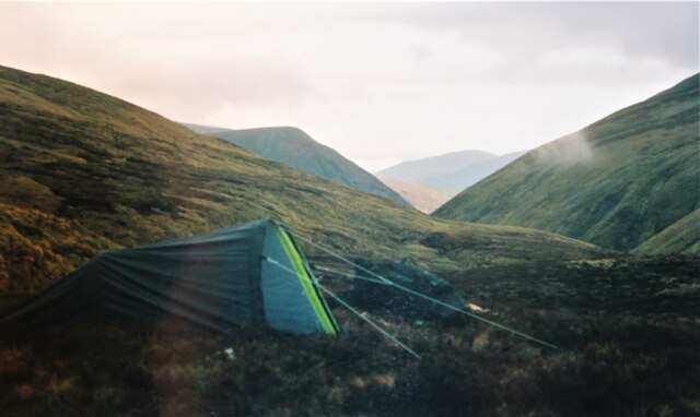
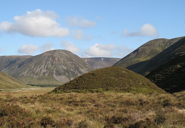
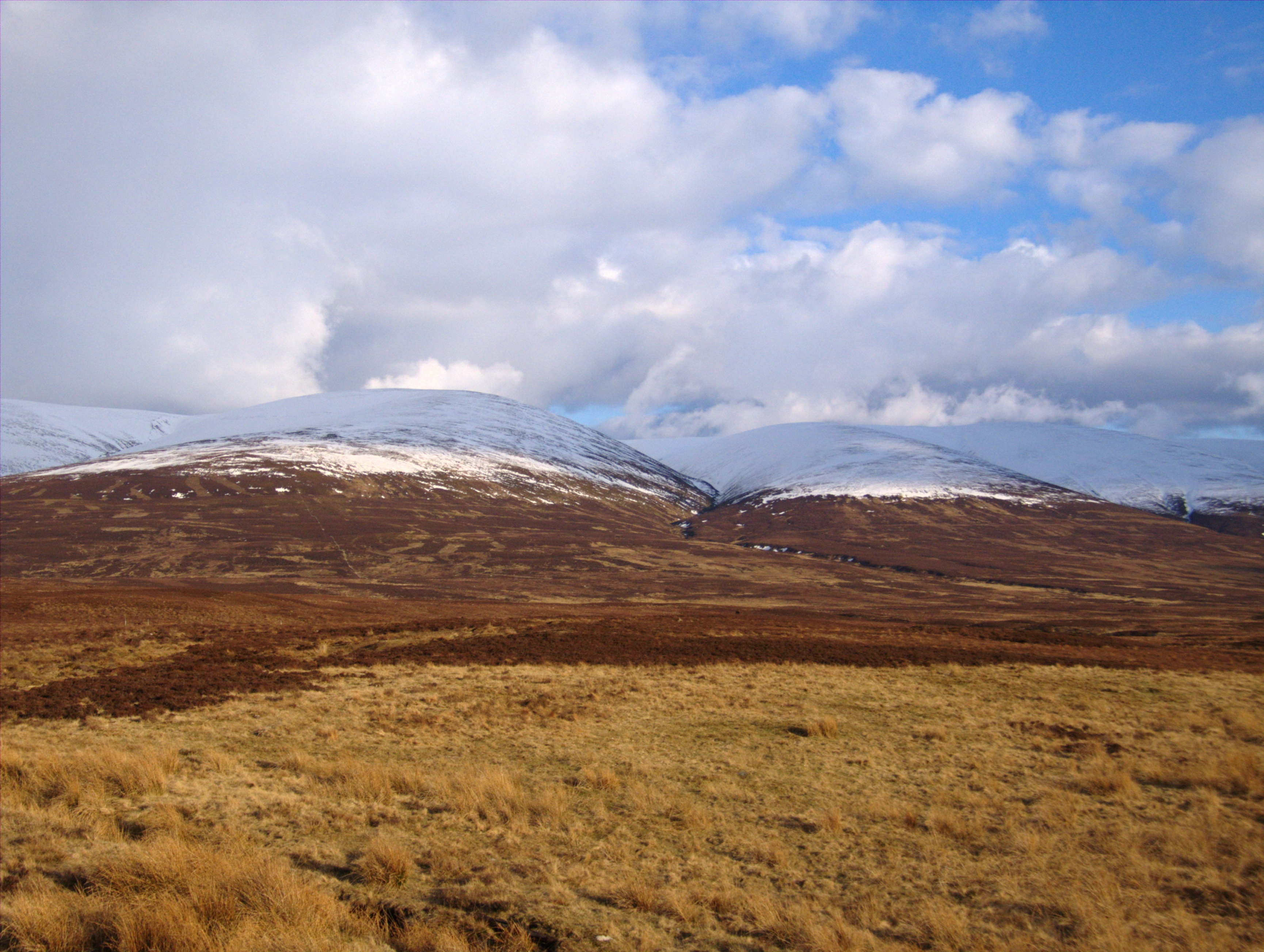
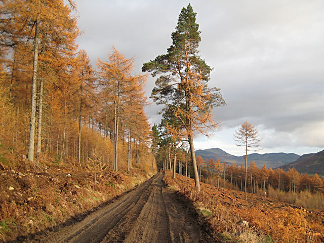
Leathad na Lice Images

Images are sourced within 2km of 56.901496/-4.0349232 or Grid Reference NN7680. Thanks to Geograph Open Source API. All images are credited.

Camp at source of Allt a' Chaoirnich Scottish 'Alpine' start at 7am for a long day's trek.
Camp at source of Allt a' Chaoirnich
Scottish 'Alpine' start at 7am for a long day's trek.
Allt nan Caoirnich The awkward descent to the Garbh Gaick by Comyn's Road uses the east side of this gorge.
Allt nan Caoirnich
The awkward descent to the Garbh Gaick by Comyn's Road uses the east side of this gorge.
Allt Aillig alluvial fan A constantly changing scene, but so remote from roads that it will receive little recording. In December 2015 heavy rain devastated Ballater and rearranged some of the Mounth's geography. Bridges and roads were destroyed, rivers rerouted and here in the Gaick a lot of material was washed down the gorges and on to the glen floor.
Allt Aillig alluvial fan
A constantly changing scene, but so remote from roads that it will receive little recording. In December 2015 heavy rain devastated Ballater and rearranged some of the Mounth's geography. Bridges and roads were destroyed, rivers rerouted and here in the Gaick a lot of material was washed down the gorges and on to the glen floor.
Comyn's road descends to the Gharbh Ghaig Another name for Comyn's Road or Rathad nan Cuimeinach is the Garbh Gaick or rough Gaick, named after the deep glen and burn in the picture.
Since Glen Garry, the road has crossed gently sloping moorland, here the ground drops away and the road begins its descent to the Gaick.  The line of the route, little used since the sixteenth century can clearly be seen as a terrace in the hillside. Further downhill, landslides and rock fall have all but obliterated the route.
Comyn's road descends to the Gharbh Ghaig
Another name for Comyn's Road or Rathad nan Cuimeinach is the Garbh Gaick or rough Gaick, named after the deep glen and burn in the picture. Since Glen Garry, the road has crossed gently sloping moorland, here the ground drops away and the road begins its descent to the Gaick. The line of the route, little used since the sixteenth century can clearly be seen as a terrace in the hillside. Further downhill, landslides and rock fall have all but obliterated the route.
Allt a'  Chaoirnich - Leum nam Fiann Taken from the hazardous descent of Comyn's Road from the Mounth Plateau. The gorge cuts deep into the high ground and has very unstable slopes. Rockfall, avalanche and landslide are all hazards here, and have all but obliterated the ancient road. 
The map names a Leum nam Fiann.  Why the warriors jumped is a mystery, but the Gaick is rich in Gaelic legend and folklore - there is a story here.
Allt a' Chaoirnich - Leum nam Fiann
Taken from the hazardous descent of Comyn's Road from the Mounth Plateau. The gorge cuts deep into the high ground and has very unstable slopes. Rockfall, avalanche and landslide are all hazards here, and have all but obliterated the ancient road. The map names a Leum nam Fiann. Why the warriors jumped is a mystery, but the Gaick is rich in Gaelic legend and folklore - there is a story here.
Allt Gharbh Ghaig A frosty morning at just under 500m in the wild Gaick. View upstream towards the northern slopes of Bac na Creige.
Allt Gharbh Ghaig
A frosty morning at just under 500m in the wild Gaick. View upstream towards the northern slopes of Bac na Creige.
Allt Gharbh Ghaig The fast flowing Allt Gharbh Ghaig becomes braided when it meets the flat floor of the lower glen. The hills here weather into small stones and are easily eroded. There are few crags, the steep slopes being made of screes covered in peat and vegetation. The burns still shift a lot of stones down on to the glen floor leading to constant course changes and braiding in the rivers.
Allt Gharbh Ghaig
The fast flowing Allt Gharbh Ghaig becomes braided when it meets the flat floor of the lower glen. The hills here weather into small stones and are easily eroded. There are few crags, the steep slopes being made of screes covered in peat and vegetation. The burns still shift a lot of stones down on to the glen floor leading to constant course changes and braiding in the rivers.
Burns leaving the Sròn Bhùirich plateau Two burns on a precipitous descent to the Garbh Gaick from the boggy plateau above.
Burns leaving the Sròn Bhùirich plateau
Two burns on a precipitous descent to the Garbh Gaick from the boggy plateau above.
Allt Gharbh Ghaig View downstream with the steep slopes of Sròn Bhùirich.
Allt Gharbh Ghaig
View downstream with the steep slopes of Sròn Bhùirich.
Glacial mound, Garbh Ghaig Mound of glacial gravel, deposited by a burn flowing off ice in the Garbh Ghaig glen. These were held to be houses of the fairies. Rather sinister given the Gaick's reputation.
Sgòr Dearg in the background.
Glacial mound, Garbh Ghaig
Mound of glacial gravel, deposited by a burn flowing off ice in the Garbh Ghaig glen. These were held to be houses of the fairies. Rather sinister given the Gaick's reputation. Sgòr Dearg in the background.
An Dubh-easain Waterfall running off the plateau from a hanging valley.
An Dubh-easain
Waterfall running off the plateau from a hanging valley.
An Dubh-easain Draining a hanging valley off the plateau. This is a little known large waterfall in a remote setting beyond the sight of most tourists.
An Dubh-easain
Draining a hanging valley off the plateau. This is a little known large waterfall in a remote setting beyond the sight of most tourists.
Coire an Dubh-easan The Garbh Ghaig glen below the waterfall  with the Alltan Crom falling in from right.
Coire an Dubh-easan
The Garbh Ghaig glen below the waterfall with the Alltan Crom falling in from right.
Allt Gharbh Chaig The braided river with the Dubh-easain waterfall in the background.
Allt Gharbh Chaig
The braided river with the Dubh-easain waterfall in the background.
Plateau above Bruthach nan Creagan Above the craggy slopes of Bruthach nan Creagan is a big area of high dry tundra plateau. Looking across the mossy ground into Inverness-shire from near the march.
Plateau above Bruthach nan Creagan
Above the craggy slopes of Bruthach nan Creagan is a big area of high dry tundra plateau. Looking across the mossy ground into Inverness-shire from near the march.
Plateau above Bruthach nan Creagan Near the 853m summit marked by the Ordnance Survey. The actual highest point is hard to identify on such a large featureless summit. 
View across the Monadh Ghaig tundra, across the deep Garbh Ghaig glen to a distant Carn an t-Sabhail in what used to be called the Cairngorms before the name became applied to almost the whole of the Mounth.
This is on the northern march of Atholl which at the time of visit was also the boundary of the extremely arbitrarily defined, and somewhat misnamed "Cairngorms" National Park. There were plans at this time to add Atholl to the park.
Plateau above Bruthach nan Creagan
Near the 853m summit marked by the Ordnance Survey. The actual highest point is hard to identify on such a large featureless summit. View across the Monadh Ghaig tundra, across the deep Garbh Ghaig glen to a distant Carn an t-Sabhail in what used to be called the Cairngorms before the name became applied to almost the whole of the Mounth. This is on the northern march of Atholl which at the time of visit was also the boundary of the extremely arbitrarily defined, and somewhat misnamed "Cairngorms" National Park. There were plans at this time to add Atholl to the park.
Plateau beyond Sròn Bhùirich The 852m summit is just as flat and featurless as its neighbour to the south. The view is towards Sròn Bhùirich, the middle green top in the picture. Sròn Bhùirich is a sharp looking peak and ridge above the Gaick Pass <a href="https://www.geograph.org.uk/photo/817834">NN7583 : Sròn Bhùirich</a>. The reality is that it is the edge of a vast plateau. These uplands are the collecting grounds for the snows of the Gaick's infamous avalanches.
Plateau beyond Sròn Bhùirich
The 852m summit is just as flat and featurless as its neighbour to the south. The view is towards Sròn Bhùirich, the middle green top in the picture. Sròn Bhùirich is a sharp looking peak and ridge above the Gaick Pass NN7583 : Sròn Bhùirich. The reality is that it is the edge of a vast plateau. These uplands are the collecting grounds for the snows of the Gaick's infamous avalanches.
Deer herd, Allt an Dubh-easain The deer were grazing in Coire Crom, far from my route. Only when I passed south of them in the rapidly strengthening wind, they detected me, and ran for Atholl, across my route.  Now at the end of July, stags are joining the herds of hinds and calves, the rutting season is approaching. Along with the blooming heather, a sign that summer will soon end.
Deer herd, Allt an Dubh-easain
The deer were grazing in Coire Crom, far from my route. Only when I passed south of them in the rapidly strengthening wind, they detected me, and ran for Atholl, across my route. Now at the end of July, stags are joining the herds of hinds and calves, the rutting season is approaching. Along with the blooming heather, a sign that summer will soon end.
Show me another place!

Leathad na Lice is located at Grid Ref: NN7680 (Lat: 56.901496, Lng: -4.0349232)

Unitary Authority: Highland

Police Authority: Highlands and Islands

What 3 Words

///awoke.moral.implore. Near Newtonmore, Highland

Nearby Locations

Leathad na Lice

Related Wikis

Grampian Mountains

The Grampian Mountains (Scottish Gaelic: Am Monadh) is one of the three major mountain ranges in Scotland, that together occupy about half of Scotland...

Meall Chuaich

Meall Chuaich (951 m) is a mountain in the Grampian Mountains of Scotland, located east of the village of Dalwhinnie. Although the mountain lacks any distinctive...

Càrn na Caim

Carn na Caim (941 m) is a mountain in the Grampian Mountains of Scotland. It lies on the border of Highland and Perth and Kinross, east of the Pass of...

Forest of Atholl

The Forest of Atholl (also known as Atholl Forest) is a deer forest near the Scottish village of Blair Atholl, Perth and Kinross, first recorded in the...

Nearby Amenities

Located within 500m of 56.901496,-4.0349232
Ele: 781
Natural: peak
Lat/Long: 56.9014983/-4.0347593
The data included in this document is from www.openstreetmap.org. The data is made available under ODbL.

Have you been to Leathad na Lice?

Leave your review of Leathad na Lice below (or comments, questions and feedback).