Corridow Hill

Hill, Mountain in Dumfriesshire

Scotland

Corridow Hill

The Southern Upland Way near Cramley Knowes
The Southern Upland Way near Cramley Knowes Credit: Dave Kelly

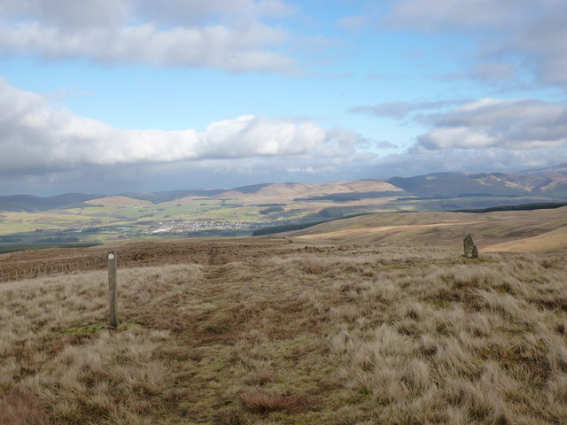
Corridow Hill is a prominent hill located in Dumfriesshire, Scotland. It rises to an elevation of 213 meters (699 feet) above sea level, making it a notable landmark in the area. The hill is situated near the village of Corriedow and offers stunning panoramic views of the surrounding countryside.

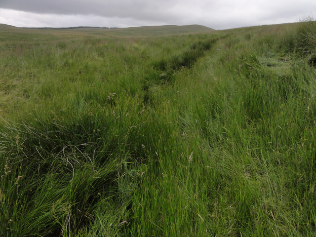
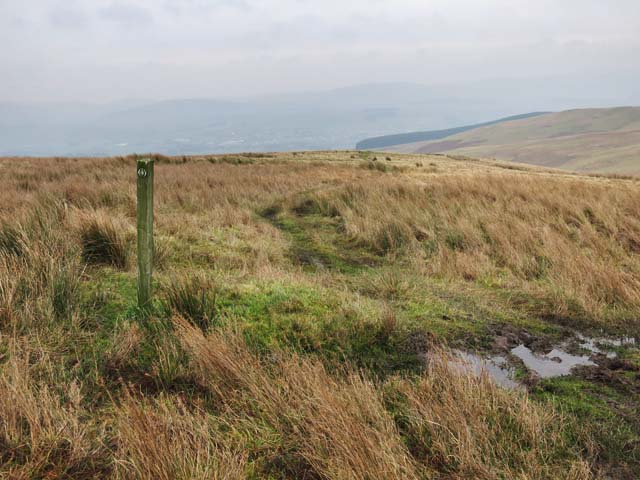
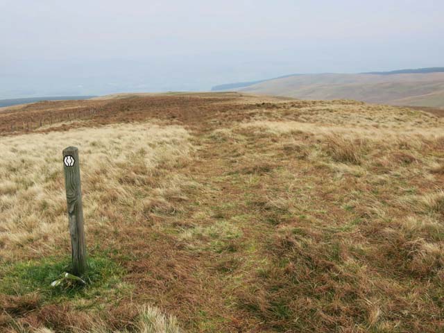
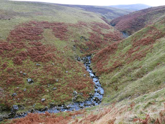
Corridow Hill is popular among hikers and outdoor enthusiasts, who come to explore its rugged terrain and enjoy the peaceful surroundings. The hill is covered in grassy slopes and scattered with rocky outcrops, providing a challenging yet rewarding climb for visitors.

At the summit of Corridow Hill, visitors can take in breathtaking views of the rolling hills and valleys of Dumfriesshire, as well as distant views of the Solway Firth and the Cumbrian Mountains. On clear days, it is possible to see as far as the Isle of Man and the Lake District.

Overall, Corridow Hill is a picturesque natural landmark that offers visitors the opportunity to experience the beauty of the Scottish countryside and enjoy a peaceful escape from the hustle and bustle of everyday life.

If you have any feedback on the listing, please let us know in the comments section below.

Corridow Hill Images

Images are sourced within 2km of 55.324074/-3.9547714 or Grid Reference NS7605. Thanks to Geograph Open Source API. All images are credited.

The Southern Upland Way near Cramley Knowes
The Southern Upland Way near Whing Head
So near and yet so far! The Southern Upland Way just cuts the north-western corner of this square: from 7601807000 to 7600006973. I wanted to get further into the square, but was frustrated by deep water channels, hidden by long grass, as seen in the photograph. Unfortunately, in trying to get further in, I made a navigational error, which resulted in taking the photograph from 7506. A proper Geograph will look pretty much the same, but nonetheless this will have to remain a supplemental: real Geographers don’t cheat!!
So near and yet so far!
The Southern Upland Way just cuts the north-western corner of this square: from 7601807000 to 7600006973. I wanted to get further into the square, but was frustrated by deep water channels, hidden by long grass, as seen in the photograph. Unfortunately, in trying to get further in, I made a navigational error, which resulted in taking the photograph from 7506. A proper Geograph will look pretty much the same, but nonetheless this will have to remain a supplemental: real Geographers don’t cheat!!
Single track road in Scaur Glen Glenwhargen Craig is prominent on the left hand side of the view.
Single track road in Scaur Glen
Glenwhargen Craig is prominent on the left hand side of the view.
Southern Upland Way south of Sanquhar
Southern Upland Way south of Sanquhar At the highest point on the moor near Whing Head
Southern Upland Way south of Sanquhar
At the highest point on the moor near Whing Head
Whing Burn south of Sanquhar The burn cuts a narrow valley in the surrounding moorland
Whing Burn south of Sanquhar
The burn cuts a narrow valley in the surrounding moorland
Scaur Water and Glenwhargen Craig These crags loom some 250 metres or so above the Scaur Glen.
Scaur Water and Glenwhargen Craig
These crags loom some 250 metres or so above the Scaur Glen.
The top of Glenwhargen Craig The Craig is the most striking feature of this quiet glen.
The top of Glenwhargen Craig
The Craig is the most striking feature of this quiet glen.
Head of the March Burn The tract of ground between here and the Welltrees Burn has the unusual name Botany Bay.
Head of the March Burn
The tract of ground between here and the Welltrees Burn has the unusual name Botany Bay.
Looking towards Welltrees Tappin 'Tappin' is a local south-west Scots word for the summit of a hill or peak.
Looking towards Welltrees Tappin
'Tappin' is a local south-west Scots word for the summit of a hill or peak.
Whing Head The Southern Upland Way can be picked up at the end of this drystane dyke.
Whing Head
The Southern Upland Way can be picked up at the end of this drystane dyke.
Southern Upland Way Looking towards the town of Sanquhar down in Nithsdale, with the Lowther Hills beyond.
Southern Upland Way
Looking towards the town of Sanquhar down in Nithsdale, with the Lowther Hills beyond.
Southern Upland Way at Cramley Knowes Looking towards Glenmaddie Craig.
Southern Upland Way at Cramley Knowes
Looking towards Glenmaddie Craig.
Glenmaddie Craig A small rocky knoll east of Cloud Hill.
Glenmaddie Craig
A small rocky knoll east of Cloud Hill.
Southern Upland Way near Cloud Hill Looking towards Welltrees Tappin.
Southern Upland Way near Cloud Hill
Looking towards Welltrees Tappin.
View down Scaur Glen Taken from the Southern Upland Way near Cloud Hill.
View down Scaur Glen
Taken from the Southern Upland Way near Cloud Hill.
Shiel Cottage An isolated house in the hill-farming country of the Scaur Glen, south-west of Sanquhar.
Shiel Cottage
An isolated house in the hill-farming country of the Scaur Glen, south-west of Sanquhar.
Show me another place!

Corridow Hill is located at Grid Ref: NS7605 (Lat: 55.324074, Lng: -3.9547714)

Unitary Authority: Dumfries and Galloway

Police Authority: Dumfries and Galloway

What 3 Words

///souk.nicknames.shifters. Near Sanquhar, Dumfries & Galloway

Nearby Locations

Corridow Hill

Related Wikis

Sanquhar Castle

Sanquhar Castle, now a ruin, was built in the 13th century; the ruins are situated north east of Dumfries overlooking the River Nith. Situated on the southern...

Sanquhar Tolbooth

Sanquhar Tolbooth is a municipal building in the High Street in Sanquhar, Dumfries and Galloway, Scotland. The structure, which accommodates a local history...

Sanquhar

Sanquhar (Scots: Sanchar, Scottish Gaelic: Seanchair) is a village on the River Nith in Dumfries and Galloway, Scotland, north of Thornhill and west of...

Nithsdale Wanderers F.C.

Nithsdale Wanderers Football Club are a Scottish football club based in Sanquhar, Dumfries and Galloway. Their home ground is Lorimer Park and they currently...

Nearby Amenities

Located within 500m of 55.324074,-3.9547714
The data included in this document is from www.openstreetmap.org. The data is made available under ODbL.

Have you been to Corridow Hill?

Leave your review of Corridow Hill below (or comments, questions and feedback).