Blackbreast
Hill, Mountain in Kirkcudbrightshire
Scotland
Blackbreast

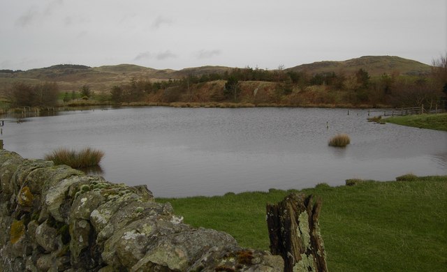
Blackbreast is a prominent hill located in the region of Kirkcudbrightshire, Scotland. Situated approximately 3 miles southeast of the town of Kirkcudbright, it forms part of the Galloway Hills range. The hill has an elevation of 347 meters (1,138 feet), making it a popular destination for hikers and outdoor enthusiasts.
Blackbreast offers stunning panoramic views of the surrounding countryside, including the nearby Solway Firth and the picturesque town of Kirkcudbright. The hill is covered in heather and grass, providing a vibrant and colorful landscape, particularly during the summer months.
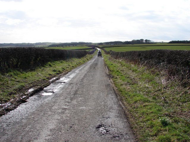
The ascent of Blackbreast is relatively straightforward, with a well-defined path leading to the summit. The hill is accessible from several points, including a car park located at the base of the hill, allowing for convenient access for visitors.
The summit of Blackbreast offers a flat and spacious area, providing the perfect spot for picnics and enjoying the breathtaking vistas. On a clear day, it is possible to see as far as the Lake District in England. Wildlife is abundant in the area, with various bird species, including peregrine falcons and red kites, often spotted soaring above the hill.
Overall, Blackbreast in Kirkcudbrightshire is a scenic and easily accessible hill, offering stunning views and a chance to immerse oneself in the natural beauty of the Galloway Hills. Whether one is a seasoned hiker or a casual nature lover, Blackbreast is a must-visit destination for anyone exploring the Kirkcudbrightshire region.
If you have any feedback on the listing, please let us know in the comments section below.
Blackbreast Images
Images are sourced within 2km of 54.848165/-3.9331023 or Grid Reference NX7552. Thanks to Geograph Open Source API. All images are credited.


Blackbreast is located at Grid Ref: NX7552 (Lat: 54.848165, Lng: -3.9331023)
Unitary Authority: Dumfries and Galloway
Police Authority: Dumfries and Galloway
What 3 Words
///provide.ordeals.warthog. Near Kirkcudbright, Dumfries & Galloway
Nearby Locations
Related Wikis

Wickerman Festival
The Wickerman Festival was an annual music festival held near Auchencairn in Dumfries and Galloway, Scotland. Dubbed "Scotland's Alternative Music festival...

Auchencairn
Auchencairn ([ɔxən'kʰɛ:(r)n]) is a village in the historical county of Kirkcudbrightshire in the Dumfries and Galloway region of Scotland. It is located...

Dundrennan
Dundrennan (Gaelic: Dun Droighnein) is a village Dumfries and Galloway, Scotland, about 5 miles (8 km) east of Kirkcudbright. Its population is around...

Dundrennan Abbey
Dundrennan Abbey, in Dundrennan, Scotland, near to Kirkcudbright, was a Cistercian monastery in the Romanesque architectural style, established in 1142...

Airieland
Airieland is a farm in the historical county of Kirkcudbrightshire, in the Scottish council area of Dumfries and Galloway. It is found 3 miles (5 km) south...

Orchardton Castle
Orchardton Castle overlooks the Solway Coast. Built in the 1880s, this is a Grade B listed property formerly known as Orchardton House. Built around a...

High Banks cup and ring markings
The High Banks cup and ring markings are a series of Neolithic or Bronze Age carvings on an outcrop of rock near High Banks farm, 3 km SE of Kirkcudbright...

Tongland
Tongland is a small village about 2 miles (3 km) north of Kirkcudbright, in the historic county of Kirkcudbrightshire in Dumfries and Galloway, Scotland...
Have you been to Blackbreast?
Leave your review of Blackbreast below (or comments, questions and feedback).