Cairn Dulnan

Hill, Mountain in Inverness-shire

Scotland

Cairn Dulnan

The Allt Mor from the moor Estate track can be clearly seen on the other side of the river, but unable to cross because it was in spate.
The Allt Mor from the moor Credit: John Ferguson

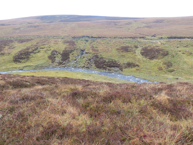
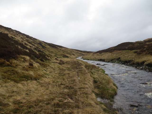
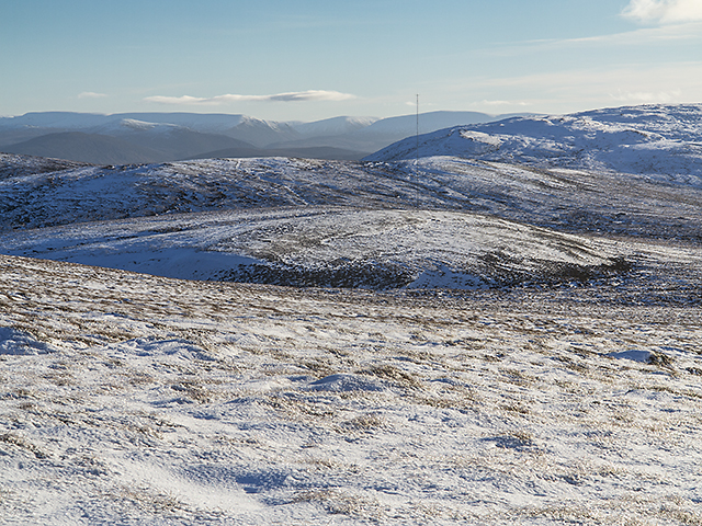
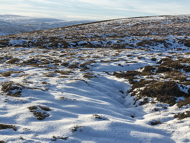
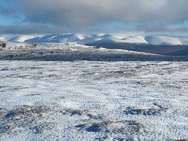
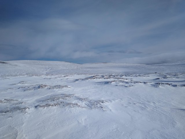
Cairn Dulnan is a prominent hill located in Inverness-shire, Scotland. It lies within the beautiful Cairngorms National Park, which is known for its stunning landscapes and diverse wildlife. Standing at an elevation of approximately 868 meters (2,848 feet), Cairn Dulnan offers breathtaking panoramic views of the surrounding area.

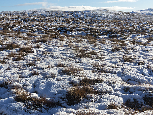
The hill is made up of ancient granite rocks, which have been shaped by glacial activity over thousands of years. Its distinctive shape and rugged terrain make it a popular destination for hikers and mountaineers looking for a challenge. The ascent to the summit can be challenging, as the path is steep and requires some scrambling, but the reward is well worth it.

Once at the top, visitors are treated to magnificent vistas of the Cairngorms, including the neighboring peaks of Cairn Gorm and Ben Macdui. On clear days, it is even possible to see as far as the Moray Firth and the North Sea.

Cairn Dulnan is also home to a variety of native flora and fauna, including heather, mosses, and lichens. Birdwatchers may spot golden eagles soaring overhead, while mountain hares and red deer roam the slopes.

Due to its location within the national park, Cairn Dulnan is protected and maintained by conservation efforts. Visitors are encouraged to follow the designated paths and respect the natural environment to ensure its preservation for future generations to enjoy.

If you have any feedback on the listing, please let us know in the comments section below.

Cairn Dulnan Images

Images are sourced within 2km of 57.170409/-4.0654295 or Grid Reference NH7510. Thanks to Geograph Open Source API. All images are credited.

The Allt Mor from the moor Estate track can be clearly seen on the other side of the river, but unable to cross because it was in spate.
The Allt Mor from the moor
Estate track can be clearly seen on the other side of the river, but unable to cross because it was in spate.
The Allt Mor river
The Allt Mor river
The Monadhliath - a suitable site for a wind farm? Winter comes to the Monadhliath Mountains in central Scotland, with snow now extending to the 500 metre contour line. A wild and unspoiled place, with the Cairngorm Mountains visible in the distance, viewed here from the summit area of Cairn Dulnan. Astonishingly, this most beautiful of places is under threat from a wind farm - Allt Duine - an anemometer mast can be seen in the middle distance. The scale of the proposed development  - covering approximately 40 OS grid squares - can be seen from RWE-Innogy's website linked below. 

<span class="nowrap"><a title="http://www.rwe.com/web/cms/en/306982/rwe-innogy/sites/wind-onshore/united-kingdom/in-development/location/" rel="nofollow ugc noopener" href="http://www.rwe.com/web/cms/en/306982/rwe-innogy/sites/wind-onshore/united-kingdom/in-development/location/">Link</a><img style="margin-left:2px;" alt="External link" title="External link - shift click to open in new window" src="https://s1.geograph.org.uk/img/external.png" width="10" height="10"/></span>
<span class="nowrap"><a title="http://www.rwe.com/web/cms/mediablob/en/306988/data/306982/1/rwe-innogy/sites/wind-onshore/united-kingdom/in-development/location/blob.pdf" rel="nofollow ugc noopener" href="http://www.rwe.com/web/cms/mediablob/en/306988/data/306982/1/rwe-innogy/sites/wind-onshore/united-kingdom/in-development/location/blob.pdf">Link</a><img style="margin-left:2px;" alt="External link" title="External link - shift click to open in new window" src="https://s1.geograph.org.uk/img/external.png" width="10" height="10"/></span>
The Monadhliath - a suitable site for a wind farm?
Winter comes to the Monadhliath Mountains in central Scotland, with snow now extending to the 500 metre contour line. A wild and unspoiled place, with the Cairngorm Mountains visible in the distance, viewed here from the summit area of Cairn Dulnan. Astonishingly, this most beautiful of places is under threat from a wind farm - Allt Duine - an anemometer mast can be seen in the middle distance. The scale of the proposed development - covering approximately 40 OS grid squares - can be seen from RWE-Innogy's website linked below. LinkExternal link LinkExternal link
West of Cairn Dulnan Peat-hagged ground to the west of Cairn Dulnan in the Monadhliath Mountains. This area is relatively easy to access for a Geograph unphotographed grid square as of November 2013 - a hill track provides an easy route to the A9, leading to the vicinity of A9 layby 116. Night walking in winter is not problematic, although fording the 6km-distant Raitts Burn in the dark is "interesting".
West of Cairn Dulnan
Peat-hagged ground to the west of Cairn Dulnan in the Monadhliath Mountains. This area is relatively easy to access for a Geograph unphotographed grid square as of November 2013 - a hill track provides an easy route to the A9, leading to the vicinity of A9 layby 116. Night walking in winter is not problematic, although fording the 6km-distant Raitts Burn in the dark is "interesting".
View from 701 metre spot height A view from the 701 metre spot height situated approximately 1.5km south of Cairn Dulnan in the Monadhliath Mountains, with the Cairngorms visible in the distance. It is very cold here on a November afternoon, with recently fallen snow covering the ground above 500 metres height. Sadly, this beautiful area is threatened by a wind energy development, which would cover approximately 40 square kilometres of the Monadhliath.
View from 701 metre spot height
A view from the 701 metre spot height situated approximately 1.5km south of Cairn Dulnan in the Monadhliath Mountains, with the Cairngorms visible in the distance. It is very cold here on a November afternoon, with recently fallen snow covering the ground above 500 metres height. Sadly, this beautiful area is threatened by a wind energy development, which would cover approximately 40 square kilometres of the Monadhliath.
Moorland east of Chaochan na Gaibhre November in the Monadhliath Mountains, with snow now covering moorland situated to the east of Chaochan na Gaibhre.
Moorland east of Chaochan na Gaibhre
November in the Monadhliath Mountains, with snow now covering moorland situated to the east of Chaochan na Gaibhre.
Bleak Monadh Liath The featureless, trackless expanse of the snow covered Monadh Liath is beautiful and terrifying at the same time.
Bleak Monadh Liath
The featureless, trackless expanse of the snow covered Monadh Liath is beautiful and terrifying at the same time.
Show me another place!

Cairn Dulnan is located at Grid Ref: NH7510 (Lat: 57.170409, Lng: -4.0654295)

Unitary Authority: Highland

Police Authority: Highlands and Islands

What 3 Words

///commutes.paddocks.airbrush. Near Kingussie, Highland

Nearby Locations

Cairn Dulnan

Related Wikis

Monadhliath Mountains

The Monadhliath Mountains , or Monadh Liath, are a range of mountains in Scotland. Monadh Liath is Scottish Gaelic, and means "grey mountain range". Running...

Highland Wildlife Park

The Highland Wildlife Park is a 105-hectare (260-acre) safari park and zoo near Kingussie, Highland, Scotland. The park is located within the Cairngorms...

Dunachton

Dunachton (Scottish Gaelic: Dùn Neachdain) is an estate on the north-west shore of Loch Insh in Badenoch and Strathspey, in the Highlands of Scotland....

Creag Bheag

Creag Bheag is a prominent hill in Scotland. == Etymology == The word Creag is a variation of crag (rock), while the gaelic term Bheag can be translated...

Nearby Amenities

Located within 500m of 57.170409,-4.0654295
Cairn Dulnan
Ele: 729
Natural: peak
Source: OS7
Lat/Long: 57.1737553/-4.062704
The data included in this document is from www.openstreetmap.org. The data is made available under ODbL.

Have you been to Cairn Dulnan?

Leave your review of Cairn Dulnan below (or comments, questions and feedback).