Creag an Lochain

Hill, Mountain in Sutherland

Scotland

Creag an Lochain

Rock on Hillside looking N The featureless slopes and misty weather made photographing this square a challenge, but the rocks did add some interest.
Rock on Hillside looking N Credit: Calum McRoberts

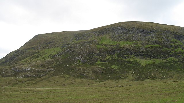
Creag an Lochain, located in Sutherland, Scotland, is a prominent hill/mountain that stands at an elevation of 827 meters (2,713 feet). It is part of the Northwest Highlands, which are known for their rugged beauty and breathtaking landscapes.

Creag an Lochain is characterized by its distinctive shape, with a steep and rocky face that offers a challenging ascent for experienced hikers and climbers. The summit provides panoramic views of the surrounding countryside, including the nearby lochs, mountains, and glens. On clear days, it is possible to see as far as the North Sea.

The hill/mountain is home to a diverse range of flora and fauna, including various species of birds, mammals, and plants. It is particularly notable for its heather-covered slopes, which burst into vibrant colors during the summer months, creating a stunning spectacle for visitors.

Access to Creag an Lochain is mostly via foot, with several well-marked paths leading to the summit. However, it is important to note that the terrain can be challenging and requires appropriate hiking gear and experience. Additionally, weather conditions in the area can be unpredictable, and it is advisable to check forecasts and be prepared for sudden changes.

Creag an Lochain offers a rewarding outdoor experience for nature enthusiasts and adventure seekers alike. Its rugged beauty, diverse wildlife, and breathtaking views make it a popular destination for hikers, climbers, and photographers, allowing visitors to immerse themselves in the natural wonders of the Scottish Highlands.

If you have any feedback on the listing, please let us know in the comments section below.

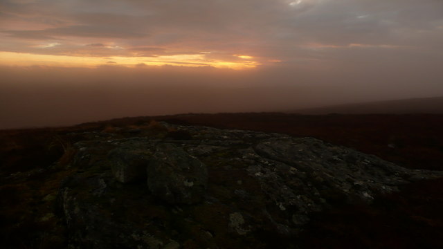
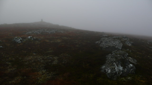
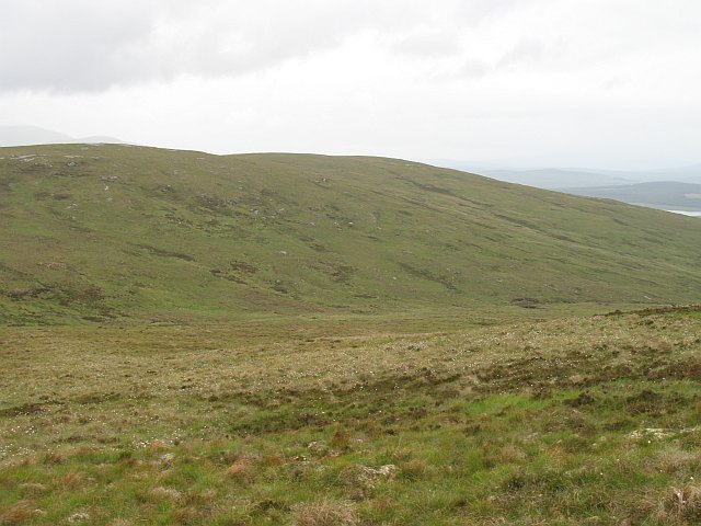
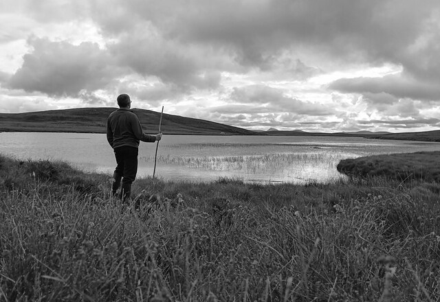
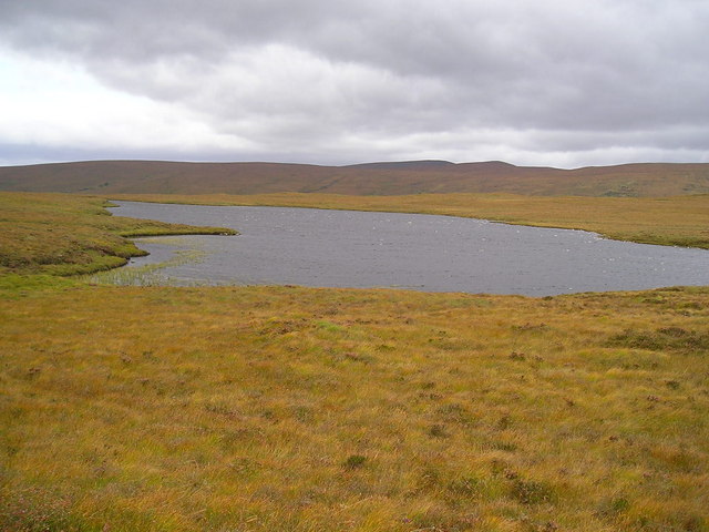
Creag an Lochain Images

Images are sourced within 2km of 58.240917/-4.1274389 or Grid Reference NC7529. Thanks to Geograph Open Source API. All images are credited.

Rock on Hillside looking N The featureless slopes and misty weather made photographing this square a challenge, but the rocks did add some interest.
Rock on Hillside looking N
The featureless slopes and misty weather made photographing this square a challenge, but the rocks did add some interest.
Twin rocks on hillside This was a lone feature on an otherwise featureless hillside.  The ground like many hills in this remote corner was very wet underfoot.
Twin rocks on hillside
This was a lone feature on an otherwise featureless hillside. The ground like many hills in this remote corner was very wet underfoot.
Rock outcrop near summit It was a very misty sunrise to start 2008 in the North of Scotland.  Less than 1km short of the summit of the hill, it was nice to stand on firm ground as this is a very wet hill.
Rock outcrop near summit
It was a very misty sunrise to start 2008 in the North of Scotland. Less than 1km short of the summit of the hill, it was nice to stand on firm ground as this is a very wet hill.
Trig point on summit of Cnoc an Liath-bhaid Mhoir Unfortunately the 1st hill did not provide any views over this remote landscape.
Trig point on summit of Cnoc an Liath-bhaid Mhoir
Unfortunately the 1st hill did not provide any views over this remote landscape.
Trig point and hillside of Cnoc an Liath-bhaid Mhoir Looking back along the misty hillside to the summit.
Trig point and hillside of Cnoc an Liath-bhaid Mhoir
Looking back along the misty hillside to the summit.
Cnoc an Liath-bhaid Mhòir The north ridge with the trig point visible on the skyline. Easy going, but boggy.
Cnoc an Liath-bhaid Mhòir
The north ridge with the trig point visible on the skyline. Easy going, but boggy.
Cnoc an Liath-bhaid Mhòir The south top of a moorland hill. Most of Cnoc an Liath-bhaid Mhòir is covered in peat.
Cnoc an Liath-bhaid Mhòir
The south top of a moorland hill. Most of Cnoc an Liath-bhaid Mhòir is covered in peat.
Cnoc an Liath-bhaid Mhòir View across the summit area of Cnoc an Liath-bhaid Mhòir towards Ben Armine, across a large expanse of blanket bog at the head of Strath Skinsdale.
Cnoc an Liath-bhaid Mhòir
View across the summit area of Cnoc an Liath-bhaid Mhòir towards Ben Armine, across a large expanse of blanket bog at the head of Strath Skinsdale.
Lochan, Cnoc an Liath-bhaid Mhòir Below Creag an Lochain, a circular pool on a peaty plateau. Cloud is beginning to form on Ben Armine's southern top, Creag Mhòr.
Lochan, Cnoc an Liath-bhaid Mhòir
Below Creag an Lochain, a circular pool on a peaty plateau. Cloud is beginning to form on Ben Armine's southern top, Creag Mhòr.
The head of the Allt a' Bheallach Shallow glen under Creag Liath.
The head of the Allt a' Bheallach
Shallow glen under Creag Liath.
Gazing Homewards A Caithnessian considers his distant homeland from the wilds of Sutherland-shire.
Gazing Homewards
A Caithnessian considers his distant homeland from the wilds of Sutherland-shire.
View from Creag an Lochain On the lower slopes of Creag an Lochain with Loch na Gaineimh in sight.
View from Creag an Lochain
On the lower slopes of Creag an Lochain with Loch na Gaineimh in sight.
Boggy Moorland North of Cnoc a' Chrom-uillt Looking towards Creag Dhubh and, in the distance, Ben Armine.
Boggy Moorland North of Cnoc a' Chrom-uillt
Looking towards Creag Dhubh and, in the distance, Ben Armine.
Looking East from Slopes of Cnoc a' Chrom-uillt Looking over the Allt a' Choire Bhuidhe and up the SW slopes of Cnoc an Liath-bhaid Mhòir.
Looking East from Slopes of Cnoc a' Chrom-uillt
Looking over the Allt a' Choire Bhuidhe and up the SW slopes of Cnoc an Liath-bhaid Mhòir.
Allt a' Choire Bhuidhe The "stream of the yellow corrie", with Cnoc an t-Sìthein ("hill of the fairy knoll") behind it.
Allt a' Choire Bhuidhe
The "stream of the yellow corrie", with Cnoc an t-Sìthein ("hill of the fairy knoll") behind it.
Upper Reaches of An Cròm-allt Creag Dhubh on the left and Loch Truderscaig in the distance. The burn is bordered by a wide area of grass, which contrasts with the heathery moorland around.
Upper Reaches of An Cròm-allt
Creag Dhubh on the left and Loch Truderscaig in the distance. The burn is bordered by a wide area of grass, which contrasts with the heathery moorland around.
Lower Slopes of Cnoc an Liath-bhaid Mhoir Grassy moorland.
Lower Slopes of Cnoc an Liath-bhaid Mhoir
Grassy moorland.
On Cnoc Liath-bhaid Mhoir Boggy terrain. Ben Armine distant.
On Cnoc Liath-bhaid Mhoir
Boggy terrain. Ben Armine distant.
Show me another place!

Creag an Lochain is located at Grid Ref: NC7529 (Lat: 58.240917, Lng: -4.1274389)

Unitary Authority: Highland

Police Authority: Highlands and Islands

What 3 Words

///searched.curve.discloses. Near Kinbrace, Highland

Related Wikis

Loch Badanloch

Loch Badanloch is a loch in Sutherland in the Highland Council Area of northern Scotland. The settlement on the lake is Bandanloch Lodge. The hamlet of...

Loch Nan Clar

Loch Nan Clar is a loch in Sutherland in the Highland Council Area of northern Scotland. It is located near the B871 main road, and there is no settlement...

Loch Rimsdale

Loch Rimsdale is a loch in the Farr parish in Sutherland in the Highland Council Area of northern Scotland. It is located near the B871 main road. There...

Ben Armine

Ben Armine (705 m) is a remote hill in Sutherland in the far north of Scotland. It lies in inland, north of the village of Lairg. The best known summit...

Nearby Amenities

Located within 500m of 58.240917,-4.1274389
Creag an Lochain
Ele: 391
Natural: peak
Lat/Long: 58.2415618/-4.1280692
The data included in this document is from www.openstreetmap.org. The data is made available under ODbL.

Have you been to Creag an Lochain?

Leave your review of Creag an Lochain below (or comments, questions and feedback).