Creag Liath

Hill, Mountain in Perthshire

Scotland

Creag Liath

Minor road in Glen Lednock Looking southward.
Minor road in Glen Lednock Credit: Peter Wood

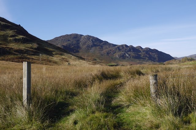
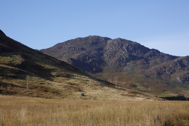
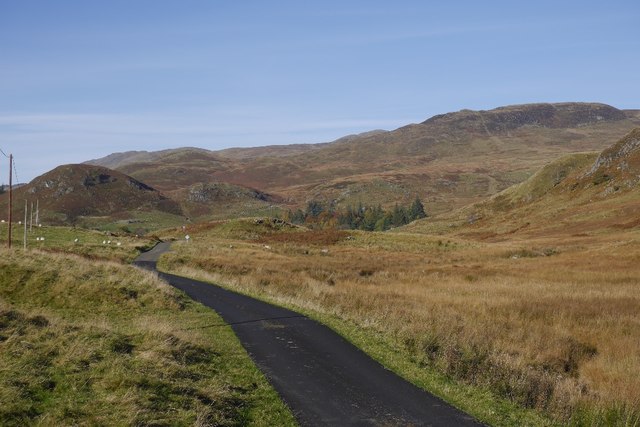
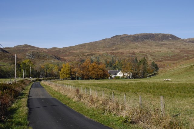
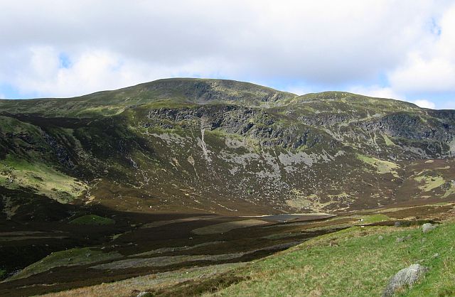
Creag Liath, located in Perthshire, Scotland, is a prominent hill/mountain that stands at an elevation of approximately 862 meters (2,828 feet) above sea level. It is situated within the wider Ben Lawers range, known for its stunning natural beauty and varied terrain. Creag Liath is a popular destination among hikers and nature enthusiasts due to its accessibility and breathtaking panoramic views.

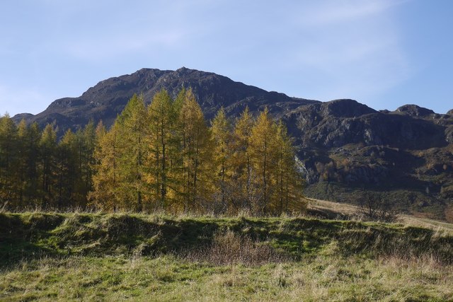
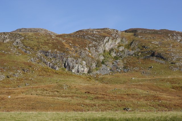
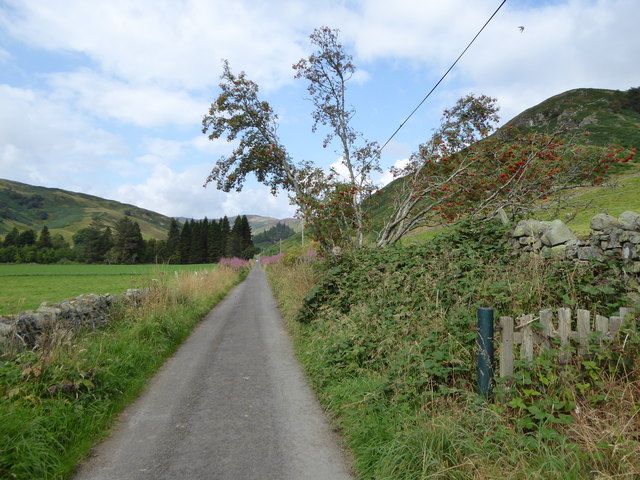
The hill/mountain is characterized by its distinctive rocky summit, which offers unparalleled vistas of the surrounding landscape, including Loch Tay and the rolling hills of Perthshire. The ascent to the top is moderately challenging, with a well-defined path that meanders through moorlands and heather-clad slopes. Along the way, visitors can encounter a diverse range of flora and fauna, including heath bedstraw, purple saxifrage, and red grouse.

Creag Liath is also known for its historical significance, with remnants of ancient settlements and burial sites scattered throughout the area. Archaeological findings suggest that the hill/mountain was inhabited during the Neolithic and Bronze Age periods, adding to its allure and appeal for history buffs.

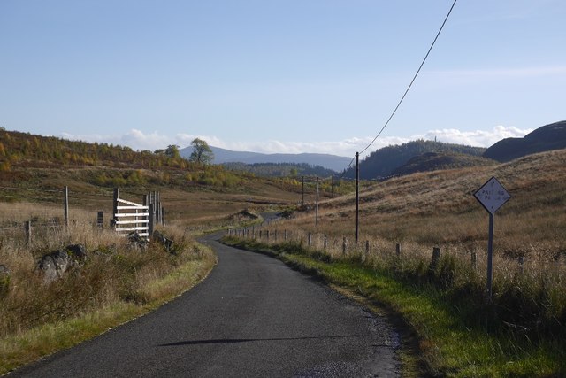
Outdoor activities such as hillwalking, photography, and birdwatching are popular pursuits on Creag Liath. However, it is essential that visitors come prepared with suitable clothing, footwear, and navigational equipment, as the weather conditions can change rapidly, and the terrain can be challenging in certain areas.

Overall, Creag Liath in Perthshire offers a captivating outdoor experience, combining natural beauty, historical significance, and an opportunity to immerse oneself in the rugged splendor of the Scottish countryside.

If you have any feedback on the listing, please let us know in the comments section below.
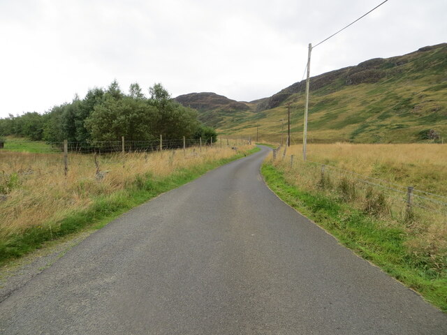
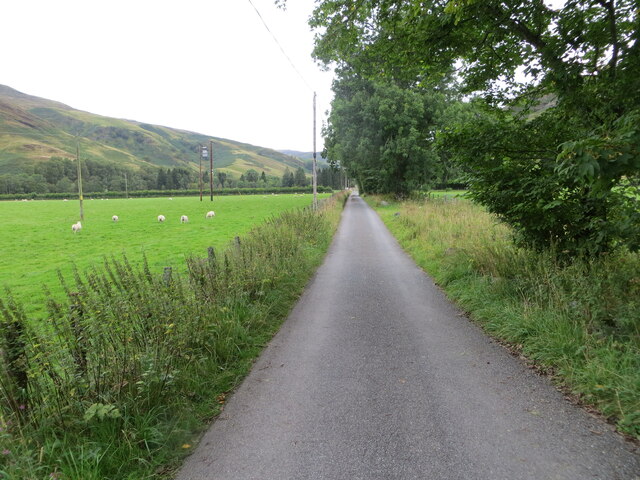
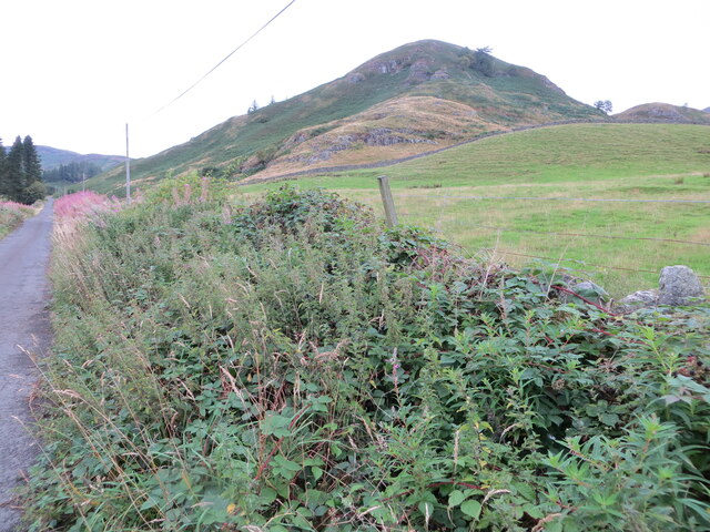
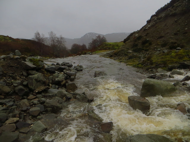
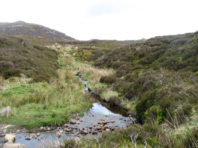
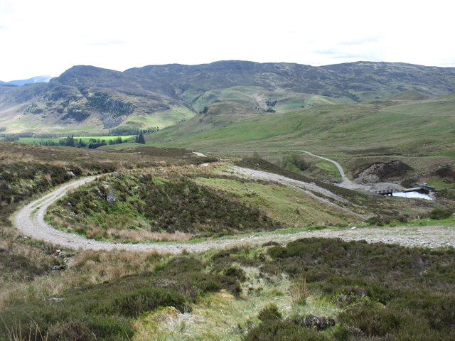
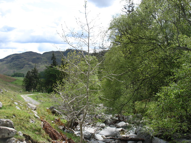
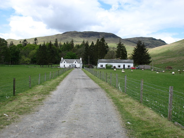
Creag Liath Images

Images are sourced within 2km of 56.419513/-4.0274269 or Grid Reference NN7527. Thanks to Geograph Open Source API. All images are credited.

Minor road in Glen Lednock Looking southward.
Minor road in Glen Lednock
Looking southward.
Glen Lednock - Rough pastureland near East Ballindaloch Looking north-eastward. The hills ahead all seem have Creag or Chreag in their names.
Glen Lednock - Rough pastureland near East Ballindaloch
Looking north-eastward. The hills ahead all seem have Creag or Chreag in their names.
Glen Lednock - Minor road at the abandoned cottage of Kinnel at East Ballindalloch Looking northward.
Glen Lednock - Minor road at the abandoned cottage of Kinnel at East Ballindalloch
Looking northward.
Glen Lednock - Approaching the end of the public road near Invergeldie Looking north-westward.
Glen Lednock - Approaching the end of the public road near Invergeldie
Looking north-westward.
Glen Lednock - An Dùn at Invergeldie Looking north-westward from the Glen road
Glen Lednock - An Dùn at Invergeldie
Looking north-westward from the Glen road
Invergeldie Burn in Spate Invergeldie Burn in spate at the ford just below the dam.  This was during the heavy rains of Storm Desmond, December 2015.  Crossing the burn was rather interesting.
Invergeldie Burn in Spate
Invergeldie Burn in spate at the ford just below the dam. This was during the heavy rains of Storm Desmond, December 2015. Crossing the burn was rather interesting.
A minor tributary of the Invergeldie Burn Meall Reamhar in the background.
A minor tributary of the Invergeldie Burn
Meall Reamhar in the background.
Descending to the Invergeldie Burn from Ben Chonzie The small dam diverts most of the Burn into the Glen Lednock Reservoir.
Descending to the Invergeldie Burn from Ben Chonzie
The small dam diverts most of the Burn into the Glen Lednock Reservoir.
The Invergeldie Burn Flowing down to the River Lednock. There is not much water today: most of what there is has been diverted higher up into Loch Lednock Reservoir.
The Invergeldie Burn
Flowing down to the River Lednock. There is not much water today: most of what there is has been diverted higher up into Loch Lednock Reservoir.
Coishavachan cottages The track to Ben Chonzie passes in front of the right-hand cottage, and then cuts back behind the trees to climb, initially, beside the Invergeldie Burn.
Coishavachan cottages
The track to Ben Chonzie passes in front of the right-hand cottage, and then cuts back behind the trees to climb, initially, beside the Invergeldie Burn.
Glen Lednock Rashy ground beside the road. The craggy hill is Balnacoul Castle, home of some steep rock climbs.
Glen Lednock
Rashy ground beside the road. The craggy hill is Balnacoul Castle, home of some steep rock climbs.
Road, Glen Lednock The road leaves the river, passes behind a newly forested small hill before dropping out of the hanging valley. The land is rather wet and rashy, anything dry is covered in bracken.
Road, Glen Lednock
The road leaves the river, passes behind a newly forested small hill before dropping out of the hanging valley. The land is rather wet and rashy, anything dry is covered in bracken.
Balnacoul Castle Home of some climbing crags in Glen Lednock.
Balnacoul Castle
Home of some climbing crags in Glen Lednock.
Larches in Glen Lednock Against a background of the Balnacoul Castle crags.
Larches in Glen Lednock
Against a background of the Balnacoul Castle crags.
Road in Glen Lednock
Crag in Glen Lednock One of many schist crags in the glen.
Crag in Glen Lednock
One of many schist crags in the glen.
Road, Invergeldie Near the end of the public road in Glen Lednock and approaching a popular starting point for Ben Chonzie.
Road, Invergeldie
Near the end of the public road in Glen Lednock and approaching a popular starting point for Ben Chonzie.
Road in Glen Lednock The public road ends at Invergeldie but continues as a private road up to the Loch Lednock dam.  The small hill of An Dun ('the fort') is visible on the right.
Road in Glen Lednock
The public road ends at Invergeldie but continues as a private road up to the Loch Lednock dam. The small hill of An Dun ('the fort') is visible on the right.
Show me another place!

Creag Liath is located at Grid Ref: NN7527 (Lat: 56.419513, Lng: -4.0274269)

Unitary Authority: Perth and Kinross

Police Authority: Tayside

What 3 Words

///donor.nerves.townhouse. Near Comrie, Perth & Kinross

Related Wikis

Central Lowlands

The Central Lowlands, sometimes called the Midland Valley or Central Valley, is a geologically defined area of relatively low-lying land in southern Scotland...

Dunira, Perthshire

Dunira (Scottish Gaelic: Dùn Iar) is an estate of about 350 hectares (860 acres) in Perthshire, Scotland, 3 miles (5 kilometres) northwest of Comrie and...

Dalchonzie Halt railway station

Dalchonzie Halt railway station, Dalchonzie Platform railway station or Dalchonzie Siding in the Parish of Comrie, Perth and Kinross, Scotland was an intermediate...

Ben Chonzie

Ben Chonzie or Ben-y-Hone (Scottish Gaelic: Beinn a' Chomhainn, 'mountain of the narrowness', or possibly from Beinn Chòinnich, 'mossy mountain') is a...

Nearby Amenities

Located within 500m of 56.419513,-4.0274269
The data included in this document is from www.openstreetmap.org. The data is made available under ODbL.

Have you been to Creag Liath?

Leave your review of Creag Liath below (or comments, questions and feedback).