Hollybush

Settlement in Worcestershire Malvern Hills

England

Hollybush

The Eastnor Obelisk View to the Eastnor Obelisk viewed from Hangman's Hill in the Malvern Hills.
The Eastnor Obelisk Credit: Philip Halling

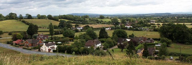
Hollybush is a small village located in the county of Worcestershire, England. Situated approximately 5 miles southwest of the town of Redditch, it is nestled in the heart of the picturesque countryside. With a population of around 800 residents, Hollybush offers a peaceful and close-knit community atmosphere.

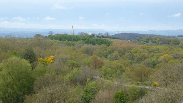
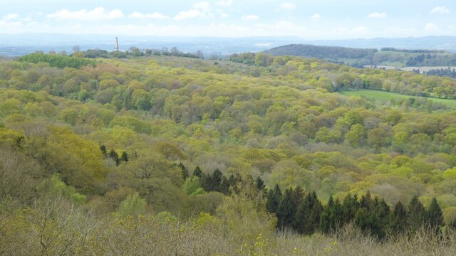
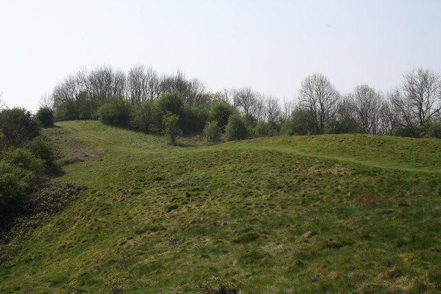
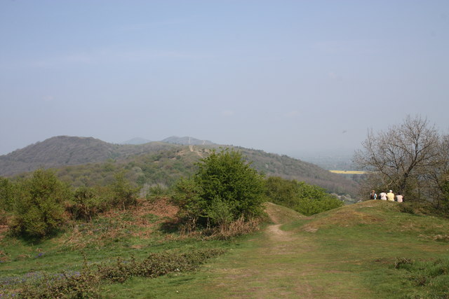
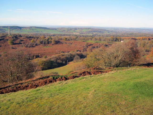
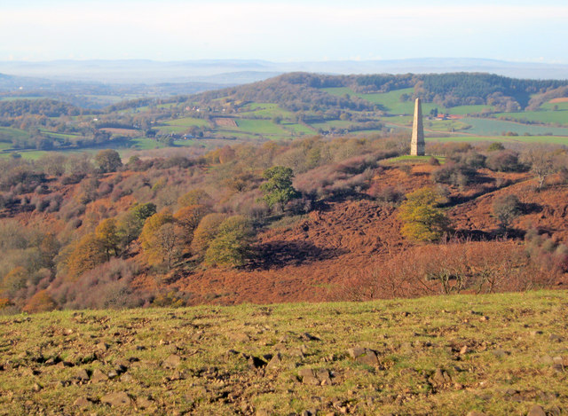
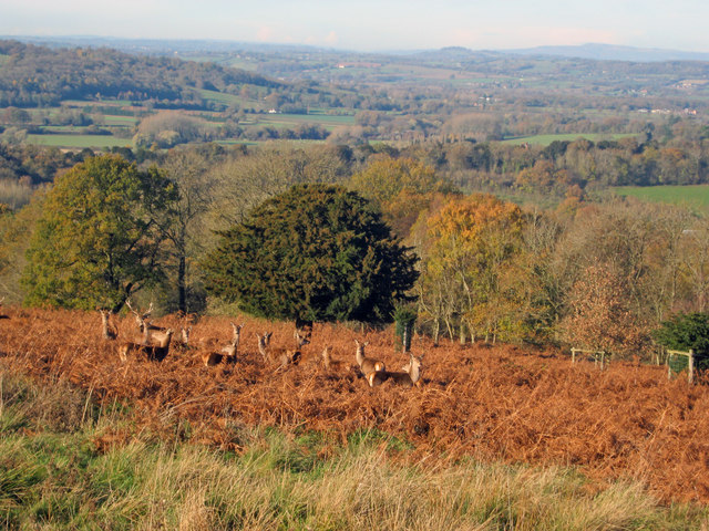
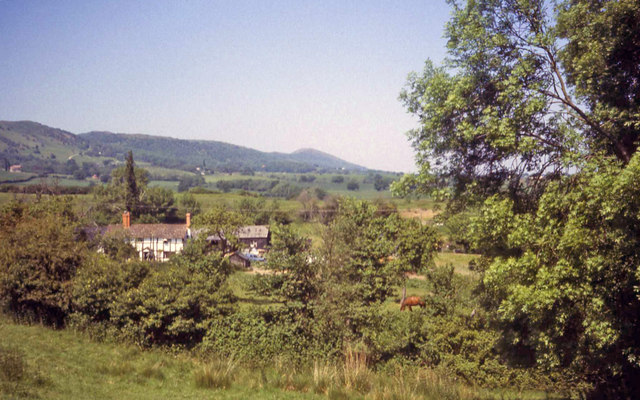
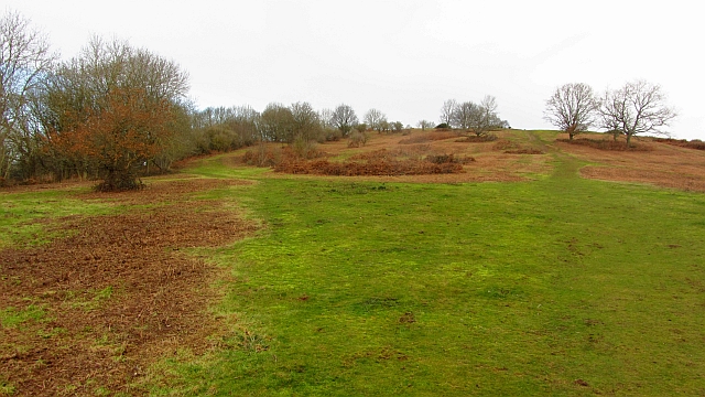
The village is known for its natural beauty, surrounded by rolling hills, lush green fields, and charming woodland areas. It is a popular destination for nature lovers and outdoor enthusiasts, with numerous walking and cycling routes available to explore the surrounding countryside.

Despite its small size, Hollybush has a few amenities to cater to its residents' needs. These include a local pub, a village hall, and a primary school. Additionally, the nearby town of Redditch offers a wider range of facilities, including shops, supermarkets, and leisure activities.

Hollybush is well-connected to neighboring areas via a network of roads, making it easily accessible for visitors and commuters. The village also benefits from regular bus services that connect it to Redditch and other nearby towns.

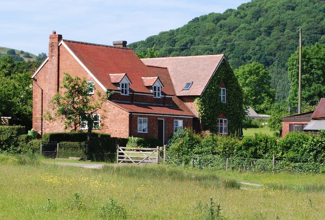
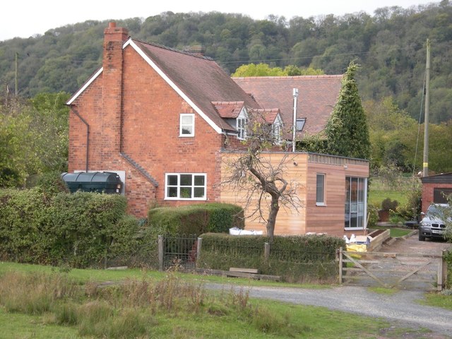
In terms of history, Hollybush has a rich heritage, with some buildings dating back to the 17th century. The village has managed to retain its traditional charm, with a mix of old and new properties blending seamlessly into the picturesque landscape.

Overall, Hollybush offers a tranquil and idyllic setting for those seeking a peaceful countryside retreat, while still providing convenient access to nearby amenities and transport links.

If you have any feedback on the listing, please let us know in the comments section below.
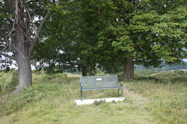
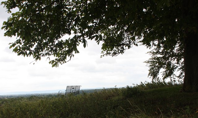
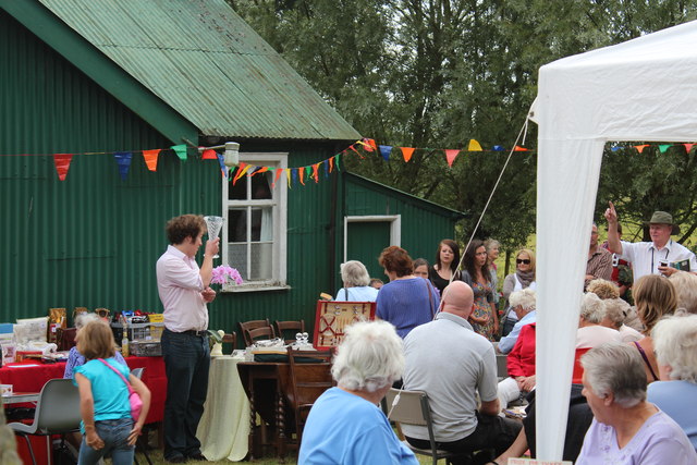
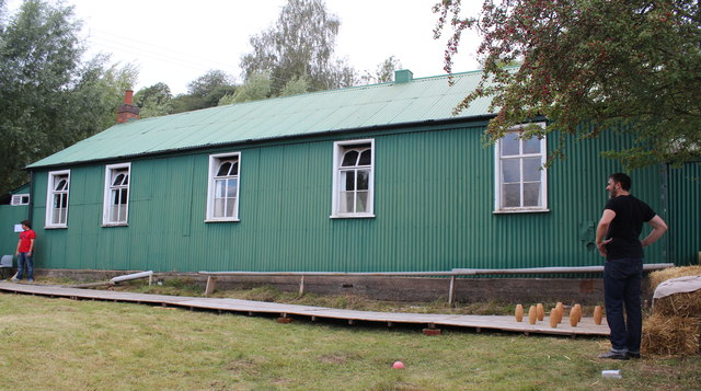
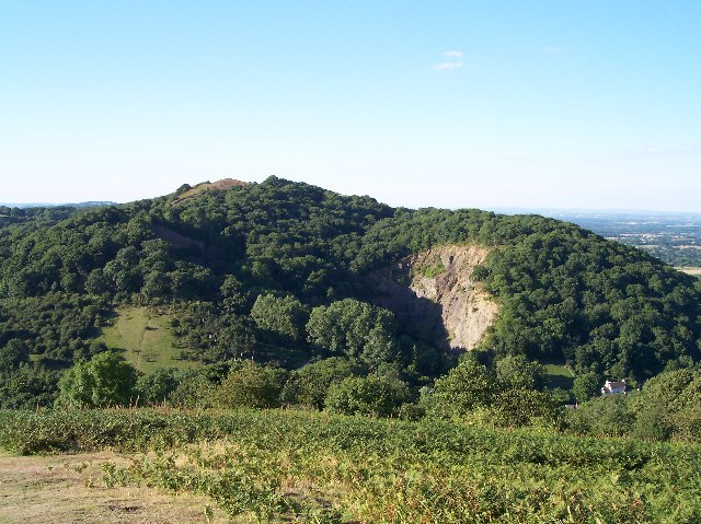
Hollybush Images

Images are sourced within 2km of 52.028612/-2.34687 or Grid Reference SO7636. Thanks to Geograph Open Source API. All images are credited.

The Eastnor Obelisk View to the Eastnor Obelisk viewed from Hangman's Hill in the Malvern Hills.
The Eastnor Obelisk
View to the Eastnor Obelisk viewed from Hangman's Hill in the Malvern Hills.
Springtime woodland Springtime woodland in the Malvern Hills.  The Eastnor Obelisk can be seen in the middle distance.
Springtime woodland
Springtime woodland in the Malvern Hills. The Eastnor Obelisk can be seen in the middle distance.
Hollybush Hill It can be quite hard to imagine that 2000 years ago this quiet spot was part of a busy town - the Midsummer Hill iron-age hill-fort. 
Excavations in the late 1960s by Stan Stanford showed the area full of small building plots. 
Each plot had been reused time and time again over the centuries suggesting continuous occupation. 
The buildings used four posts arranged in a square - not at all like the round huts usually depicted for this era.
Evidence for similar square buildings have been found in other so called "hill-forts" in Herefordshire and the Welsh Marches
Hollybush Hill
It can be quite hard to imagine that 2000 years ago this quiet spot was part of a busy town - the Midsummer Hill iron-age hill-fort. Excavations in the late 1960s by Stan Stanford showed the area full of small building plots. Each plot had been reused time and time again over the centuries suggesting continuous occupation. The buildings used four posts arranged in a square - not at all like the round huts usually depicted for this era. Evidence for similar square buildings have been found in other so called "hill-forts" in Herefordshire and the Welsh Marches
North gate of Midsummer Hill iron-age  hill-fort Looking north along the Malvern Hills.
Another hill-fort occupies Herefordshire Beacon on the left.
Straight ahead are three overlapping peaks of Pinnacle Hill (north and south) and Black Hill.
In the far distance one can just make out Worcestershire Beacon in the haze.
North gate of Midsummer Hill iron-age hill-fort
Looking north along the Malvern Hills. Another hill-fort occupies Herefordshire Beacon on the left. Straight ahead are three overlapping peaks of Pinnacle Hill (north and south) and Black Hill. In the far distance one can just make out Worcestershire Beacon in the haze.
The shelter on Midsummer Hill The shelter was built by the owners of Eastnor Castle and the hill.
In 1923 the hill was given to the National Trust in memory of Captain Reginald Somers Cocks, MC who died in the first world war.
The shelter on Midsummer Hill
The shelter was built by the owners of Eastnor Castle and the hill. In 1923 the hill was given to the National Trust in memory of Captain Reginald Somers Cocks, MC who died in the first world war.
Hillfort ditch on Midsummer Hill Looking north-west from Midsummer Hill with the Somers Obelisk on the left and Peacock Villa on the right. A commanding view across the countryside as autumn takes a grip. The ditch just below runs around the complete top of Midsummer Hill and Hollybush Hill to enclose a large area. Less well-known than its neighbour the Hereford Beacon, but may well have been just as important in the Iron Age.
Hillfort ditch on Midsummer Hill
Looking north-west from Midsummer Hill with the Somers Obelisk on the left and Peacock Villa on the right. A commanding view across the countryside as autumn takes a grip. The ditch just below runs around the complete top of Midsummer Hill and Hollybush Hill to enclose a large area. Less well-known than its neighbour the Hereford Beacon, but may well have been just as important in the Iron Age.
The obelisk from Midsummer Hill From Midsummer Hill looking west across Eastnor Park to Frith Hill above Ledbury.
The obelisk from Midsummer Hill
From Midsummer Hill looking west across Eastnor Park to Frith Hill above Ledbury.
Red Deer in Eastnor Park View north-east towards a group of deer foraging amongst the bracken. Around 200 deer roam the large area of parkland.
Red Deer in Eastnor Park
View north-east towards a group of deer foraging amongst the bracken. Around 200 deer roam the large area of parkland.
Coombegreen The view from Wendy Woodward's seat atop the hillock on Coombegreen Common.
Looking out to the houses on the B4208 and those on Birts Street.
<a href="https://www.geograph.org.uk/photo/2511815">SO7736 : Wendy Woodward's seat, Coombegreen Common</a>
Coombegreen
The view from Wendy Woodward's seat atop the hillock on Coombegreen Common. Looking out to the houses on the B4208 and those on Birts Street. SO7736 : Wendy Woodward's seat, Coombegreen Common
Wendy Woodward's seat, Coombegreen Common The seat is at the front of the hill overlooking the Severn Plain.
Behind are several commemorative trees including one dating back to 1937 for the King's Coronation.
<a href="https://www.geograph.org.uk/photo/2511845">SO7736 : Plaque on Wendy Woodward's seat, Coombe Green</a>
<a href="https://www.geograph.org.uk/photo/2511865">SO7736 : Wendy Woodward's seat, Coombe Green Common</a>
<a href="https://www.geograph.org.uk/photo/2511797">SO7736 : Coombegreen</a>
Wendy Woodward's seat, Coombegreen Common
The seat is at the front of the hill overlooking the Severn Plain. Behind are several commemorative trees including one dating back to 1937 for the King's Coronation. SO7736 : Plaque on Wendy Woodward's seat, Coombe Green SO7736 : Wendy Woodward's seat, Coombe Green Common SO7736 : Coombegreen
Plaque on Wendy Woodward's seat, Coombe Green In loving memory of
Wendy Woodward
Died 3 March 2004 aged 90 years
Enjoy the view as she did
<a href="https://www.geograph.org.uk/photo/2511815">SO7736 : Wendy Woodward's seat, Coombegreen Common</a>
Plaque on Wendy Woodward's seat, Coombe Green
In loving memory of Wendy Woodward Died 3 March 2004 aged 90 years Enjoy the view as she did SO7736 : Wendy Woodward's seat, Coombegreen Common
Wendy Woodward's seat, Coombe Green Common At the front of the hill overlooking the Severn Plain.
<a href="https://www.geograph.org.uk/photo/2511815">SO7736 : Wendy Woodward's seat, Coombegreen Common</a>
Wendy Woodward's seat, Coombe Green Common
At the front of the hill overlooking the Severn Plain. SO7736 : Wendy Woodward's seat, Coombegreen Common
Hollybush Fete, Hollybush Church Hall, 2011 An auction of donated items too good for the bric-a-brac stall is taking place.
On the other side of the hall the skittles competition was taking place.
On this side books, CDs, a raffle.
Inside the hall, Cakes, jams, produce (I bought a box of quinces for £1!) clothes, and the bric-a-brac stall.
Scrummy cakes and cups of tea served in the adjoining room.
Hollybush Fete, Hollybush Church Hall, 2011
An auction of donated items too good for the bric-a-brac stall is taking place. On the other side of the hall the skittles competition was taking place. On this side books, CDs, a raffle. Inside the hall, Cakes, jams, produce (I bought a box of quinces for £1!) clothes, and the bric-a-brac stall. Scrummy cakes and cups of tea served in the adjoining room.
Skittles, Hollybush village fete, 2011 At the back of the church hall.
The ball return guttering is still working despite slowly deteriorating over the decades.
Skittles, Hollybush village fete, 2011
At the back of the church hall. The ball return guttering is still working despite slowly deteriorating over the decades.
Farmhouse at Golden Valley One of several timber-framed houses dotted around this part of the common. Beyond to the north is the ridge of the Malvern Hills.
Farmhouse at Golden Valley
One of several timber-framed houses dotted around this part of the common. Beyond to the north is the ridge of the Malvern Hills.
'Ambleside' Castlemorton Common 2009 A large victorian house, considerably extended with matching gables, tiles and brickwork.
'Ambleside' Castlemorton Common 2009
A large victorian house, considerably extended with matching gables, tiles and brickwork.
Ambleside, Castlemorton Common 2011 Large Victorian House now altered and extended. 

Design by Josh Thomas Design House, Ledbury.
<span class="nowrap"><a title="http://www.joshthomasdesignhouse.co.uk/architecture/" rel="nofollow ugc noopener" href="http://www.joshthomasdesignhouse.co.uk/architecture/">Link</a><img style="margin-left:2px;" alt="External link" title="External link - shift click to open in new window" src="https://s1.geograph.org.uk/img/external.png" width="10" height="10"/></span>
Ambleside, Castlemorton Common 2011
Large Victorian House now altered and extended. Design by Josh Thomas Design House, Ledbury. LinkExternal link
Chase End Hill Path junction on the southern end of the Malvern Hills. It is much quieter here than up at the Malvern end and the paths are grass or moss covered. The common is about to be grazed again and fencing has been put in to keep the stock in.
In 2001 the Malvern Hills was closed off as part of precautions against foot and mouth disease. I can remember the feeling of being conned when  I later found out that there was no livestock up at the Malvern end as the sheep kept getting out and trashing expensive gardens. There was of course no need whatsoever to close the place down and we were all caught admiring the King's dashing new threads.  
The cessation of grazing has encouraged sycamores as well as the more desirable succession woodlands. Chase End has been regularly mown.
Chase End Hill
Path junction on the southern end of the Malvern Hills. It is much quieter here than up at the Malvern end and the paths are grass or moss covered. The common is about to be grazed again and fencing has been put in to keep the stock in. In 2001 the Malvern Hills was closed off as part of precautions against foot and mouth disease. I can remember the feeling of being conned when I later found out that there was no livestock up at the Malvern end as the sheep kept getting out and trashing expensive gardens. There was of course no need whatsoever to close the place down and we were all caught admiring the King's dashing new threads. The cessation of grazing has encouraged sycamores as well as the more desirable succession woodlands. Chase End has been regularly mown.
Show me another place!

Hollybush is located at Grid Ref: SO7636 (Lat: 52.028612, Lng: -2.34687)

Administrative County: Worcestershire

District: Malvern Hills

Police Authority: West Mercia

What 3 Words

///gown.riverbank.chap. Near Ledbury, Herefordshire

Related Wikis

Hollybush, Worcestershire

Hollybush is a small village in Worcestershire at the southern end of the Malvern Hills and close to the borders of both Gloucestershire and Herefordshire...

Raggedstone Hill

Raggedstone Hill is situated on the range of Malvern Hills that runs approximately 13 kilometres (8 mi) north-south along the Herefordshire-Worcestershire...

Midsummer Hill

Midsummer Hill is situated in the range of Malvern Hills that runs approximately 13 kilometres (8 mi) north-south along the Herefordshire-Worcestershire...

Hollybush Hill

Hollybush Hill is situated in the range of Malvern Hills that runs approximately 13 kilometres (8 mi) north–south along the Herefordshire–Worcestershire...

Nearby Amenities

Located within 500m of 52.028612,-2.34687
Telephone
Booth: K6
Covered: booth
Man Made: telephone_box
Mapillary: 166305388756857
Old Phone: +44 1531 632602
Survey Date: 2020-10-15
Lat/Long: 52.0300421/-2.349139
Barrier: cattle_grid
Lat/Long: 52.0297936/-2.353147
Ragged Stone Hill
Ele: 254
Natural: peak
Wikidata: Q7282912
Wikipedia: en:Raggedstone Hill
Lat/Long: 52.0259009/-2.3523048
Hollybush
Is In: Herefordshire
Place: village
Wikidata: Q8536401
Lat/Long: 52.029289/-2.3516257
Hollybush Village
Naptan AtcoCode: 2000G645000
Naptan Bearing: NW
Naptan BusStopType: CUS
Naptan CommonName: Hollybush Village
Naptan Indicator: adj
Naptan NaptanCode: wocgapjd
Naptan Street: Ledbury Road
Naptan Verified: no
Source: naptan_import
Lat/Long: 52.0298605/-2.3454125
Hollybush Pottery
Naptan AtcoCode: 2000G645002
Naptan Bearing: W
Naptan BusStopType: CUS
Naptan CommonName: Hollybush Pottery
Naptan Indicator: adj
Naptan Landmark: Pottery near Phone Box
Naptan NaptanCode: wocdwjat
Naptan Street: Ledbury Road
Naptan Verified: no
Source: naptan_import
Lat/Long: 52.0300439/-2.3494083
Bus Stop
Worcestershire Way
Naptan AtcoCode: 2090A20581
Naptan Bearing: W
Naptan CommonName: Worcestershire Way
Naptan Indicator: opp car park
Naptan Landmark: Bus Shelter
Naptan NaptanCode: herapjmp
Naptan Street: A438
Route Ref: 244;388;671
Shelter: yes
Source: naptan_import;survey
Lat/Long: 52.0292999/-2.3540129
Fixme: where does public footpath go from here?
Lat/Long: 52.0260182/-2.343998
Information: board
Tourism: information
Lat/Long: 52.0297702/-2.3527394
Natural: peak
Source: survey
Lat/Long: 52.0257303/-2.3503734
Barrier: stile
Lat/Long: 52.029766/-2.3531798
Ragged Stone
Power: pole
Transformer: distribution
Voltage Primary: 11000
Lat/Long: 52.0262386/-2.3434772
Power: pole
Lat/Long: 52.0261008/-2.3410351
Power: pole
Lat/Long: 52.0307639/-2.3444813
Hollybush
Power: pole
Transformer: distribution
Voltage Primary: 11000
Lat/Long: 52.0295939/-2.345522
Power: pole
Lat/Long: 52.0288192/-2.3450573
Power: pole
Lat/Long: 52.0279733/-2.344537
Power: pole
Lat/Long: 52.0270927/-2.3439995
Power: pole
Lat/Long: 52.029881/-2.3527519
Power: pole
Lat/Long: 52.0299578/-2.3534158
Parking
Lat/Long: 52.0290365/-2.3412278
Power: pole
Lat/Long: 52.0295745/-2.3526098
Power: pole
Lat/Long: 52.0291801/-2.352424
Power: pole
Lat/Long: 52.0291083/-2.3518695
Hollybush West
Power: pole
Transformer: distribution
Voltage Primary: 11000
Lat/Long: 52.0291805/-2.3512164
Power: pole
Lat/Long: 52.0294546/-2.3506417
Power: pole
Lat/Long: 52.0296875/-2.3501033
Power: pole
Lat/Long: 52.029789/-2.3492315
Power: pole
Lat/Long: 52.0298699/-2.3485643
Power: pole
Lat/Long: 52.0298835/-2.3479843
Power: pole
Lat/Long: 52.029905/-2.3473285
Power: pole
Lat/Long: 52.0298385/-2.3467069
Power: pole
Lat/Long: 52.0298154/-2.3460478
Power: pole
Lat/Long: 52.0314161/-2.3443781
Power: pole
Lat/Long: 52.0319937/-2.3442869
Power: pole
Lat/Long: 52.0298604/-2.3446839
Power: pole
Lat/Long: 52.0295456/-2.3447134
Power: pole
Lat/Long: 52.0260878/-2.3421391
Defibrillator
Defibrillator Location: next to old red phone box on A438 in Hollybush
Emergency: defibrillator
Indoor: no
Mapillary: 166305388756857
Lat/Long: 52.0300538/-2.3490779
Post Box
Collection Times: Mo-Fr 09:00; Sa 07:00
Post Box Mounting: pier
Post Box Type: lamp
Ref: HR8 303D
Royal Cypher: EIIR
Lat/Long: 52.0298163/-2.3496017
The data included in this document is from www.openstreetmap.org. The data is made available under ODbL.

Have you been to Hollybush?

Leave your review of Hollybush below (or comments, questions and feedback).