Pitechiat Hill

Hill, Mountain in Dumfriesshire

Scotland

Pitechiat Hill

Kirkland Hill viewed from above Tod Grain Part of Glenaylmer Craig is visible on the flank of Kirkland Hill.
Kirkland Hill viewed from above Tod Grain Credit: Alan O'Dowd

Pitechiat Hill is a prominent landmark located in Dumfriesshire, Scotland. Situated in the southern part of the county, it forms part of the Lowther Hills range, which stretches along the border between Dumfriesshire and Lanarkshire.

With an elevation of approximately 1,522 feet (464 meters), Pitechiat Hill offers stunning panoramic views of the surrounding countryside. Its distinctive shape and steep slopes make it a notable feature in the landscape. The hill is covered with heather and grass, providing habitats for a variety of wildlife, including birds, small mammals, and insects.

Pitechiat Hill is a popular destination for outdoor enthusiasts, attracting hikers, walkers, and nature lovers. There are several well-marked trails that lead to the summit, offering different levels of difficulty to cater to various fitness levels. Along the way, visitors can enjoy the peaceful surroundings, with the opportunity to spot wildflowers and bird species.

The summit of Pitechiat Hill offers breathtaking views across Dumfriesshire and beyond. On clear days, one can see as far as the Solway Firth and even the distant peaks of the Lake District in England. It is a perfect spot for photographers and those seeking a peaceful retreat amidst nature.

Overall, Pitechiat Hill is a picturesque and accessible natural landmark in Dumfriesshire, providing a great outdoor experience for individuals who appreciate the beauty of Scotland's countryside.

If you have any feedback on the listing, please let us know in the comments section below.

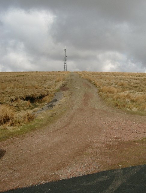
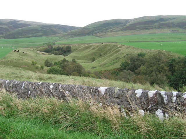
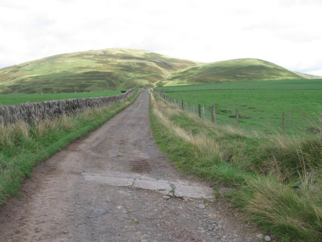
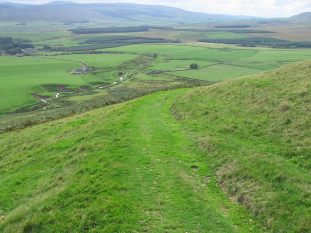
Pitechiat Hill Images

Images are sourced within 2km of 55.415193/-3.9967932 or Grid Reference NS7315. Thanks to Geograph Open Source API. All images are credited.

Kirkland Hill viewed from above Tod Grain Part of Glenaylmer Craig is visible on the flank of Kirkland Hill.
Kirkland Hill viewed from above Tod Grain
Part of Glenaylmer Craig is visible on the flank of Kirkland Hill.
Glenaylmer Craig A rarity in these rolling Southern Uplands hills – some exposed rock, named Glenaylmer Craig.
Glenaylmer Craig
A rarity in these rolling Southern Uplands hills – some exposed rock, named Glenaylmer Craig.
View down Tod Grain 'Grain' is a Scots word meaning an upper branch of a stream or burn.
View down Tod Grain
'Grain' is a Scots word meaning an upper branch of a stream or burn.
Hardy tree near the foot of Tod Grain A rarity in these windswept hills – a small tree that has managed to grown in a sheltered location.
Hardy tree near the foot of Tod Grain
A rarity in these windswept hills – a small tree that has managed to grown in a sheltered location.
The south-east flank of Kirkland Hill A view across the Glenaylmer Burn towards where Craig Sike cuts a deep cleft on the flank of Kirkland Hill.
The south-east flank of Kirkland Hill
A view across the Glenaylmer Burn towards where Craig Sike cuts a deep cleft on the flank of Kirkland Hill.
Upper reaches of the Glenaylmer Burn Near the head of a small burn that flows into the River Nith, flowing through this small, creased stream valley on the way.
Upper reaches of the Glenaylmer Burn
Near the head of a small burn that flows into the River Nith, flowing through this small, creased stream valley on the way.
Looking towards the head of the Glenaylmer Burn The autumn afternoon sunlight highlights the creases and scallops on the lower slopes of Pitechiat Hill and Todholes Hill, by the small, deep valley of the Glenaylmer Burn.
Looking towards the head of the Glenaylmer Burn
The autumn afternoon sunlight highlights the creases and scallops on the lower slopes of Pitechiat Hill and Todholes Hill, by the small, deep valley of the Glenaylmer Burn.
Trig point on Kirkland Hill A hill taking its name, along with the farm of Kirkland to the south, from the ancient St. Connel's Kirk at its foot.

The wind turbines of Kennoxhead Wind Farm, visible in the distance, are a new addition since my last visit to this hill, in 2015.
Trig point on Kirkland Hill
A hill taking its name, along with the farm of Kirkland to the south, from the ancient St. Connel's Kirk at its foot. The wind turbines of Kennoxhead Wind Farm, visible in the distance, are a new addition since my last visit to this hill, in 2015.
Kirkconnel TV-Relay tower On Todholes Hill above the Nith Valley near Sanquhar. The hill commands fine views both ways at 481metres.
Kirkconnel TV-Relay tower
On Todholes Hill above the Nith Valley near Sanquhar. The hill commands fine views both ways at 481metres.
Track up to the radio mast at Todholes Hill
Fence leading to Cocker Hill
Polbower burn
Polbower burn
Track to Vennel
Track to Vennel
Glenaylmer Burn
Glenaylmer Burn
Kirkland Hill trig point S6091
Glengap Burn
Glengap Burn
Looking west from Pitechiat Hill Very rough moorland, with a few shepherd's quad-bike tracks.
Looking west from Pitechiat Hill
Very rough moorland, with a few shepherd's quad-bike tracks.
Looking to Todholes From the side of Pitechiat Hill. Rushes and rough moorland in abundance on the hill, good grazing in the valley of the River Nith. Librymoor plantations on the south side of the valley.
Looking to Todholes
From the side of Pitechiat Hill. Rushes and rough moorland in abundance on the hill, good grazing in the valley of the River Nith. Librymoor plantations on the south side of the valley.
Show me another place!

Pitechiat Hill is located at Grid Ref: NS7315 (Lat: 55.415193, Lng: -3.9967932)

Unitary Authority: Dumfries and Galloway

Police Authority: Dumfries and Galloway

What 3 Words

///overlook.button.finishers. Near Kirkconnel, Dumfries & Galloway

Nearby Locations

Pitechiat Hill

Related Wikis

Kirkconnel railway station

Kirkconnel railway station is a railway station in the town of Kirkconnel, Dumfries and Galloway, Scotland. The station is unstaffed, owned by Network...

Kirkconnel

Kirkconnel (Gaelic: Cille Chonbhaill) is a small parish in Dumfries and Galloway, southwestern Scotland. It is located on the A76 near the head of Nithsdale...

Kelloside

Kelloside is a historic place south of Kirkconnel parish and the River Nith in Dumfries and Galloway, Dumfriesshire, Scotland. Old Kelloside is located...

Kelloholm

Kelloholm is a village in Dumfries and Galloway, Scotland. It has a primary school, a public house and several shops. Kelloholm lies next to Kirkconnel...

Nearby Amenities

Located within 500m of 55.415193,-3.9967932
Power: pole
Lat/Long: 55.4145862/-4.003984
Power: pole
Lat/Long: 55.4149945/-4.0033122
Power: pole
Lat/Long: 55.4154554/-4.0025296
Power: pole
Lat/Long: 55.4159061/-4.001722
Power: pole
Lat/Long: 55.4163888/-4.0009281
Power: pole
Lat/Long: 55.4168523/-4.0001725
Power: pole
Lat/Long: 55.4172465/-3.9994985
Power: pole
Lat/Long: 55.4176188/-3.9988719
Power: pole
Lat/Long: 55.417891/-3.9977771
Power: pole
Lat/Long: 55.4181632/-3.9966596
Power: pole
Lat/Long: 55.4183802/-3.9957707
Power: pole
Lat/Long: 55.4185959/-3.9949224
Power: pole
Lat/Long: 55.4191312/-3.9942664
The data included in this document is from www.openstreetmap.org. The data is made available under ODbL.

Have you been to Pitechiat Hill?

Leave your review of Pitechiat Hill below (or comments, questions and feedback).