Scout Head

Hill, Mountain in Stirlingshire

Scotland

Scout Head

Garshellach Forest On the eastern slopes of Carleatheran. The field in front is in the process of being cut for silage
Garshellach Forest Credit: Eirian Evans

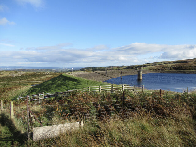
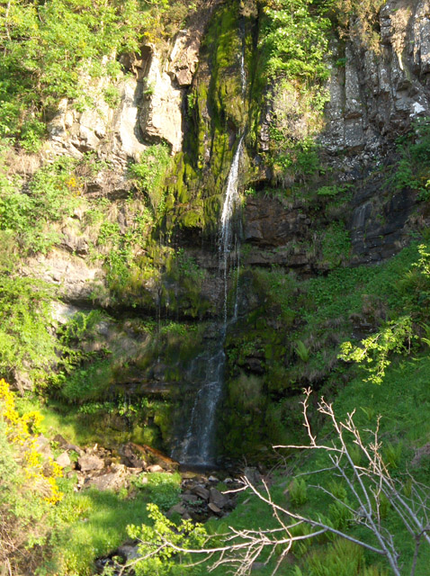
Scout Head is a prominent hill located in Stirlingshire, Scotland. It stands at an elevation of approximately 458 meters (1,503 feet) above sea level. Situated in the southern part of the Ochil Hills range, Scout Head offers stunning panoramic views of the surrounding countryside.

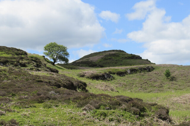
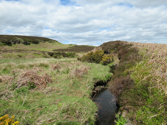
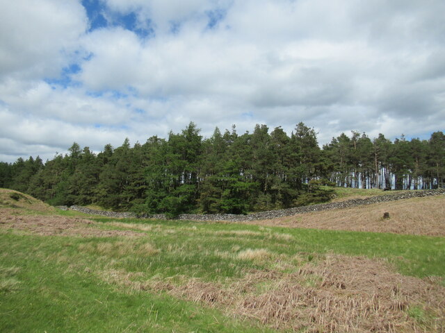
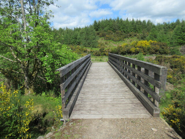
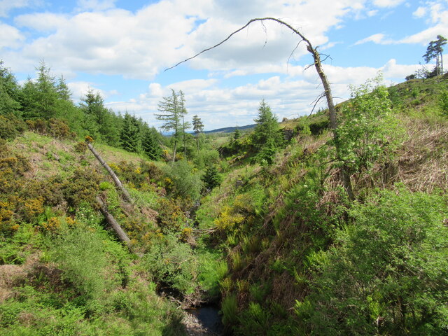
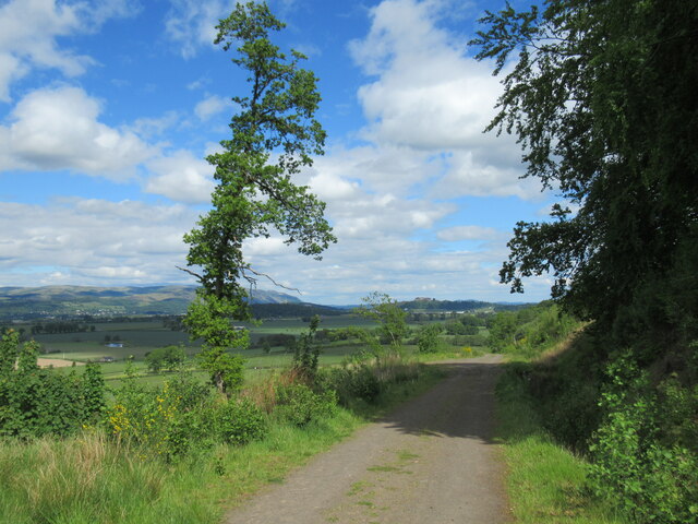
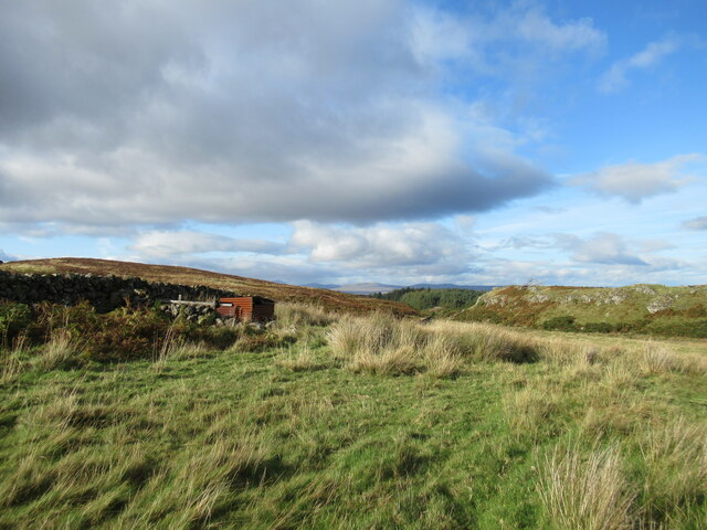
The hill is easily accessible, with a well-defined path leading to its summit. The ascent to the top is relatively moderate, making it an ideal destination for hikers and nature enthusiasts of all skill levels. The trail passes through a diverse landscape, including heather moorland, rocky outcrops, and patches of native woodland.

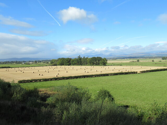
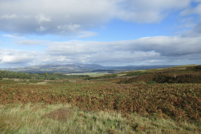
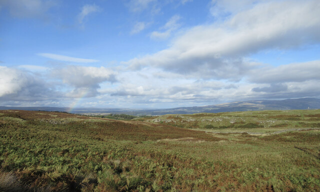
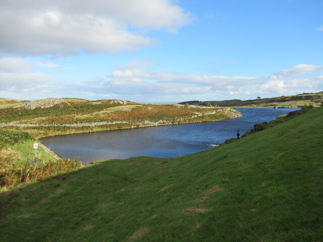
At the summit of Scout Head, visitors are rewarded with breathtaking views across the Stirlingshire countryside. On clear days, the eye-catching sights extend as far as the River Forth and the Trossachs National Park. The hill is also an excellent spot for birdwatching, with several species of birds making their homes in the surrounding area.

Scout Head is a popular destination for outdoor activities such as walking, picnicking, and photography. It is frequented by locals and tourists alike, attracted by its natural beauty and tranquil atmosphere. The hill provides a peaceful escape from the hustle and bustle of nearby urban areas, allowing visitors to immerse themselves in the stunning Scottish countryside.

Overall, Scout Head in Stirlingshire is a picturesque hill offering breathtaking views and a peaceful retreat for outdoor enthusiasts. Whether it's for a leisurely walk or a more challenging hike, this natural gem is sure to impress all who venture to its summit.

If you have any feedback on the listing, please let us know in the comments section below.
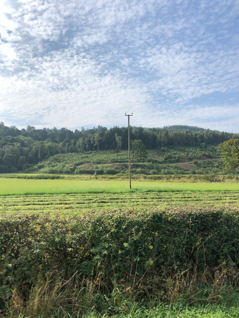
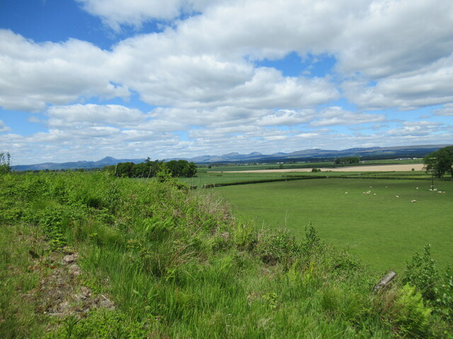
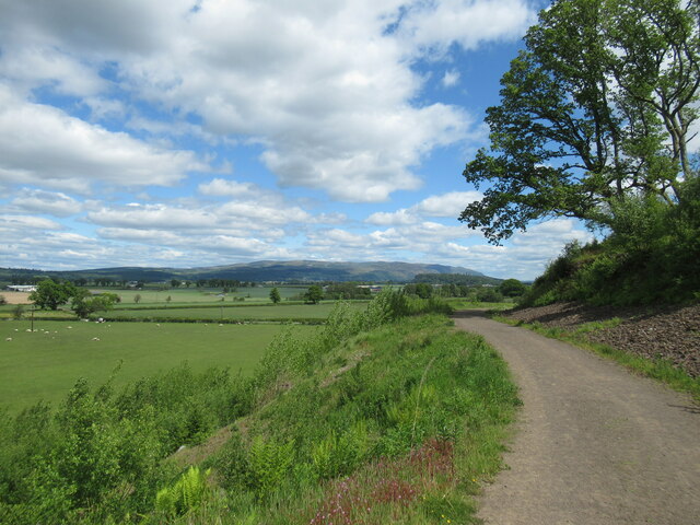
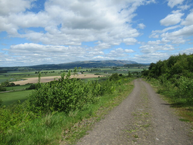
Scout Head Images

Images are sourced within 2km of 56.11404/-4.0360021 or Grid Reference NS7393. Thanks to Geograph Open Source API. All images are credited.

Garshellach Forest On the eastern slopes of Carleatheran. The field in front is in the process of being cut for silage
Garshellach Forest
On the eastern slopes of Carleatheran. The field in front is in the process of being cut for silage
Farmland by the River Forth Viewed from the track into Garshellach Forest, with Ben Ledi, Stuc a' Chroin and Ben Vorlich the prominent hills in the distance.
Farmland by the River Forth
Viewed from the track into Garshellach Forest, with Ben Ledi, Stuc a' Chroin and Ben Vorlich the prominent hills in the distance.
View towards Ochil Hills from the track into Garshellach Forest Flat farmland by the River Forth lies below the forestry track.
View towards Ochil Hills from the track into Garshellach Forest
Flat farmland by the River Forth lies below the forestry track.
Track at Garshellach Forest A forestry track with a view across flat farmlands by the River Forth to the Wallace Monument and the Ochil Hills in the distance.
Track at Garshellach Forest
A forestry track with a view across flat farmlands by the River Forth to the Wallace Monument and the Ochil Hills in the distance.
Lone tree in the Touch Hills The Touch Hills (pronounced 'tooch', with the 'ch' as in loch), are an array of many knolls, hillocks and layered basalt lava flows. The name apparently derives from the Gaelic word 'tulach', meaning knoll or hillock, and it's not difficult to see why.
Lone tree in the Touch Hills
The Touch Hills (pronounced 'tooch', with the 'ch' as in loch), are an array of many knolls, hillocks and layered basalt lava flows. The name apparently derives from the Gaelic word 'tulach', meaning knoll or hillock, and it's not difficult to see why.
West Burn A burn on the Touch Hills (pronounced 'tooch', with the 'ch' as in loch), a swathe of lumpy, little-frequented moorland south of the River Forth west of Stirling.
West Burn
A burn on the Touch Hills (pronounced 'tooch', with the 'ch' as in loch), a swathe of lumpy, little-frequented moorland south of the River Forth west of Stirling.
Boundary wall and forestry at Mickle Indernade A couple of cuckoos were calling from the plantation. It's possible to go between the forest and the open moorland here via the hole in the wall near the left of the photo.
Boundary wall and forestry at Mickle Indernade
A couple of cuckoos were calling from the plantation. It's possible to go between the forest and the open moorland here via the hole in the wall near the left of the photo.
Footbridge over the West Burn in Garshellach Forest Various paths and tracks exist within Garshellach Forest which offer a variety of walks.
Footbridge over the West Burn in Garshellach Forest
Various paths and tracks exist within Garshellach Forest which offer a variety of walks.
West Burn in Garshellach Forest A view from the footbridge over this small burn in the Garshellach Forest, which drains into the River Forth via the Touch Burn (pronounced 'tooch', with the ch sound as in 'loch').
West Burn in Garshellach Forest
A view from the footbridge over this small burn in the Garshellach Forest, which drains into the River Forth via the Touch Burn (pronounced 'tooch', with the ch sound as in 'loch').
View from track in Garshellach Forest The Ochil Hills and Stirling Castle can both be seen in the distance.
View from track in Garshellach Forest
The Ochil Hills and Stirling Castle can both be seen in the distance.
Bales in field near West Carse Some of the hills at the southern edge of the Highlands are visible in the distance.
Bales in field near West Carse
Some of the hills at the southern edge of the Highlands are visible in the distance.
Heather and Scots pines at Slack of Ballangair The large-scale map attaches the name Slack of Ballangair to this area, where the West Burn flows through quite a deep ravine. The first part of the name probably derives from the Gaelic word slochd, meaning 'pit' or 'hollow'.
Heather and Scots pines at Slack of Ballangair
The large-scale map attaches the name Slack of Ballangair to this area, where the West Burn flows through quite a deep ravine. The first part of the name probably derives from the Gaelic word slochd, meaning 'pit' or 'hollow'.
Bracken and moorland on the Touch Hills The Touch Hills (pronounced 'tooch', with the 'ch' as in 'loch') are an expanse of moorland containing lots of lumpy, bumpy ground that doesn't give the easiest of walking, but there are good view over Stirling towards the Ochil Hills.
Bracken and moorland on the Touch Hills
The Touch Hills (pronounced 'tooch', with the 'ch' as in 'loch') are an expanse of moorland containing lots of lumpy, bumpy ground that doesn't give the easiest of walking, but there are good view over Stirling towards the Ochil Hills.
One of the Touch Reservoirs The smallest and easternmost of the Touch Reservoirs is just visible on the left-hand side of the photograph, lying below its slightly larger neighbour.

Touch is pronounced 'tooch', with the 'ch' as in 'loch'.
One of the Touch Reservoirs
The smallest and easternmost of the Touch Reservoirs is just visible on the left-hand side of the photograph, lying below its slightly larger neighbour. Touch is pronounced 'tooch', with the 'ch' as in 'loch'.
Outcrops on the Touch Hills Touch is pronounced 'tooch', with the 'ch' as in 'loch, although the hills are really just an expanse of lumpy moorland with small rock outcrops.

A partial rainbow is visible in the distance.
Outcrops on the Touch Hills
Touch is pronounced 'tooch', with the 'ch' as in 'loch, although the hills are really just an expanse of lumpy moorland with small rock outcrops. A partial rainbow is visible in the distance.
Eastern reservoir, Touch Hills This is the smallest and further east of the three Touch Reservoirs. Touch is pronounced 'tooch', with the 'ch' as in 'loch'.
Eastern reservoir, Touch Hills
This is the smallest and further east of the three Touch Reservoirs. Touch is pronounced 'tooch', with the 'ch' as in 'loch'.
Rough ground on the Touch Hills Touch is pronounced 'tooch', with the 'ch' as in 'loch'.
Rough ground on the Touch Hills
Touch is pronounced 'tooch', with the 'ch' as in 'loch'.
Cut line, Garshelloch Woods. The ride is the route of the Finnart - Grangemouth pipeline. Crude oil  is imported at a deep water terminal in Loch Long and transported to the refinery at Grangemouth by pipeline. The route is kept clear of trees.
Cut line, Garshelloch Woods.
The ride is the route of the Finnart - Grangemouth pipeline. Crude oil is imported at a deep water terminal in Loch Long and transported to the refinery at Grangemouth by pipeline. The route is kept clear of trees.
Show me another place!

Scout Head is located at Grid Ref: NS7393 (Lat: 56.11404, Lng: -4.0360021)

Unitary Authority: Stirling

Police Authority: Forth Valley

What 3 Words

///eliminate.heap.homeward. Near Stirling

Nearby Locations

Scout Head Shallow Tongue

Related Wikis

Touch House

Touch House is a country house located 4 kilometres (2.5 mi) west of Stirling in central Scotland. It stands at the foot of the Touch Hills, on the south...

Downie's Loup

Downie's Loup is a waterfall of Scotland located near the village of Gargunnock. == See also == Waterfalls of Scotland == References ==

Gargunnock railway station

Gargunnock railway station served the village of Gargunnock, Stirling, Scotland, from 1856 to 1959 on the Forth and Clyde Junction Railway. == History... ==

Stirling (UK Parliament constituency)

Stirling is a county constituency of the House of Commons of the Parliament of the United Kingdom. It elects one Member of Parliament (MP) by the first...

Nearby Amenities

Located within 500m of 56.11404,-4.0360021
Scout Hill
Corbett: no
Donald: no
Graham: no
Munro: no
Natural: peak
Lat/Long: 56.1140994/-4.0361973
Turning Circle
Source: survey
Lat/Long: 56.1130226/-4.0325436
Turning Circle
Source: survey
Lat/Long: 56.1113291/-4.0332941
The data included in this document is from www.openstreetmap.org. The data is made available under ODbL.

Have you been to Scout Head?

Leave your review of Scout Head below (or comments, questions and feedback).