Cnoc Garbh Beag

Hill, Mountain in Sutherland

Scotland

Cnoc Garbh Beag

A Rough Moorland Track in a Remote Area of Sutherland
A Rough Moorland Track in a Remote Area of Sutherland Credit: Andrew Tryon

Cnoc Garbh Beag, located in Sutherland, Scotland, is a prominent hill that offers breathtaking views and a challenging climb. Standing at an elevation of 712 meters (2,336 feet), it is often classified as a Corbett, which refers to a Scottish mountain between 2,500 and 3,000 feet in height.

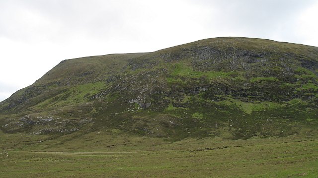
The hill is situated in a remote and rugged part of Sutherland, surrounded by stunning Highland scenery. It is part of the expansive Ben More Assynt and Conival range, which attracts outdoor enthusiasts and hikers from all over the world. Cnoc Garbh Beag is known for its rocky terrain, with steep slopes and craggy outcrops that make it a thrilling but demanding climb.

The ascent to the summit is a rewarding experience, offering panoramic views of the surrounding landscape. On clear days, hikers can see as far as the Atlantic Ocean, the nearby peaks of Ben More Assynt and Conival, and the vast rolling hills of the Scottish Highlands. The hill's location also provides an opportunity for wildlife spotting, as it is home to various bird species and occasionally red deer.

Access to Cnoc Garbh Beag is often gained from nearby Inchnadamph, a small hamlet in Sutherland. The route to the summit typically involves a combination of well-defined paths, open moorland, and rocky sections, requiring a good level of fitness and navigation skills.

Overall, Cnoc Garbh Beag offers a challenging and rewarding hiking experience, allowing visitors to immerse themselves in the rugged beauty of the Scottish Highlands.

If you have any feedback on the listing, please let us know in the comments section below.

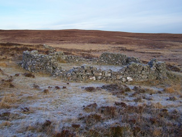
Cnoc Garbh Beag Images

Images are sourced within 2km of 58.161749/-4.1551776 or Grid Reference NC7321. Thanks to Geograph Open Source API. All images are credited.

A Rough Moorland Track in a Remote Area of Sutherland
A Remote Bridge on the Allt Garbh Beag in Sutherland A small rough track crosses this wild and almost featureless area of moorland.  This plateaux is perhaps one of the remotest areas in mainland Britain - the nearest public road is around 10km away.
A Remote Bridge on the Allt Garbh Beag in Sutherland
A small rough track crosses this wild and almost featureless area of moorland. This plateaux is perhaps one of the remotest areas in mainland Britain - the nearest public road is around 10km away.
View towards Ben Armine in Sutherland A very remote area of moorland in Sutherland, Scotland.  The summits in the background are 713m and 703m high.
View towards Ben Armine in Sutherland
A very remote area of moorland in Sutherland, Scotland. The summits in the background are 713m and 703m high.
A Remote and Uninhabited Moorland Plateau in Sutherland, Scotland
Garvary Burn Watercourse in Sutherland
A Stream in Strath Skinsdale, Sutherland A clear and unpolluted stream - one of many that drain this remote and uninhabited area of moorland in Sutherland.  This stream is a tributary to the rivers Skinsdale, the Blackwater and finally the Brora.
A Stream in Strath Skinsdale, Sutherland
A clear and unpolluted stream - one of many that drain this remote and uninhabited area of moorland in Sutherland. This stream is a tributary to the rivers Skinsdale, the Blackwater and finally the Brora.
The Confluence of Two Small Streams in Strath Skinsdale, Sutherland The area of pebbles washed up on the grassy bank indicates recent flooding.
The Confluence of Two Small Streams in Strath Skinsdale, Sutherland
The area of pebbles washed up on the grassy bank indicates recent flooding.
Partially dilapidated 19th Century sheepfold in the frost. Set on the west bank of Allt an Loin Earraich, over Cnoc na Feannaig, east of Ben Armine Lodge.
Partially dilapidated 19th Century sheepfold in the frost.
Set on the west bank of Allt an Loin Earraich, over Cnoc na Feannaig, east of Ben Armine Lodge.
Show me another place!

Cnoc Garbh Beag is located at Grid Ref: NC7321 (Lat: 58.161749, Lng: -4.1551776)

Unitary Authority: Highland

Police Authority: Highlands and Islands

What 3 Words

///sourcing.gardens.corner. Near Kinbrace, Highland

Nearby Locations

Cnoc Garbh Beag

Related Wikis

Ben Armine

Ben Armine (705 m) is a remote hill in Sutherland in the far north of Scotland. It lies in inland, north of the village of Lairg. The best known summit...

Have you been to Cnoc Garbh Beag?

Leave your review of Cnoc Garbh Beag below (or comments, questions and feedback).