Birch Hill

Hill, Mountain in Kirkcudbrightshire

Scotland

Birch Hill

Kirkstead, Kirkcudbright Now in ruins, the cottage of Kirkstead stands 350 yards to the WNW of St Michael's Kirk, of which there is now no trace. The Ordnance Survey Name Book states that the cottage was supposed to have been built on the site of the church's graveyard, hence Kirk (church) and Stead (farmhouse and its outbuildings - compare with homestead, steading etc). Two other names in the area also relate to the church: Kirkstead Bridge (44 yards to the WNW of the cottage), and St Michael's Glen (which carries a burn to the north of the church).
Kirkstead, Kirkcudbright Credit: Forrest and Jen

Birch Hill is a prominent hill located in Kirkcudbrightshire, a historic county in southwest Scotland. Situated near the town of Kirkcudbright, Birch Hill is known for its picturesque views and natural beauty. Standing at a height of approximately 300 meters (984 feet), it offers stunning vistas of the surrounding countryside, including the rolling hills and valleys that characterize this region.

The hill takes its name from the abundance of birch trees that populate its slopes. These trees, known for their slender trunks and distinctive white bark, add to the charm and uniqueness of Birch Hill. The forested areas of the hill provide a habitat for various wildlife species, including birds and small mammals, making it a popular spot for nature enthusiasts and birdwatchers.

Birch Hill also offers numerous walking trails and paths, which allow visitors to explore its scenic landscapes and enjoy the peaceful ambiance of the area. The hill's gentle slopes make it suitable for hikers of all abilities, providing a pleasant outdoor experience for both casual strollers and more experienced trekkers.

Additionally, Birch Hill is located within close proximity to other attractions in Kirkcudbrightshire, such as the historic town of Kirkcudbright with its vibrant arts scene, and the beautiful coastline of the Solway Firth. This makes Birch Hill an ideal destination for those looking to combine hillwalking with cultural and coastal experiences.

In summary, Birch Hill in Kirkcudbrightshire is a picturesque and accessible hill offering stunning views, diverse wildlife, and enjoyable walking opportunities, making it a must-visit location for nature lovers and outdoor enthusiasts.

If you have any feedback on the listing, please let us know in the comments section below.
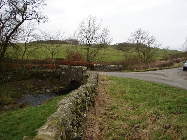
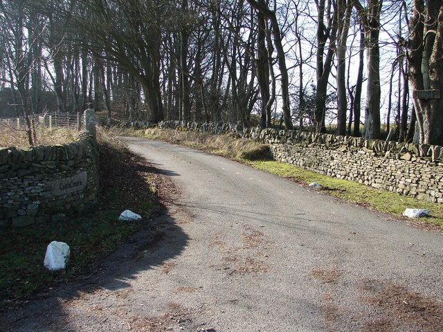
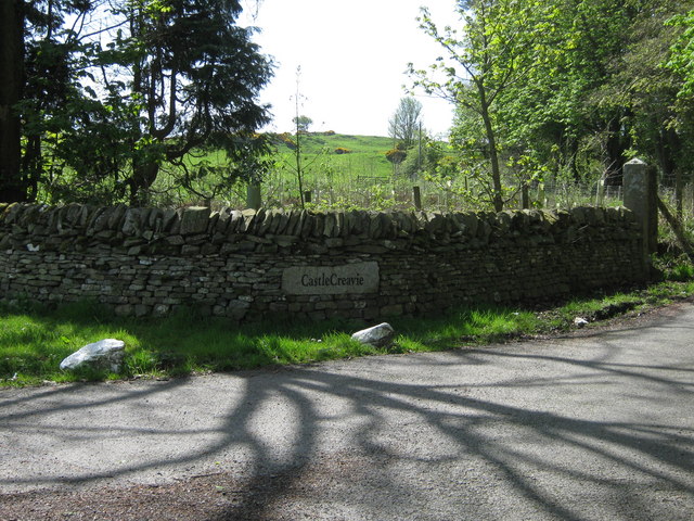
Birch Hill Images

Images are sourced within 2km of 54.837873/-3.9772722 or Grid Reference NX7351. Thanks to Geograph Open Source API. All images are credited.

Kirkstead, Kirkcudbright Now in ruins, the cottage of Kirkstead stands 350 yards to the WNW of St Michael's Kirk, of which there is now no trace. The Ordnance Survey Name Book states that the cottage was supposed to have been built on the site of the church's graveyard, hence Kirk (church) and Stead (farmhouse and its outbuildings - compare with homestead, steading etc). Two other names in the area also relate to the church: Kirkstead Bridge (44 yards to the WNW of the cottage), and St Michael's Glen (which carries a burn to the north of the church).
Kirkstead, Kirkcudbright
Now in ruins, the cottage of Kirkstead stands 350 yards to the WNW of St Michael's Kirk, of which there is now no trace. The Ordnance Survey Name Book states that the cottage was supposed to have been built on the site of the church's graveyard, hence Kirk (church) and Stead (farmhouse and its outbuildings - compare with homestead, steading etc). Two other names in the area also relate to the church: Kirkstead Bridge (44 yards to the WNW of the cottage), and St Michael's Glen (which carries a burn to the north of the church).
Wetland beneath Newlaw Hill Rough farmland looking a bit like the Dundrennan ranges.
Wetland beneath Newlaw Hill
Rough farmland looking a bit like the Dundrennan ranges.
Farm track, Bombie Galloway, dry at last. The armco suggests that cattle are loaded here.
Farm track, Bombie
Galloway, dry at last. The armco suggests that cattle are loaded here.
Road, Bombie A minor road between Dundrennan and Kirkcudbright. A near miss: Bombie Hill only overlooks the military lands - it would have been priceless if the name applied to one of the range hills instead.
Road, Bombie
A minor road between Dundrennan and Kirkcudbright. A near miss: Bombie Hill only overlooks the military lands - it would have been priceless if the name applied to one of the range hills instead.
Fields, Bombie Hill A previous view: <a href="https://www.geograph.org.uk/photo/736083">NX7149 : Bombie Hill</a>
Fields, Bombie Hill
A previous view: NX7149 : Bombie Hill
Road and fields, Bombie Grassland, somewhat parched at the end of a long dry spell.
Road and fields, Bombie
Grassland, somewhat parched at the end of a long dry spell.
Sign for the delightfully named tongue of Bombie
Drumboy Bridge Junction of roads to Dundrennan, Kirkcarswell and Whinnieliggate at Drumboy Bridge. The Abbey Burn flows under the bridge en route to the Solway Firth via Dundrennan Abbey.
Drumboy Bridge
Junction of roads to Dundrennan, Kirkcarswell and Whinnieliggate at Drumboy Bridge. The Abbey Burn flows under the bridge en route to the Solway Firth via Dundrennan Abbey.
Auchengool New plantation on the Auchengool estate. Auchengool House lies to the upper left of the picture, the farm and cottages to the right.
Auchengool
New plantation on the Auchengool estate. Auchengool House lies to the upper left of the picture, the farm and cottages to the right.
Castle Creavie Copse View from Castle Creavie entrance, the Drumboy-Buckland lane continues westward past the copse.
Castle Creavie Copse
View from Castle Creavie entrance, the Drumboy-Buckland lane continues westward past the copse.
Castle Creavie Entrance Entrance to Castle Creavie farm and holiday workshops.
Castle Creavie Entrance
Entrance to Castle Creavie farm and holiday workshops.
Bombie Hill Grazing fields on northern slopes of Bombie Hill.
Bombie Hill
Grazing fields on northern slopes of Bombie Hill.
Castle Creavie Settlement View from ancient settlement site at Castle Creavie to the north-eastern slopes of Bombie Hill. In the distance an Easter Day snow shower approaches Bombie Farm.
Castle Creavie Settlement
View from ancient settlement site at Castle Creavie to the north-eastern slopes of Bombie Hill. In the distance an Easter Day snow shower approaches Bombie Farm.
Entrance to Castle Creavie This is the entrance to Castle Creavie farm and holiday workshops.
Entrance to Castle Creavie
This is the entrance to Castle Creavie farm and holiday workshops.
Public Footpath to Newlaw Hill The public footpath up on to Newlaw Hill.
Public Footpath to Newlaw Hill
The public footpath up on to Newlaw Hill.
Abbey Burn near Drumboy Bridge Parish of Rerrick
Abbey Burn near Drumboy Bridge
Parish of Rerrick
Treelined roadway at Auchengool roadend.
Granite gatepost But no gate
Granite gatepost
But no gate
Show me another place!

Birch Hill is located at Grid Ref: NX7351 (Lat: 54.837873, Lng: -3.9772722)

Unitary Authority: Dumfries and Galloway

Police Authority: Dumfries and Galloway

What 3 Words

///acquaint.craftsman.crunchy. Near Kirkcudbright, Dumfries & Galloway

Nearby Locations

Birch Hill

Related Wikis

High Banks cup and ring markings

The High Banks cup and ring markings are a series of Neolithic or Bronze Age carvings on an outcrop of rock near High Banks farm, 3 km SE of Kirkcudbright...

Dundrennan

Dundrennan (Gaelic: Dun Droighnein) is a village Dumfries and Galloway, Scotland, about 5 miles (8 km) east of Kirkcudbright. Its population is around...

Dundrennan Abbey

Dundrennan Abbey, in Dundrennan, Scotland, near to Kirkcudbright, was a Cistercian monastery in the Romanesque architectural style, established in 1142...

Wickerman Festival

The Wickerman Festival was an annual music festival held near Auchencairn in Dumfries and Galloway, Scotland. Dubbed "Scotland's Alternative Music festival...

Nearby Amenities

Located within 500m of 54.837873,-3.9772722
Power: pole
Lat/Long: 54.8383208/-3.96952
Power: pole
Lat/Long: 54.8390329/-3.9699893
Power: pole
Lat/Long: 54.8397009/-3.9704426
Power: pole
Lat/Long: 54.8397812/-3.9716255
Power: pole
Lat/Long: 54.8398538/-3.9729881
Power: pole
Lat/Long: 54.8400314/-3.9755576
Power: pole
Lat/Long: 54.8401118/-3.9768478
Power: pole
Lat/Long: 54.8401952/-3.9781567
Power: pole
Lat/Long: 54.8402832/-3.97942
Power: pole
Lat/Long: 54.840362/-3.9807826
Power: pole
Lat/Long: 54.8404315/-3.9819359
Power: pole
Lat/Long: 54.8405411/-3.9833977
The data included in this document is from www.openstreetmap.org. The data is made available under ODbL.

Have you been to Birch Hill?

Leave your review of Birch Hill below (or comments, questions and feedback).