Meall na Gaoithe

Hill, Mountain in Sutherland

Scotland

Meall na Gaoithe

The End of a Beautiful Day in Sutherland About 9pm in the evening in a remote area of northern Britain.  The sun is about to set behind the hill Meall na Gaoithe (gaelic for Hill of the Wind).  The water in front of the hill is Loch Bad an t-Sean-tighe (Gaelic for the Lake by the Hill with the Old House).  The water from here is a tributary to first the River Black Water and eventually the River Brora.
The End of a Beautiful Day in Sutherland Credit: Andrew Tryon

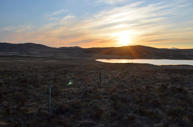
Meall na Gaoithe is a prominent hill located in Sutherland, a county in the northern Highlands of Scotland. It stands at an elevation of 574 meters (1,883 feet) and is known for its stunning panoramic views of the surrounding landscape. The hill is situated near the village of Durness and is a popular destination for hikers and nature enthusiasts.

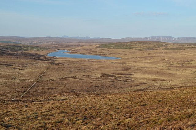
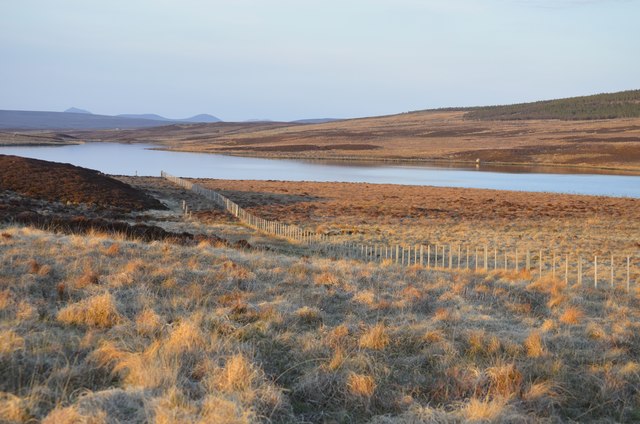
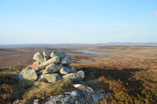
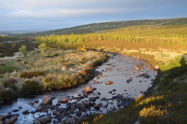
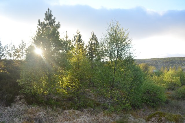
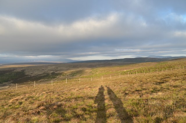
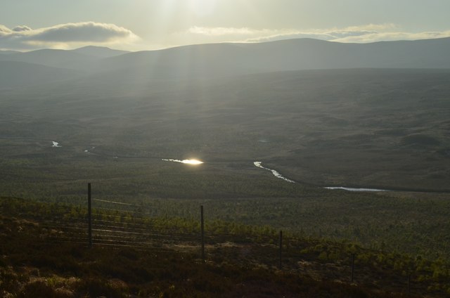
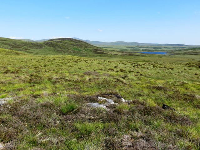
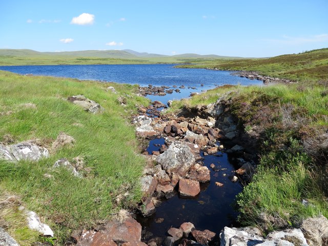
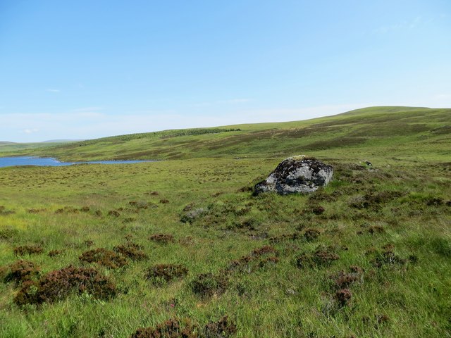
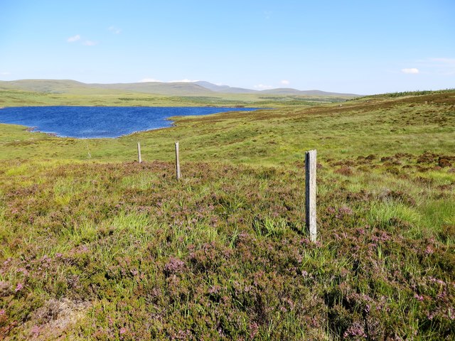
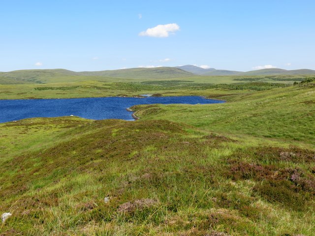
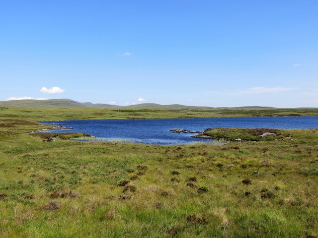
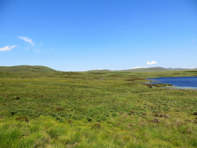
The terrain of Meall na Gaoithe is characterized by a mixture of heather moorland, rocky outcrops, and patches of grass. The summit offers unobstructed vistas of the rugged coastline, with the Atlantic Ocean stretching out to the west, and the majestic peaks of the nearby mountains visible to the east. On clear days, it is even possible to catch a glimpse of the distant Outer Hebrides islands.

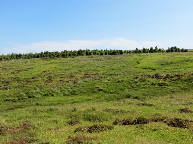
The ascent to the summit is relatively straightforward, with a well-defined path leading hikers through the undulating landscape. The route is suitable for all levels of fitness, although the final section may require some scrambling over rocks. The hill can be conquered in a few hours, making it an ideal choice for a day hike.

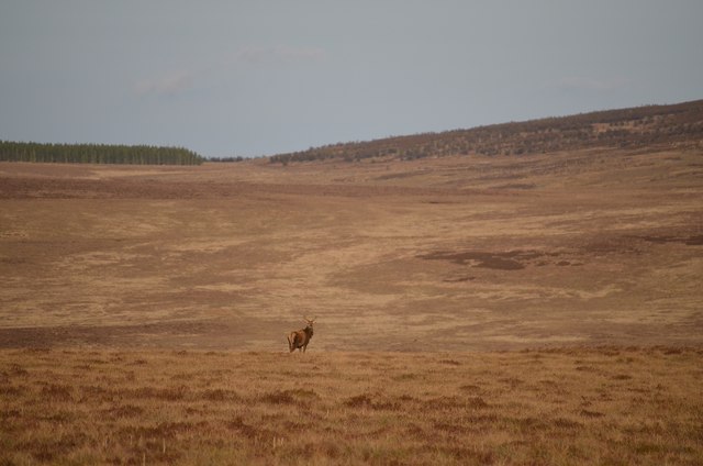
Meall na Gaoithe is also notable for its rich wildlife. The hill is home to a variety of bird species, including golden eagles, peregrine falcons, and red-throated divers. It is not uncommon to spot deer and other small mammals while exploring the area.

Overall, Meall na Gaoithe offers a rewarding outdoor experience, combining stunning views, diverse flora and fauna, and a sense of tranquility in the heart of the Scottish Highlands.

If you have any feedback on the listing, please let us know in the comments section below.

Meall na Gaoithe Images

Images are sourced within 2km of 58.095337/-4.167322 or Grid Reference NC7213. Thanks to Geograph Open Source API. All images are credited.

The End of a Beautiful Day in Sutherland About 9pm in the evening in a remote area of northern Britain.  The sun is about to set behind the hill Meall na Gaoithe (gaelic for Hill of the Wind).  The water in front of the hill is Loch Bad an t-Sean-tighe (Gaelic for the Lake by the Hill with the Old House).  The water from here is a tributary to first the River Black Water and eventually the River Brora.
The End of a Beautiful Day in Sutherland
About 9pm in the evening in a remote area of northern Britain. The sun is about to set behind the hill Meall na Gaoithe (gaelic for Hill of the Wind). The water in front of the hill is Loch Bad an t-Sean-tighe (Gaelic for the Lake by the Hill with the Old House). The water from here is a tributary to first the River Black Water and eventually the River Brora.
View of Bac na Lice, Sutherland Classic East Sutherland scenery.  View facing east from the side of Creag Riabhach (hill) over an area known as Bac na Lice.
View of Bac na Lice, Sutherland
Classic East Sutherland scenery. View facing east from the side of Creag Riabhach (hill) over an area known as Bac na Lice.
Evening Light at Loch Bad an t-Sean-tighe Gaelic place names can be quite descriptive of the landscape:  The Gaelic, Loch Bad an t-Sean-tighe, roughly translates to Lake by the Hill with the Old House.  Sean-tighe (pronounced Shan Tie) means old house and is related to the English word "Shanty".
Evening Light at Loch Bad an t-Sean-tighe
Gaelic place names can be quite descriptive of the landscape: The Gaelic, Loch Bad an t-Sean-tighe, roughly translates to Lake by the Hill with the Old House. Sean-tighe (pronounced Shan Tie) means old house and is related to the English word "Shanty".
Lonely Deer, East Sutherland Photo taken near Bac na Lice and Meall na Gaoithe in the county of Sutherland.  The hill rising up in the background about 2km away is Cnoc Leamhnachd (293m).
Lonely Deer, East Sutherland
Photo taken near Bac na Lice and Meall na Gaoithe in the county of Sutherland. The hill rising up in the background about 2km away is Cnoc Leamhnachd (293m).
Summit of Creag Riabhach (Stripey Hill), Sutherland A small cairn marks the summit of Creag Riabhach (312 m, 1023 ft).  The Gaelic name Creag Riabhach translates to Stripey Hill.   The vast emptiness of the inland East Sutherland landscape can be appreciated from this vantage point.
Summit of Creag Riabhach (Stripey Hill), Sutherland
A small cairn marks the summit of Creag Riabhach (312 m, 1023 ft). The Gaelic name Creag Riabhach translates to Stripey Hill. The vast emptiness of the inland East Sutherland landscape can be appreciated from this vantage point.
Loch nam Faoileag, Sutherland Loch nam Faoileag (Gaelic: Seagull Loch) is a very small moorland Loch, barely the size of a swimming pool.  Although named as a 'Loch' on the Ordnance Survey 25k map, waterbodies of this size in the Scottish Highlands are more often named as 'Lochans' (small Lochs) or are sometimes considered too small to even be named at all.  Could this be Scotland's smallest Loch?  At the time this photo was taken, the loch was more of a muddy pool following several days of warm dry weather.
Loch nam Faoileag, Sutherland
Loch nam Faoileag (Gaelic: Seagull Loch) is a very small moorland Loch, barely the size of a swimming pool. Although named as a 'Loch' on the Ordnance Survey 25k map, waterbodies of this size in the Scottish Highlands are more often named as 'Lochans' (small Lochs) or are sometimes considered too small to even be named at all. Could this be Scotland's smallest Loch? At the time this photo was taken, the loch was more of a muddy pool following several days of warm dry weather.
Bend in the Coirefrois Burn, Sutherland Photo taken at about 9pm on a late spring evening.
Bend in the Coirefrois Burn, Sutherland
Photo taken at about 9pm on a late spring evening.
Sunlight shining through Young Trees
Cnoc an Alltain Rhiabhaich, Sutherland Hills south of Ben Armine Lodge in Sutherland
Cnoc an Alltain Rhiabhaich, Sutherland
Hills south of Ben Armine Lodge in Sutherland
View Towards Coirefrois Burn from the South The line of the Coirefrois watercourse is highlighted by the evening sunshine.
View Towards Coirefrois Burn from the South
The line of the Coirefrois watercourse is highlighted by the evening sunshine.
Moorland looking towards Loch an Eoin
Small unnamed burn flowing into the southern end of Loch an Eoin
Erratic on the moor above Loch an Eoin
Remains of an old fence running down to Loch an Eoin
Loch an Eoin
Loch an Eoin
Natural woodland plantation above Loch an Eoin
Bay on Loch an Eoin
Bay on Loch an Eoin
Moorland and small plantation at Loch an Eoin
Show me another place!

Meall na Gaoithe is located at Grid Ref: NC7213 (Lat: 58.095337, Lng: -4.167322)

Unitary Authority: Highland

Police Authority: Highlands and Islands

What 3 Words

///manifests.oaks.regrowth. Near Lairg, Highland

Nearby Locations

Meall na Gaoithe

Related Wikis

West Langwell

West Langwell is a small crofting settlement in Rogart, Sutherland is in the Scottish council area of Highland within the Scottish Highlands. The village...

Dalreavoch

Dalreavoch (Scottish Gaelic: An Dail Riabhach) is a small crofting hamlet in Rogart in Sutherland, Scottish Highlands and is in the Scottish council...

Battle of Alltan-Beath

The Battle of Alltan-Beath, also known as the Battle of Ailtan-Beath, was a Scottish clan battle said to have taken place in 1542 in the village of Knockarthur...

East Langwell

East Langwell is a small, remote crofting settlement in Rogart, Sutherland, Scottish Highlands and is in the Scottish council area of Highland.West Langwell...

Nearby Amenities

Located within 500m of 58.095337,-4.167322
Meall na Gaoithe
Ele: 298
Natural: peak
Lat/Long: 58.0950664/-4.1666098
The data included in this document is from www.openstreetmap.org. The data is made available under ODbL.

Have you been to Meall na Gaoithe?

Leave your review of Meall na Gaoithe below (or comments, questions and feedback).