Black Hill

Hill, Mountain in Somerset Somerset West and Taunton

England

Black Hill

View above Castle Cleave Coombe
View above Castle Cleave Coombe Credit: David Martin

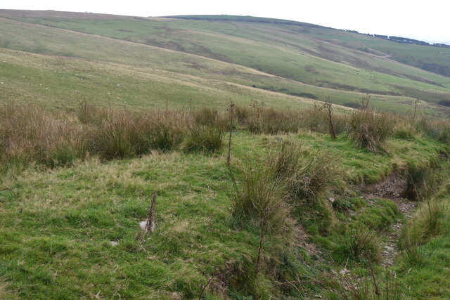
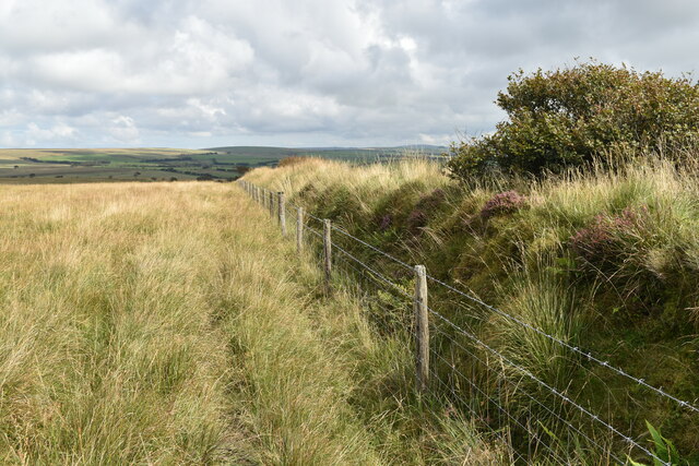
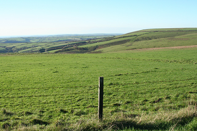
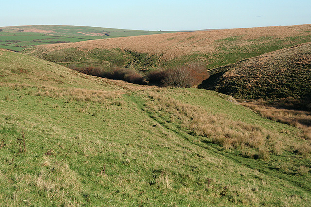
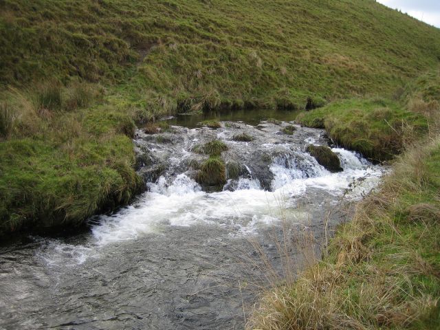
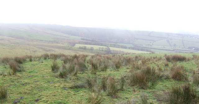
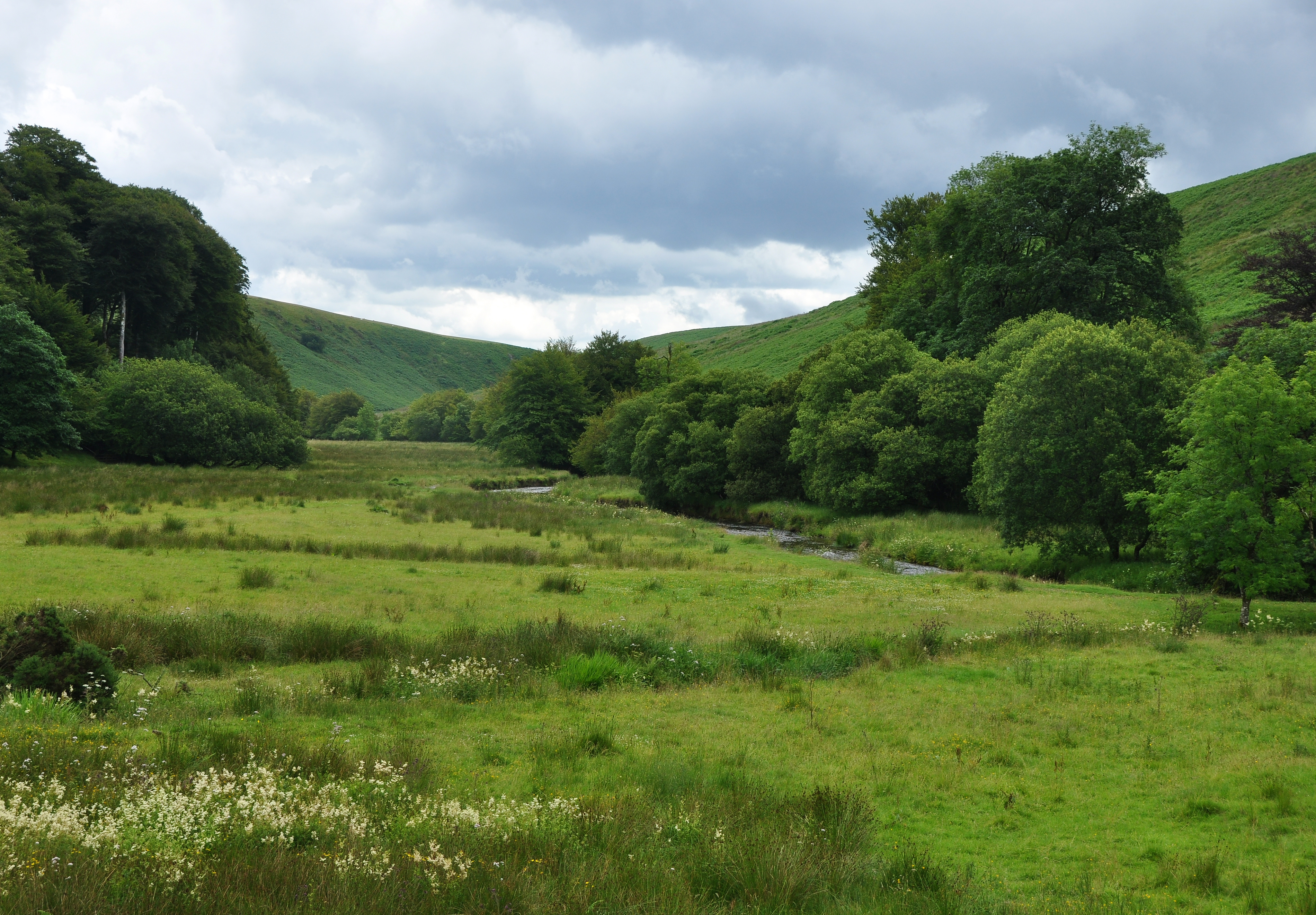
Black Hill is a prominent hill located in Somerset, England. It is situated within the Mendip Hills, a range known for its picturesque landscapes and diverse wildlife. Rising up to an elevation of 325 meters (1,066 feet), Black Hill offers breathtaking panoramic views of the surrounding countryside.

The hill is characterized by its distinctive dark appearance, hence the name "Black Hill." The dark coloration is a result of the abundance of carboniferous limestone, which forms the geological composition of the area. This limestone also contributes to the rich biodiversity found on the hill, supporting a variety of plant and animal species.

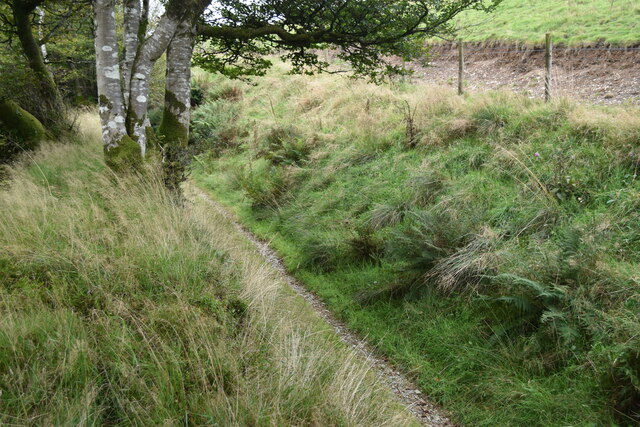
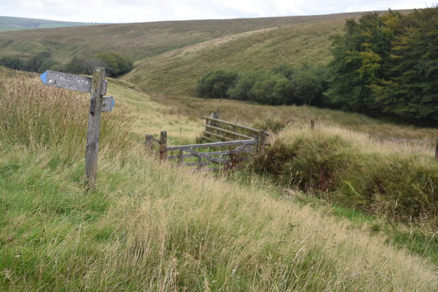
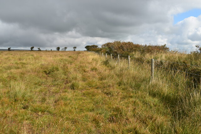
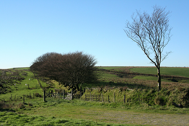
Black Hill is a popular destination for outdoor enthusiasts, attracting hikers, walkers, and nature lovers throughout the year. The hill features well-maintained footpaths and trails, allowing visitors to explore its scenic beauty at their own pace. The summit provides an ideal spot for picnics, with designated areas offering stunning vistas of the surrounding countryside.

The hill is also home to a range of wildlife, including rabbits, foxes, and a variety of bird species. The diverse flora and fauna create an idyllic natural habitat, making Black Hill a haven for nature enthusiasts.

In addition to its natural beauty, Black Hill holds historical significance as well. The area is dotted with remnants of ancient settlements, including burial mounds and stone circles, providing a glimpse into the region's rich cultural heritage.

Overall, Black Hill offers a perfect blend of natural beauty, recreational opportunities, and historical significance, making it a must-visit destination for those seeking tranquility and a connection with nature in Somerset.

If you have any feedback on the listing, please let us know in the comments section below.

Black Hill Images

Images are sourced within 2km of 51.136069/-3.8301848 or Grid Reference SS7239. Thanks to Geograph Open Source API. All images are credited.

View above Castle Cleave Coombe
Footpath between banks in Lew Combe
Footpath junction above Mole's Chamber
On the ramparts at Shoulsbury Castle With the trig point visible on the skyline.
On the ramparts at Shoulsbury Castle
With the trig point visible on the skyline.
Ramparts and ditch at Shoulsbury Castle At this point, there are two ramparts separated by a ditch.
Ramparts and ditch at Shoulsbury Castle
At this point, there are two ramparts separated by a ditch.
Edge of access land near Shoulsbury Castle
Edge of access land above Castle Common
Brayford, Rockley Farm This is a place where my wife and myself had a lovely holiday in 1990.
Brayford, Rockley Farm
This is a place where my wife and myself had a lovely holiday in 1990.
North Molton: towards Setta Barrow Looking north-north-west from North Twitchen. Setta Barrow stands on the skyline beyond the square, above the line of trees on the right
North Molton: towards Setta Barrow
Looking north-north-west from North Twitchen. Setta Barrow stands on the skyline beyond the square, above the line of trees on the right
High Bray: Bray Common Looking west-north-west. Bideford Bay and the coast to Hartland can be seen at this point if not in this shot
High Bray: Bray Common
Looking west-north-west. Bideford Bay and the coast to Hartland can be seen at this point if not in this shot
High Bray: towards Castle Common Looking west
High Bray: towards Castle Common
Looking west
Exmoor: near Mole’s Chamber Three stories relate to farmer Mole falling from his horse and drowning in a bog; his body preserved in the peat. The valley here provides a tributary of the Barle. Looking east
Exmoor: near Mole’s Chamber
Three stories relate to farmer Mole falling from his horse and drowning in a bog; his body preserved in the peat. The valley here provides a tributary of the Barle. Looking east
High Bray: Shoulsbury Castle On the southern rampart looking west-north-west towards the coast. Dartmoor, Bideford Bay, Lundy and the South Wales coast can all be seen from this location. And Bodmin Moor too, on clear days. Shoulsbury Castle stands on private ground on the western edge of Exmoor. But access gates for pedestrians have been provided. It is uncertain whether this is an Iron Age enclosure. It covers 1.6 hectares
High Bray: Shoulsbury Castle
On the southern rampart looking west-north-west towards the coast. Dartmoor, Bideford Bay, Lundy and the South Wales coast can all be seen from this location. And Bodmin Moor too, on clear days. Shoulsbury Castle stands on private ground on the western edge of Exmoor. But access gates for pedestrians have been provided. It is uncertain whether this is an Iron Age enclosure. It covers 1.6 hectares
Challacombe: Shoulsbury Castle A BAE Systems Jetstream T2 belonging to the Royal Navy buzzes the trig point at Shoulsbury. Looking north east
Challacombe: Shoulsbury Castle
A BAE Systems Jetstream T2 belonging to the Royal Navy buzzes the trig point at Shoulsbury. Looking north east
High Bray: Shoulsbury Castle On the eastern rampart looking south-south-west towards Rockley and Muxworthy
High Bray: Shoulsbury Castle
On the eastern rampart looking south-south-west towards Rockley and Muxworthy
River Barle A small waterfall on the river Barle just below Acklands Farm
River Barle
A small waterfall on the river Barle just below Acklands Farm
Barle Valley Looking West up the Barle valley from the Two Moors Way.
Barle Valley
Looking West up the Barle valley from the Two Moors Way.
Rough grazing near Henthitchen Combe At about 450m. elevation.
Rough grazing near Henthitchen Combe
At about 450m. elevation.
Show me another place!

Black Hill is located at Grid Ref: SS7239 (Lat: 51.136069, Lng: -3.8301848)

Administrative County: Somerset

District: Somerset West and Taunton

Police Authority: Avon and Somerset

What 3 Words

///landscape.efficient.treetop. Near Lynton, Devon

Related Wikis

Shoulsbury castle

Shoulsbury Castle is an Iron Age hill fort close to Challacombe in Devon, England. It takes the form of a multi-ditch and rampart enclosure close to the...

Barle Valley

Barle Valley is a 1,540 acres (620 ha) Site of Special Scientific Interest within Exmoor National Park, situated in the counties of Devon and Somerset...

Challacombe

Challacombe is a small village on the edge of the Exmoor National Park, in Devon, England. The village has a small general shop/Post Office and a single...

Chains (geological site)

The Chains is the name given to the north-west plateau of Exmoor, Somerset, England. This plateau lies above the 1,500 feet (457 m) contour line, and includes...

Bentwitchen

Bentwitchen is a hamlet in Devon, England. == References ==
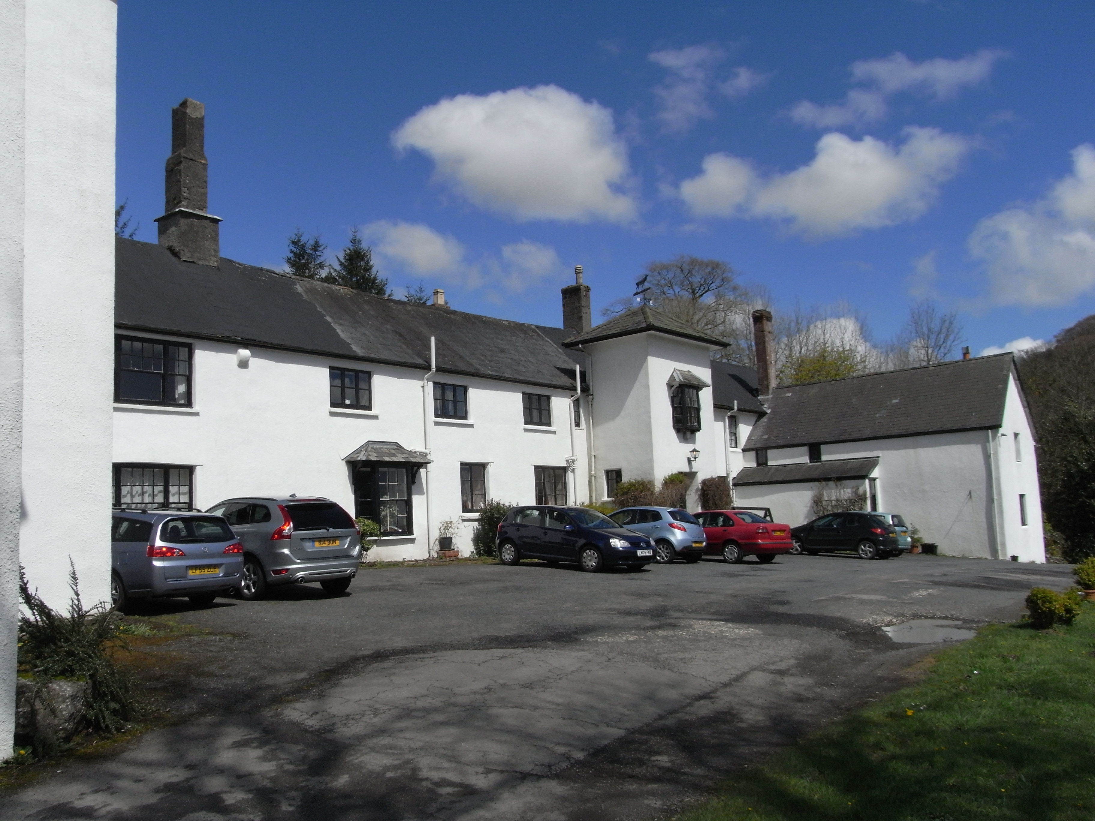
Simonsbath House

Simonsbath House is a historic house in Simonsbath on Exmoor in Somerset, England. The Grade II listed building is now the Simonsbath House Hotel, and...

Simonsbath

Simonsbath () is a small village high on Exmoor in the English county of Somerset. It is the principal settlement in the Exmoor civil parish, which is...

Charles, Devon

Charles is a village and former civil parish, now in the parish of Brayford, in the North Devon district of Devon, England. Its nearest town is South Molton...

Nearby Amenities

Located within 500m of 51.136069,-3.8301848
Sloley Stone
Junction: yes
Lat/Long: 51.138949/-3.8346416
Passing Place
Lat/Long: 51.1375915/-3.8337989
Passing Place
Lat/Long: 51.1384335/-3.8345526
Passing Place
Lat/Long: 51.1320503/-3.8274871
Passing Place
Lat/Long: 51.1328606/-3.8278759
Bench
Lat/Long: 51.1358965/-3.8319279
Passing Place
Lat/Long: 51.1366716/-3.8327621
The data included in this document is from www.openstreetmap.org. The data is made available under ODbL.

Have you been to Black Hill?

Leave your review of Black Hill below (or comments, questions and feedback).