Hollins Green

Settlement in Lancashire

England

Hollins Green

The Black Swan
The Black Swan Credit: Mick Garratt

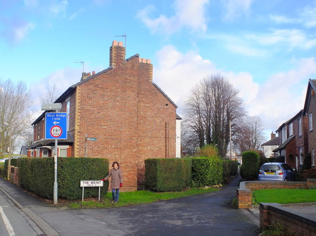
Hollins Green is a small rural village located in Lancashire, England. Situated approximately 10 miles south of the city of Manchester, the village is known for its picturesque countryside views and tranquil atmosphere.

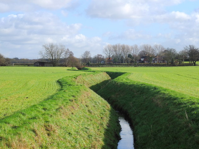
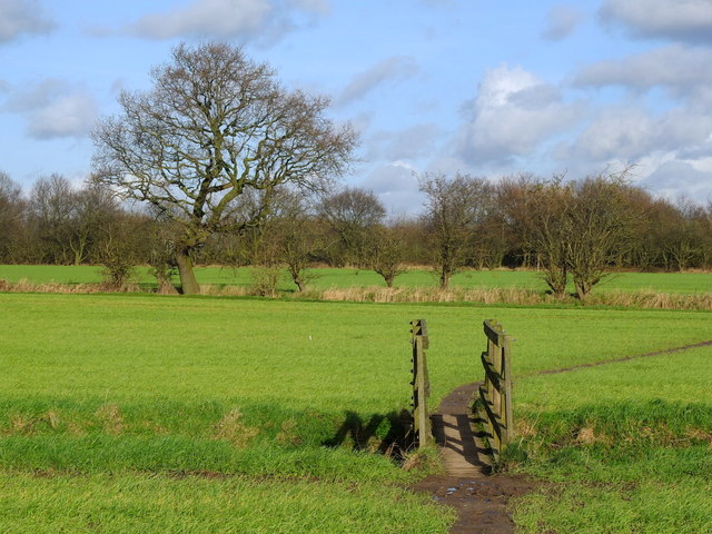
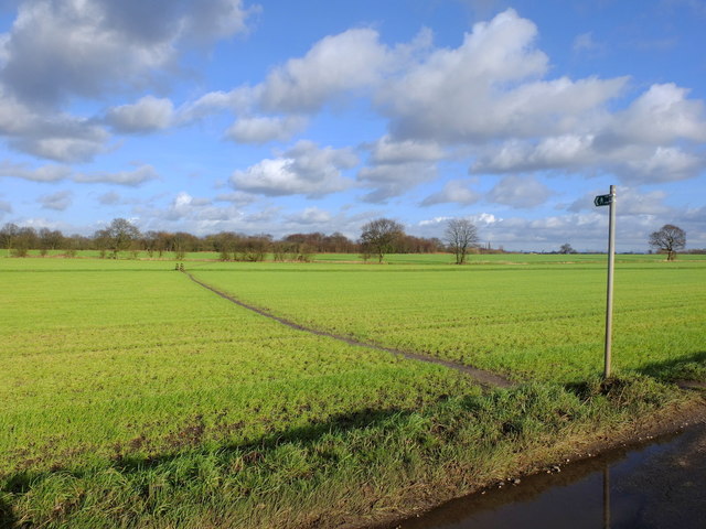
The village is surrounded by farmland and green fields, making it an ideal destination for those looking to escape the hustle and bustle of city life. Hollins Green is home to a close-knit community of residents who take pride in maintaining the village's historic charm and character.

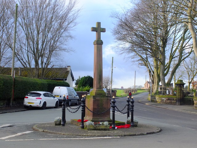
In terms of amenities, Hollins Green offers a local pub, a primary school, and a village hall where community events and activities are regularly held. The village is also well-connected to nearby towns and cities, with good transport links making it easy to access the wider Lancashire area.

Overall, Hollins Green is a peaceful and scenic village that offers a high quality of life for its residents. With its rural surroundings and strong sense of community spirit, it is a popular choice for those seeking a quieter pace of life in the beautiful Lancashire countryside.

If you have any feedback on the listing, please let us know in the comments section below.

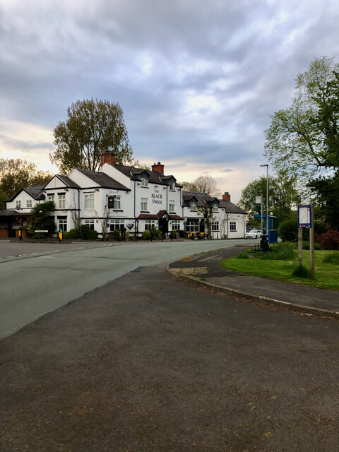
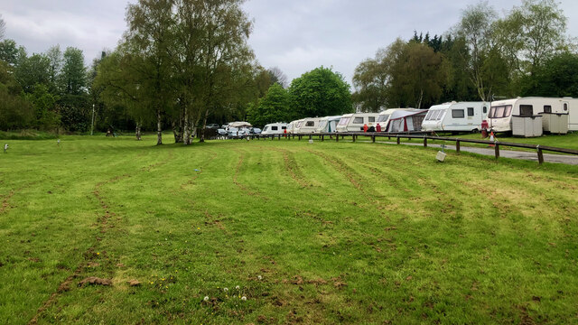
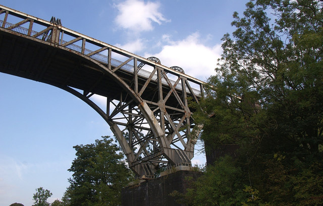
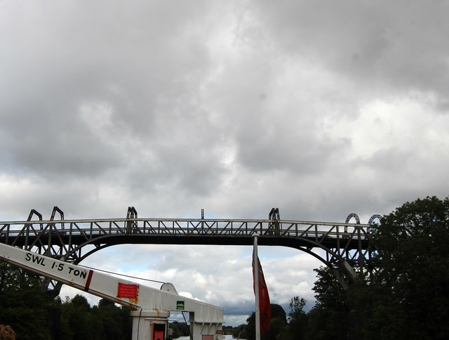
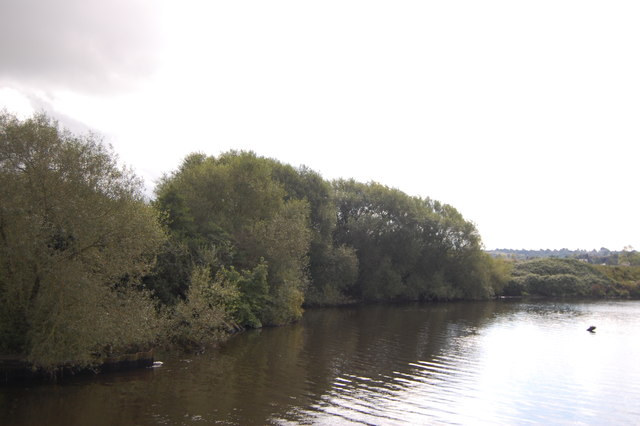
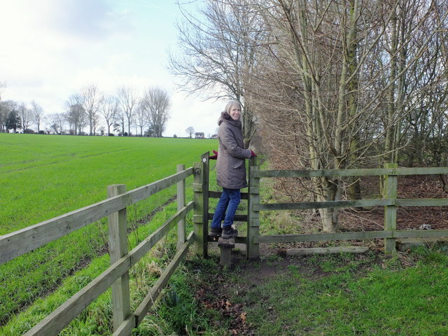
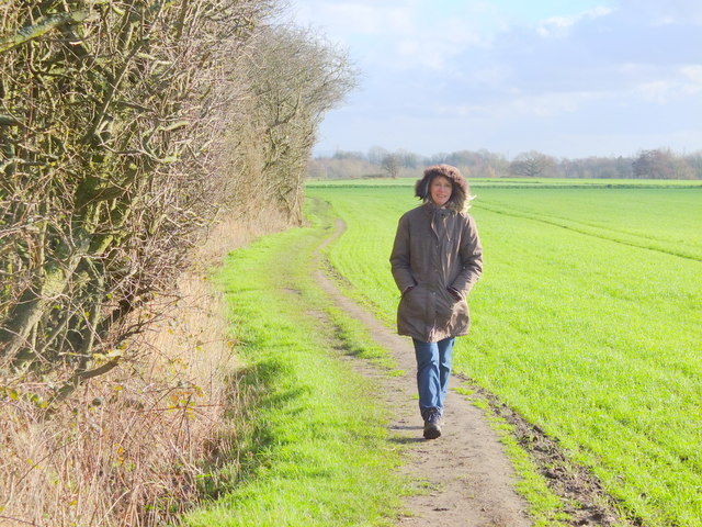
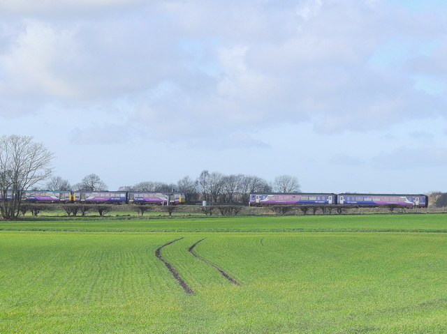
Hollins Green Images

Images are sourced within 2km of 53.414108/-2.45809 or Grid Reference SJ6990. Thanks to Geograph Open Source API. All images are credited.

The Black Swan
The Black Swan
"Holiday Park" Not the most salubrious.
"Holiday Park"
Not the most salubrious.
Warburton Toll Bridge Crossing the Manchester Ship Canal.
Warburton Toll Bridge
Crossing the Manchester Ship Canal.
Warburton Toll Bridge Taken from the Manchester Ship Canal, with superstructure of our Mersey ferry in the foreground.
Warburton Toll Bridge
Taken from the Manchester Ship Canal, with superstructure of our Mersey ferry in the foreground.
Manchester Ship Canal near Warburton
Stile near Mount Pleasant Farm
Footpath west of Mount Pleasant Farm, Hollins Green
Trains near Glazebrook
Field drains near Holingreave Farm
Footpath near Hollingreave Farm
Cross at Hollins Green
The Weint, Hollins Green
Manchester Ship Canal near Warburton The Manchester Ship Canal, which took six years to build and was opened in 1894, is a 36-mile-long inland waterway linking Manchester to the Irish Sea at Liverpool. It generally follows the original routes of the rivers Mersey and Irwell through the historic counties of Cheshire and Lancashire. Several sets of locks lift vessels about 60 feet up to the Manchester Docks (now Salford Quays), where the canal's terminus was built.

When the ship canal opened in January 1894 it was the largest river navigation canal in the world, and enabled the newly created Port of Manchester to become Britain's third busiest port despite the city being about 40 miles inland. Since its opening, the canal handled a wide range of ships and cargoes, from coastal vessels to intra-European shipping and inter-continental cargo liners; Manchester Liners established regular sailings by large ocean-going vessels.

The amount of freight carried by the canal peaked in 1958 at 18 million long tons but changes to shipping methods and the growth of containerisation during the 1970s and 1980s caused traffic to decline, resulting in the closure of the docks at Salford in 1984. Although able to accommodate a range of vessels from coastal ships to inter-continental cargo liners, the canal is no longer large enough for most modern vessels.
Manchester Ship Canal near Warburton
The Manchester Ship Canal, which took six years to build and was opened in 1894, is a 36-mile-long inland waterway linking Manchester to the Irish Sea at Liverpool. It generally follows the original routes of the rivers Mersey and Irwell through the historic counties of Cheshire and Lancashire. Several sets of locks lift vessels about 60 feet up to the Manchester Docks (now Salford Quays), where the canal's terminus was built. When the ship canal opened in January 1894 it was the largest river navigation canal in the world, and enabled the newly created Port of Manchester to become Britain's third busiest port despite the city being about 40 miles inland. Since its opening, the canal handled a wide range of ships and cargoes, from coastal vessels to intra-European shipping and inter-continental cargo liners; Manchester Liners established regular sailings by large ocean-going vessels. The amount of freight carried by the canal peaked in 1958 at 18 million long tons but changes to shipping methods and the growth of containerisation during the 1970s and 1980s caused traffic to decline, resulting in the closure of the docks at Salford in 1984. Although able to accommodate a range of vessels from coastal ships to inter-continental cargo liners, the canal is no longer large enough for most modern vessels.
Manchester Ship Canal, Warburton High Level (Toll) Bridge Warburton Toll-Bridge is a privately owned statutory tolled bridge which connects the A57 with the A6144 in Trafford across the Manchester Ship Canal. The toll was originally charged for crossing the original stone bridge built in 1863, which spanned the River Mersey prior to its later diversion into the Manchester Ship Canal.
Manchester Ship Canal, Warburton High Level (Toll) Bridge
Warburton Toll-Bridge is a privately owned statutory tolled bridge which connects the A57 with the A6144 in Trafford across the Manchester Ship Canal. The toll was originally charged for crossing the original stone bridge built in 1863, which spanned the River Mersey prior to its later diversion into the Manchester Ship Canal.
Manchester Ship Canal near Warburton The Manchester Ship Canal, which took six years to build and was opened in 1894, is a 36-mile-long inland waterway linking Manchester to the Irish Sea at Liverpool. It generally follows the original routes of the rivers Mersey and Irwell through the historic counties of Cheshire and Lancashire. Several sets of locks lift vessels about 60 feet up to the Manchester Docks (now Salford Quays), where the canal's terminus was built.

When the ship canal opened in January 1894 it was the largest river navigation canal in the world, and enabled the newly created Port of Manchester to become Britain's third busiest port despite the city being about 40 miles inland. Since its opening, the canal handled a wide range of ships and cargoes, from coastal vessels to intra-European shipping and inter-continental cargo liners; Manchester Liners established regular sailings by large ocean-going vessels.

The amount of freight carried by the canal peaked in 1958 at 18 million long tons but changes to shipping methods and the growth of containerisation during the 1970s and 1980s caused traffic to decline, resulting in the closure of the docks at Salford in 1984. Although able to accommodate a range of vessels from coastal ships to inter-continental cargo liners, the canal is no longer large enough for most modern vessels.
Manchester Ship Canal near Warburton
The Manchester Ship Canal, which took six years to build and was opened in 1894, is a 36-mile-long inland waterway linking Manchester to the Irish Sea at Liverpool. It generally follows the original routes of the rivers Mersey and Irwell through the historic counties of Cheshire and Lancashire. Several sets of locks lift vessels about 60 feet up to the Manchester Docks (now Salford Quays), where the canal's terminus was built. When the ship canal opened in January 1894 it was the largest river navigation canal in the world, and enabled the newly created Port of Manchester to become Britain's third busiest port despite the city being about 40 miles inland. Since its opening, the canal handled a wide range of ships and cargoes, from coastal vessels to intra-European shipping and inter-continental cargo liners; Manchester Liners established regular sailings by large ocean-going vessels. The amount of freight carried by the canal peaked in 1958 at 18 million long tons but changes to shipping methods and the growth of containerisation during the 1970s and 1980s caused traffic to decline, resulting in the closure of the docks at Salford in 1984. Although able to accommodate a range of vessels from coastal ships to inter-continental cargo liners, the canal is no longer large enough for most modern vessels.
Gas installation below Warburton High Level Bridge The Warburton High Level Bridge crosses the Manchester Ship Canal which is just out of view to the right side of the image; there's a similar gas installation site on the other (east) side of the canal.
Gas installation below Warburton High Level Bridge
The Warburton High Level Bridge crosses the Manchester Ship Canal which is just out of view to the right side of the image; there's a similar gas installation site on the other (east) side of the canal.
Show me another place!

Hollins Green is located at Grid Ref: SJ6990 (Lat: 53.414108, Lng: -2.45809)

Unitary Authority: Warrington

Police Authority: Cheshire

What 3 Words

///think.pasting.newsreel. Near Partington, Manchester

Nearby Locations

Hollins Green

Related Wikis

Hollins Green

Hollins Green is a village on the eastern edge of Warrington, in the Warrington district, in the ceremonial county of Cheshire and formerly in the historic...

Warburton, Greater Manchester

Warburton is a village and civil parish within the Metropolitan Borough of Trafford in Greater Manchester, England. Historically in Cheshire, Warburton...

Rixton Clay Pits

Rixton Clay Pits (also known as Rixton Claypits) is a former clay extraction site in Rixton, near Hollins Green, Warrington, England. Formerly farmland...

St Werburgh's Church, Warburton

St Werburgh's Church is the name of two separate churches in the village of Warburton, Greater Manchester, England. The older church is located to the...

Nearby Amenities

Located within 500m of 53.414108,-2.45809
Hollins Green
Is In: Glazebrook
Place: village
Source: npe
Wikidata: Q5881521
Lat/Long: 53.4147717/-2.4579727
Source: Landsat
Lat/Long: 53.4102163/-2.457284
Source: Landsat
Lat/Long: 53.412356/-2.4553401
Source: Landsat
Lat/Long: 53.4138838/-2.4535945
Source: Landsat
Lat/Long: 53.4139648/-2.4519289
Source: Landsat
Lat/Long: 53.4129282/-2.4533648
Source: Landsat
Lat/Long: 53.4119279/-2.4542414
Source: Landsat
Lat/Long: 53.4106962/-2.4555038
Source: Landsat
Lat/Long: 53.4099504/-2.4560524
Give Way
Lat/Long: 53.4130643/-2.4566716
Give Way
Direction: backward
Lat/Long: 53.4131304/-2.4569514
Bus Stop
Black Swan
Bus: yes
Departures Board: no
Naptan AtcoCode: 069000019080
Naptan NaptanCode: wrgawma
Public Transport: platform
Shelter: yes
Tactile Paving: no
Lat/Long: 53.4165774/-2.4557854
Bus Stop
Black Swan
Bus: yes
Departures Board: timetable
Naptan AtcoCode: 069000029010
Naptan NaptanCode: wrgawjw
Public Transport: platform
Shelter: yes
Tactile Paving: no
Lat/Long: 53.4161437/-2.4561299
Bus Stop
Eagle and Child
Bus: yes
Departures Board: realtime
Naptan AtcoCode: 069000029020
Naptan NaptanCode: wrgawmd
Public Transport: platform
Shelter: yes
Lat/Long: 53.4133217/-2.456637
Bus Stop
The Red Lion
Bus: yes
Departures Board: timetable
Naptan AtcoCode: 069000019070
Naptan NaptanCode: wrgawmg
Public Transport: platform
Shelter: no
Lat/Long: 53.4143054/-2.4563607
Post Box
Brand: Royal Mail
Brand Wikidata: Q638098
Mapillary: 477751566867453
Operator: Royal Mail
Operator Wikidata: Q638098
Post Box Mounting: building
Post Box Type: wall
Ref: WA3 223
Royal Cypher: EIIR
Survey Date: 2020-03-26
Lat/Long: 53.4150148/-2.4563123
Post Box
Brand: Royal Mail
Brand Wikidata: Q638098
Operator: Royal Mail
Operator Wikidata: Q638098
Post Box Type: lamp
Ref: WA3 156
Royal Cypher: EIIR
Lat/Long: 53.4151205/-2.4613081
Give Way
Lat/Long: 53.4128746/-2.4566536
Barrier: bollard
Bollard: fixed
Material: concrete
Lat/Long: 53.4151344/-2.4613029
Milestone
HE Ref: 1392448
Listed Status: Grade II
Wikidata: Q111788024
Lat/Long: 53.4141441/-2.4562208
The data included in this document is from www.openstreetmap.org. The data is made available under ODbL.

Have you been to Hollins Green?

Leave your review of Hollins Green below (or comments, questions and feedback).