Hollins

Settlement in Lancashire

England

Hollins

Edgar Wood The former Dusty Miller <a href="https://www.geograph.org.uk/photo/2666576">SD8605 : Dusty Miller</a> is now the Edgar Wood. A Craft Union pub.  It is named after the world acclaimed Middleton architect, Edgar Wood <span class="nowrap"><a title="http://middletonheritage.co.uk/arts-and-crafts-trail/" rel="nofollow ugc noopener" href="http://middletonheritage.co.uk/arts-and-crafts-trail/">Link</a><img style="margin-left:2px;" alt="External link" title="External link - shift click to open in new window" src="https://s1.geograph.org.uk/img/external.png" width="10" height="10"/></span>  

<a href="https://www.geograph.org.uk/photo/6992739">SD8605 : Sign of the Edgar Wood</a>.
Edgar Wood Credit: Gerald England

Hollins is a small village located in the borough of Rossendale, within the county of Lancashire, England. Situated approximately 15 miles north of Manchester, Hollins is nestled amidst the picturesque countryside of the Rossendale Valley.

The village is primarily residential, with a population of around 2,000 people. It is known for its close-knit community and friendly atmosphere. Hollins offers a range of amenities to its residents, including a primary school, a post office, a convenience store, and a few local businesses.

The surrounding countryside provides ample opportunities for outdoor activities, such as hiking, cycling, and horse riding. The nearby Irwell Valley and the Rossendale Way offer stunning views and scenic walks for nature enthusiasts. Additionally, the village is within easy reach of the stunning Hollingworth Lake, a popular destination for boating, fishing, and picnicking.

Transportation links in Hollins are convenient, with regular bus services connecting the village to nearby towns and cities. The M66 motorway is also easily accessible, providing quick access to Manchester and other major cities in the region.

Hollins is rich in history, with some notable landmarks in the area. The St. Thomas Church, a beautiful Victorian-era structure, stands as a testament to the village's heritage. The nearby towns of Rawtenstall and Ramsbottom offer additional attractions, including museums, parks, and a thriving local food scene.

Overall, Hollins offers a peaceful and idyllic lifestyle, making it an attractive place to live for those seeking a balance between rural tranquility and proximity to urban amenities.

If you have any feedback on the listing, please let us know in the comments section below.
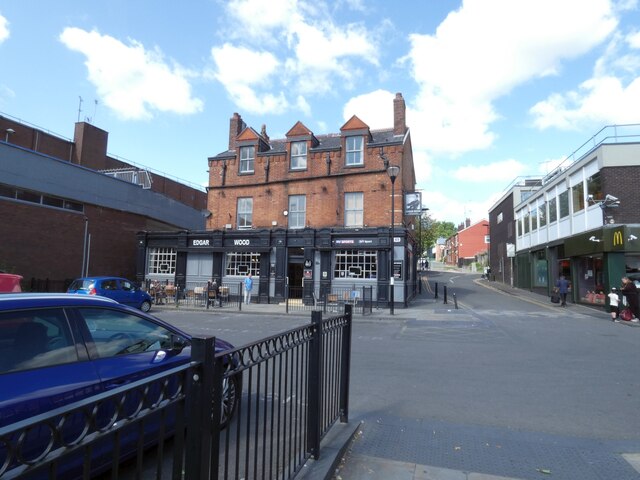
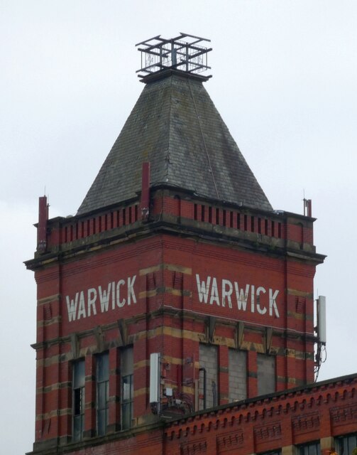
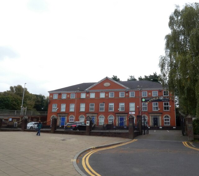
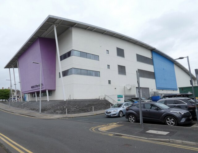
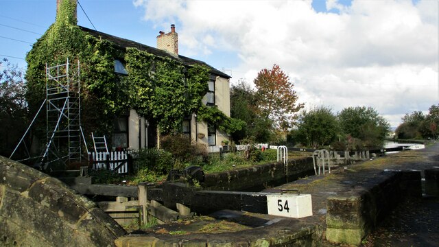
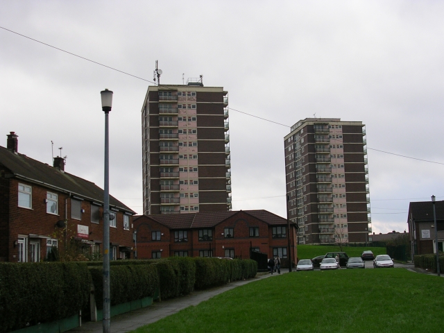
Hollins Images

Images are sourced within 2km of 53.563945/-2.196998 or Grid Reference SD8707. Thanks to Geograph Open Source API. All images are credited.

Edgar Wood The former Dusty Miller <a href="https://www.geograph.org.uk/photo/2666576">SD8605 : Dusty Miller</a> is now the Edgar Wood. A Craft Union pub.  It is named after the world acclaimed Middleton architect, Edgar Wood <span class="nowrap"><a title="http://middletonheritage.co.uk/arts-and-crafts-trail/" rel="nofollow ugc noopener" href="http://middletonheritage.co.uk/arts-and-crafts-trail/">Link</a><img style="margin-left:2px;" alt="External link" title="External link - shift click to open in new window" src="https://s1.geograph.org.uk/img/external.png" width="10" height="10"/></span>  

<a href="https://www.geograph.org.uk/photo/6992739">SD8605 : Sign of the Edgar Wood</a>.
Edgar Wood
The former Dusty Miller SD8605 : Dusty Miller is now the Edgar Wood. A Craft Union pub. It is named after the world acclaimed Middleton architect, Edgar Wood LinkExternal link SD8605 : Sign of the Edgar Wood.
Sign of the Edgar Wood Sign for the Edgar Wood <a href="https://www.geograph.org.uk/photo/6992736">SD8605 : Edgar Wood</a>.
Sign of the Edgar Wood
Sign for the Edgar Wood SD8605 : Edgar Wood.
Tesco Extra 
The filling station at the superstore which was built on the site of the former Middleton civic buildings. In the background is the now derelict Grade II listed <span class="nowrap"><a title="https://historicengland.org.uk/listing/the-list/list-entry/1356232" rel="nofollow ugc noopener" href="https://historicengland.org.uk/listing/the-list/list-entry/1356232">Link</a><img style="margin-left:2px;" alt="External link" title="External link - shift click to open in new window" src="https://s1.geograph.org.uk/img/external.png" width="10" height="10"/></span> Warwick Mill.
Tesco Extra
The filling station at the superstore which was built on the site of the former Middleton civic buildings. In the background is the now derelict Grade II listed LinkExternal link Warwick Mill.
Warwick Mill 
The  Grade II listed <span class="nowrap"><a title="https://historicengland.org.uk/listing/the-list/list-entry/1356232" rel="nofollow ugc noopener" href="https://historicengland.org.uk/listing/the-list/list-entry/1356232">Link</a><img style="margin-left:2px;" alt="External link" title="External link - shift click to open in new window" src="https://s1.geograph.org.uk/img/external.png" width="10" height="10"/></span> Warwick Mill is presently in somewhat derelict state.
Warwick Mill
The Grade II listed LinkExternal link Warwick Mill is presently in somewhat derelict state.
Warwick House 
The property dated 1990 appears to be the offices for a large number of companies with addresses divided between Conway House, Balmoral House and Windsor House.

Note: Photograph is for record purposes only. The photographer has no personal connection with any of the businesses depicted.
Warwick House
The property dated 1990 appears to be the offices for a large number of companies with addresses divided between Conway House, Balmoral House and Windsor House. Note: Photograph is for record purposes only. The photographer has no personal connection with any of the businesses depicted.
Middleton Arena 
Construction of the Middleton Arena was completed in December 2008 and the Arena officially opened for business on 4th January 2009.

It was built on Corporation Street (since renamed LCpl Joel Halliwell VC Way) on the site formerly occupied by the Hippodrome Nightclub (previously The Empire Cinema) and the old civic amenity site. To make way for construction the Hippodrome was levelled in August 2007.

Operated by yourtrust (formerly Link4Life) the arena comprises a gymnasium, swimming pools, sauna and steam rooms, sports hall & squash and a cafe. <span class="nowrap"><a title="https://www.yourtrustrochdale.co.uk/venues/middleton-arena/" rel="nofollow ugc noopener" href="https://www.yourtrustrochdale.co.uk/venues/middleton-arena/">Link</a><img style="margin-left:2px;" alt="External link" title="External link - shift click to open in new window" src="https://s1.geograph.org.uk/img/external.png" width="10" height="10"/></span>
Middleton Arena
Construction of the Middleton Arena was completed in December 2008 and the Arena officially opened for business on 4th January 2009. It was built on Corporation Street (since renamed LCpl Joel Halliwell VC Way) on the site formerly occupied by the Hippodrome Nightclub (previously The Empire Cinema) and the old civic amenity site. To make way for construction the Hippodrome was levelled in August 2007. Operated by yourtrust (formerly Link4Life) the arena comprises a gymnasium, swimming pools, sauna and steam rooms, sports hall & squash and a cafe. LinkExternal link
Middleton Arena Construction of the Middleton Arena was completed in December 2008 and the Arena officially opened for business on 4th January 2009.

It was built on Corporation Street (since renamed LCpl Joel Halliwell VC Way) on the site formerly occupied by the Hippodrome Nightclub (previously The Empire Cinema) and the old civic amenity site. To make way for construction, the Hippodrome was levelled in August 2007.

Operated by yourtrust (formerly Link4Life) the arena comprises a gymnasium, swimming pools, sauna and steam rooms, sports hall & squash and a cafe. <span class="nowrap"><a title="https://www.yourtrustrochdale.co.uk/venues/middleton-arena/" rel="nofollow ugc noopener" href="https://www.yourtrustrochdale.co.uk/venues/middleton-arena/">Link</a><img style="margin-left:2px;" alt="External link" title="External link - shift click to open in new window" src="https://s1.geograph.org.uk/img/external.png" width="10" height="10"/></span>
Middleton Arena
Construction of the Middleton Arena was completed in December 2008 and the Arena officially opened for business on 4th January 2009. It was built on Corporation Street (since renamed LCpl Joel Halliwell VC Way) on the site formerly occupied by the Hippodrome Nightclub (previously The Empire Cinema) and the old civic amenity site. To make way for construction, the Hippodrome was levelled in August 2007. Operated by yourtrust (formerly Link4Life) the arena comprises a gymnasium, swimming pools, sauna and steam rooms, sports hall & squash and a cafe. LinkExternal link
Middleton Market Place At the junction of the A664 Assheton Way and the B6189 Market Place.

#1 on the left is the Assheton Arms. Originally a J.W.Lees pub it now only operates as a B&B <a href="https://www.geograph.org.uk/photo/7026148">SD8706 : Sign of the Assheton Arms Hotel</a>.

#3 in the middle is the Grade II listed <span class="nowrap"><a title="https://historicengland.org.uk/listing/the-list/list-entry/1068505" rel="nofollow ugc noopener" href="https://historicengland.org.uk/listing/the-list/list-entry/1068505">Link</a><img style="margin-left:2px;" alt="External link" title="External link - shift click to open in new window" src="https://s1.geograph.org.uk/img/external.png" width="10" height="10"/></span> building  built in 1892 for the Manchester and Salford Bank. The local architect Edgar Wood was responsible for its design  comprising buff-coloured terracotta with a clay tile roof, 3 bays and 3 storeys. There is a panelled round-arched door between bays 2 and 3 with blocked archivolt and coat of arms above. Three 3-light mullion and transom basket-arched windows within segmental recesses on the ground floor. Secondary doors to extreme left and right. Similar 4-light windows on the first and second floor the latter within bold gabled dormers. All windows have leaded lights. The gabled dormers are only narrowly divided by the plane of the roof which continues down to a deep eaves projection. Elaborate rainwater heads with rosette motifs and downpipes with flamboyant brackets convey the rainwater to a trough at first floor sill level. The trough has bead-and-reel enrichment and channels water to an internal drain. Bold ridge chimney stacks. It became a Williams Deacon bank and subsequently the Royal Bank of Scotland. Having stood empty for many years plans to turn it into a nightclub were rejected. It has recently opened as the Lekki Lounge <span class="nowrap"><a title="https://www.lekkiloungemanchester.co.uk/" rel="nofollow ugc noopener" href="https://www.lekkiloungemanchester.co.uk/">Link</a><img style="margin-left:2px;" alt="External link" title="External link - shift click to open in new window" src="https://s1.geograph.org.uk/img/external.png" width="10" height="10"/></span> describing itself as having the best Afro Caribbean cuisine in Manchester.

#5 on the right has for many years been a branch of the Royal Bank of Scotland but that too has now closed.
Middleton Market Place
At the junction of the A664 Assheton Way and the B6189 Market Place. #1 on the left is the Assheton Arms. Originally a J.W.Lees pub it now only operates as a B&B SD8706 : Sign of the Assheton Arms Hotel. #3 in the middle is the Grade II listed LinkExternal link building built in 1892 for the Manchester and Salford Bank. The local architect Edgar Wood was responsible for its design comprising buff-coloured terracotta with a clay tile roof, 3 bays and 3 storeys. There is a panelled round-arched door between bays 2 and 3 with blocked archivolt and coat of arms above. Three 3-light mullion and transom basket-arched windows within segmental recesses on the ground floor. Secondary doors to extreme left and right. Similar 4-light windows on the first and second floor the latter within bold gabled dormers. All windows have leaded lights. The gabled dormers are only narrowly divided by the plane of the roof which continues down to a deep eaves projection. Elaborate rainwater heads with rosette motifs and downpipes with flamboyant brackets convey the rainwater to a trough at first floor sill level. The trough has bead-and-reel enrichment and channels water to an internal drain. Bold ridge chimney stacks. It became a Williams Deacon bank and subsequently the Royal Bank of Scotland. Having stood empty for many years plans to turn it into a nightclub were rejected. It has recently opened as the Lekki Lounge LinkExternal link describing itself as having the best Afro Caribbean cuisine in Manchester. #5 on the right has for many years been a branch of the Royal Bank of Scotland but that too has now closed.
Lekki Lounge #3 Market Place, Middleton is the Grade II listed <span class="nowrap"><a title="https://historicengland.org.uk/listing/the-list/list-entry/1068505" rel="nofollow ugc noopener" href="https://historicengland.org.uk/listing/the-list/list-entry/1068505">Link</a><img style="margin-left:2px;" alt="External link" title="External link - shift click to open in new window" src="https://s1.geograph.org.uk/img/external.png" width="10" height="10"/></span> building  built in 1892 for the Manchester and Salford Bank. The local architect Edgar Wood <a href="https://www.geograph.org.uk/photo/7026144">SD8706 : Edgar Wood (1860 - 1935)</a> was responsible for its design  comprising buff-coloured terracotta with a clay tile roof, 3 bays and 3 storeys. There is a panelled round-arched door between bays 2 and 3 with blocked archivolt and coat of arms above. Three 3-light mullion and transom basket-arched windows within segmental recesses on the ground floor. Secondary doors to extreme left and right. Similar 4-light windows on the first and second floor the latter within bold gabled dormers. All windows have leaded lights. The gabled dormers are only narrowly divided by the plane of the roof which continues down to a deep eaves projection. Elaborate rainwater heads with rosette motifs and downpipes with flamboyant brackets convey the rainwater to a trough at first floor sill level. The trough has bead-and-reel enrichment and channels water to an internal drain. Bold ridge chimney stacks. It became a Williams Deacon bank and subsequently the Royal Bank of Scotland. Having stood empty for many years plans to turn it into a nightclub were rejected. It has recently opened as the Lekki Lounge <span class="nowrap"><a title="https://www.lekkiloungemanchester.co.uk/" rel="nofollow ugc noopener" href="https://www.lekkiloungemanchester.co.uk/">Link</a><img style="margin-left:2px;" alt="External link" title="External link - shift click to open in new window" src="https://s1.geograph.org.uk/img/external.png" width="10" height="10"/></span> describing itself as having the best Afro Caribbean cuisine in Manchester.
Lekki Lounge
#3 Market Place, Middleton is the Grade II listed LinkExternal link building built in 1892 for the Manchester and Salford Bank. The local architect Edgar Wood SD8706 : Edgar Wood (1860 - 1935) was responsible for its design comprising buff-coloured terracotta with a clay tile roof, 3 bays and 3 storeys. There is a panelled round-arched door between bays 2 and 3 with blocked archivolt and coat of arms above. Three 3-light mullion and transom basket-arched windows within segmental recesses on the ground floor. Secondary doors to extreme left and right. Similar 4-light windows on the first and second floor the latter within bold gabled dormers. All windows have leaded lights. The gabled dormers are only narrowly divided by the plane of the roof which continues down to a deep eaves projection. Elaborate rainwater heads with rosette motifs and downpipes with flamboyant brackets convey the rainwater to a trough at first floor sill level. The trough has bead-and-reel enrichment and channels water to an internal drain. Bold ridge chimney stacks. It became a Williams Deacon bank and subsequently the Royal Bank of Scotland. Having stood empty for many years plans to turn it into a nightclub were rejected. It has recently opened as the Lekki Lounge LinkExternal link describing itself as having the best Afro Caribbean cuisine in Manchester.
Former Bricklayers Arms Former Gartside's pub now Domino's Pizza.
Former Bricklayers Arms
Former Gartside's pub now Domino's Pizza.
Edgar Wood (1860 - 1935) 
The plaque on what is now the Lekki Lounge <a href="https://www.geograph.org.uk/photo/7026044">SD8706 : Lekki Lounge</a> reads:

MIDDLETON CIVIC
ASSOCIATION

EDGAR
WOOD
ARCHITECT
(1860 - 1935)

MANCHESTER
AND SALFORD BANK
1892
GRADE II LISTED BUILDING

ROCHDALE METROPOLITAN
BOROUGH COUNCIL
Edgar Wood (1860 - 1935)
The plaque on what is now the Lekki Lounge SD8706 : Lekki Lounge reads: MIDDLETON CIVIC ASSOCIATION EDGAR WOOD ARCHITECT (1860 - 1935) MANCHESTER AND SALFORD BANK 1892 GRADE II LISTED BUILDING ROCHDALE METROPOLITAN BOROUGH COUNCIL
Sign of the Assheton Arms Hotel Sign for the Assheton Arms Hotel <a href="https://www.geograph.org.uk/photo/7026018">SD8706 : Middleton Market Place</a>.
Sign of the Assheton Arms Hotel
Sign for the Assheton Arms Hotel SD8706 : Middleton Market Place.
Sign of the New Inn Sign for the New Inn <a href="https://www.geograph.org.uk/photo/7026249">SD8706 : New Inn and D Igoe optometrist</a>.
Sign of the New Inn
New Inn and D Igoe optometrist Long Street, Middleton.

<a href="https://www.geograph.org.uk/photo/7026222">SD8706 : Sign of the New Inn</a>.
New Inn and D Igoe optometrist
Long Street, Middleton. SD8706 : Sign of the New Inn.
Manchester Golf Course Trig Point Flush Bracket S2789
Glade Wood
Glade Wood
Masts at dusk Rochdale Way
Lock House, Slattocks By the side of Rochdale Canal Lock No.54
Lock House, Slattocks
By the side of Rochdale Canal Lock No.54
Show me another place!

Hollins is located at Grid Ref: SD8707 (Lat: 53.563945, Lng: -2.196998)

Unitary Authority: Rochdale

Police Authority: Greater Manchester

What 3 Words

///unrealistic.issued.assets. Near Middleton, Manchester

Related Wikis

St Anne's Academy

St Anne's Academy is an 11–16 mixed comprehensive academy in Middleton area of the Metropolitan Borough of Rochdale in Greater Manchester, United Kingdom...

Hopwood Hall

Hopwood Hall is a Grade II* historic house in Middleton, Greater Manchester, England, which was the ancestral country home of the landed gentry family...

Cardinal Langley Roman Catholic High School

The Cardinal Langley Roman Catholic High School is a Roman Catholic secondary school in Middleton, Greater Manchester, England, for ages 11–18. The school...

Langley, Greater Manchester

Langley is an suburb near Middleton, Greater Manchester, England, 4.4 miles (7.1 km) southwest of Rochdale and 5.5 miles (8.9 km) northeast of Manchester...

Nearby Amenities

Located within 500m of 53.563945,-2.196998
Noexit: yes
Lat/Long: 53.5649998/-2.2037956
Bus Stop
Whalley Road/Selby Road
Bus: yes
Naptan AtcoCode: 1800NE01691
Naptan Bearing: E
Naptan CommonName: Whalley Road/Selby Road
Naptan Indicator: House No. 30
Naptan Landmark: HOUSE 30
Naptan NaptanCode: mandwdmt
Naptan PlusbusZoneRef: MNCRPIC
Naptan ShortCommonName: Selby Road
Naptan Street: WHALLEY ROAD
Naptan Verified: no
Network: TfGM
Public Transport: platform
Source: naptan_import
Lat/Long: 53.5630496/-2.1972247
Bus Stop
Whalley Road/Kingswood Road
Bus: yes
Naptan AtcoCode: 1800NE02181
Naptan Bearing: E
Naptan CommonName: Whalley Road/Kingswood Road
Naptan Indicator: Opp St Annes
Naptan Landmark: HOUSE 76
Naptan NaptanCode: mandwdpw
Naptan PlusbusZoneRef: MNCRPIC
Naptan ShortCommonName: Kingswood Road
Naptan Street: WHALLEY ROAD
Naptan Verified: no
Network: TfGM
Public Transport: platform
Source: naptan_import
Lat/Long: 53.5627119/-2.2003031
Bus Stop
Tintern Road/Abbey Road
Bus: yes
Naptan AtcoCode: 1800NE03011
Naptan Bearing: E
Naptan CommonName: Tintern Road/Abbey Road
Naptan Indicator: Op House 32
Naptan Landmark: HOUSE 32
Naptan NaptanCode: mandwgma
Naptan PlusbusZoneRef: MNCRPIC
Naptan ShortCommonName: Abbey Road
Naptan Street: TINTERN ROAD
Naptan Verified: no
Network: TfGM
Public Transport: platform
Source: naptan_import
Lat/Long: 53.5641689/-2.1998117
Bus Stop
Tintern Road/Hopwood Road
Bus: yes
Naptan AtcoCode: 1800NE03021
Naptan Bearing: SE
Naptan CommonName: Tintern Road/Hopwood Road
Naptan Indicator: Op House 102
Naptan Landmark: HOUSE 107
Naptan NaptanCode: mandwgmd
Naptan PlusbusZoneRef: MNCRPIC
Naptan ShortCommonName: Hopwood Road
Naptan Street: TINTERN ROAD
Naptan Verified: no
Network: TfGM
Public Transport: platform
Source: naptan_import
Lat/Long: 53.5640966/-2.1945873
Bus Stop
Tintern Road/Whalley Road
Bus: yes
Naptan AtcoCode: 1800NE03031
Naptan Bearing: S
Naptan CommonName: Tintern Road/Whalley Road
Naptan Indicator: Nr Open Land
Naptan Landmark: NR OPEN LAND
Naptan NaptanCode: mandwgmg
Naptan PlusbusZoneRef: MNCRPIC
Naptan ShortCommonName: Whalley Road
Naptan Street: TINTERN ROAD
Naptan Verified: no
Network: TfGM
Public Transport: platform
Source: naptan_import
Lat/Long: 53.5626686/-2.1938863
Bus Stop
Nowell Road/Hollin Shops
Bus: yes
Naptan AtcoCode: 1800NE03041
Naptan Bearing: S
Naptan CommonName: Nowell Road/Hollin Shops
Naptan Indicator: Hills Bakery
Naptan Landmark: HILLS BAKERY
Naptan NaptanCode: mandwgmj
Naptan PlusbusZoneRef: MNCRPIC
Naptan ShortCommonName: Hollin Shops
Naptan Street: NOWELL ROAD
Naptan Verified: no
Network: TfGM
Public Transport: platform
Source: naptan_import
Lat/Long: 53.5617621/-2.1930367
Bus Stop
Whalley Road/Tintern Road
Bus: yes
Naptan AtcoCode: 1800NE24751
Naptan Bearing: E
Naptan CommonName: Whalley Road/Tintern Road
Naptan Indicator: Opp House 5
Naptan Landmark: HOUSE 2
Naptan NaptanCode: mangamjp
Naptan PlusbusZoneRef: MNCRPIC
Naptan ShortCommonName: Tintern Road
Naptan Street: WHALLEY ROAD
Naptan Verified: no
Network: TfGM
Public Transport: platform
Source: naptan_import
Lat/Long: 53.5624429/-2.194459
Bus Stop
Waverley Road/Primary School
Bus: yes
Naptan AtcoCode: 1800NE24771
Naptan Bearing: W
Naptan CommonName: Waverley Road/Primary School
Naptan Indicator: School
Naptan Landmark: SCHOOL
Naptan NaptanCode: mangampa
Naptan PlusbusZoneRef: MNCRPIC
Naptan ShortCommonName: Primary School
Naptan Street: WAVERLEY ROAD
Naptan Verified: no
Network: TfGM
Public Transport: platform
Source: naptan_import
Lat/Long: 53.5622053/-2.1913025
Bus Stop
Tintern Road/Whalley Road
Bus: yes
Naptan AtcoCode: 1800NE41011
Naptan Bearing: N
Naptan CommonName: Tintern Road/Whalley Road
Naptan Indicator: Old Folks Home
Naptan Landmark: OLD FOLKS HOME
Naptan NaptanCode: mangdpdg
Naptan PlusbusZoneRef: MNCRPIC
Naptan ShortCommonName: Whalley Road
Naptan Street: TINTERN ROAD
Naptan Verified: no
Network: TfGM
Public Transport: platform
Source: naptan_import
Lat/Long: 53.5628304/-2.1938719
Bus Stop
Tintern Road/Abbey Road
Bus: yes
Naptan AtcoCode: 1800NE41031
Naptan Bearing: W
Naptan CommonName: Tintern Road/Abbey Road
Naptan Indicator: O/s House 24
Naptan Landmark: HOUSE 24
Naptan NaptanCode: mangdpdm
Naptan PlusbusZoneRef: MNCRPIC
Naptan ShortCommonName: Abbey Road
Naptan Street: TINTERN ROAD
Naptan Verified: no
Network: TfGM
Public Transport: platform
Source: naptan_import
Lat/Long: 53.5639976/-2.2001582
Bus Stop
Waverley Road/Primary School
Bus: yes
Naptan AtcoCode: 1800NE07421
Naptan Bearing: E
Naptan CommonName: Waverley Road/Primary School
Naptan Indicator: School
Naptan Landmark: HOUSE 18
Naptan NaptanCode: mantgwtg
Naptan PlusbusZoneRef: MNCRPIC
Naptan ShortCommonName: Primary School
Naptan Street: WAVERLEY ROAD
Naptan Verified: no
Network: TfGM
Public Transport: platform
Source: naptan_import
Lat/Long: 53.5623042/-2.1913029
Bus Stop
Whalley Road/Tintern Road
Bus: yes
Naptan AtcoCode: 1800NE08501
Naptan Bearing: W
Naptan CommonName: Whalley Road/Tintern Road
Naptan Indicator: Os House 7
Naptan Landmark: HOUSE 7
Naptan NaptanCode: mantmpma
Naptan Notes: INDICATOR AMENDED
Naptan PlusbusZoneRef: MNCRPIC
Naptan ShortCommonName: Tintern Road
Naptan Street: WHALLEY ROAD
Naptan Verified: no
Network: TfGM
Public Transport: platform
Source: naptan_import
Lat/Long: 53.5624335/-2.1947609
Bus Stop
Hollin Lane/Whalley Road
Bus: yes
Naptan AtcoCode: 1800NE26331
Naptan Bearing: N
Naptan CommonName: Hollin Lane/Whalley Road
Naptan Indicator: Nr Club
Naptan Landmark: NR CLUB
Naptan NaptanCode: mangawdp
Naptan PlusbusZoneRef: MNCRPIC
Naptan ShortCommonName: Whalley Road
Naptan Street: HOLLIN LANE
Naptan Verified: no
Network: TfGM
Public Transport: platform
Source: naptan_import
Lat/Long: 53.5630017/-2.2043356
Bus Stop
Hollin Lane/Whalley Road
Bus: yes
Naptan AtcoCode: 1800NE26341
Naptan Bearing: S
Naptan CommonName: Hollin Lane/Whalley Road
Naptan Indicator: Red Lion
Naptan Landmark: FLATS
Naptan NaptanCode: mangawdt
Naptan PlusbusZoneRef: MNCRPIC
Naptan ShortCommonName: Whalley Road
Naptan Street: HOLLIN LANE
Naptan Verified: no
Network: TfGM
Public Transport: platform
Source: naptan_import
Lat/Long: 53.5623014/-2.2038642
Bus Stop
Nowell Road/Torre Close
Bus: yes
Naptan AtcoCode: 1800NE26471
Naptan Bearing: N
Naptan CommonName: Nowell Road/Torre Close
Naptan Indicator: Op House 34
Naptan Landmark: HOUSE 34
Naptan NaptanCode: mangawjp
Naptan PlusbusZoneRef: MNCRPIC
Naptan ShortCommonName: Torre Close
Naptan Street: NOWELL ROAD
Naptan Verified: no
Network: TfGM
Public Transport: platform
Source: naptan_import
Lat/Long: 53.5613389/-2.1934726
Bus Stop
Whalley Road/Selby Road
Bus: yes
Naptan AtcoCode: 1800NE26481
Naptan Bearing: W
Naptan CommonName: Whalley Road/Selby Road
Naptan Indicator: Op House 30
Naptan Landmark: HOUSE 33
Naptan NaptanCode: mangawjt
Naptan PlusbusZoneRef: MNCRPIC
Naptan ShortCommonName: Selby Road
Naptan Street: WHALLEY ROAD
Naptan Verified: no
Network: TfGM
Public Transport: platform
Source: naptan_import
Lat/Long: 53.5629153/-2.1969221
Bus Stop
Whalley Road/Kingswood Road
Bus: yes
Naptan AtcoCode: 1800NE26491
Naptan Bearing: W
Naptan CommonName: Whalley Road/Kingswood Road
Naptan Indicator: St Agnes
Naptan Landmark: ST AGNES COURT
Naptan NaptanCode: mangawjw
Naptan PlusbusZoneRef: MNCRPIC
Naptan ShortCommonName: Kingswood Road
Naptan Street: WHALLEY ROAD
Naptan Verified: no
Network: TfGM
Public Transport: platform
Source: naptan_import
Lat/Long: 53.5626042/-2.2002271
Bus Stop
Whalley Road/Hollin Lane
Bus: yes
Naptan AtcoCode: 1800NE26501
Naptan Bearing: E
Naptan CommonName: Whalley Road/Hollin Lane
Naptan Indicator: Op Red Lion
Naptan Landmark: FLATS
Naptan NaptanCode: mangawma
Naptan PlusbusZoneRef: MNCRPIC
Naptan ShortCommonName: Hollin Lane
Naptan Street: WHALLEY ROAD
Naptan Verified: no
Network: TfGM
Public Transport: platform
Source: naptan_import
Lat/Long: 53.5627333/-2.2036398
Barrier: cycle_barrier
Lat/Long: 53.5632027/-2.191754
Barrier: kissing_gate
Lat/Long: 53.5622819/-2.1901769
Barrier: bollard
Bollard: removable
Horse: yes
Motor Vehicle: private
Lat/Long: 53.5662318/-2.2030317
Generator Method: photovoltaic
Generator Output Electricity: yes
Generator Source: solar
Generator Type: solar_photovoltaic_panel
Location: roof
Power: generator
Lat/Long: 53.5643667/-2.2028568
Generator Method: photovoltaic
Generator Output Electricity: yes
Generator Source: solar
Generator Type: solar_photovoltaic_panel
Location: roof
Power: generator
Lat/Long: 53.5643667/-2.2026438
Generator Method: photovoltaic
Generator Output Electricity: yes
Generator Source: solar
Generator Type: solar_photovoltaic_panel
Location: roof
Power: generator
Lat/Long: 53.5639348/-2.2012131
Generator Method: photovoltaic
Generator Output Electricity: yes
Generator Source: solar
Generator Type: solar_photovoltaic_panel
Location: roof
Power: generator
Lat/Long: 53.562616/-2.2028421
Generator Method: photovoltaic
Generator Output Electricity: yes
Generator Source: solar
Generator Type: solar_photovoltaic_panel
Location: roof
Power: generator
Lat/Long: 53.5640096/-2.1997209
Generator Method: photovoltaic
Generator Output Electricity: yes
Generator Source: solar
Generator Type: solar_photovoltaic_panel
Location: roof
Power: generator
Lat/Long: 53.5646727/-2.2024056
Generator Method: photovoltaic
Generator Output Electricity: yes
Generator Source: solar
Generator Type: solar_photovoltaic_panel
Location: roof
Power: generator
Lat/Long: 53.5616405/-2.2022936
Generator Method: photovoltaic
Generator Output Electricity: yes
Generator Source: solar
Generator Type: solar_photovoltaic_panel
Location: roof
Power: generator
Lat/Long: 53.5646717/-2.2025041
Generator Method: photovoltaic
Generator Output Electricity: yes
Generator Source: solar
Generator Type: solar_photovoltaic_panel
Location: roof
Power: generator
Lat/Long: 53.561417/-2.1982671
Generator Method: photovoltaic
Generator Output Electricity: yes
Generator Source: solar
Generator Type: solar_photovoltaic_panel
Location: roof
Power: generator
Lat/Long: 53.5616766/-2.1979828
Generator Method: photovoltaic
Generator Output Electricity: yes
Generator Source: solar
Generator Type: solar_photovoltaic_panel
Location: roof
Power: generator
Lat/Long: 53.5621968/-2.2022609
Generator Method: photovoltaic
Generator Output Electricity: yes
Generator Source: solar
Generator Type: solar_photovoltaic_panel
Location: roof
Power: generator
Lat/Long: 53.5622764/-2.1997692
Generator Method: photovoltaic
Generator Output Electricity: yes
Generator Source: solar
Generator Type: solar_photovoltaic_panel
Location: roof
Power: generator
Lat/Long: 53.5610824/-2.1946328
Generator Method: photovoltaic
Generator Output Electricity: yes
Generator Source: solar
Generator Type: solar_photovoltaic_panel
Location: roof
Power: generator
Lat/Long: 53.5657301/-2.1972573
Generator Method: photovoltaic
Generator Output Electricity: yes
Generator Source: solar
Generator Type: solar_photovoltaic_panel
Location: roof
Power: generator
Lat/Long: 53.564752/-2.1970481
Generator Method: photovoltaic
Generator Output Electricity: yes
Generator Source: solar
Generator Type: solar_photovoltaic_panel
Location: roof
Power: generator
Lat/Long: 53.5665545/-2.1937933
Generator Method: photovoltaic
Generator Output Electricity: yes
Generator Source: solar
Generator Type: solar_photovoltaic_panel
Location: roof
Power: generator
Lat/Long: 53.5668818/-2.1954025
Generator Method: photovoltaic
Generator Output Electricity: yes
Generator Source: solar
Generator Type: solar_photovoltaic_panel
Location: roof
Power: generator
Lat/Long: 53.5653552/-2.1985708
Generator Method: photovoltaic
Generator Output Electricity: yes
Generator Source: solar
Generator Type: solar_photovoltaic_panel
Location: roof
Power: generator
Lat/Long: 53.5653408/-2.1989195
Generator Method: photovoltaic
Generator Output Electricity: yes
Generator Source: solar
Generator Type: solar_photovoltaic_panel
Location: roof
Power: generator
Lat/Long: 53.5650652/-2.1992628
Generator Method: photovoltaic
Generator Output Electricity: yes
Generator Source: solar
Generator Type: solar_photovoltaic_panel
Location: roof
Power: generator
Lat/Long: 53.5661086/-2.2011955
Generator Method: photovoltaic
Generator Output Electricity: yes
Generator Source: solar
Generator Type: solar_photovoltaic_panel
Location: roof
Power: generator
Lat/Long: 53.5643643/-2.202778
Barrier: kissing_gate
Foot: yes
Lat/Long: 53.5665107/-2.1924917
Barrier: kissing_gate
Foot: designated
Lat/Long: 53.564163/-2.1911152
Barrier: kissing_gate
Foot: yes
Lat/Long: 53.5646147/-2.1930346
Barrier: kissing_gate
Foot: yes
Lat/Long: 53.565373/-2.1927576
Barrier: cycle_barrier
Lat/Long: 53.5669482/-2.1972605
Barrier: cycle_barrier
Lat/Long: 53.5641399/-2.1995467
The data included in this document is from www.openstreetmap.org. The data is made available under ODbL.

Have you been to Hollins?

Leave your review of Hollins below (or comments, questions and feedback).