Càrn a' Bhothain Mholaich

Hill, Mountain in Inverness-shire

Scotland

Càrn a' Bhothain Mholaich

Steep, rocky slope on Am Bodach
Steep, rocky slope on Am Bodach Credit: wrobison

Càrn a' Bhothain Mholaich is a prominent hill located in Inverness-shire, Scotland. It is part of the larger Scottish Highlands region, which is renowned for its stunning landscapes and natural beauty.

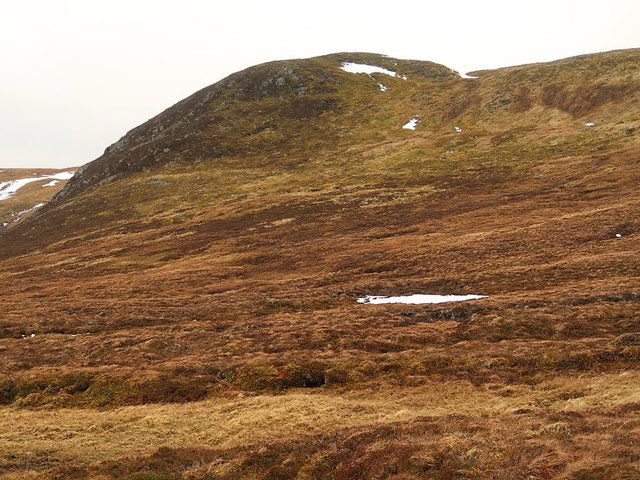
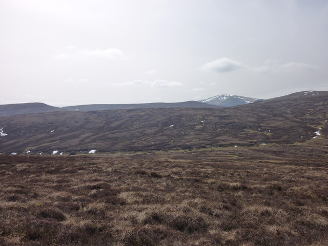
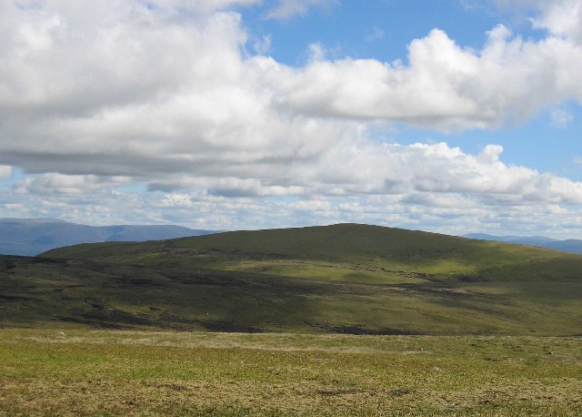
The hill stands at an elevation of approximately 706 meters (2,316 feet) above sea level, making it a challenging yet rewarding climb for outdoor enthusiasts and hikers. It is situated in a remote and untouched area, surrounded by vast stretches of heather moorland and rolling hills, providing visitors with breathtaking panoramic views of the surrounding countryside.

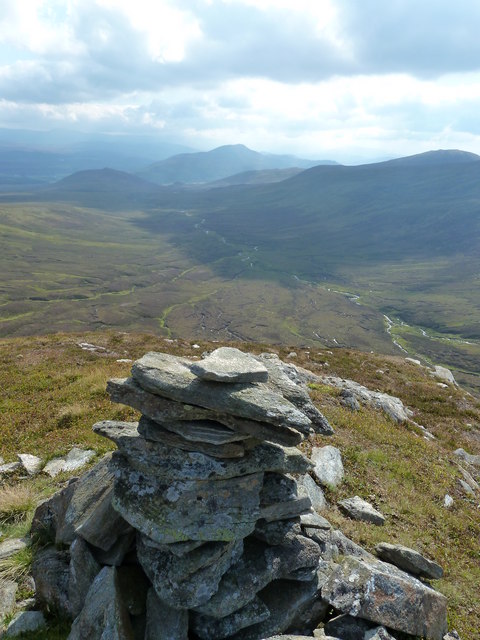
Càrn a' Bhothain Mholaich is characterized by its distinctive rocky summit, which offers a sense of adventure to those who reach its peak. The hill's rugged terrain and steep slopes make it an ideal destination for hillwalking and mountaineering, attracting both experienced climbers and amateurs looking for an exhilarating experience.

The area around Càrn a' Bhothain Mholaich is also rich in wildlife, with various species of birds, mammals, and flora. It is not uncommon to spot red deer, mountain hares, and golden eagles while exploring the hill's surroundings.

Access to Càrn a' Bhothain Mholaich is relatively straightforward, with several well-marked trails and paths leading to its summit. However, it is important for visitors to be adequately prepared and equipped, as the weather conditions in the Scottish Highlands can be unpredictable and harsh.

Overall, Càrn a' Bhothain Mholaich offers a fulfilling and challenging outdoor experience, combining stunning natural scenery with opportunities for adventure and wildlife observation. It is a must-visit destination for nature lovers and outdoor enthusiasts visiting Inverness-shire.

If you have any feedback on the listing, please let us know in the comments section below.

Càrn a' Bhothain Mholaich Images

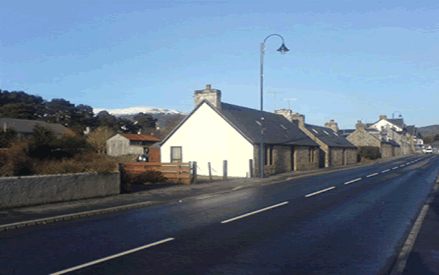
Images are sourced within 2km of 57.132565/-4.1402745 or Grid Reference NH7006. Thanks to Geograph Open Source API. All images are credited.

Steep, rocky slope on Am Bodach
Bruach nan Imirichean granite egg Over the back of the Monadhliath, in the Findhorn headwaters, a glacier has laid a little granite egg - one of the dinkiest erratics one could come across. Just shows how little peat or soil has developed since it was dropped here.  It's shrunk a lot since it left Rannoch Moor or Srath Ossian.
Bruach nan Imirichean granite egg
Over the back of the Monadhliath, in the Findhorn headwaters, a glacier has laid a little granite egg - one of the dinkiest erratics one could come across. Just shows how little peat or soil has developed since it was dropped here. It's shrunk a lot since it left Rannoch Moor or Srath Ossian.
Snowy north east slope of Carn Sgulain
On Am Bodach
On Am Bodach
View east from Carn Sgulain With the Cairngorms in the distance.
View east from Carn Sgulain
With the Cairngorms in the distance.
Am Bodach View down the Allt a'Chaorainn from the summit cairn of Am Bodach
Am Bodach
View down the Allt a'Chaorainn from the summit cairn of Am Bodach
Deep snow on the Monadhliath Gentle skylines and bright sunlit snow make this a classic sunny snow day on the Monadhliath. A hare track breaks the smooth surface.
Deep snow on the Monadhliath
Gentle skylines and bright sunlit snow make this a classic sunny snow day on the Monadhliath. A hare track breaks the smooth surface.
Meall na Gearra Looking across the heathery slopes of Meall na Gearra. A' Chailleach can be seen in the background.
Meall na Gearra
Looking across the heathery slopes of Meall na Gearra. A' Chailleach can be seen in the background.
Col between Carn an Fhreiceadain and Carn a' Bhothain Mholaich Looking into the col (roughly parallel to the road) WSW of Carn an Fhreiceadain.
Col between Carn an Fhreiceadain and Carn a' Bhothain Mholaich
Looking into the col (roughly parallel to the road) WSW of Carn an Fhreiceadain.
Southern slopes of Carn an Fhreiceadain An unmarked vehicle track leading from the main track SSW of Carn an Fhreiceadain.
Southern slopes of Carn an Fhreiceadain
An unmarked vehicle track leading from the main track SSW of Carn an Fhreiceadain.
Bruach nan Imirichean glacifluvial nick Following the Findhorn-Dulnain watershed north from Carn a' Bhothain Mholaich involves crossing a little meltwater channel that nicks the shallow col (right of picture, middle distance) - argocats have gone this way, pushing up little ribs of slightly drier peat that just bear your weight. The OS map fenceline is now just occasional posts, thankfully.
Bruach nan Imirichean glacifluvial nick
Following the Findhorn-Dulnain watershed north from Carn a' Bhothain Mholaich involves crossing a little meltwater channel that nicks the shallow col (right of picture, middle distance) - argocats have gone this way, pushing up little ribs of slightly drier peat that just bear your weight. The OS map fenceline is now just occasional posts, thankfully.
Bruach nan Imirichean glacifluvial meltwater channel The Monadhliath plateau is seamed with meltwater channels larger and smaller, coursing across the slopes and nicking cols.  Sometimes they give blessed relief from deep heather and peat hags - if they are going your way.  This one has an eclectic collection of glacially transported boulders in its bed, including far-travelled granite.
Bruach nan Imirichean glacifluvial meltwater channel
The Monadhliath plateau is seamed with meltwater channels larger and smaller, coursing across the slopes and nicking cols. Sometimes they give blessed relief from deep heather and peat hags - if they are going your way. This one has an eclectic collection of glacially transported boulders in its bed, including far-travelled granite.
Carn a' Bhothain Mholaich glacial erratic This granite erratic a couple of metres long is close to one of the main watershed intersections of the Monadhliath, where the Findhorn-Dulnain divide branches north from the Spey rim. The erratic could have come from Rannoch Moor down Loch Ericht into Strath Spey, or 'round the back' from more local sources. It could have been on the move several times over the last half million years. Others are scattered about, some even larger. The Munros behind are A' Chailleach and Carn Sgulain. Amazing no-one's been here yet, a nice moorland stroll.
Carn a' Bhothain Mholaich glacial erratic
This granite erratic a couple of metres long is close to one of the main watershed intersections of the Monadhliath, where the Findhorn-Dulnain divide branches north from the Spey rim. The erratic could have come from Rannoch Moor down Loch Ericht into Strath Spey, or 'round the back' from more local sources. It could have been on the move several times over the last half million years. Others are scattered about, some even larger. The Munros behind are A' Chailleach and Carn Sgulain. Amazing no-one's been here yet, a nice moorland stroll.
Moorland track on Carn an Fhreiceadain
West of Carn an Fhreiceadain Snow-covered moorland to the west of Carn an Fhreiceadain - relatively easy walking on stalkers paths under normal circumstances, but today thigh-deep drifting snow on the southern flank of this hill has impeded progress significantly.
West of Carn an Fhreiceadain
Snow-covered moorland to the west of Carn an Fhreiceadain - relatively easy walking on stalkers paths under normal circumstances, but today thigh-deep drifting snow on the southern flank of this hill has impeded progress significantly.
Footprints in the snow My footprints on hard-packed snow revealing my route to grid square NH7107, skirting the west flank of Carn an Fhreiceadain. There is a stalkers path buried somewhere under the snow, only traces of this are visible today.
Footprints in the snow
My footprints on hard-packed snow revealing my route to grid square NH7107, skirting the west flank of Carn an Fhreiceadain. There is a stalkers path buried somewhere under the snow, only traces of this are visible today.
Track north west of Carn an Fhreaceadain A stalkers path leading from Pitmain Lodge to the upper reaches of the River Dulnain, east of Carn Sgùlain. In many places the track is filled with drifting snow - impeding progress considerably.
Track north west of Carn an Fhreaceadain
A stalkers path leading from Pitmain Lodge to the upper reaches of the River Dulnain, east of Carn Sgùlain. In many places the track is filled with drifting snow - impeding progress considerably.
View over the Allt Mòr A view over the upper region of the Allt Mòr, with snow covered hills of the Monadhlaith visible in the background.
View over the Allt Mòr
A view over the upper region of the Allt Mòr, with snow covered hills of the Monadhlaith visible in the background.
Show me another place!

Càrn a' Bhothain Mholaich is located at Grid Ref: NH7006 (Lat: 57.132565, Lng: -4.1402745)

Unitary Authority: Highland

Police Authority: Highlands and Islands

What 3 Words

///hence.inserting.banks. Near Newtonmore, Highland

Nearby Locations

Càrn a' Bhothain Mholaich

Related Wikis

A' Chailleach (Monadhliath Mountains)

A' Chailleach (Scottish Gaelic for 'the old woman or Cailleach') is one of the Monadhliath Mountains of Scotland. It lies 7 km (4.3 mi) northwest of Newtonmore...

Creag Bheag

Creag Bheag is a prominent hill in Scotland. == Etymology == The word Creag is a variation of crag (rock), while the gaelic term Bheag can be translated...

Newtonmore

Newtonmore (Scottish Gaelic: Baile Ùr an t-Slèibh [ˈpˠalʲ uːɾˠ ən̪ˠ ˈt̪ʰlʲeːv]) is a village in the Highland council area of Scotland. The village is only...

St Vincent's Hospital, Kingussie

St Vincent's Hospital is a former health facility located in Kingussie, Scotland. The site was closed in 2021 due to the opening of the Badenoch and Strathspey...

Have you been to Càrn a' Bhothain Mholaich?

Leave your review of Càrn a' Bhothain Mholaich below (or comments, questions and feedback).