Hollington

Settlement in Staffordshire Staffordshire Moorlands

England

Hollington

Great Gate Ford Ford on a minor country road at Great Gate.
Great Gate Ford Credit: Philip Halling

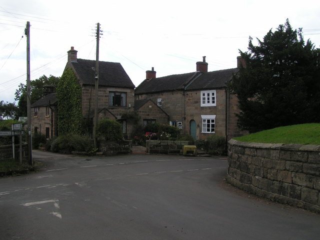
Hollington is a small village located in the county of Staffordshire, England. Situated approximately 5 miles south of the town of Uttoxeter, Hollington is surrounded by picturesque countryside, making it an ideal location for those seeking a peaceful and rural setting.

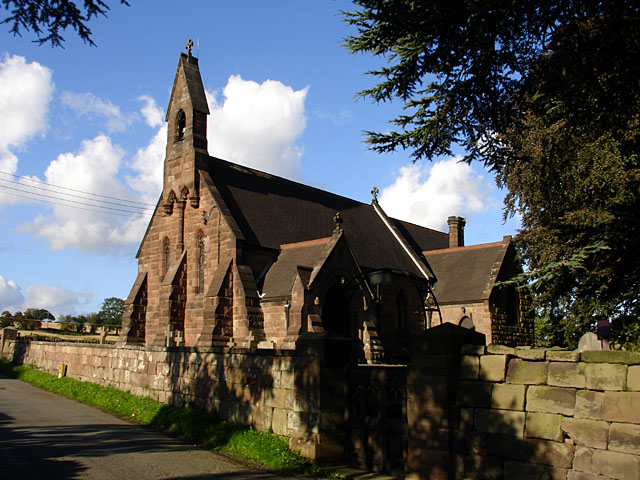
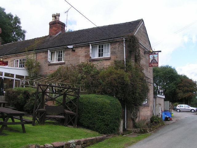
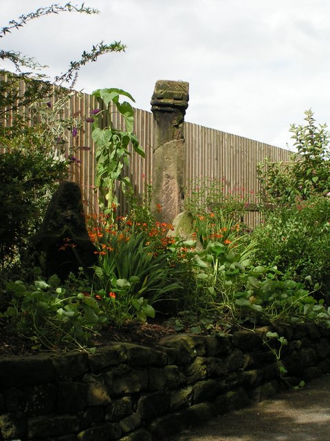
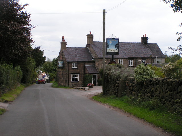
The village itself is characterized by a collection of charming cottages and traditional houses, which add to its quaint and idyllic atmosphere. The local community is close-knit and friendly, with a strong sense of community spirit. Many residents have lived in Hollington for generations, creating a sense of continuity and heritage.

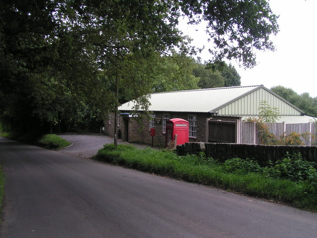
Although small in size, Hollington offers a range of amenities to cater to the needs of its residents. These include a village hall, where various community events and activities take place, a local pub serving traditional English fare, and a small convenience store for everyday essentials. For more extensive shopping options and services, residents can easily access the nearby town of Uttoxeter.

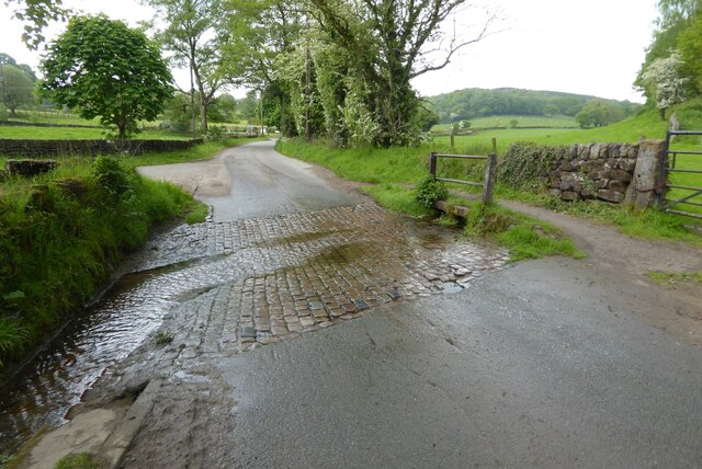
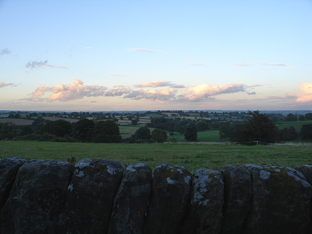
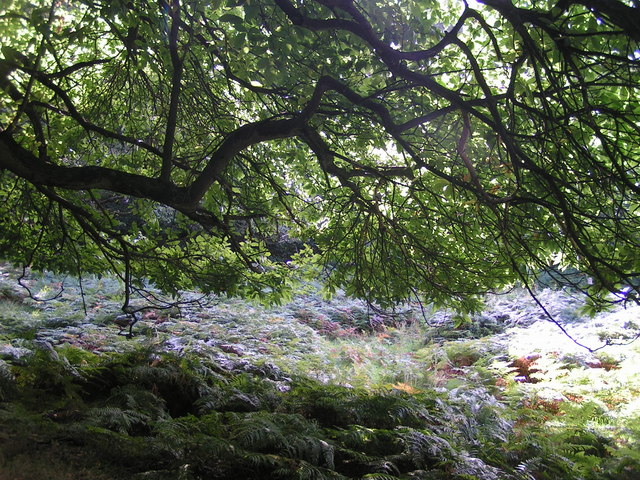
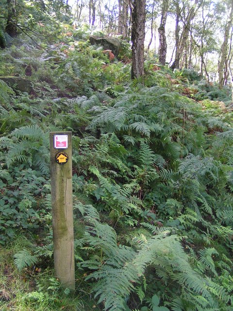
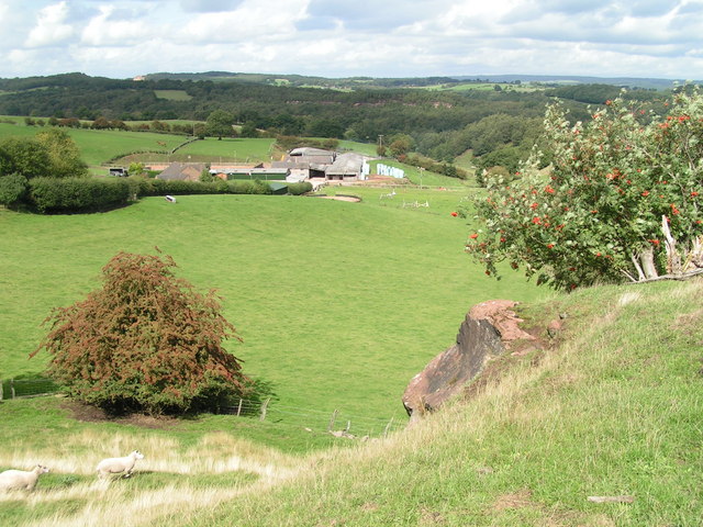
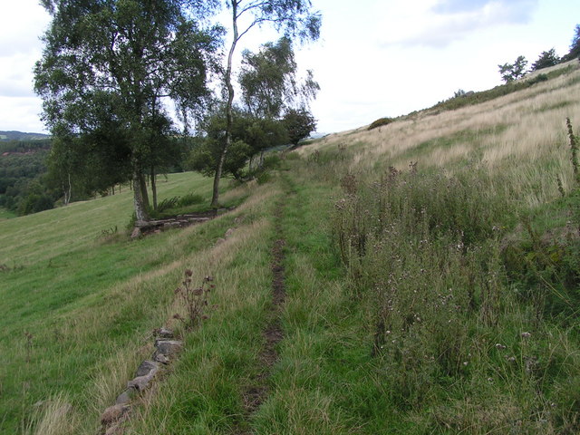
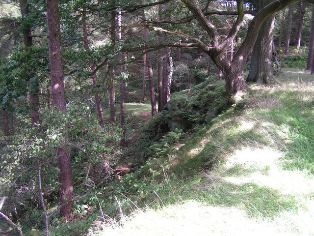
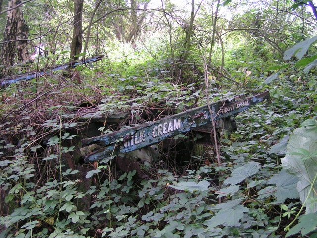
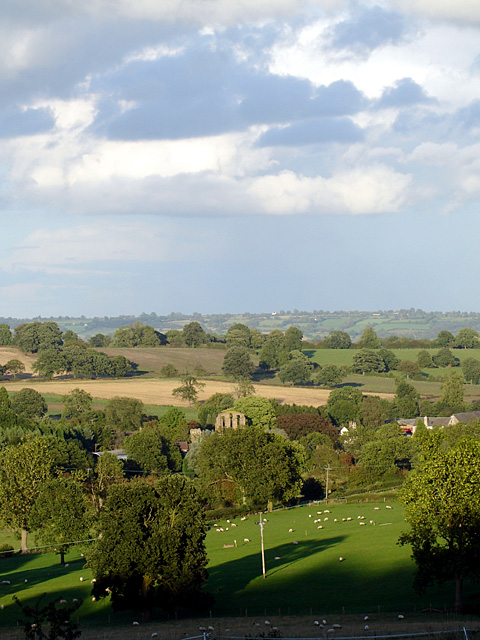
The village is surrounded by beautiful countryside, offering opportunities for outdoor activities such as walking, cycling, and horse riding. The nearby River Dove is a popular spot for fishing enthusiasts, while the stunning Peak District National Park is within a short drive, providing access to breathtaking landscapes and outdoor adventures.

In summary, Hollington is a charming and tranquil village in Staffordshire, boasting a close-knit community, picturesque surroundings, and easy access to amenities and outdoor activities.

If you have any feedback on the listing, please let us know in the comments section below.
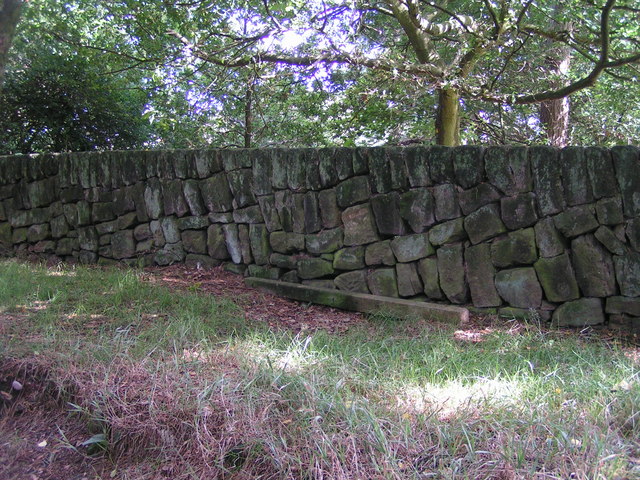
Hollington Images

Images are sourced within 2km of 52.947884/-1.915135 or Grid Reference SK0538. Thanks to Geograph Open Source API. All images are credited.

Great Gate Ford Ford on a minor country road at Great Gate.
Great Gate Ford
Ford on a minor country road at Great Gate.
Croxden Abbey The road passes through part of the abbey.
Croxden Abbey
The road passes through part of the abbey.
West Front of Croxden Abbey The abbey was initially founded 5 miles away at Cotton in 1176, and moved to this site 3 years later.
West Front of Croxden Abbey
The abbey was initially founded 5 miles away at Cotton in 1176, and moved to this site 3 years later.
West Front of Croxden Abbey Taken in the evening sunshine. The entrance leading to a farmhouse is private.
West Front of Croxden Abbey
Taken in the evening sunshine. The entrance leading to a farmhouse is private.
St Giles, Croxden St Giles was built about 1884/5 to replace an earlier chapel by the abbey.
St Giles, Croxden
St Giles was built about 1884/5 to replace an earlier chapel by the abbey.
Fields near Hollington Taken from beside the Raddle Inn on Quarry Bank.
Fields near Hollington
Taken from beside the Raddle Inn on Quarry Bank.
Underneath the spreading chestnut tree One of a grove of sweet chestnut trees in Broadmoor Wood; this one is right on the hairpin bend between Great Gate and Hollington.
Underneath the spreading chestnut tree
One of a grove of sweet chestnut trees in Broadmoor Wood; this one is right on the hairpin bend between Great Gate and Hollington.
In Broadmoor Wood Well-named: I felt ready for Broadmoor after blundering about in bouldery bracken trying to find the footpath to Lodgedale. I was reassured to find this sign indicating that (despite appearances) I was still in the right place. The path is fairly well signposted, but obviously not well used. I got utterly lost in the same wood a bit later, near the Raddle Inn in Hollington.
In Broadmoor Wood
Well-named: I felt ready for Broadmoor after blundering about in bouldery bracken trying to find the footpath to Lodgedale. I was reassured to find this sign indicating that (despite appearances) I was still in the right place. The path is fairly well signposted, but obviously not well used. I got utterly lost in the same wood a bit later, near the Raddle Inn in Hollington.
Lodgedale Looking towards Lodgedale Farm from a rock outcrop close to the Hollington road.
Lodgedale
Looking towards Lodgedale Farm from a rock outcrop close to the Hollington road.
Quarrymen's track, Lodgedale A well-made track (now a little-used footpath - the worn strip was made by sheep, not people) along the eastern slope of Lodgedale.
Quarrymen's track, Lodgedale
A well-made track (now a little-used footpath - the worn strip was made by sheep, not people) along the eastern slope of Lodgedale.
Old quarry, Hollington Disused, now wooded, stone quarries north of the road through Hollington.
Old quarry, Hollington
Disused, now wooded, stone quarries north of the road through Hollington.
Dry-stone walling, Staffordshire style This tendency to lay courses of stones at a shallow diagonal seems to be a local tradition, as I saw several walls in the area with a similar style. Earlier in my walk I said good morning to someone dry-stone-walling as I passed by, but he appeared to be laying his courses conventionally (i.e. horizontally).
Dry-stone walling, Staffordshire style
This tendency to lay courses of stones at a shallow diagonal seems to be a local tradition, as I saw several walls in the area with a similar style. Earlier in my walk I said good morning to someone dry-stone-walling as I passed by, but he appeared to be laying his courses conventionally (i.e. horizontally).
The Raddle Inn Glad to get here for a much-needed drink after getting fairly comprehensively (though briefly) lost in Broadmoor Wood. See <span class="nowrap"><a title="http://www.logcabin.co.uk" rel="nofollow ugc noopener" href="http://www.logcabin.co.uk">Link</a><img style="margin-left:2px;" alt="External link" title="External link - shift click to open in new window" src="https://s1.geograph.org.uk/img/external.png" width="10" height="10"/></span>
The Raddle Inn
Glad to get here for a much-needed drink after getting fairly comprehensively (though briefly) lost in Broadmoor Wood. See LinkExternal link
Old dairyman's cart Slowly being reclaimed by nature by the footpath just northwest of the Raddle Inn.
Old dairyman's cart
Slowly being reclaimed by nature by the footpath just northwest of the Raddle Inn.
Hollington Village Hall With adjoining postbox and phonebox.
Hollington Village Hall
With adjoining postbox and phonebox.
Old cross, Hollington After missing it the first time I finally tracked down the cross marked on the OS map - it lurks in a private garden just west of (and on the opposite side of the road from) the Star Inn.
Old cross, Hollington
After missing it the first time I finally tracked down the cross marked on the OS map - it lurks in a private garden just west of (and on the opposite side of the road from) the Star Inn.
Hollington T-junction by the church.
Hollington
T-junction by the church.
The Star Inn, Hollington
Show me another place!

Hollington is located at Grid Ref: SK0538 (Lat: 52.947884, Lng: -1.915135)

Administrative County: Staffordshire

District: Staffordshire Moorlands

Police Authority: Staffordshire

What 3 Words

///obtain.impact.method. Near Cheadle, Staffordshire

Related Wikis

Hollington, Staffordshire

Hollington is a village in the Staffordshire Moorlands in English county of Staffordshire. There are several villages of this same name, and there is a...

Croxden

Croxden is a village in the county of Staffordshire, England, south of Alton and north of Uttoxeter. The population of the civil parish as taken at the...
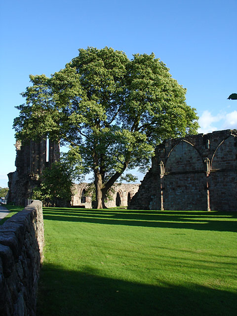
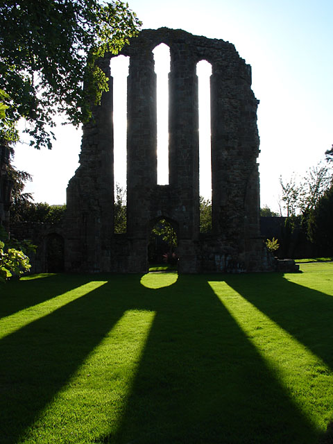
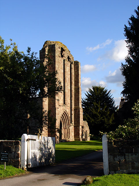
Croxden Abbey

Croxden Abbey, also known as "Abbey of the Vale of St. Mary at Croxden", was a Cistercian abbey at Croxden, Staffordshire, United Kingdom. A daughter house...

Bradley in the Moors

Bradley in the Moors is a village and former civil parish, now in the parish of Alton, in the Staffordshire Moorlands district, in the county of Staffordshire...

Beamhurst

Beamhurst is a village in Staffordshire, England. For population details taken at the 2011 census see Croxden. == References ==

Checkley

Checkley is a village and civil parish in the district of Staffordshire Moorlands in the English county of Staffordshire. == Location == The village is...

Beamhurst Lane

Beamhurst Lane is a hamlet in Uttoxeter Rural, Staffordshire, England.

St Mary's and All Saints' Church, Checkley

St Mary's and All Saints' Church is an Anglican church in the village of Checkley, Staffordshire, England. It is a Grade I listed building. The oldest...

Nearby Amenities

Located within 500m of 52.947884,-1.915135
Hollington
Place: village
Lat/Long: 52.947344/-1.9128199
Bus Stop
Village Hall
Naptan AtcoCode: 3800C836101
Naptan Bearing: NW
Naptan CommonName: Village Hall
Naptan Indicator: Adj
Naptan Landmark: Village Hall
Naptan Street: Main Rd
Naptan Verified: no
Source: naptan_import
Lat/Long: 52.9494588/-1.9194657
Bus Stop
Village Hall
Naptan AtcoCode: 3800C836102
Naptan Bearing: SE
Naptan CommonName: Village Hall
Naptan Indicator: Opp
Naptan Landmark: Village Hall
Naptan Street: Main Rd
Naptan Verified: no
Source: naptan_import
Lat/Long: 52.9496567/-1.9196737
Bus Stop
St John's Church
Naptan AtcoCode: 3800C893501
Naptan Bearing: N
Naptan CommonName: St John's Church
Naptan Indicator: Adj
Naptan Landmark: St John's Church
Naptan Street: Main Rd
Naptan Verified: no
Source: naptan_import
Lat/Long: 52.9467725/-1.9126614
Bus Stop
St John's Church
Naptan AtcoCode: 3800C893502
Naptan Bearing: SE
Naptan CommonName: St John's Church
Naptan Indicator: Opp
Naptan Landmark: St John's Church
Naptan Street: Main Rd
Naptan Verified: no
Source: naptan_import
Lat/Long: 52.946808/-1.9126951
Passing Place
Lat/Long: 52.944539/-1.9199898
Hall View
Addr Housename: Hall View
Addr Postcode: ST10 4HH
Addr Street: Rectory Road
Alt Name: Clearview Window Cleaners
Building: yes
Designation: 07803050079
Old Name: Long Close Bungalow
Lat/Long: 52.9448064/-1.9097949
Passing Place
Lat/Long: 52.9459408/-1.9155181
Barrier: stile
Steps: 1
Stile: stepover
Lat/Long: 52.9481469/-1.9089074
Barrier: stile
Steps: 1
Stile: stepover
Lat/Long: 52.9484538/-1.9120827
Barrier: stile
Steps: 1
Stile: stepover
Lat/Long: 52.9451177/-1.9103637
Barrier: stile
Steps: 1
Stile: stepover
Lat/Long: 52.948097/-1.9134248
Defibrillator
Access: yes
Booth: K6
Covered: booth
Defibrillator Location: inside old red phone box outside Hollington Village Hall
Disused Amenity: telephone
Emergency: defibrillator
Indoor: no
Man Made: telephone_box
Opening Hours: 24/7
Ref GB The Circuit: 4EFED3D1-2D1A-4879-B401-669B0B6DF975
Wheelchair: limited
Lat/Long: 52.9492072/-1.9183645
Post Box
Operator: Royal Mail
Post Box Type: lamp
Ref: ST10 289
Royal Cypher: EIIR
Royal Cypher Wikidata: Q33102113
Lat/Long: 52.9491623/-1.9182619
The data included in this document is from www.openstreetmap.org. The data is made available under ODbL.

Have you been to Hollington?

Leave your review of Hollington below (or comments, questions and feedback).