Bargatton Hill

Hill, Mountain in Kirkcudbrightshire

Scotland

Bargatton Hill

Game Park Plantation
Game Park Plantation Credit: Richard Webb

Bargatton Hill is a prominent hill located in the region of Kirkcudbrightshire, in the southwestern part of Scotland. It is situated approximately 4 miles northeast of the town of Gatehouse of Fleet and stands at an elevation of around 317 meters (1,040 feet).

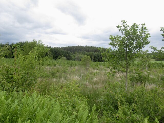
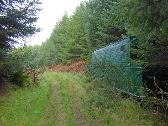
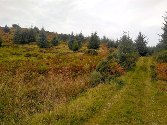
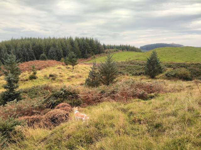
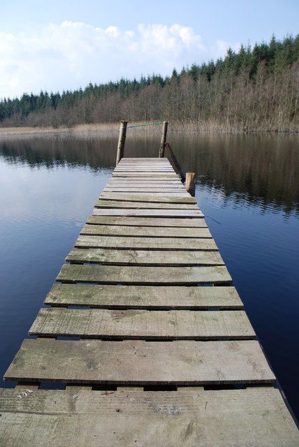
The hill is part of the larger Galloway Hills range, which is known for its stunning landscapes and natural beauty. Bargatton Hill offers breathtaking panoramic views of the surrounding countryside, with its rolling green hills, woodlands, and nearby lochs.

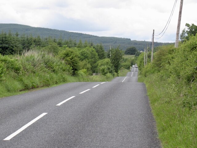
The hill is accessible via various walking routes and trails, making it a popular destination for hikers and nature enthusiasts. The ascent to the summit can be moderately challenging, but the effort is certainly rewarded by the picturesque vistas awaiting at the top. On clear days, it is possible to see as far as the Solway Firth and the Cumbrian Mountains in England.

Bargatton Hill is also home to a variety of wildlife, including red deer, buzzards, and other bird species. The area is known for its diverse flora, with heather, bracken, and wildflowers dotting the landscape.

Visitors to Bargatton Hill can enjoy a peaceful and serene environment, surrounded by the natural wonders of the Scottish countryside. Whether it is a leisurely stroll or a more adventurous hike, this hill offers an opportunity to connect with nature and soak in the beauty of Kirkcudbrightshire's landscape.

If you have any feedback on the listing, please let us know in the comments section below.

Bargatton Hill Images

Images are sourced within 2km of 54.941601/-4.0389736 or Grid Reference NX6962. Thanks to Geograph Open Source API. All images are credited.

Game Park Plantation
B795, Bellymack Moss The wooded hills above Laurieston are in the background after the road crosses farmland and small woods near the outflow of Loch Ken.
B795, Bellymack Moss
The wooded hills above Laurieston are in the background after the road crosses farmland and small woods near the outflow of Loch Ken.
A762 near Edgarton Loch
Cleared Woodland
Cleared Woodland
Woodland at Barstobrick
Abandoned Trailer in Bargatton Plantation This abandoned trailer was found at the side of a track deep in Bargatton Plantation, between Bargatton Loch and Glentoo Loch. The plantation was used for pheasant shooting, so perhaps the trailer was used for shelter or catering.
Abandoned Trailer in Bargatton Plantation
This abandoned trailer was found at the side of a track deep in Bargatton Plantation, between Bargatton Loch and Glentoo Loch. The plantation was used for pheasant shooting, so perhaps the trailer was used for shelter or catering.
Bargatton Plantation This hillside in Bargatton Plantation has been planted and felled at one time, and some new trees have popped up between the old stumps.
Bargatton Plantation
This hillside in Bargatton Plantation has been planted and felled at one time, and some new trees have popped up between the old stumps.
Edge of Bargatton Plantation Taken from the side of Bargatton Hill towards White Hill, the boundary between bargatton Plantation and a farmer's field is marked by a stone wall and fencing. Neilson's Monument can be seen on top of Barstobrick Hill in the distance.
Edge of Bargatton Plantation
Taken from the side of Bargatton Hill towards White Hill, the boundary between bargatton Plantation and a farmer's field is marked by a stone wall and fencing. Neilson's Monument can be seen on top of Barstobrick Hill in the distance.
At Camelon Bridge The A762 heading south at Camelon Bridge.
At Camelon Bridge
The A762 heading south at Camelon Bridge.
Near Edgarton Loch The A762 heading south towards Ringford seen near to Edgarton Loch.
Near Edgarton Loch
The A762 heading south towards Ringford seen near to Edgarton Loch.
The road to Bargatton The beginning of a long access road to Bargatton Farm.
The road to Bargatton
The beginning of a long access road to Bargatton Farm.
Ruined farm buildings at Lochgoy The stone building on the left was at one time a byre and the corrugated iron-clad building on the right was a cottage.
Ruined farm buildings at Lochgoy
The stone building on the left was at one time a byre and the corrugated iron-clad building on the right was a cottage.
Inside the ruined farm cottage at Lochgoy This was taken through a window opening as it would have been risky to enter the ruined building. For a view of the building, see <a href="https://www.geograph.org.uk/photo/6080666">NX6761 : Ruined farm buildings at Lochgoy</a>.
Inside the ruined farm cottage at Lochgoy
This was taken through a window opening as it would have been risky to enter the ruined building. For a view of the building, see NX6761 : Ruined farm buildings at Lochgoy.
A ruined farm cottage at Lochgoy This view of a kitchen was taken from outside as the building was in a bad state of decay. For a view of the building, see <a href="https://www.geograph.org.uk/photo/6080666">NX6761 : Ruined farm buildings at Lochgoy</a>.
A ruined farm cottage at Lochgoy
This view of a kitchen was taken from outside as the building was in a bad state of decay. For a view of the building, see NX6761 : Ruined farm buildings at Lochgoy.
An old byre at Lochgoy This farm building hasn’t been used for many years. For a wider view with an adjacent ruined cottage, see <a href="https://www.geograph.org.uk/photo/6080666">NX6761 : Ruined farm buildings at Lochgoy</a>.
An old byre at Lochgoy
This farm building hasn’t been used for many years. For a wider view with an adjacent ruined cottage, see NX6761 : Ruined farm buildings at Lochgoy.
An old access track to Lochgoy Cottage The ruined farm buildings at Lochgoy were accessed from the A762 by this track. For a view of the buildings, see <a href="https://www.geograph.org.uk/photo/6080666">NX6761 : Ruined farm buildings at Lochgoy</a>.
An old access track to Lochgoy Cottage
The ruined farm buildings at Lochgoy were accessed from the A762 by this track. For a view of the buildings, see NX6761 : Ruined farm buildings at Lochgoy.
A reed bed at Lochgoy This wetland area is on the west side of the ruined farm buildings at Lochgoy.
A reed bed at Lochgoy
This wetland area is on the west side of the ruined farm buildings at Lochgoy.
Glentoo Loch The Jetty at Glentoo Loch
Glentoo Loch
The Jetty at Glentoo Loch
Show me another place!

Bargatton Hill is located at Grid Ref: NX6962 (Lat: 54.941601, Lng: -4.0389736)

Unitary Authority: Dumfries and Galloway

Police Authority: Dumfries and Galloway

What 3 Words

///surnames.paradise.interlude. Near Castle Douglas, Dumfries & Galloway

Related Wikis

Glenlochar

Glenlochar (Gd: Gleann Lochair) is a hamlet on the western bank of the River Dee in the parish of Balmaghie in the historical county of Kirkcudbrightshire...

Bridge of Dee railway station

Bridge of Dee railway station served the settlement of Bridge of Dee, Dumfries and Galloway, Scotland from 1864 to 1949 on the Kirkcudbright Railway....

Threave Castle

Threave Castle is situated on an island in the River Dee, 2.5 kilometres (1.6 mi) west of Castle Douglas in the historical county of Kirkcudbrightshire...

Abbey Yard

Abbey Yard is a location in Dumfries and Galloway, Scotland. Abbey Yard is near Glenlochar in the historical county of Kirkcudbrightshire in the Dumfries...

Balmaghie

Balmaghie ( bal-mə-GEE), from the Scottish Gaelic Baile Mhic Aoidh, is an ecclesiastical and civil parish in the historical county of Kirkcudbrightshire...

Bridge of Dee, Galloway

Bridge of Dee, Galloway is a settlement on the River Dee, Galloway. It lies on the A75 just west of Castle Douglas, and north-east of Kirkcudbright. The...

Ringford

Ringford is a village in the historical county of Kirkcudbrightshire in Dumfries and Galloway located at grid reference NX689578 beside the Tarff Water...

Crossmichael railway station

Crossmichael railway station served the village of Crossmichael, Kirkcudbrightshire, Scotland, from 1861 to 1965 on the Portpatrick and Wigtownshire Joint...

Have you been to Bargatton Hill?

Leave your review of Bargatton Hill below (or comments, questions and feedback).