Lan Fawr

Hill, Mountain in Cardiganshire

Wales

Lan Fawr

Bryn Brawd Piler triongli ar gopa Bryn Brawd.  Mae'n  debyg y codwyd y piler ar garn o'r Oes Efydd.

A trig point on the summit of Bryn Brawd (trans. hill of the brother). Apparently, the pillar stands  on a Bronze Age cairn.
Bryn Brawd Credit: Alan Richards

Lan Fawr is a prominent hill/mountain located in the county of Cardiganshire, Wales. It is part of the Cambrian Mountains range and is situated approximately 10 miles southeast of Aberystwyth, the largest town in the area. With an elevation of 1,548 feet (472 meters), Lan Fawr offers breathtaking panoramic views of the surrounding countryside.

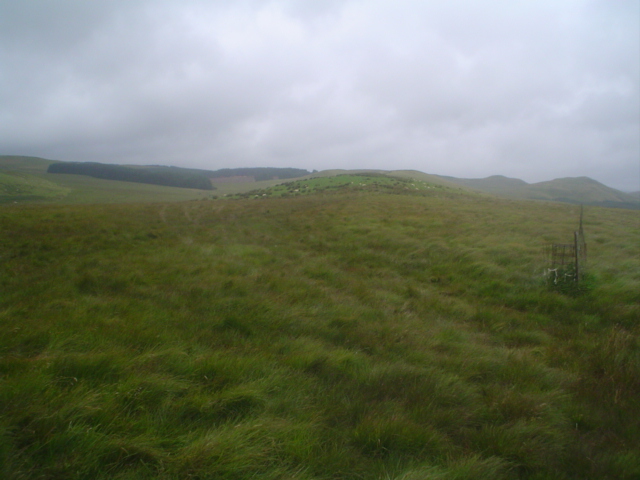
The hill/mountain is characterized by its distinct shape, resembling a whale's back, which is a common feature of the Cambrian Mountains. It is covered in heather, grasses, and scattered rocky outcrops, giving it a rugged and wild appearance. The landscape is dotted with sheep farms, adding to the rural charm of the area.

Lan Fawr is a popular destination for outdoor enthusiasts and nature lovers who enjoy hiking and hill walking. There are several well-defined trails that lead to the summit, providing visitors with varying levels of difficulty to suit their preferences and abilities. The ascent offers stunning vistas of the Cardiganshire coastline, rolling hills, and neighboring mountains.

The hill/mountain is also known for its rich biodiversity. It is home to a variety of flora and fauna, including heather, bilberry, and mosses, as well as bird species such as red grouse and curlews. Lan Fawr is part of a designated Site of Special Scientific Interest (SSSI), recognizing its ecological significance and protecting its unique ecosystems.

Overall, Lan Fawr in Cardiganshire is a picturesque hill/mountain that offers visitors a chance to immerse themselves in the natural beauty of the Cambrian Mountains and experience the tranquility of the Welsh countryside.

If you have any feedback on the listing, please let us know in the comments section below.
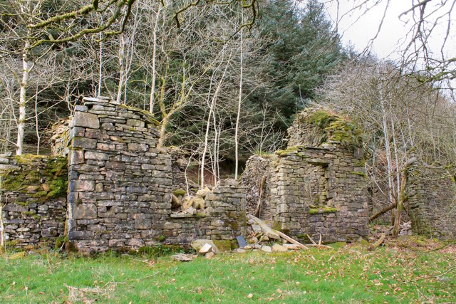
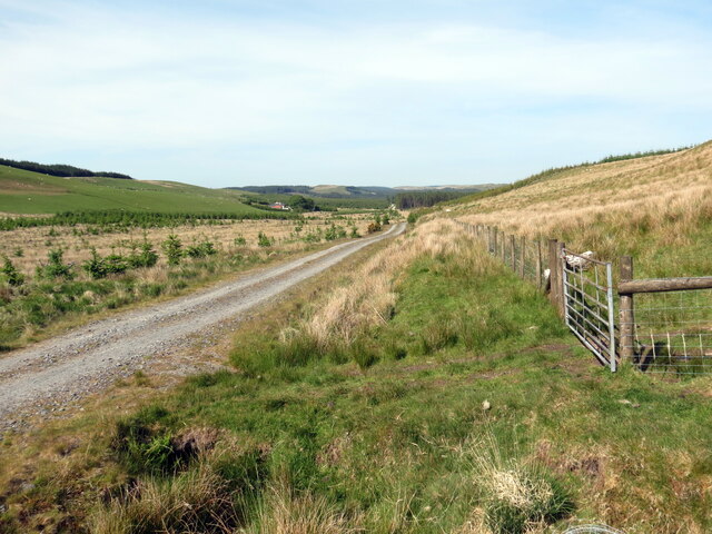
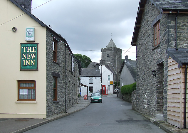
Lan Fawr Images

Images are sourced within 2km of 52.134198/-3.9116935 or Grid Reference SN6950. Thanks to Geograph Open Source API. All images are credited.

Bryn Brawd Piler triongli ar gopa Bryn Brawd.  Mae'n  debyg y codwyd y piler ar garn o'r Oes Efydd.

A trig point on the summit of Bryn Brawd (trans. hill of the brother). Apparently, the pillar stands  on a Bronze Age cairn.
Bryn Brawd
Piler triongli ar gopa Bryn Brawd. Mae'n debyg y codwyd y piler ar garn o'r Oes Efydd. A trig point on the summit of Bryn Brawd (trans. hill of the brother). Apparently, the pillar stands on a Bronze Age cairn.
Craig Curyll Brigiad o greigiau ar rostir a elwir Craig Curyll.

Outcrop of rocks on moorland known as Craig Curyll (trans. hawk rock).
Craig Curyll
Brigiad o greigiau ar rostir a elwir Craig Curyll. Outcrop of rocks on moorland known as Craig Curyll (trans. hawk rock).
Hen adfail / Old ruin Hen adfail ar ochr heol.

An old ruin at the side of a road
Hen adfail / Old ruin
Hen adfail ar ochr heol. An old ruin at the side of a road
Heol fach i Ffarmers / Minor road to Ffarmers Heol fach wledig yn mynd i gyfeiriad Ffarmers.

A minor rural road heading in the direction of Ffarmers.
Heol fach i Ffarmers / Minor road to Ffarmers
Heol fach wledig yn mynd i gyfeiriad Ffarmers. A minor rural road heading in the direction of Ffarmers.
Heol fach wledig / Minor rural road Hewl fach wledig yn mynd i gyfeiriad Ffarmers.

A minor road heading in the direction of Ffarmers.
Heol fach wledig / Minor rural road
Hewl fach wledig yn mynd i gyfeiriad Ffarmers. A minor road heading in the direction of Ffarmers.
Llechau Uchaf Anhedd-dy o'r enw Llechau Uchaf.

A property known as Llechau Uchaf (trans. stones / slabs).
Llechau Uchaf
Anhedd-dy o'r enw Llechau Uchaf. A property known as Llechau Uchaf (trans. stones / slabs).
Lluest-bryn-serth Abandoned farmhouse on the edge of the forest near Blaen-Cothi.
Lluest-bryn-serth
Abandoned farmhouse on the edge of the forest near Blaen-Cothi.
View down the Twrch Valley From above Wernfeudwy
View down the Twrch Valley
From above Wernfeudwy
Ffens derfyn ucheldir / Upland boundary fence Gât yn rhoi mynediad i'r rhostir o blanhigfa gonifferaidd.

A gate gives access to the moorland from the conifer plantation.
Ffens derfyn ucheldir / Upland boundary fence
Gât yn rhoi mynediad i'r rhostir o blanhigfa gonifferaidd. A gate gives access to the moorland from the conifer plantation.
Trac coedwigaeth  / Forestry track Trac coedwigaeth ar odre Bryn Mwysau.

A forestry track below Bryn Mwysau (?pleasant hill).
Trac coedwigaeth / Forestry track
Trac coedwigaeth ar odre Bryn Mwysau. A forestry track below Bryn Mwysau (?pleasant hill).
Trac coedwigaeth / Forestry track Trac coedwigaeth ger Drainllwyn-du.

A forestry track near Drainllwyn-du (trans.  black grove of hawthorn trees).
Trac coedwigaeth / Forestry track
Trac coedwigaeth ger Drainllwyn-du. A forestry track near Drainllwyn-du (trans. black grove of hawthorn trees).
Carreg Curyll Safle posibl Carreg Curyll. Carreg naturiol ydyw ond oherwydd ei thebygrwydd trawiadol i faenhir mae'n bosibl y'i defnyddiwyd at ddibenion defodol yn ystod yr Oes Neolithig hwyr / Oes Efydd cynnar.   

The possible site of Carreg Curyll (trans. stone of the hawk). A natural rock but because of its striking similarity to a standing stone it may have been used for ritual purposes during the late Neolithic / early Bronze Age.
Carreg Curyll
Safle posibl Carreg Curyll. Carreg naturiol ydyw ond oherwydd ei thebygrwydd trawiadol i faenhir mae'n bosibl y'i defnyddiwyd at ddibenion defodol yn ystod yr Oes Neolithig hwyr / Oes Efydd cynnar. The possible site of Carreg Curyll (trans. stone of the hawk). A natural rock but because of its striking similarity to a standing stone it may have been used for ritual purposes during the late Neolithic / early Bronze Age.
Across the Valley to Esgair Hendre, Carmarthenshire The view across the glacial valley shows clearly the narrow cruciform "footprint" of the forestry plantation on Esgair Hendre.
Across the Valley to Esgair Hendre, Carmarthenshire
The view across the glacial valley shows clearly the narrow cruciform "footprint" of the forestry plantation on Esgair Hendre.
Nant Fawr, Ceredigion and Carmarthenshire The brook is used to define the county border here.
Nant Fawr, Ceredigion and Carmarthenshire
The brook is used to define the county border here.
Farmland, Ceredigion and Carmarthenshire The county border wiggles around in this image so I've added both!
Farmland, Ceredigion and Carmarthenshire
The county border wiggles around in this image so I've added both!
Rough Grazing Land on the Floodplain, near nant-y-Llyn, Carmarthenshire
Nant yr Adar This tributary of the upper Afon Cothi runs from right to left across the photo, which also shows the afforestation on the valley's north-western side with the summit of Bryn Mwysau above it.
Nant yr Adar
This tributary of the upper Afon Cothi runs from right to left across the photo, which also shows the afforestation on the valley's north-western side with the summit of Bryn Mwysau above it.
View Northeast along ridge of Bryn Ceiliogau The ridge rises ahead and curves right towards Bryn Mwysau and Llethr Erwast. The sharp wedge-shape of the plantation (top left of photo) also stands out on the O.S. map in the next grid square to the north.
View Northeast along ridge of Bryn Ceiliogau
The ridge rises ahead and curves right towards Bryn Mwysau and Llethr Erwast. The sharp wedge-shape of the plantation (top left of photo) also stands out on the O.S. map in the next grid square to the north.
Show me another place!

Lan Fawr is located at Grid Ref: SN6950 (Lat: 52.134198, Lng: -3.9116935)

Unitary Authority: Ceredigion

Police Authority: Dyfed Powys

What 3 Words

///expensive.vent.toothpick. Near Tregaron, Ceredigion

Nearby Locations

Lan Fawr Cwm Twrch

Related Wikis

Pentre-rhew

Pentre-rhew is a hamlet in the community of Llanddewibrefi, Ceredigion, Wales, which is 58.3 miles (93.9 km) from Cardiff and 169.6 miles (272.9 km) from...

St David's Church, Llanddewi Brefi

St David's Church is a Grade II* listed medieval church in the Welsh village of Llanddewi Brefi, 3 miles south of Tregaron in the county of Ceredigion...

Llanddewi Brefi

Llanddewi Brefi (Welsh pronunciation: [ɬanˈðɛwi ˈbrɛvi]) is a village, parish and community of approximately 500 people in Ceredigion, Wales. The village...

Gogoyan

Gogoyan is a hamlet in the community of Llanddewibrefi, Ceredigion, Wales, which is 58.9 miles (94.8 km) from Cardiff and 171.1 miles (275.3 km) from...

Ffarmers

Ffarmers is a village near Lampeter, in the north of Carmarthenshire, Wales. It was named after the old "Farmers' Arms" public house, which is now closed...

Llanfair Clydogau

Llanfair Clydogau is a small village and community encompassing 3,232 hectares (7,990 acres), located about 4 miles (6.4 km) north-east of Lampeter on...

Llanycrwys

Llanycrwys is a hamlet and community located in Carmarthenshire, Wales. Situated in the historical Cayo Hundred in the Union of Lampeter, it is situated...

Mynydd Mallaen

Mynydd Mallaen (Welsh: [ˈmənɨð ˈmaɬain]) is an expansive plateau to the northwest of Cilycwm in northeast Carmarthenshire, Wales. It forms part of the...

Nearby Amenities

Located within 500m of 52.134198,-3.9116935
Lan Fawr
Ele: 429
Natural: peak
Lat/Long: 52.1336303/-3.912833
The data included in this document is from www.openstreetmap.org. The data is made available under ODbL.

Have you been to Lan Fawr?

Leave your review of Lan Fawr below (or comments, questions and feedback).