Creag Dail nan Gillean

Hill, Mountain in Sutherland

Scotland

Creag Dail nan Gillean

Damaged Bridge over the River Blackwater, near Ben Armine Lodge, Sutherland The abutments have been washed out and the deck is twisted and unstable.  A private estate bridge in a very remote part of the country, it is unlikely to see much use.
Damaged Bridge over the River Blackwater, near Ben Armine Lodge, Sutherland Credit: Andrew Tryon

Creag Dail nan Gillean is a prominent hill located in the county of Sutherland, Scotland. It is situated in the far northwestern part of the country, near the village of Tongue. The hill is part of the larger Ben Hope and Ben Loyal range, which are known for their picturesque landscapes and challenging hiking trails.

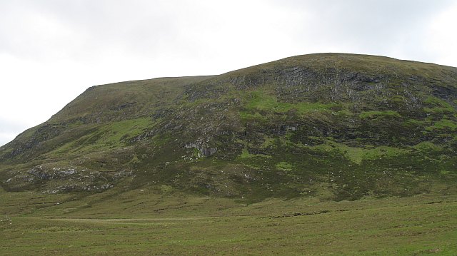
Standing at an elevation of 766 meters (2,513 feet), Creag Dail nan Gillean offers breathtaking views of the surrounding countryside. Its distinctive shape, with steep slopes and a rocky summit, makes it a popular destination for outdoor enthusiasts and climbers. The hill is composed mainly of quartzite and schist, creating a rugged and dramatic terrain.

Reaching the summit of Creag Dail nan Gillean requires a moderate level of fitness and navigation skills. There are multiple routes available to hikers, varying in difficulty and length. The most popular ascent starts from the small car park located at the base of the hill, following a well-marked path that gradually gains elevation.

Once at the top, visitors are rewarded with stunning vistas of the surrounding mountains and lochs. On clear days, it is possible to see as far as the Isle of Skye and the Outer Hebrides. The hill is also home to a variety of wildlife, including red deer and golden eagles, adding to the natural beauty of the area.

Overall, Creag Dail nan Gillean offers a challenging yet rewarding outdoor experience, attracting both experienced climbers and nature lovers alike. Its breathtaking views and unique geological features make it a must-visit destination for those exploring the Scottish Highlands.

If you have any feedback on the listing, please let us know in the comments section below.

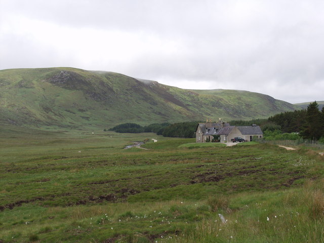
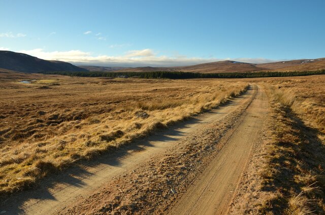
Creag Dail nan Gillean Images

Images are sourced within 2km of 58.139396/-4.2226822 or Grid Reference NC6918. Thanks to Geograph Open Source API. All images are credited.

Damaged Bridge over the River Blackwater, near Ben Armine Lodge, Sutherland The abutments have been washed out and the deck is twisted and unstable.  A private estate bridge in a very remote part of the country, it is unlikely to see much use.
Damaged Bridge over the River Blackwater, near Ben Armine Lodge, Sutherland
The abutments have been washed out and the deck is twisted and unstable. A private estate bridge in a very remote part of the country, it is unlikely to see much use.
Track by the River Blackwater, above Ben Armine Lodge, Sutherland Looking downstream towards Ben Armine Lodge.
Track by the River Blackwater, above Ben Armine Lodge, Sutherland
Looking downstream towards Ben Armine Lodge.
Path in Ben Armine Forest, Sutherland One of the paths within the area of Sutherland known as Ben Armine Forest.  The path is seldom used and not very worn.  The remote Ben Armine Lodge lies behind the plantation ahead.
Path in Ben Armine Forest, Sutherland
One of the paths within the area of Sutherland known as Ben Armine Forest. The path is seldom used and not very worn. The remote Ben Armine Lodge lies behind the plantation ahead.
Timber Bridge over Allt Coire a' Mhile Near to Ben Armine Lodge in Sutherland, Scotland
Timber Bridge over Allt Coire a' Mhile
Near to Ben Armine Lodge in Sutherland, Scotland
Ben Armine Lodge The lodge is sheltered by a plantation of Pinus contorta
Ben Armine Lodge
The lodge is sheltered by a plantation of Pinus contorta
Step in the floor of Strath na Seilge A rocky steep part of the course of the Abhainn Strath na Seilge. Whins make their first appearance travelling downstream.
Step in the floor of Strath na Seilge
A rocky steep part of the course of the Abhainn Strath na Seilge. Whins make their first appearance travelling downstream.
Forestry block near Ben Armine Lodge A block of woodland beneath Ben Armine.  The trees near the edge have suffered years of deer abuse, and are stunted or dead.
Forestry block near Ben Armine Lodge
A block of woodland beneath Ben Armine. The trees near the edge have suffered years of deer abuse, and are stunted or dead.
Glas-loch Mòr A large moorland loch perched above Strath na Seilge. View from Creag Mhòr on Ben Armine.
Glas-loch Mòr
A large moorland loch perched above Strath na Seilge. View from Creag Mhòr on Ben Armine.
Bridge, Strath na Seilge A new bridge across the Abhainn Strath na Seilge or Black Water. The river changes its name on the maps around here.
Bridge, Strath na Seilge
A new bridge across the Abhainn Strath na Seilge or Black Water. The river changes its name on the maps around here.
Track Strath na Seilge Estate track leading from Ben Armine Lodge up  Strath na Seilge. The fences around the plantation have recently been removed.
Track Strath na Seilge
Estate track leading from Ben Armine Lodge up Strath na Seilge. The fences around the plantation have recently been removed.
Abhainn Srath na Seilge or Black Water The river has now changed its name on the 1:25,000 map to Black Water. The river drains a large area of Ben Armine Forest and there is only one bridge upstream of here.
Abhainn Srath na Seilge or Black Water
The river has now changed its name on the 1:25,000 map to Black Water. The river drains a large area of Ben Armine Forest and there is only one bridge upstream of here.
Ben Armine Lodge, Scotland The remote Ben Armine Lodge on the Sutherland Estate in the northern Scottish Highlands. The lodge was once visited by Sir Winston Churchill.
Ben Armine Lodge, Scotland
The remote Ben Armine Lodge on the Sutherland Estate in the northern Scottish Highlands. The lodge was once visited by Sir Winston Churchill.
Ben Armine Lodge, viewed from Ben Horn, Sutherland The small and very remote lodge at Ben Armine, the loneliness of which is shown to good effect by this telephoto view from Ben Horn, some 16km (10 miles) away to the southeast.  The lodge is probably one of the remotest buildings in mainland Britain, being around 7 miles from the nearest public road or inhabited building.  It sits in a landscape with not other buildings.
Ben Armine Lodge, viewed from Ben Horn, Sutherland
The small and very remote lodge at Ben Armine, the loneliness of which is shown to good effect by this telephoto view from Ben Horn, some 16km (10 miles) away to the southeast. The lodge is probably one of the remotest buildings in mainland Britain, being around 7 miles from the nearest public road or inhabited building. It sits in a landscape with not other buildings.
Approaching Ben Armine Lodge, Sutherland Approaching the remote lodge at the end of the 7 mile long private driveway.  The lodge sits in an empty landscape with no other habitation for many miles in any direction.  It is used part time as a holiday let.
Approaching Ben Armine Lodge, Sutherland
Approaching the remote lodge at the end of the 7 mile long private driveway. The lodge sits in an empty landscape with no other habitation for many miles in any direction. It is used part time as a holiday let.
Creag Dhubh View North West across NC7017.

The hill Creag Dhubh can be seen in the distance.
Creag Dhubh
View North West across NC7017. The hill Creag Dhubh can be seen in the distance.
Ben Armine Lodge
Ben Armine Lodge
Leathad an Eich Ghlais Peaty ridge running down from Ben Armine to Srath na Seilge. Tussocky grass on the flat floor of the strath, I was glad of the path.
Leathad an Eich Ghlais
Peaty ridge running down from Ben Armine to Srath na Seilge. Tussocky grass on the flat floor of the strath, I was glad of the path.
Forestry block, Srath na Seilge Block of pinewoods near Ben Armine Lodge, with the back of Creag Mhòr visible through the trees. The woodland has an almost natural appearance because it is probable that it was not fenced for some time and deer have picked off the trees at the boundary.
Forestry block, Srath na Seilge
Block of pinewoods near Ben Armine Lodge, with the back of Creag Mhòr visible through the trees. The woodland has an almost natural appearance because it is probable that it was not fenced for some time and deer have picked off the trees at the boundary.
Show me another place!

Creag Dail nan Gillean is located at Grid Ref: NC6918 (Lat: 58.139396, Lng: -4.2226822)

Unitary Authority: Highland

Police Authority: Highlands and Islands

What 3 Words

///polishing.incomes.beep. Near Lairg, Highland

Related Wikis

Ben Armine

Ben Armine (705 m) is a remote hill in Sutherland in the far north of Scotland. It lies in inland, north of the village of Lairg. The best known summit...

West Langwell

West Langwell is a small crofting settlement in Rogart, Sutherland is in the Scottish council area of Highland within the Scottish Highlands. The village...

Have you been to Creag Dail nan Gillean?

Leave your review of Creag Dail nan Gillean below (or comments, questions and feedback).