Sròn nam Broighleag

Hill, Mountain in Perthshire

Scotland

Sròn nam Broighleag

Ridge over Stuc Gharbh with Srath a' Ghlinne below
Ridge over Stuc Gharbh with Srath a' Ghlinne below Credit: Colin Park

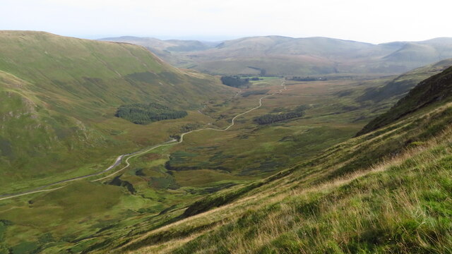
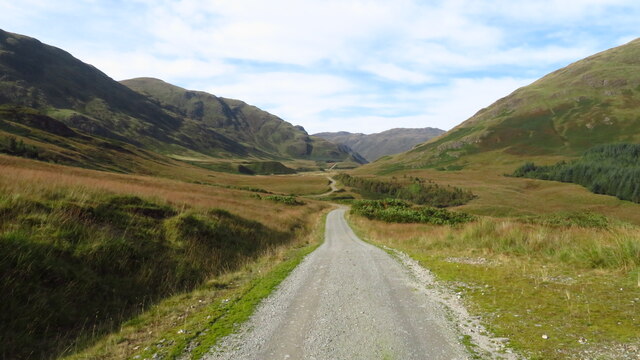
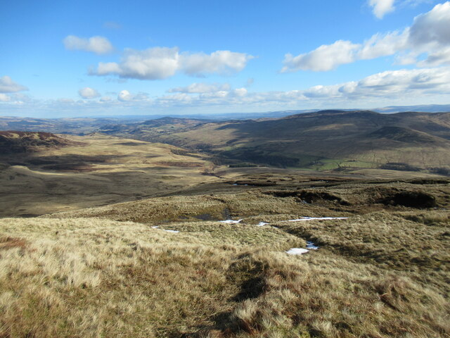
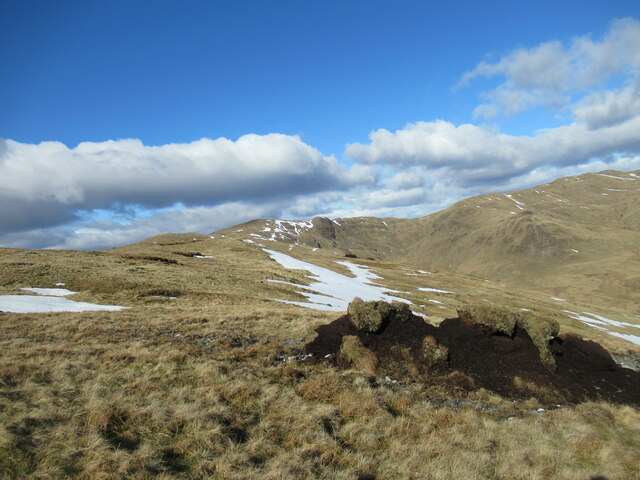
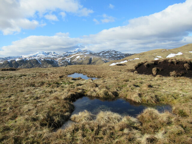
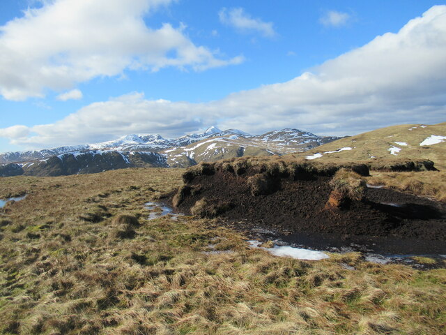
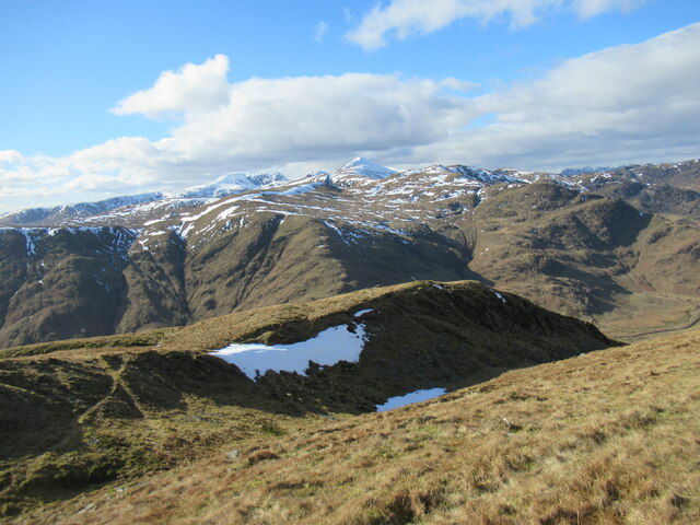
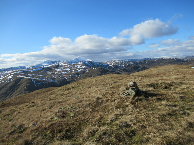
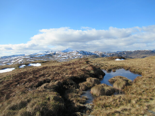
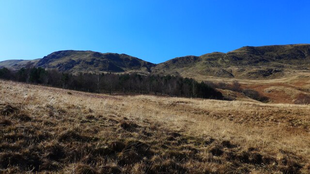
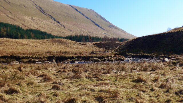
Sròn nam Broighleag is a prominent hill located in Perthshire, Scotland. It is part of the Grampian Mountains, which extend across the central and northeastern regions of the country. Standing at an elevation of approximately 815 meters (2,674 feet), Sròn nam Broighleag offers breathtaking panoramic views of the surrounding landscape.

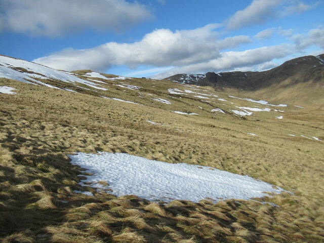
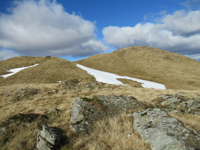
The hill is characterized by its rugged and rocky terrain, with steep slopes and craggy outcrops. Its summit is marked by a cairn, providing a great spot for hikers and nature enthusiasts to rest and admire the scenic vistas. The ascent to the top can be challenging but is rewarding, as on clear days, one can see the stunning Loch Rannoch and Loch Tummel to the west, as well as the peaks of Schiehallion and Ben Lawers in the distance.

The area around Sròn nam Broighleag is rich in biodiversity, with a variety of flora and fauna. Heather and bracken dominate the hillside, creating a colorful landscape during the summer months. The hill is also home to several bird species, including golden eagles, peregrine falcons, and red grouse.

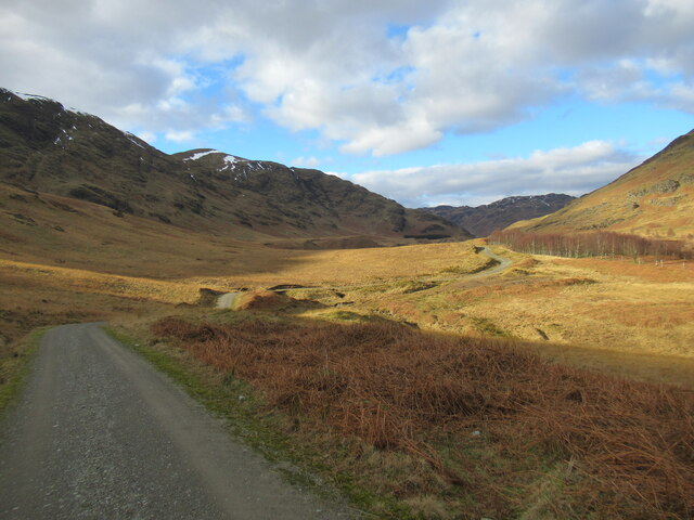
Outdoor activities such as hillwalking, hiking, and birdwatching are popular among visitors to Sròn nam Broighleag. The hill provides a tranquil and serene environment, offering an escape from the hustle and bustle of everyday life. Its natural beauty and stunning views make it a must-visit destination for nature lovers and outdoor enthusiasts alike.

If you have any feedback on the listing, please let us know in the comments section below.

Sròn nam Broighleag Images

Images are sourced within 2km of 56.340817/-4.1288735 or Grid Reference NN6818. Thanks to Geograph Open Source API. All images are credited.

Ridge over Stuc Gharbh with Srath a' Ghlinne below
Srath a' Ghlinne leading down to Glen Artney
View north along track through Srath a' Ghlinne
Slopes of Sròn na Maoile Looking towards Coire a' Choire, on Beinn Dearg, in Glen Artney.
Slopes of Sròn na Maoile
Looking towards Coire a' Choire, on Beinn Dearg, in Glen Artney.
Looking down Sròn nan Cabar into Glen Artney Sròn nan Cabar means 'nose (or promontory) of the logs'. The word 'caber', better known from being tossed at Highland Games events, derives from this Gaelic word, 'cabar'.
Looking down Sròn nan Cabar into Glen Artney
Sròn nan Cabar means 'nose (or promontory) of the logs'. The word 'caber', better known from being tossed at Highland Games events, derives from this Gaelic word, 'cabar'.
Peat hag and snow patches on Sròn na Maoile Remnants of eroded peat on Beinn Dearg, above Glen Artney.
Peat hag and snow patches on Sròn na Maoile
Remnants of eroded peat on Beinn Dearg, above Glen Artney.
Half-frozen bog pools north-west of Sròn na Maoile Some eroded peat hags are visible on the right, and in the distance, with the pointed snow-covered peak of Ben Vorlich prominent in the distance.
Half-frozen bog pools north-west of Sròn na Maoile
Some eroded peat hags are visible on the right, and in the distance, with the pointed snow-covered peak of Ben Vorlich prominent in the distance.
Peat hags north-west of Sròn na Maoile Eroded remnants of peat cover on the hillside, with the snowy peak of Ben Vorlich prominent in the distance.
Peat hags north-west of Sròn na Maoile
Eroded remnants of peat cover on the hillside, with the snowy peak of Ben Vorlich prominent in the distance.
Sròn nam Broighleag One of a succession of lumps and bumps at the western end of the Beinn Dearg in Glen Artney, Sròn nam Broighleag translates from Gaelic as 'nose (or promontory) of the blaeberries'.
Sròn nam Broighleag
One of a succession of lumps and bumps at the western end of the Beinn Dearg in Glen Artney, Sròn nam Broighleag translates from Gaelic as 'nose (or promontory) of the blaeberries'.
Spur leading off Sròn na Broighleag Sròn na Broighleag translates from Gaelic as 'nose (or promontory) of the blaeberries.

The snowy peak of Ben Vorlich is prominent in the distance.
Spur leading off Sròn na Broighleag
Sròn na Broighleag translates from Gaelic as 'nose (or promontory) of the blaeberries. The snowy peak of Ben Vorlich is prominent in the distance.
Western top of Beinn Dearg A resurvey carried out in the last few years has concluded that this is actually the highest point on Beinn Dearg, rather than the top to the north-east as previously thought. This is, therefore, the Graham summit.
Western top of Beinn Dearg
A resurvey carried out in the last few years has concluded that this is actually the highest point on Beinn Dearg, rather than the top to the north-east as previously thought. This is, therefore, the Graham summit.
Part-frozen bog pool near the summit of Beinn Dearg The snowy peak of Ben Vorlich is prominent in the distance.
Part-frozen bog pool near the summit of Beinn Dearg
The snowy peak of Ben Vorlich is prominent in the distance.
Hillsides above the head of Srath a' Ghlinne The hillside of Meall Reamhar rises on the other side of the forestry plantation.
Hillsides above the head of Srath a' Ghlinne
The hillside of Meall Reamhar rises on the other side of the forestry plantation.
View up Srath a' Ghlinne A wide hill-flanked valley running roughly north-west to south-east from upper Glen Artney.
View up Srath a' Ghlinne
A wide hill-flanked valley running roughly north-west to south-east from upper Glen Artney.
Looking up to Carn Labhruinn from the Strath a' Ghlinne
Footbridge over the Allt Strath a' Ghlinne
New bridge on the track up Strath a' Ghlinne The OS still mark this as a 'ford'.
New bridge on the track up Strath a' Ghlinne
The OS still mark this as a 'ford'.
New bridge and ford at the head of Strath a' Ghlinne
Show me another place!

Sròn nam Broighleag is located at Grid Ref: NN6818 (Lat: 56.340817, Lng: -4.1288735)

Unitary Authority: Perth and Kinross

Police Authority: Tayside

What 3 Words

///distanced.exit.wealth. Near Comrie, Perth & Kinross

Related Wikis

Glen Artney

Glen Artney or Glenartney is a valley in Perthshire, Scotland.Several ships have been named Glenartney: SS Glenartney (1869), an iron-hulled steamship...

Dundurn, Scotland

Dundurn is the site of a Pictish hillfort in what is now Strathearn in Perth and Kinross, Scotland. The fort was situated on a hill with the River Earn...

Ben Vorlich, Loch Earn

Ben Vorlich (Scottish Gaelic: Beinn Mhùrlaig) is a mountain in the Southern Highlands of Scotland. It lies south of Loch Earn and Ardvorlich, and a short...

St Fillans

St Fillans is a village in Perthshire in the central highlands of Scotland, in the council area of Perth and Kinross. The village lies at the eastern end...

Neish Island

Neish Island is an island in Loch Earn, Scotland. == History == It is recorded that in 1490 James IV of Scotland ordered Lord Drummond to cast down the...

St Fillans railway station

St Fillans railway station served the village of St Fillans, in the historical county of Perthshire, Scotland, from 1901 to 1951 on the Lochearnhead, St...

Beinn nan Eun (Perth and Kinross)

Beinn nan Eun is a hill in the Glen Artney Hills range immediately south of the Highland Boundary Fault, part of the Central Lowlands of Scotland. The...

Aberuchill Castle

Aberuchill Castle is located 3 kilometres (1.9 mi) west of Comrie in Perthshire, Scotland. It comprises an early 17th-century tower house, which was extended...

Have you been to Sròn nam Broighleag?

Leave your review of Sròn nam Broighleag below (or comments, questions and feedback).