Creagan Reamhar
Hill, Mountain in Sutherland
Scotland
Creagan Reamhar

Creagan Reamhar, located in the county of Sutherland in the Scottish Highlands, is a prominent hill/mountain that stands tall at an elevation of approximately 769 meters (2,523 feet). It lies within the vast expanse of the Northwest Highlands, known for its rugged landscapes and breathtaking natural beauty.
Creagan Reamhar is characterized by its distinctive rocky terrain, featuring steep slopes and craggy outcrops that add to its allure. Its name, derived from Scottish Gaelic, translates to "thick crag" or "stout rock," which aptly describes its rugged appearance. The hill/mountain is predominantly composed of quartzite and schist, contributing to its impressive and imposing geological formations.
At the summit of Creagan Reamhar, one can enjoy stunning panoramic views of the surrounding area, including the vast moorlands and lochs that dot the landscape. On clear days, the vistas extend far into the distance, offering glimpses of nearby peaks and the vastness of the Scottish Highlands.
Creagan Reamhar attracts outdoor enthusiasts, hikers, and climbers seeking a challenging yet rewarding experience. Its steep slopes and rocky terrain provide an exhilarating ascent, ensuring an unforgettable adventure for those who dare to conquer its heights.
The hill/mountain also offers a habitat for various wildlife species, including deer, mountain hares, and numerous bird species. Its remote location contributes to the preservation of these natural ecosystems, making it an ideal destination for nature lovers and wildlife enthusiasts.
Overall, Creagan Reamhar stands as a testament to the majestic beauty of Scotland's highlands, offering visitors an opportunity to immerse themselves in its untamed grandeur and witness nature at its finest.
If you have any feedback on the listing, please let us know in the comments section below.
Creagan Reamhar Images
Images are sourced within 2km of 57.919844/-4.2258622 or Grid Reference NH6894. Thanks to Geograph Open Source API. All images are credited.


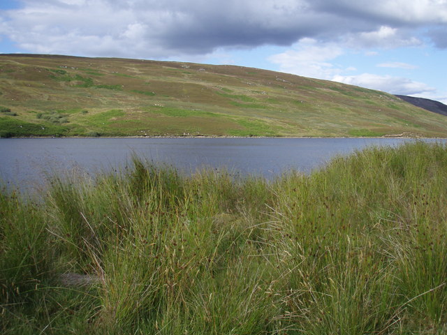
![Heading for the Evelix crossing Meall Moraig and Meall na Diolaid [hills] lie ahead.](https://s1.geograph.org.uk/geophotos/07/17/82/7178257_8c513319.jpg)


Creagan Reamhar is located at Grid Ref: NH6894 (Lat: 57.919844, Lng: -4.2258622)
Unitary Authority: Highland
Police Authority: Highlands and Islands
What 3 Words
///sticking.graver.withdraws. Near Dornoch, Highland
Nearby Locations
Related Wikis

Achvaich
Achvaich (Scottish Gaelic: Achadh a' Bhàthaich) is a remote crofting settlement in the Dornoch, Achvaich Sutherland area and is within the Scottish council...
Loch Buidhe (Bonar Bridge)
Loch Buidhe is a freshwater loch in Sutherland, Highland council area, Scotland. It is located about 8 km (5 mi) north-east of Bonar Bridge. The name is...

Spinningdale
Spinningdale (Scottish Gaelic: Spainnigeadal) is a hamlet, in the Parish of Creich, on the north shore of the Dornoch Firth in eastern Sutherland, in the...

A949 road
The A949 is a major road in Sutherland, in the Highland area of Scotland. It has staggered junctions with the A9. From the A949 the A9 runs (1) generally...

Loch Migdale
Loch Migdale is a freshwater loch (Lake) near Bonar Bridge, in Sutherland, Highland, Scotland. The loch contains a crannog (artificial-island home) dating...

Rearquhar
Rearquhar is a township, which lies in the valley of the River Evelix, 4 miles northwest from Dornoch, in Sutherland, Scottish Highlands and is in the...
Migdale Hoard
The Migdale Hoard is a group of early Bronze Age jewellery discovered by workmen blasting a granite knoll behind Bonar Bridge, Scotland, near what is known...

Creich
Creich (Scottish Gaelic: Craoich, pronounced [kʰɾɯːç]) is a substantial parish on the north side of the Dornoch Firth the largest settlement being Bonar...
Have you been to Creagan Reamhar?
Leave your review of Creagan Reamhar below (or comments, questions and feedback).