Black Hill

Hill, Mountain in Stirlingshire

Scotland

Black Hill

Forested slopes of Meike Bin
Forested slopes of Meike Bin Credit: Richard Webb

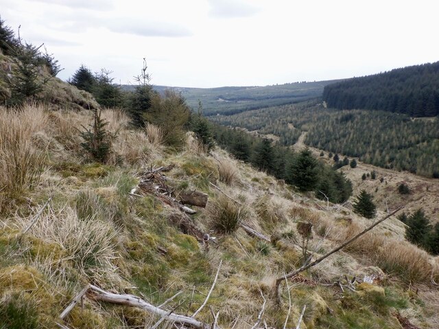
Black Hill is a prominent hill located in Stirlingshire, Scotland. It is part of the Southern Uplands range and stands at an elevation of 729 meters (2,391 feet). Situated near the village of Blackridge, the hill offers stunning panoramic views of the surrounding landscape.

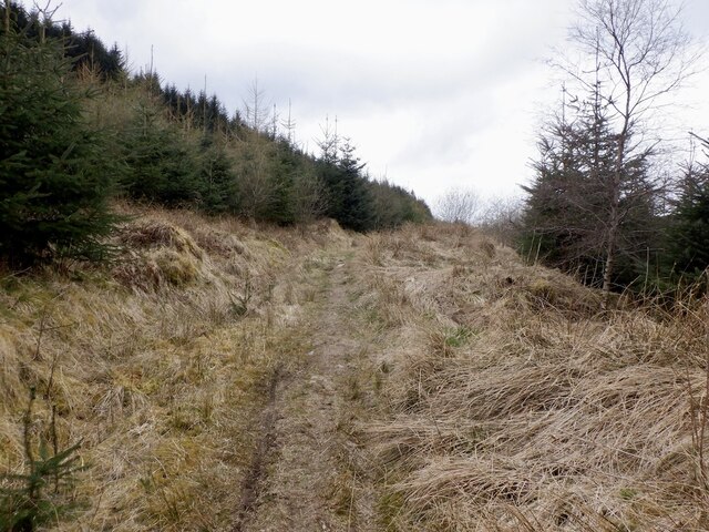
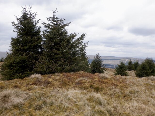
The terrain of Black Hill is characterized by a mixture of heather-covered moorland, rocky outcrops, and occasional patches of woodland. The hill is a popular destination for hikers and nature enthusiasts, offering a range of walking routes of varying difficulty. The most common starting point for these walks is the small car park near the village.

One of the most notable features of Black Hill is its trig point, which marks the highest point on the hill. This trig point, also known as a triangulation station, was used in the past to accurately map the surrounding area. Today, it serves as a popular landmark for visitors, providing an excellent spot for photographs and panoramic views.

The hill is home to a variety of flora and fauna, including heather, bilberry, and cotton grass. Birdwatchers may spot species such as grouse, buzzards, and kestrels, while the patient observer may even catch a glimpse of the elusive mountain hare.

Black Hill offers a sense of tranquility and escape from the hustle and bustle of everyday life. Its natural beauty and captivating vistas make it a must-visit destination for outdoor enthusiasts and anyone seeking a peaceful retreat in the heart of Stirlingshire.

If you have any feedback on the listing, please let us know in the comments section below.

Black Hill Images

Images are sourced within 2km of 56.004651/-4.1323498 or Grid Reference NS6781. Thanks to Geograph Open Source API. All images are credited.

Forested slopes of Meike Bin
Meikle Bin View from the north side of Lecket Hill.
Meikle Bin
View from the north side of Lecket Hill.
East side of Lecket Hill Rough grassland around Boyd's Burn.
East side of Lecket Hill
Rough grassland around Boyd's Burn.
Meikle Bin trig point
Carron Valley Forest Various stages in the forestry cycle here.  The road is now a through route with a connection to the lower road.
Carron Valley Forest
Various stages in the forestry cycle here. The road is now a through route with a connection to the lower road.
View towards Meikle Bin In Carron Valley Forest.
View towards Meikle Bin
In Carron Valley Forest.
Road, Carron Valley Forest Recently connected at the west end allowing a loop with the lower road or access to the Bins.
Road, Carron Valley Forest
Recently connected at the west end allowing a loop with the lower road or access to the Bins.
Carron Valley Forest Bit of a drop to a burn revealed by clearfell.
Carron Valley Forest
Bit of a drop to a burn revealed by clearfell.
Carron Valley Forest Young trees and a view of Little Bin - my objective for the day.
Carron Valley Forest
Young trees and a view of Little Bin - my objective for the day.
Newish road, Carron Valley Forest Continuing from a previous dead end and connecting up with roads by the Bin Burn. Meikle Bin in the background.
Newish road, Carron Valley Forest
Continuing from a previous dead end and connecting up with roads by the Bin Burn. Meikle Bin in the background.
Signpost, Carron Valley Forest A path from here goes between the Bins. It is rather attractive and in dry weather a good bit of singletrack cycling.
Signpost, Carron Valley Forest
A path from here goes between the Bins. It is rather attractive and in dry weather a good bit of singletrack cycling.
Path between the Bins A very attractive path between Meikle and Little Bins. Little Bin is now easily, but very steeply accessed from this path.
Path between the Bins
A very attractive path between Meikle and Little Bins. Little Bin is now easily, but very steeply accessed from this path.
Path between the Bins A very attractive path between Meikle and Little Bins. Little Bin is now easily, but very steeply accessed from this path.
Path between the Bins
A very attractive path between Meikle and Little Bins. Little Bin is now easily, but very steeply accessed from this path.
Bin Burn A steep defile between the Meikle and Little Bin hills.  Very steep sides but Little Bin can now be easily ascended from here without any tree related difficulties.
Bin Burn
A steep defile between the Meikle and Little Bin hills. Very steep sides but Little Bin can now be easily ascended from here without any tree related difficulties.
Northeast flank of Meikle Bin A steep slope, with sheep above a path following the Bin Burn.
Northeast flank of Meikle Bin
A steep slope, with sheep above a path following the Bin Burn.
Path between the Bins
Slopes of Little Bin Very steep ground, but the decaying remains of the conifer plantation that once stood here are no longer an obstacle, having rotted down.
Slopes of Little Bin
Very steep ground, but the decaying remains of the conifer plantation that once stood here are no longer an obstacle, having rotted down.
Summit of Little Bin A top I once feared due to arborial, Sitkaish horrors was still tough to visit, but only on account of the steep sides. The summit area is attractive with self seeded scattered trees.
Summit of Little Bin
A top I once feared due to arborial, Sitkaish horrors was still tough to visit, but only on account of the steep sides. The summit area is attractive with self seeded scattered trees.
Show me another place!

Black Hill is located at Grid Ref: NS6781 (Lat: 56.004651, Lng: -4.1323498)

Unitary Authority: North Lanarkshire

Police Authority: Lanarkshire

What 3 Words

///face.alas.gathering. Near Milton of Campsie, East Dunbartonshire

Nearby Locations

Black Hill

Related Wikis

Meikle Bin

Meikle Bin is a peak in the Campsie Fells in Central Scotland. It is the second-highest of the group at 570 metres (1,870 ft), and with its prominence...

Peggie's Spout

Peggie's Spout is a waterfall of Scotland. == See also == Waterfalls of Scotland == References ==

Queenzieburn

Queenzieburn (Scots: Queenieburn) is a small settlement in the historic county of Stirlingshire and the Council Area of North Lanarkshire, Scotland. Its...

Glorat

Glorat is a place and estate in the parish of Campsie in East Dunbartonshire, Scotland. == History == A towerhouse was built at Glorat in the 16th century...

Nearby Amenities

Located within 500m of 56.004651,-4.1323498
Black Hill
Corbett: no
Ele: 480
Graham: no
Munro: no
Natural: peak
Lat/Long: 56.0046459/-4.1310004
The data included in this document is from www.openstreetmap.org. The data is made available under ODbL.

Have you been to Black Hill?

Leave your review of Black Hill below (or comments, questions and feedback).