Belt Hill

Hill, Mountain in Kirkcudbrightshire

Scotland

Belt Hill

War memorial above Balmaclellan Balmaclellan's war memorial is on the north side of the A712 above the small settlement which is out of view.
War memorial above Balmaclellan Credit: Trevor Littlewood

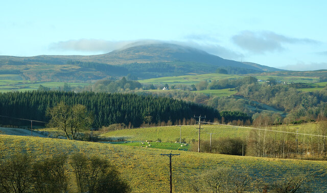
Belt Hill is a prominent hill located in the region of Kirkcudbrightshire, Scotland. Situated near the town of Gatehouse of Fleet, it is a notable natural feature in the area. With an elevation of approximately 292 meters (958 feet), Belt Hill offers stunning panoramic views of the surrounding landscape.

The hill is primarily composed of sedimentary rock formations, giving it a distinctive appearance. Its slopes are covered in heather and grasses, providing a natural habitat for a variety of plant and animal species. The hill is also home to a diverse range of birdlife, making it a popular spot for birdwatching enthusiasts.

Belt Hill is easily accessible to hikers and nature enthusiasts, with several well-marked trails leading to its summit. The ascent to the top is moderate, making it suitable for individuals of various fitness levels. Once at the summit, visitors are rewarded with breathtaking views of the Galloway Forest Park, the Solway Firth, and the distant hills of Dumfries and Galloway.

The hill is steeped in local folklore and history. It is said to have been an important landmark for ancient tribes and later served as a lookout point during conflicts in the region. Today, it continues to be a cherished natural landmark and a popular destination for outdoor activities such as hillwalking and photography.

In conclusion, Belt Hill in Kirkcudbrightshire is a picturesque and accessible hill that offers stunning views of the surrounding landscape. Its rich biodiversity, historical significance, and recreational opportunities make it a must-visit destination for nature enthusiasts and those seeking a taste of Scotland's natural beauty.

If you have any feedback on the listing, please let us know in the comments section below.
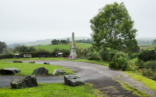
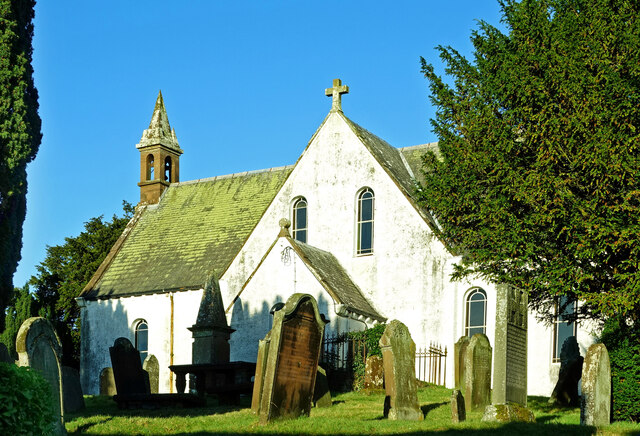
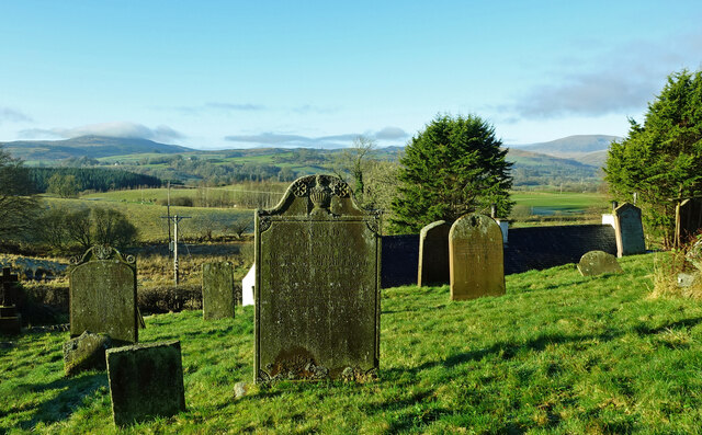
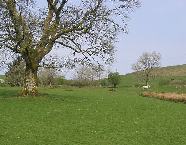
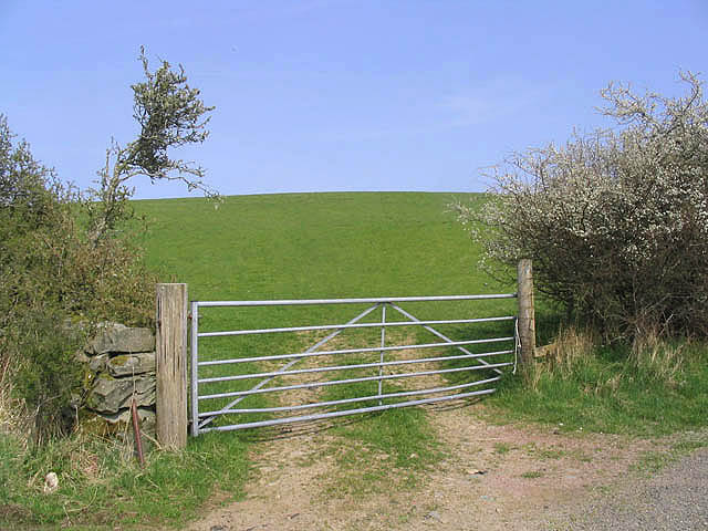
Belt Hill Images

Images are sourced within 2km of 55.088043/-4.0877593 or Grid Reference NX6679. Thanks to Geograph Open Source API. All images are credited.

War memorial above Balmaclellan Balmaclellan's war memorial is on the north side of the A712 above the small settlement which is out of view.
War memorial above Balmaclellan
Balmaclellan's war memorial is on the north side of the A712 above the small settlement which is out of view.
Balmaclellan Church Many of these churches in small rural communities have monthly Sunday services. Balmaclellan’s turn is the first Sunday of each month.
Balmaclellan Church
Many of these churches in small rural communities have monthly Sunday services. Balmaclellan’s turn is the first Sunday of each month.
Balmaclellan Graveyard The gravestones show that this is a very old religious site with burials recorded in the early 18th century.
Balmaclellan Graveyard
The gravestones show that this is a very old religious site with burials recorded in the early 18th century.
Balmaclellan Graveyard view There can’t be many churches that enjoy such a wonderful view of the local countryside. Mulloch Hill is shown on the skyline.
Balmaclellan Graveyard view
There can’t be many churches that enjoy such a wonderful view of the local countryside. Mulloch Hill is shown on the skyline.
Track leading towards Barscobe, Balmaclellan.
Barscobe Hill Looking down from an outcrop towards Troquhain Loch.
Barscobe Hill
Looking down from an outcrop towards Troquhain Loch.
A tree in Glen Knowe This old hawthorn tree stands in an area of rough and improved grazing for cattle and sheep.
A tree in Glen Knowe
This old hawthorn tree stands in an area of rough and improved grazing for cattle and sheep.
The summit cairn on Barscobe Hill The white marked stones on the top of the cairn indicates that this is a favourite perch for birds of prey.
The summit cairn on Barscobe Hill
The white marked stones on the top of the cairn indicates that this is a favourite perch for birds of prey.
Barscobe Castle Balmaclellan Kirkcudbrightshire Scotland Seventeenth Century tower house.
Barscobe Castle Balmaclellan Kirkcudbrightshire Scotland
Seventeenth Century tower house.
Barscobe Castle Balmaclellan Kirkcudbrightshire Scotland Seventeenth Century Tower House.
Barscobe Castle Balmaclellan Kirkcudbrightshire Scotland
Seventeenth Century Tower House.
Barscobe Castle Balmaclellan Kirkcudbrightshire Scotland Armorial panel bearing the arms of Maclellan and Gordon with the initials of the builder of the castle William Maclellan and his wife Mary Gordon. Situated above the main door.
Barscobe Castle Balmaclellan Kirkcudbrightshire Scotland
Armorial panel bearing the arms of Maclellan and Gordon with the initials of the builder of the castle William Maclellan and his wife Mary Gordon. Situated above the main door.
Barscobe Castle Balmaclellan Kirkcudbrightshire Scotland Detail of window from Barscobe castle showing date of construction (1648).
Barscobe Castle Balmaclellan Kirkcudbrightshire Scotland
Detail of window from Barscobe castle showing date of construction (1648).
Barscobe Castle Balmaclellan Kirkcudbrightshire Scotland Detail of bell Barscobe Castle.
Barscobe Castle Balmaclellan Kirkcudbrightshire Scotland
Detail of bell Barscobe Castle.
Balmaclellan Monument View of the monument and hills in distance
Balmaclellan Monument
View of the monument and hills in distance
Bogleknowe Bogleknowe Cottage on the A712 heading towards Balmaclellan
Bogleknowe
Bogleknowe Cottage on the A712 heading towards Balmaclellan
Troquhain Bridge
Troquhain Bridge
Horses in a field To the east of Ironlosh and viewed from the A712.
Horses in a field
To the east of Ironlosh and viewed from the A712.
Pasture field To the west of Galrinnies Farm.
Pasture field
To the west of Galrinnies Farm.
Show me another place!

Belt Hill is located at Grid Ref: NX6679 (Lat: 55.088043, Lng: -4.0877593)

Unitary Authority: Dumfries and Galloway

Police Authority: Dumfries and Galloway

What 3 Words

///protester.producers.lamps. Near Castle Douglas, Dumfries & Galloway

Related Wikis

Balmaclellan

Balmaclellan (Scottish Gaelic: Baile Mac-a-ghille-dhiolan, meaning town of the MacLellans) is a small hillside village of stone houses with slate roofs...
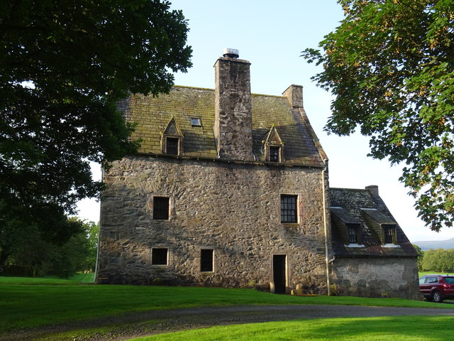
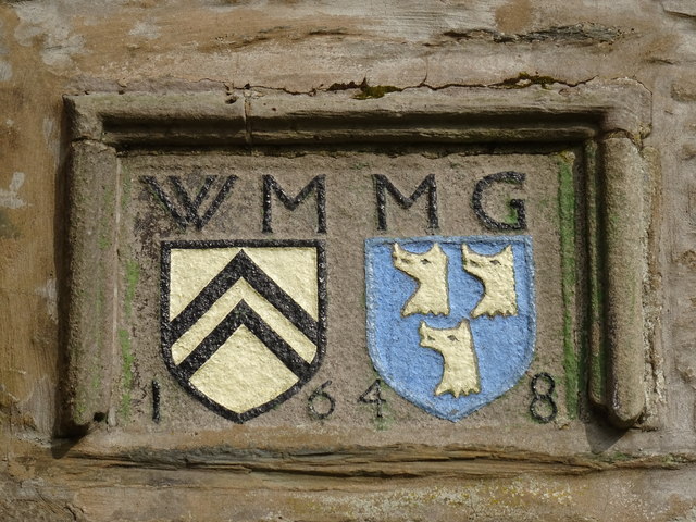
Barscobe Castle

Barscobe Castle is a 17th-century tower house in Balmaclellan, Kirkcudbrightshire, Scotland. It is a typical house of a country laird, and according to...
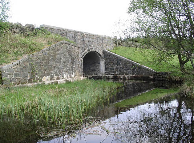
Ken Bridge

The Ken Bridge is a road bridge about 0.8 kilometres (0.5 mi) north east of New Galloway in Dumfries and Galloway, Scotland, which carries the A712 road...

New Galloway

New Galloway (Scottish Gaelic: Gall-Ghàidhealaibh Nuadh) is a town in the historical county of Kirkcudbrightshire in Dumfries and Galloway. It lies on...

Kells, Dumfries and Galloway

Kells parish, in the Stewartry of Kirkcudbright in Scotland, is located 14 miles (NWbN) from Castle-Douglas, and 19 miles (NbW) from Kirkcudbright. It...

Ironmacannie Mill

Ironmacannie Mill is a historic watermill near Balmaclellan in Dumfries and Galloway, Scotland. Built in the 18th and 19th centuries, on the site of an...

New Galloway Town Hall

The New Galloway Town Hall is a municipal building in Dumfries and Galloway, Scotland, situated on the town's high street. A tolbooth has existed on the...

Kenmure Castle

Kenmure Castle is a fortified house or castle in The Glenkens, 1 mile (1.6 km) south of the town of New Galloway in Kirkcudbrightshire, Galloway, south...

Nearby Amenities

Located within 500m of 55.088043,-4.0877593
Power: pole
Lat/Long: 55.0852517/-4.0925636
Power: pole
Lat/Long: 55.0857684/-4.0914482
Power: pole
Lat/Long: 55.0861928/-4.0905432
Power: pole
Lat/Long: 55.0866281/-4.0896212
Power: pole
Lat/Long: 55.0871254/-4.0885738
Power: pole
Lat/Long: 55.0875972/-4.0875668
Power: pole
Lat/Long: 55.0881273/-4.0864515
Power: pole
Lat/Long: 55.0886562/-4.0853107
Power: pole
Lat/Long: 55.0891231/-4.0843525
Power: pole
Lat/Long: 55.0895814/-4.0833753
Power: pole
Lat/Long: 55.0899231/-4.0826423
Power: pole
Lat/Long: 55.0895255/-4.0824596
Power: pole
Lat/Long: 55.0913577/-4.0833434
Power: pole
Lat/Long: 55.091213/-4.0828569
Power: pole
Lat/Long: 55.0857922/-4.0930819
Power: pole
Lat/Long: 55.0863636/-4.0936173
Power: pole
Lat/Long: 55.0870008/-4.0942206
Power: pole
Lat/Long: 55.0876428/-4.0948367
Power: pole
Lat/Long: 55.08832/-4.0950513
The data included in this document is from www.openstreetmap.org. The data is made available under ODbL.

Have you been to Belt Hill?

Leave your review of Belt Hill below (or comments, questions and feedback).