Box Knowe

Hill, Mountain in Stirlingshire

Scotland

Box Knowe

Moorland on the Campsie Fells Just north of Cort-ma-Law, looking to Meikle Bin.
Moorland on the Campsie Fells Credit: Stephen Sweeney

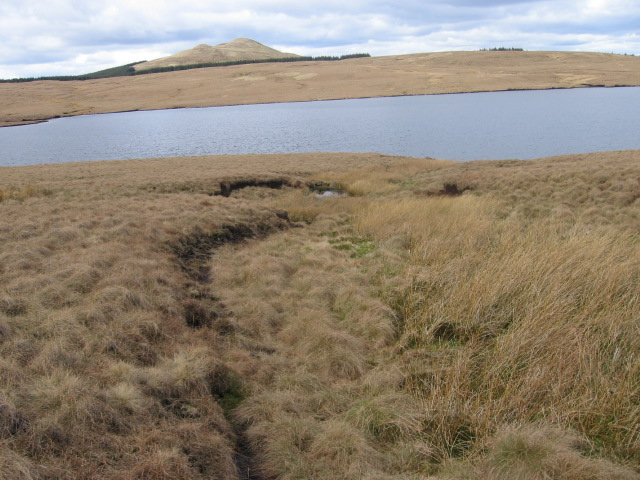
Box Knowe is a prominent hill located in Stirlingshire, Scotland. It rises to an elevation of approximately 419 meters (1,375 feet) above sea level, making it a popular destination for hikers and outdoor enthusiasts. Situated near the village of Gargunnock, Box Knowe offers breathtaking views of the surrounding countryside and is often referred to as a hidden gem in the region.

The hill is characterized by its gentle slopes, covered in a mix of grass and heather, making it easily accessible for walkers of all abilities. The terrain is relatively stable and not overly challenging, making it suitable for families and beginners. The well-marked trails leading to the summit are frequented by locals and tourists alike, providing an opportunity to enjoy the beauty of the Scottish landscape.

At the top of Box Knowe, visitors are rewarded with panoramic views that stretch across the rolling hills and valleys of Stirlingshire. On clear days, it is even possible to see as far as the Trossachs National Park and the distant peaks of the Scottish Highlands. The summit also offers a great vantage point for photographers, capturing the stunning scenery and the changing colors throughout the seasons.

Box Knowe is also known for its rich biodiversity, with a variety of flora and fauna inhabiting the hill. It is home to an array of bird species, including buzzards and kestrels, which can be seen soaring above the slopes. The hillside is also dotted with sheep, adding to the picturesque charm of the area.

Overall, Box Knowe is a must-visit destination for nature lovers and those seeking a peaceful escape in the heart of Stirlingshire. Its accessibility, stunning views, and diverse wildlife make it an ideal location for outdoor exploration and appreciation of Scotland's natural beauty.

If you have any feedback on the listing, please let us know in the comments section below.

Box Knowe Images

Images are sourced within 2km of 55.991695/-4.1384186 or Grid Reference NS6679. Thanks to Geograph Open Source API. All images are credited.

Moorland on the Campsie Fells Just north of Cort-ma-Law, looking to Meikle Bin.
Moorland on the Campsie Fells
Just north of Cort-ma-Law, looking to Meikle Bin.
Birkenburn Reservoir The dam of Birkenburn reservoir set in the Kilsyth Hills, Stirlingshire. The distant view is towards Tinto. <a href="https://www.geograph.org.uk/photo/1058884">NS9534 : The enormous cairn on Tinto summit</a>
Birkenburn Reservoir
The dam of Birkenburn reservoir set in the Kilsyth Hills, Stirlingshire. The distant view is towards Tinto. NS9534 : The enormous cairn on Tinto summit
Path towards Meikle Bin The bogfest continues, the Campsie plateau.
Path towards Meikle Bin
The bogfest continues, the Campsie plateau.
Glen to the north of Cort-Ma-Law This wee glen eventually develops a well-defined burn, whose beginnings can be seen here.
Glen to the north of Cort-Ma-Law
This wee glen eventually develops a well-defined burn, whose beginnings can be seen here.
From Lecket Hill to Cort-Ma-Law The picture looks towards the top of Lecket Hill from just below the top of Cort-Ma-Law, a popular through route in the Campsies.
From Lecket Hill to Cort-Ma-Law
The picture looks towards the top of Lecket Hill from just below the top of Cort-Ma-Law, a popular through route in the Campsies.
Angle in Fenceline, looking towards Meikle Bin In the heart of the boggy Campsie Fells
Angle in Fenceline, looking towards Meikle Bin
In the heart of the boggy Campsie Fells
Birkenburn Reservoir Directly under the regular NE approach path into Glasgow Airport
Birkenburn Reservoir
Directly under the regular NE approach path into Glasgow Airport
Hillside west of Birkenburn reservoir
Southern hillside of Meikle Bin
On Black Hill
On Black Hill
Meikle Bin fire break track south side This is the path from the south looking up to Meikle Bin. The main path from the forest joins this from the east just within the tree line.
Meikle Bin fire break track south side
This is the path from the south looking up to Meikle Bin. The main path from the forest joins this from the east just within the tree line.
Hillside above Birkenburn Reservoir
Clear  valley in forest below Meikle Bin
Clear valley in forest below Meikle Bin
Across Birkenburn Reservoir towards Meikle Bin
Towards Meikle Bin from forest clearing on Black Hill
Rough Moorland
Rough Moorland
Firebreak in Carron Valley Forest A extremely muddy firebreak I decided not to venture too far along, though the map indicated that it should lead eventually to a forest track.
Firebreak in Carron Valley Forest
A extremely muddy firebreak I decided not to venture too far along, though the map indicated that it should lead eventually to a forest track.
Rough grasses on the plateau. With Meikle Bin (the Bin) as a backdrop.
Rough grasses on the plateau.
With Meikle Bin (the Bin) as a backdrop.
Show me another place!

Box Knowe is located at Grid Ref: NS6679 (Lat: 55.991695, Lng: -4.1384186)

Unitary Authority: East Dunbartonshire

Police Authority: Greater Glasgow

What 3 Words

///free.water.inflamed. Near Milton of Campsie, East Dunbartonshire

Nearby Locations

Box Knowe

Related Wikis

Meikle Bin

Meikle Bin is a peak in the Campsie Fells in Central Scotland. It is the second-highest of the group at 570 metres (1,870 ft), and with its prominence...

Peggie's Spout

Peggie's Spout is a waterfall of Scotland. == See also == Waterfalls of Scotland == References ==

Glorat

Glorat is a place and estate in the parish of Campsie in East Dunbartonshire, Scotland. == History == A towerhouse was built at Glorat in the 16th century...

Glorat House

Glorat House is a 19th-century mansion house in East Dunbartonshire, Scotland. It is located in Milton of Campsie, in the former county of Stirlingshire...

Nearby Amenities

Located within 500m of 55.991695,-4.1384186
Box Knowe
Munro: no
Natural: peak
Lat/Long: 55.9923305/-4.1393403
The data included in this document is from www.openstreetmap.org. The data is made available under ODbL.

Have you been to Box Knowe?

Leave your review of Box Knowe below (or comments, questions and feedback).