Quickbeam Hill

Hill, Mountain in Devon South Hams

England

Quickbeam Hill

Flooded Pit, Leftlake The extraction pit for china clay.
Flooded Pit, Leftlake Credit: Chris Andrews

Quickbeam Hill is a prominent natural landmark located in Devon, England. It is a hill that rises to an elevation of approximately 240 meters (787 feet) above sea level, offering stunning panoramic views of the surrounding countryside. The hill is covered in lush greenery, with a mix of deciduous and coniferous trees dotting its slopes.

Quickbeam Hill is a popular destination for hikers and nature enthusiasts, with several well-marked trails leading to the summit. The hill is known for its diverse wildlife, including a variety of bird species, insects, and small mammals. Visitors may also spot wildflowers and other flora during their hike.

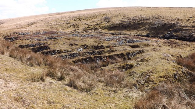
In addition to its natural beauty, Quickbeam Hill also holds historical significance. It is believed to have been inhabited by humans for thousands of years, with archaeological evidence suggesting the presence of ancient settlements in the area. The hill is also said to have played a role in local folklore and legends, adding to its mystique and allure.

Overall, Quickbeam Hill is a picturesque and tranquil spot in Devon, offering visitors a peaceful retreat into nature and a glimpse into the region's rich history and natural beauty.

If you have any feedback on the listing, please let us know in the comments section below.

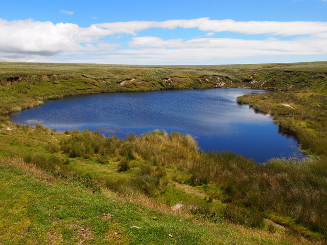
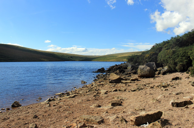
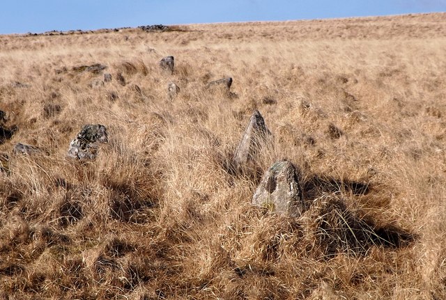
Quickbeam Hill Images

Images are sourced within 2km of 50.467004/-3.8951113 or Grid Reference SX6564. Thanks to Geograph Open Source API. All images are credited.
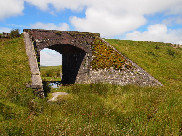
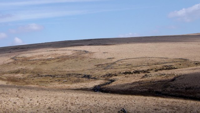
Flooded Pit, Leftlake The extraction pit for china clay.
Flooded Pit, Leftlake
The extraction pit for china clay.
Tramway Bridge, Leftlake
Avon Dam Reservoir South West Water's Avon Dam Reservoir was opened in 1957.
<span class="nowrap"><a title="https://en.wikipedia.org/wiki/Dartmoor_reservoirs" rel="nofollow ugc noopener" href="https://en.wikipedia.org/wiki/Dartmoor_reservoirs">Link</a><img style="margin-left:2px;" alt="External link" title="External link - shift click to open in new window" src="https://s1.geograph.org.uk/img/external.png" width="10" height="10"/></span>
Avon Dam Reservoir
South West Water's Avon Dam Reservoir was opened in 1957. LinkExternal link
Buckfastleigh Moor [12] The path has descended into an area known as Huntingdon Corner.  Here the Western Wella Brook flows into the infant River Avon. The structure seen here would appear to have been for a pipeline to cross the river.
Buckfastleigh Moor [12]
The path has descended into an area known as Huntingdon Corner. Here the Western Wella Brook flows into the infant River Avon. The structure seen here would appear to have been for a pipeline to cross the river.
Buckfastleigh Moor [13] From the area known as Huntingdon Corner is this view up the valley of the infant River Avon.
Buckfastleigh Moor [13]
From the area known as Huntingdon Corner is this view up the valley of the infant River Avon.
On the Abbot's Way [1] Now a public bridleway, the Abbot's Way heads down the valley of the River Avon towards the Avon Dam Reservoir. The Abbot's Way has a legend, see <span class="nowrap"><a title="http://www.dartmoor.gov.uk/learning/dartmoor-legends/the-legend-of-the-abbots-way" rel="nofollow ugc noopener" href="http://www.dartmoor.gov.uk/learning/dartmoor-legends/the-legend-of-the-abbots-way">Link</a><img style="margin-left:2px;" alt="External link" title="External link - shift click to open in new window" src="https://s1.geograph.org.uk/img/external.png" width="10" height="10"/></span>
On the Abbot's Way [1]
Now a public bridleway, the Abbot's Way heads down the valley of the River Avon towards the Avon Dam Reservoir. The Abbot's Way has a legend, see LinkExternal link
On the Abbot's Way [2] Seen from the Abbot's Way bridleway is this view of the valley of the infant River Avon. The Avon Dam Reservoir is seen in the distance.  The Abbot's Way has a legend, see <span class="nowrap"><a title="http://www.dartmoor.gov.uk/learning/dartmoor-legends/the-legend-of-the-abbots-way" rel="nofollow ugc noopener" href="http://www.dartmoor.gov.uk/learning/dartmoor-legends/the-legend-of-the-abbots-way">Link</a><img style="margin-left:2px;" alt="External link" title="External link - shift click to open in new window" src="https://s1.geograph.org.uk/img/external.png" width="10" height="10"/></span>
On the Abbot's Way [2]
Seen from the Abbot's Way bridleway is this view of the valley of the infant River Avon. The Avon Dam Reservoir is seen in the distance. The Abbot's Way has a legend, see LinkExternal link
On the Abbot's Way [3] Seen from the Abbot's Way bridleway is this view of the valley of the infant River Avon. The Avon Dam Reservoir is seen in the distance.  The Abbot's Way has a legend, see <span class="nowrap"><a title="http://www.dartmoor.gov.uk/learning/dartmoor-legends/the-legend-of-the-abbots-way" rel="nofollow ugc noopener" href="http://www.dartmoor.gov.uk/learning/dartmoor-legends/the-legend-of-the-abbots-way">Link</a><img style="margin-left:2px;" alt="External link" title="External link - shift click to open in new window" src="https://s1.geograph.org.uk/img/external.png" width="10" height="10"/></span>
On the Abbot's Way [3]
Seen from the Abbot's Way bridleway is this view of the valley of the infant River Avon. The Avon Dam Reservoir is seen in the distance. The Abbot's Way has a legend, see LinkExternal link
Path to the dam [1] Seen from the path is this view of the infant River Avon flowing into the Avon Dam Reservoir.
Path to the dam [1]
Seen from the path is this view of the infant River Avon flowing into the Avon Dam Reservoir.
Path to the dam [2] The path runs alongside the Avon Dam Reservoir.
Path to the dam [2]
The path runs alongside the Avon Dam Reservoir.
Old Wayside Cross on Western White Barrow, South Brent parish Petre's Cross, old head and shaft, Starkey No.02 by the moorland track, in parish of South Brent (South Hams District), on the summit cairn, Western White Barrow, on a pile of stones beside an abandoned shelter.

Scheduled Monument.
List Entry Number: 1002661 <span class="nowrap"><a title="https://historicengland.org.uk/listing/the-list/list-entry/1002661" rel="nofollow ugc noopener" href="https://historicengland.org.uk/listing/the-list/list-entry/1002661">Link</a><img style="margin-left:2px;" alt="External link" title="External link - shift click to open in new window" src="https://s1.geograph.org.uk/img/external.png" width="10" height="10"/></span>

Surveyed

Milestone Society National ID: DVSH_SBR03
Old Wayside Cross on Western White Barrow, South Brent parish
Petre's Cross, old head and shaft, Starkey No.02 by the moorland track, in parish of South Brent (South Hams District), on the summit cairn, Western White Barrow, on a pile of stones beside an abandoned shelter. Scheduled Monument. List Entry Number: 1002661 LinkExternal link Surveyed Milestone Society National ID: DVSH_SBR03
Old Wayside Cross Dean by Two Moors Way, Prior parish Huntingdon Cross, old head and shaft, Starkey No.01 by the Two Moors Way, in parish of Dean Prior (South Hams District), confluence of the River Avon and the Western Wella Brook, below Huntingdon Warren, beside a stone boundary wall on the moor.

Devon & Dartmoor HER.
HER Number: MDV5249 <span class="nowrap"><a title="https://www.heritagegateway.org.uk/Gateway/Results_Single.aspx?uid=MDV5249&resourceID=104" rel="nofollow ugc noopener" href="https://www.heritagegateway.org.uk/Gateway/Results_Single.aspx?uid=MDV5249&resourceID=104">Link</a><img style="margin-left:2px;" alt="External link" title="External link - shift click to open in new window" src="https://s1.geograph.org.uk/img/external.png" width="10" height="10"/></span>

Surveyed

Milestone Society National ID: DVSH_WBU05
Old Wayside Cross Dean by Two Moors Way, Prior parish
Huntingdon Cross, old head and shaft, Starkey No.01 by the Two Moors Way, in parish of Dean Prior (South Hams District), confluence of the River Avon and the Western Wella Brook, below Huntingdon Warren, beside a stone boundary wall on the moor. Devon & Dartmoor HER. HER Number: MDV5249 LinkExternal link Surveyed Milestone Society National ID: DVSH_WBU05
Old Waymarker Stone near Western White Barrow, South Brent parish Western White Barrow marker stone, standing stone by the moorland path, in parish of South Brent (South Hams District), just below the summit cairn, Western White Barrow, on open moor.

Surveyed

Milestone Society National ID: DVSH_SBR04
Old Waymarker Stone near Western White Barrow, South Brent parish
Western White Barrow marker stone, standing stone by the moorland path, in parish of South Brent (South Hams District), just below the summit cairn, Western White Barrow, on open moor. Surveyed Milestone Society National ID: DVSH_SBR04
Hook Lake prehistoric stone row A single prehistoric stone row measuring 227m long, including at least 92 mainly medium-sized stones and a few small stones. The row is orientated north to south and leads downslope (south) from a cairn. The southern length of the row is partly incorporated into a prehistoric enclosure wall and at one-point a round house has been built up against one of the row stones. <span class="nowrap"><a title="https://stonerows.wordpress.com/gazetteer/region/dartmoor/hook-lake/" rel="nofollow ugc noopener" href="https://stonerows.wordpress.com/gazetteer/region/dartmoor/hook-lake/">Link</a><img style="margin-left:2px;" alt="External link" title="External link - shift click to open in new window" src="https://s1.geograph.org.uk/img/external.png" width="10" height="10"/></span>
Hook Lake prehistoric stone row
A single prehistoric stone row measuring 227m long, including at least 92 mainly medium-sized stones and a few small stones. The row is orientated north to south and leads downslope (south) from a cairn. The southern length of the row is partly incorporated into a prehistoric enclosure wall and at one-point a round house has been built up against one of the row stones. LinkExternal link
Pair of prehistoric enclosed settlements at Hook Lake Two Bronze Age enclosures, several houses, cairns and a stone row at Hook Lake. <span class="nowrap"><a title="https://www.megalithic.co.uk/article.php?sid=14936" rel="nofollow ugc noopener" href="https://www.megalithic.co.uk/article.php?sid=14936">Link</a><img style="margin-left:2px;" alt="External link" title="External link - shift click to open in new window" src="https://s1.geograph.org.uk/img/external.png" width="10" height="10"/></span>
Pair of prehistoric enclosed settlements at Hook Lake
Two Bronze Age enclosures, several houses, cairns and a stone row at Hook Lake. LinkExternal link
Alluvial tin streamwork in the Erme Valley A series of waste dumps revetted by drystone walling known as stiling. The dumps were produced during systematic working of the tin deposits. <span class="nowrap"><a title="https://earlytin.wordpress.com/thesis-1986/chapter-five-fieldwork-interpretation/extraction-alluvial-streamworks/" rel="nofollow ugc noopener" href="https://earlytin.wordpress.com/thesis-1986/chapter-five-fieldwork-interpretation/extraction-alluvial-streamworks/">Link</a><img style="margin-left:2px;" alt="External link" title="External link - shift click to open in new window" src="https://s1.geograph.org.uk/img/external.png" width="10" height="10"/></span>
Alluvial tin streamwork in the Erme Valley
A series of waste dumps revetted by drystone walling known as stiling. The dumps were produced during systematic working of the tin deposits. LinkExternal link
Hook Lake tin mill Building which housed stamping machinery used to crush tin ore. <span class="nowrap"><a title="https://earlytin.wordpress.com/thesis-1986/chapter-three-mining-technology/processing-stamping/" rel="nofollow ugc noopener" href="https://earlytin.wordpress.com/thesis-1986/chapter-three-mining-technology/processing-stamping/">Link</a><img style="margin-left:2px;" alt="External link" title="External link - shift click to open in new window" src="https://s1.geograph.org.uk/img/external.png" width="10" height="10"/></span>
Hook Lake tin mill
Building which housed stamping machinery used to crush tin ore. LinkExternal link
Moorland above Avon valley With a distant glimpse of the Avon Dam reservoir.
Moorland above Avon valley
With a distant glimpse of the Avon Dam reservoir.
Show me another place!

Quickbeam Hill is located at Grid Ref: SX6564 (Lat: 50.467004, Lng: -3.8951113)

Administrative County: Devon

District: South Hams

Police Authority: Devon and Cornwall

What 3 Words

///tipping.idea.factually. Near South Brent, Devon

Related Wikis

Stalldown Barrow

Stalldown Barrow, sometimes called Staldon, is a megalithic site in Devon, about 5 km from Harford. It consists of a long stone row. It is fairly close...

Ryder's Hill

At 515 m, Ryder's Hill is the highest point on the southern part of Dartmoor, Devon, England. On its summit there are two standing stones and a low cairn...

Duck's Pool, Dartmoor

Duck's Pool is a small depression set in a remote location in the southern half of Dartmoor, Devon, England at grid reference SX624678. It lies between...

Badworthy

Badworthy is a village in Devon, England.

Nearby Amenities

Located within 500m of 50.467004,-3.8951113
Quickbeam Hill
Created By: Potlatch 0.10f
Natural: peak
Source: NPE
Lat/Long: 50.466906/-3.894636
Petre's Pit
Historic: archaeological_site
Lat/Long: 50.4675833/-3.8912294
The data included in this document is from www.openstreetmap.org. The data is made available under ODbL.

Have you been to Quickbeam Hill?

Leave your review of Quickbeam Hill below (or comments, questions and feedback).