Meall Ruigh nam Biorag
Hill, Mountain in Inverness-shire
Scotland
Meall Ruigh nam Biorag

Meall Ruigh nam Biorag is a hill located in the Scottish Highlands, specifically in Inverness-shire. It stands at an elevation of 582 meters (1,909 feet) above sea level, making it a popular destination for hikers and outdoor enthusiasts looking to enjoy the stunning views of the surrounding landscape.
The hill is characterized by its rugged terrain, with rocky outcrops and grassy slopes that provide a challenging yet rewarding hiking experience. The summit offers panoramic views of the surrounding mountains, glens, and lochs, including the famous Loch Ness.
Meall Ruigh nam Biorag is situated within the Glen Affric National Nature Reserve, known for its diverse flora and fauna, including rare species of birds, plants, and insects. Hikers may also encounter wildlife such as red deer and mountain hares while exploring the hill.
Access to Meall Ruigh nam Biorag is typically via well-marked hiking trails that wind their way through the picturesque Scottish countryside. The hill is a popular destination for day trips or longer hikes, offering a true taste of the Highlands' natural beauty and rugged charm.
If you have any feedback on the listing, please let us know in the comments section below.
Meall Ruigh nam Biorag Images
Images are sourced within 2km of 56.986082/-4.2134978 or Grid Reference NN6590. Thanks to Geograph Open Source API. All images are credited.


Meall Ruigh nam Biorag is located at Grid Ref: NN6590 (Lat: 56.986082, Lng: -4.2134978)
Unitary Authority: Highland
Police Authority: Highlands and Islands
What 3 Words
///arching.rave.strict. Near Newtonmore, Highland
Nearby Locations
Related Wikis

Catlodge
Catlodge (Scottish Gaelic: Caitleag) is a hamlet, in the district of Newtonmore in Inverness-shire, Scottish Highlands and is in the Scottish council...

Etteridge
Etteridge (Scottish Gaelic: Eadrais) is a small remote hamlet, situated close to Loch Etteridge in Inverness-shire, Scottish Highlands and is in the Scottish...
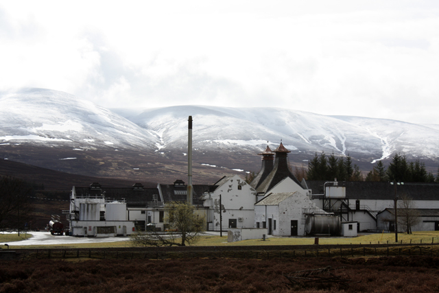
Dalwhinnie distillery
Dalwhinnie distillery, situated in the Highland village of Dalwhinnie in Scotland, produces single malt Scotch whisky. Whilst labelled as Highland, as...

Laggan, Badenoch
Laggan (Gaelic: Lagan ) is a village in Badenoch, in the Highland region of Scotland. It is beside the River Spey, about 10 km west of Newtonmore. The...
Nearby Amenities
Located within 500m of 56.986082,-4.2134978Have you been to Meall Ruigh nam Biorag?
Leave your review of Meall Ruigh nam Biorag below (or comments, questions and feedback).