Stannon Tor

Hill, Mountain in Devon West Devon

England

Stannon Tor

Bronze Age Reave on Assycombe Hill A reave is the name given to prehistoric field boundaries on Dartmoor.
Bronze Age Reave on Assycombe Hill Credit: Sandy Gerrard

Stannon Tor is a prominent granite outcrop located in the Dartmoor National Park, Devon, England. It is situated near the village of Sticklepath, approximately 5 miles west of the town of Okehampton. Standing at an elevation of 1,375 feet (419 meters), Stannon Tor is classified as a hill rather than a mountain.

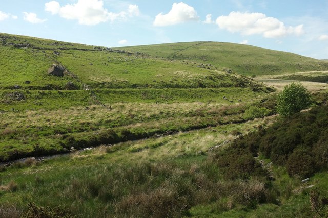
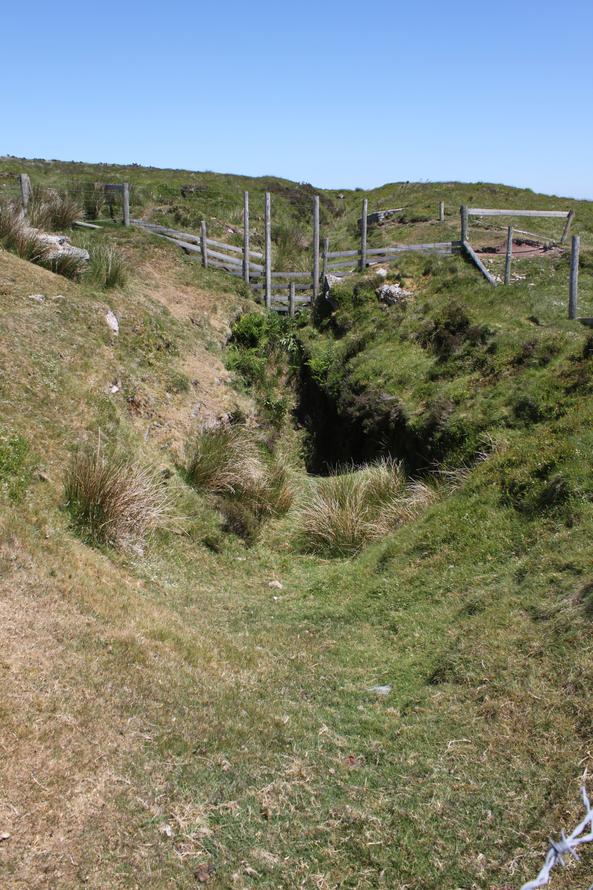
The tor is characterized by its rugged and dramatic appearance, with large granite boulders piled on top of each other. It is a popular destination for hikers and climbers, offering stunning panoramic views of the surrounding countryside, including the rolling hills and valleys of Dartmoor. On clear days, it is even possible to catch a glimpse of the distant coastline.

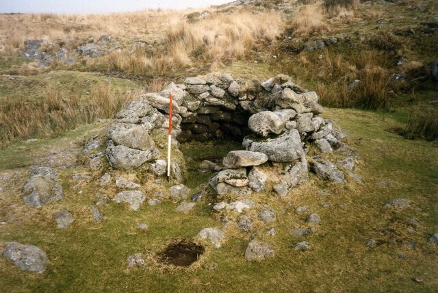
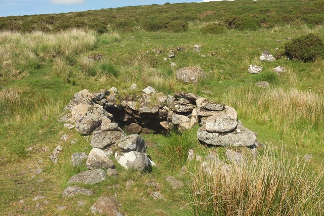
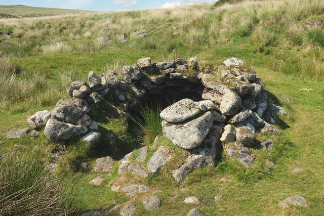
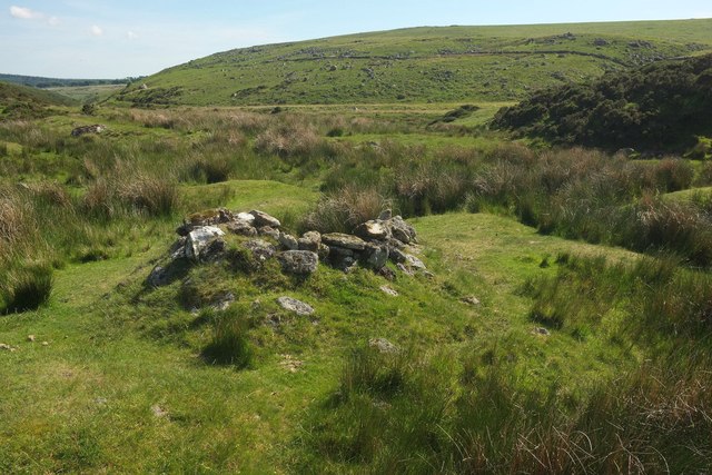
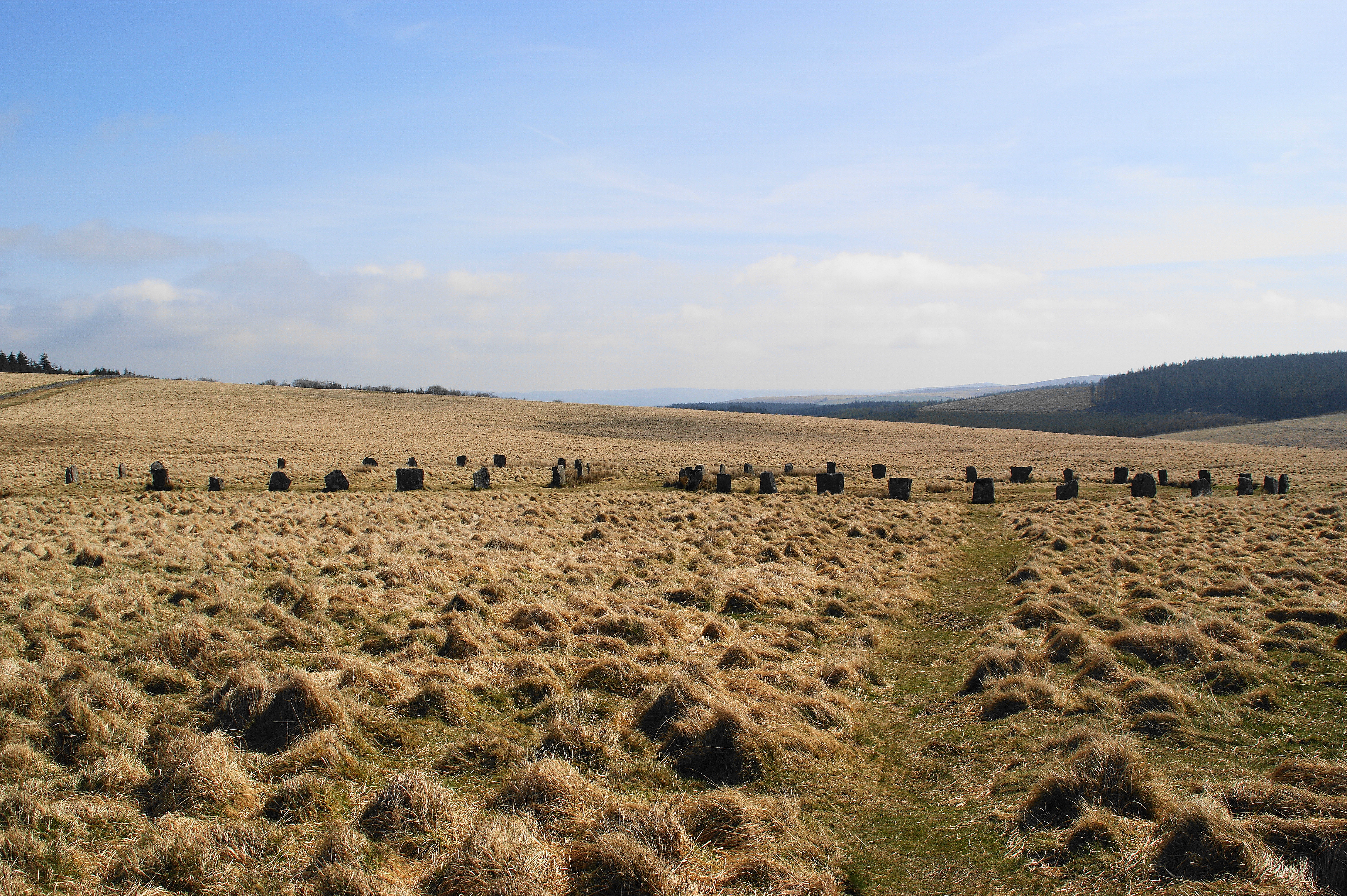
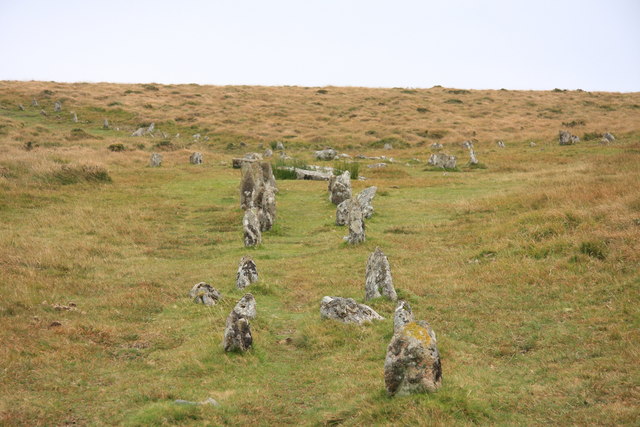
The tor is also known for its rich history and archaeological importance. The area around Stannon Tor contains several Bronze Age hut circles, evidence of ancient settlements that once thrived in the region. Additionally, there are various prehistoric stone rows and cairns nearby, adding to the historical significance of the area.

Stannon Tor is accessible to visitors via footpaths and trails, with parking areas available nearby. It is recommended to wear appropriate footwear and clothing, as the terrain can be uneven and exposed. The tor provides an excellent opportunity for outdoor enthusiasts to explore the natural beauty and cultural heritage of Dartmoor National Park.

If you have any feedback on the listing, please let us know in the comments section below.

Stannon Tor Images

Images are sourced within 2km of 50.614301/-3.9141297 or Grid Reference SX6481. Thanks to Geograph Open Source API. All images are credited.

Bronze Age Reave on Assycombe Hill A reave is the name given to prehistoric field boundaries on Dartmoor.
Bronze Age Reave on Assycombe Hill
A reave is the name given to prehistoric field boundaries on Dartmoor.
Ruined farmhouse near Stannon Tor Scale 2m <span class="nowrap"><a title="https://www.heritagegateway.org.uk/Gateway/Results_Single.aspx?uid=MDV15310&resourceID=104" rel="nofollow ugc noopener" href="https://www.heritagegateway.org.uk/Gateway/Results_Single.aspx?uid=MDV15310&resourceID=104">Link</a><img style="margin-left:2px;" alt="External link" title="External link - shift click to open in new window" src="https://s1.geograph.org.uk/img/external.png" width="10" height="10"/></span>
Ruined farmhouse near Stannon Tor
Scale 2m LinkExternal link
Beehive hut in Great Stannon Newtake Scale 1m <span class="nowrap"><a title="https://historicengland.org.uk/listing/the-list/list-entry/1019266?section=official-list-entry" rel="nofollow ugc noopener" href="https://historicengland.org.uk/listing/the-list/list-entry/1019266?section=official-list-entry">Link</a><img style="margin-left:2px;" alt="External link" title="External link - shift click to open in new window" src="https://s1.geograph.org.uk/img/external.png" width="10" height="10"/></span>
Beehive hut in Great Stannon Newtake
Scale 1m LinkExternal link
Longhouse at Assycombe Farm Scale 2m <span class="nowrap"><a title="https://www.heritagegateway.org.uk/Gateway/Results_Single.aspx?uid=MDV6703&resourceID=104" rel="nofollow ugc noopener" href="https://www.heritagegateway.org.uk/Gateway/Results_Single.aspx?uid=MDV6703&resourceID=104">Link</a><img style="margin-left:2px;" alt="External link" title="External link - shift click to open in new window" src="https://s1.geograph.org.uk/img/external.png" width="10" height="10"/></span>
Longhouse at Assycombe Farm
Scale 2m LinkExternal link
Dartmoor near Statts Bridge
Approaching Statts Bridge The B3212 crossing Dartmoor and approaching Statts Bridge.
Approaching Statts Bridge
The B3212 crossing Dartmoor and approaching Statts Bridge.
Moors close to Fernworthy Forest
Horse in the edge of Fernworthy Forest
Broadun Bronze Age Settlement View from Chittaford Down <span class="nowrap"><a title="https://historicengland.org.uk/listing/the-list/list-entry/1021333?section=official-list-entry" rel="nofollow ugc noopener" href="https://historicengland.org.uk/listing/the-list/list-entry/1021333?section=official-list-entry">Link</a><img style="margin-left:2px;" alt="External link" title="External link - shift click to open in new window" src="https://s1.geograph.org.uk/img/external.png" width="10" height="10"/></span>
Broadun Bronze Age Settlement
View from Chittaford Down LinkExternal link
Track to Fair Holm
Track to Fair Holm
Vitifer Leat The path of the disused Vitifer Mine leat crossing the edge of Winney's Down. Looking upstream towards the East Dart Waterfall above which the leat took its water.
Vitifer Leat
The path of the disused Vitifer Mine leat crossing the edge of Winney's Down. Looking upstream towards the East Dart Waterfall above which the leat took its water.
Vitifer Leat A clapper bridge over the disused Vitifer Mine Leat which took water from the East Dart River.
Vitifer Leat
A clapper bridge over the disused Vitifer Mine Leat which took water from the East Dart River.
Cattle and sheep grazing by the B3212 The B3212 runs 36 miles across Dartmoor from Exeter <a href="https://www.geograph.org.uk/photo/5399048">SX9192 : B3212</a> to Yelverton <a href="https://www.geograph.org.uk/photo/5699221">SX5267 : B3212, A386 junction</a>.
<span class="nowrap"><a title="http://www.sabre-roads.org.uk/wiki/index.php?title=B3212" rel="nofollow ugc noopener" href="http://www.sabre-roads.org.uk/wiki/index.php?title=B3212">Link</a><img style="margin-left:2px;" alt="External link" title="External link - shift click to open in new window" src="https://s1.geograph.org.uk/img/external.png" width="10" height="10"/></span>
Cattle and sheep grazing by the B3212
The B3212 runs 36 miles across Dartmoor from Exeter SX9192 : B3212 to Yelverton SX5267 : B3212, A386 junction. LinkExternal link
B3212 The B3212 runs 36 miles across Dartmoor from Exeter <a href="https://www.geograph.org.uk/photo/5399048">SX9192 : B3212</a> to Yelverton <a href="https://www.geograph.org.uk/photo/5699221">SX5267 : B3212, A386 junction</a>.
<span class="nowrap"><a title="http://www.sabre-roads.org.uk/wiki/index.php?title=B3212" rel="nofollow ugc noopener" href="http://www.sabre-roads.org.uk/wiki/index.php?title=B3212">Link</a><img style="margin-left:2px;" alt="External link" title="External link - shift click to open in new window" src="https://s1.geograph.org.uk/img/external.png" width="10" height="10"/></span>
B3212
The B3212 runs 36 miles across Dartmoor from Exeter SX9192 : B3212 to Yelverton SX5267 : B3212, A386 junction. LinkExternal link
Beehive hut by Lade Hill Brook Sadly depleted compared with the images at <a href="https://www.geograph.org.uk/photo/1989015">SX6381 : Beehive hut</a> and <a href="https://www.geograph.org.uk/photo/15204">SX6381 : Beehive hut</a>; see also <a href="https://www.geograph.org.uk/photo/3782935">SX6381 : Tinners Beehive Hut</a> and <a href="https://www.geograph.org.uk/photo/1390857">SX6381 : Beehive hut</a>. The ancient monument is described at <span class="nowrap"><a title="https://www.historicengland.org.uk/listing/the-list/list-entry/1019266" rel="nofollow ugc noopener" href="https://www.historicengland.org.uk/listing/the-list/list-entry/1019266">Link</a><img style="margin-left:2px;" alt="External link" title="External link - shift click to open in new window" src="https://s1.geograph.org.uk/img/external.png" width="10" height="10"/></span> . "The tinners' building in Great Stannon Newtake ... survives very well and contains both environmental and structural information. This building is amongst the most visually impressive of the beehive huts on the Moor ... The hut is built within a disused streamwork tye and it is presumed that it was constructed by tinners, perhaps for storage purposes and as a shelter."
Beehive hut by Lade Hill Brook
Sadly depleted compared with the images at SX6381 : Beehive hut and SX6381 : Beehive hut; see also SX6381 : Tinners Beehive Hut and SX6381 : Beehive hut. The ancient monument is described at LinkExternal link . "The tinners' building in Great Stannon Newtake ... survives very well and contains both environmental and structural information. This building is amongst the most visually impressive of the beehive huts on the Moor ... The hut is built within a disused streamwork tye and it is presumed that it was constructed by tinners, perhaps for storage purposes and as a shelter."
Beehive hut by Lade Hill Brook Another view of <a href="https://www.geograph.org.uk/photo/5413619">SX6381 : Beehive hut by Lade Hill Brook</a> from a slightly different angle. <a title="https://www.geograph.org.uk/search.php?i=72347803" href="https://www.geograph.org.uk/search.php?i=72347803">Link</a> The ancient monument is described at <span class="nowrap"><a title="https://www.historicengland.org.uk/listing/the-list/list-entry/1019266" rel="nofollow ugc noopener" href="https://www.historicengland.org.uk/listing/the-list/list-entry/1019266">Link</a><img style="margin-left:2px;" alt="External link" title="External link - shift click to open in new window" src="https://s1.geograph.org.uk/img/external.png" width="10" height="10"/></span>
Beehive hut by Lade Hill Brook
Another view of SX6381 : Beehive hut by Lade Hill Brook from a slightly different angle. Link The ancient monument is described at LinkExternal link
Beehive hut by Lade Hill Brook A rear view of <a href="https://www.geograph.org.uk/photo/5413619">SX6381 : Beehive hut by Lade Hill Brook</a> / <a href="https://www.geograph.org.uk/photo/5413622">SX6381 : Beehive hut by Lade Hill Brook</a>, looking down the valley to the junction with the East Dart.
Beehive hut by Lade Hill Brook
A rear view of SX6381 : Beehive hut by Lade Hill Brook / SX6381 : Beehive hut by Lade Hill Brook, looking down the valley to the junction with the East Dart.
East Dart valley west of Stannon Tor On the right the valley bends sharply westwards (heading upstream) at the junction with the Lade Hill Brook. <a href="https://www.geograph.org.uk/photo/5413761">SX6381 : East Dart River</a> looks across the valley to the left from this point. On the left across the valley is the prominent line of the Powder Mills Leat.
East Dart valley west of Stannon Tor
On the right the valley bends sharply westwards (heading upstream) at the junction with the Lade Hill Brook. SX6381 : East Dart River looks across the valley to the left from this point. On the left across the valley is the prominent line of the Powder Mills Leat.
Show me another place!

Stannon Tor is located at Grid Ref: SX6481 (Lat: 50.614301, Lng: -3.9141297)

Administrative County: Devon

District: West Devon

Police Authority: Devon and Cornwall

What 3 Words

///choppers.polo.wake. Near Chagford, Devon

Nearby Locations

Stannon Tor

Related Wikis

Grey Wethers

Grey Wethers consists of a pair of prehistoric stone circles, situated on grassy plateau to the north of Postbridge, Dartmoor, in the United Kingdom....

Postbridge

Postbridge is a hamlet in the heart of Dartmoor in the English county of Devon. It lies on the B3212, roughly midway between Princetown and Moretonhampstead...

Warren House Inn

The Warren House Inn is a remote and isolated public house in the heart of Dartmoor, Devon, England. It is the highest pub in southern England at 1,425...

Birch Tor and Vitifer mine

Birch Tor and Vitifer mine was a tin mine on Dartmoor, Devon, England. Located in the valley of the Redwater Brook, to the east of the B3212 Moretonhampstead...

Dartmoor Forest

Dartmoor Forest is a civil parish in Devon, England. It was formed in 1987 by the splitting of the former parish of Lydford. It covers about 56,000 acres...

Bellever

Bellever is a hamlet in Dartmoor, Devon, England. It is located on the river East Dart about 2 kilometres (1 mi) south of Postbridge. The first mention...

Bellever Tor

Bellever Tor is a granite tor in the centre of Dartmoor, England. It provides panoramic 360 degree views and is located near Bellever Forest and the popular...

Shovel Down

Shovel Down is an area of Dartmoor in Devon that is covered in megaliths including the remains of several stone rows, the Fourfold Stone Circle, and several...

Related Videos

Best Places to Visit in UK | Best Holiday Place in UK | Dartmoor | Aathi World

Best Place to visit in UK. Dartmoor Forest near Devon is an all in one holiday spot with lake, sandy beach, waterfall and other ...

Nearby Amenities

Located within 500m of 50.614301,-3.9141297
Stannon Tor
Ele: 462
Natural: peak
Source: NPE
Lat/Long: 50.6140955/-3.9144067
The Sheepfold
Historic: ruins
Lat/Long: 50.61179/-3.9174488
The data included in this document is from www.openstreetmap.org. The data is made available under ODbL.

Have you been to Stannon Tor?

Leave your review of Stannon Tor below (or comments, questions and feedback).