Carreg-y-Saeth

Hill, Mountain in Merionethshire

Wales

Carreg-y-Saeth

The Eastern End of Bwlch Tyddiad
The Eastern End of Bwlch Tyddiad Credit: Chris Andrews

The requested URL returned error: 429 Too Many Requests

If you have any feedback on the listing, please let us know in the comments section below.

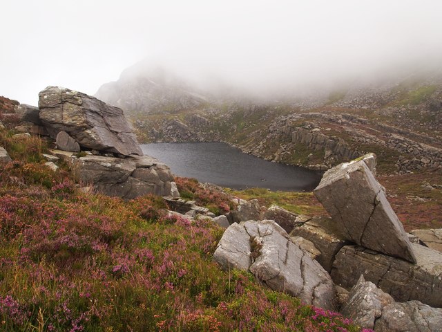
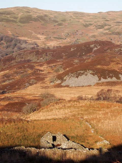
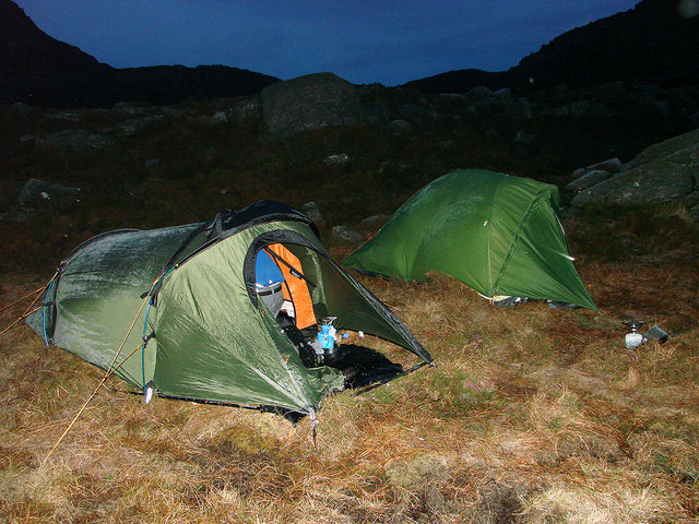
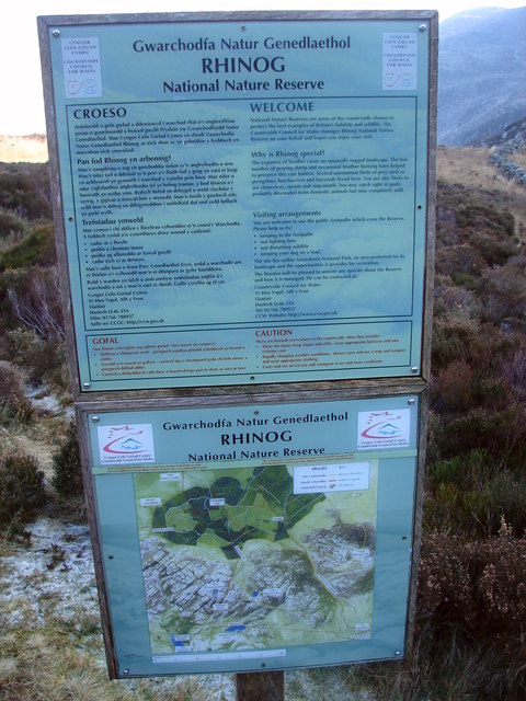
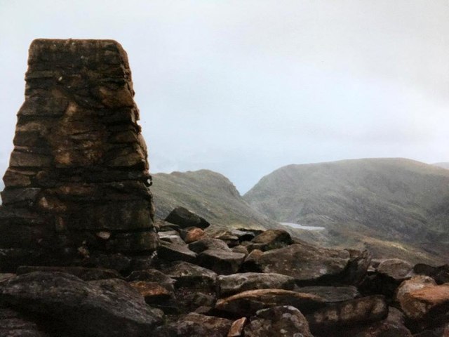
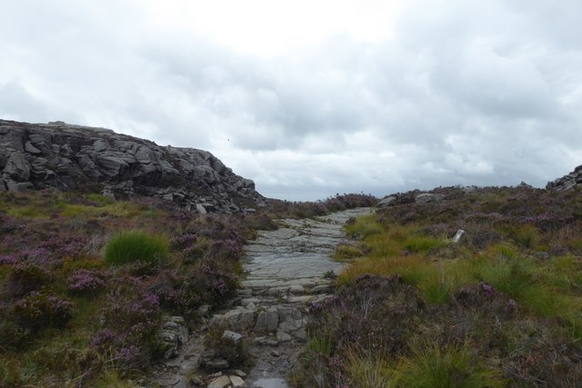
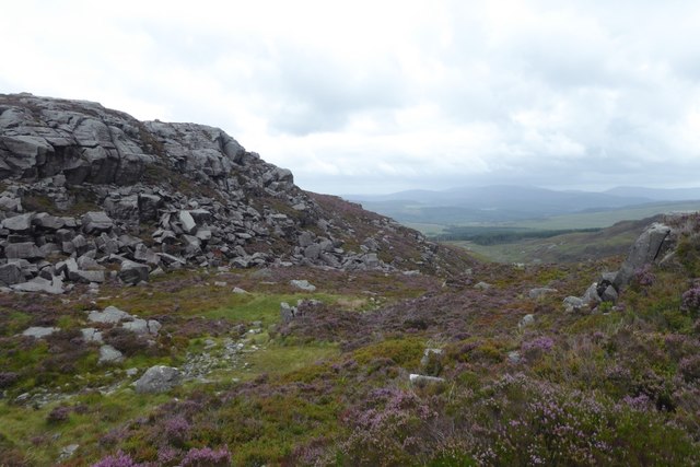
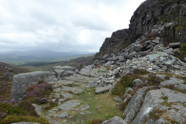
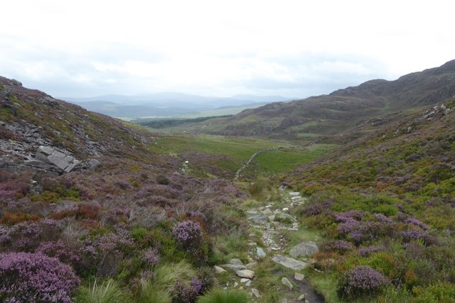
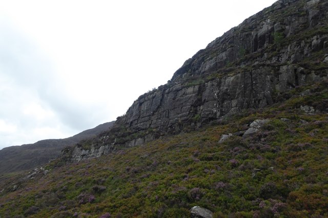
Carreg-y-Saeth Images

Images are sourced within 2km of 52.852468/-4.0157252 or Grid Reference SH6430. Thanks to Geograph Open Source API. All images are credited.

The Eastern End of Bwlch Tyddiad
Below Rhinog Fawr
Below Rhinog Fawr
Above Cwm Nantcol A mix of moorland and unimproved pasture, with very poor drainage.
Above Cwm Nantcol
A mix of moorland and unimproved pasture, with very poor drainage.
The Ruins of Hafotty The name means summer house or dwelling and is associated with the practice of transhumance, that is moving livestock from one grazing ground to another, such as the highlands in the summer.
The Ruins of Hafotty
The name means summer house or dwelling and is associated with the practice of transhumance, that is moving livestock from one grazing ground to another, such as the highlands in the summer.
Ruined Smithy, Cwm-yr-Afon Manganese Mine The mine was worked on and off between 1889 and 1922.
Ruined Smithy, Cwm-yr-Afon Manganese Mine
The mine was worked on and off between 1889 and 1922.
Sheepfold, Foel Ddu
Sheepfold, Foel Ddu
Below Rhinog Fawr
Below Rhinog Fawr
Gloyw Lyn from a gully to its SSE Footpaths from all sides of Gloyw Lyn seem to stop at its shores, with no connecting routes. Hence we had ascended the hill from the eastern shore, without finding the "proper" path. Since, apart from the Roman Steps route, all the paths marked on the map in this area seem to be exceptionally vague and rough, simply choosing a line of fairly minimal resistance is as good an option as any. We did later join the path, but still found it very hard to discern on the ground, and of no real benefit.
Gloyw Lyn from a gully to its SSE
Footpaths from all sides of Gloyw Lyn seem to stop at its shores, with no connecting routes. Hence we had ascended the hill from the eastern shore, without finding the "proper" path. Since, apart from the Roman Steps route, all the paths marked on the map in this area seem to be exceptionally vague and rough, simply choosing a line of fairly minimal resistance is as good an option as any. We did later join the path, but still found it very hard to discern on the ground, and of no real benefit.
A frosty start to the day By Llyn Du in the Rhinogs
A frosty start to the day
By Llyn Du in the Rhinogs
Cooking lunch near Gloyw Lyn I did clear everything up when I had finished - honest!
Cooking lunch near Gloyw Lyn
I did clear everything up when I had finished - honest!
Rhinog National Nature Reserve Information board
Rhinog National Nature Reserve
Information board
Trig point on Rhinog Fawr 2362' / 720m
Along the Roman Steps Part of the ascent of Rhinog Fawr from Cwm Bychan.
Along the Roman Steps
Part of the ascent of Rhinog Fawr from Cwm Bychan.
North of Rhinog Fawr Looking along the Roman Steps path.
North of Rhinog Fawr
Looking along the Roman Steps path.
Loose rocks Looking along part of the Roman Steps path.
Loose rocks
Looking along part of the Roman Steps path.
Descent towards Craigddu-isaf Looking along the descent from the Roman Steps.
Descent towards Craigddu-isaf
Looking along the descent from the Roman Steps.
Cliffs above the Roman Steps Looking up at the cliffs above the path.
Cliffs above the Roman Steps
Looking up at the cliffs above the path.
Show me another place!

Carreg-y-Saeth is located at Grid Ref: SH6430 (Lat: 52.852468, Lng: -4.0157252)

Unitary Authority: Gwynedd

Police Authority: North Wales

What 3 Words

///nuzzling.warm.slime. Near Harlech, Gwynedd

Nearby Locations

Carreg-y-Saeth Gloyw Lyn

Related Wikis

Llyn Cwm Bychan

Llyn Cwm Bychan is a lake in north Wales, and is one of the sources of the River Artro which flows south westwards through Llanbedr and onwards to the...

River Artro

The River Artro (Welsh: Afon Artro) is a river in Gwynedd, Wales. It is about 4.5 miles (7.2 km) long and has its source at Llyn Cwm Bychan below Rhinog...

Rhinog Fawr

Rhinog Fawr is a mountain in Snowdonia, North Wales and forms part of the Rhinogydd range. It is the third highest summit of the Rhinogydd, losing out...

Dwyfor Meirionnydd (Senedd constituency)

Dwyfor Meirionnydd is a constituency of the Senedd, first created for the former Assembly's 2007 election. It elects one Member of the Senedd by the first...

Nearby Amenities

Located within 500m of 52.852468,-4.0157252
Castell Carreg-y-saeth
Historic: castle
Lat/Long: 52.8519172/-4.020483
Carreg-y-Saeth
Ele: 452
Natural: peak
Wikidata: Q106709772
Lat/Long: 52.852558/-4.0161199
The data included in this document is from www.openstreetmap.org. The data is made available under ODbL.

Have you been to Carreg-y-Saeth?

Leave your review of Carreg-y-Saeth below (or comments, questions and feedback).