Sittaford Tor

Hill, Mountain in Devon West Devon

England

Sittaford Tor

Beehive hut in Great Stannon Newtake Scale 1m <span class="nowrap"><a title="https://historicengland.org.uk/listing/the-list/list-entry/1019266?section=official-list-entry" rel="nofollow ugc noopener" href="https://historicengland.org.uk/listing/the-list/list-entry/1019266?section=official-list-entry">Link</a><img style="margin-left:2px;" alt="External link" title="External link - shift click to open in new window" src="https://s1.geograph.org.uk/img/external.png" width="10" height="10"/></span>
Beehive hut in Great Stannon Newtake Credit: Sandy Gerrard

Sittaford Tor is a prominent hill located in the Dartmoor National Park in Devon, England. It stands at an elevation of 527 meters (1,729 feet) and is a popular destination for hikers and nature enthusiasts.

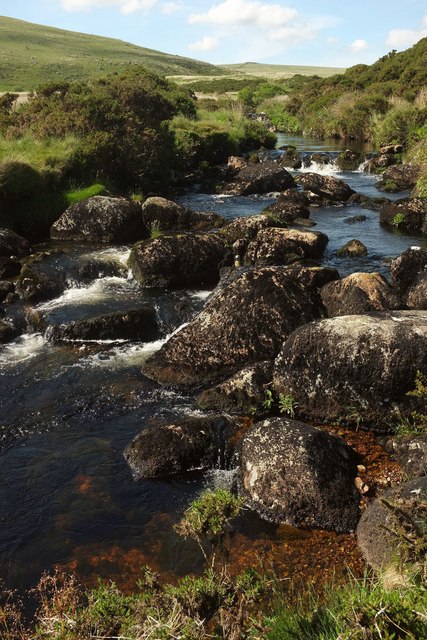
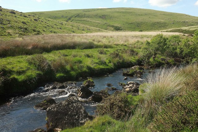
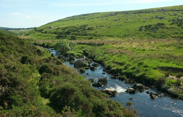
The tor is characterized by its unique granite outcrop, which forms a distinctive rocky summit. From the top of Sittaford Tor, visitors are rewarded with breathtaking panoramic views of the surrounding moorland, including the expansive Fernworthy Forest and the nearby Hameldown Range.

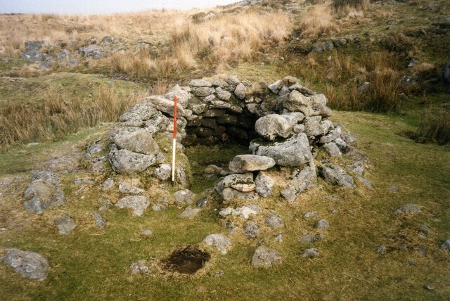
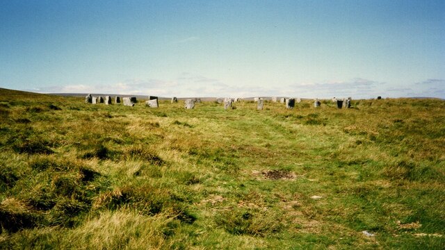
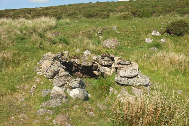
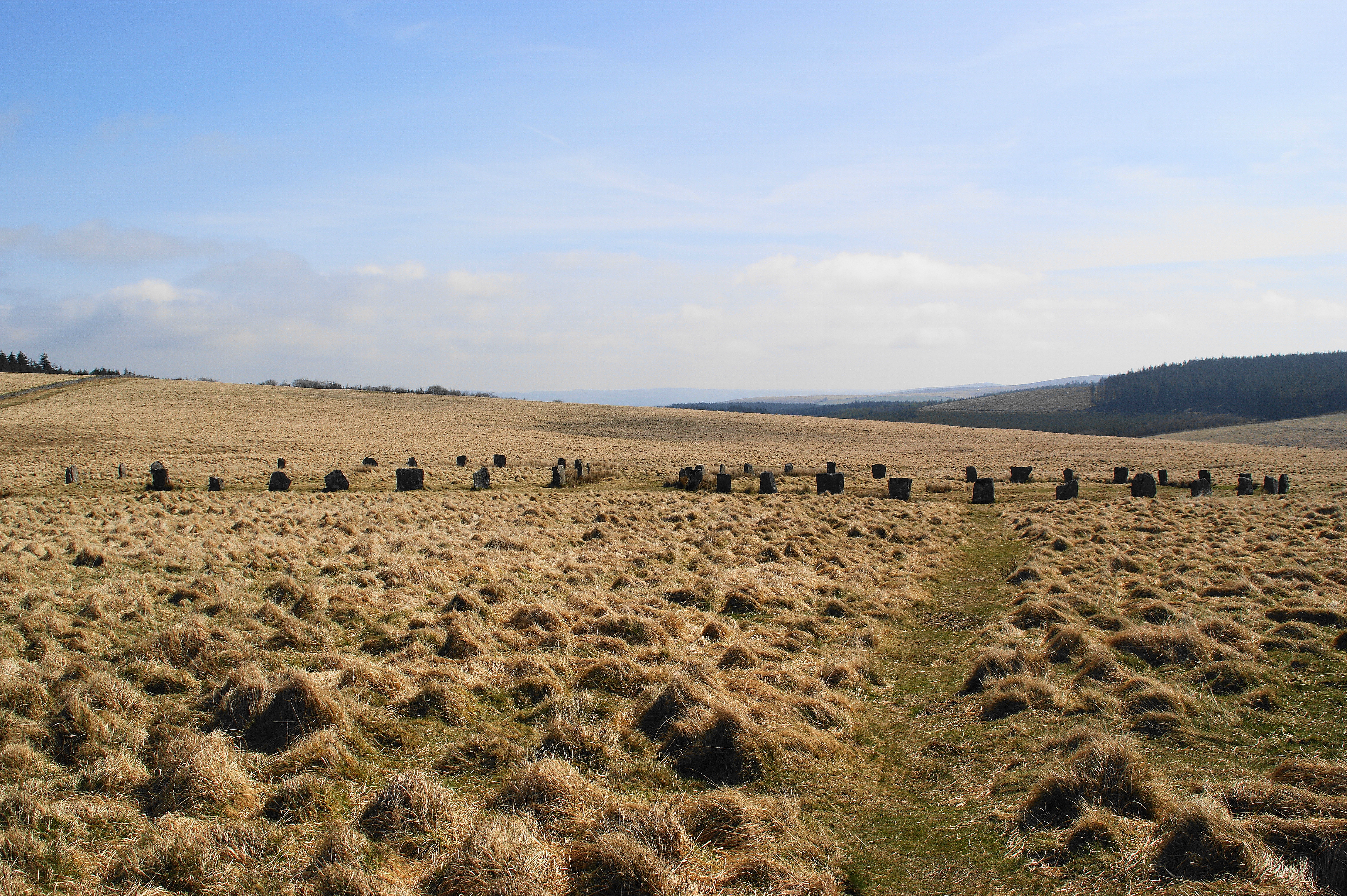
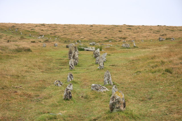
The tor is accessible from various points, with several walking routes leading to its summit. One popular route starts from the nearby village of Postbridge, taking hikers through picturesque moorland landscapes and past ancient stone circles and burial mounds.

Sittaford Tor is also known for its association with the mysterious and captivating legend of the "Sittaford Mystery." This famous Agatha Christie novel, published in 1931, revolves around a murder that takes place on the remote tor during a snowstorm.

In addition to its natural beauty and historical significance, Sittaford Tor offers a diverse array of flora and fauna. The surrounding moorland is home to various bird species, including the iconic Dartford warbler, as well as many rare plants and wildflowers.

Overall, Sittaford Tor is a captivating destination that combines stunning natural landscapes, intriguing history, and a sense of adventure, making it a must-visit location for anyone exploring the Dartmoor National Park in Devon.

If you have any feedback on the listing, please let us know in the comments section below.

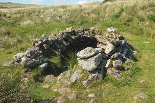
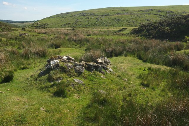
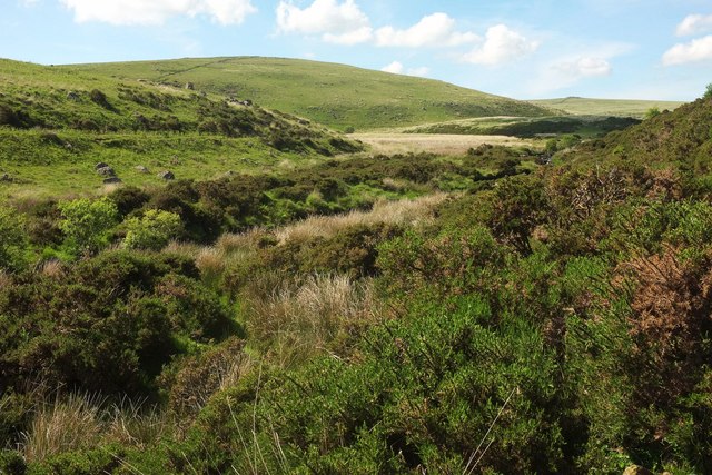
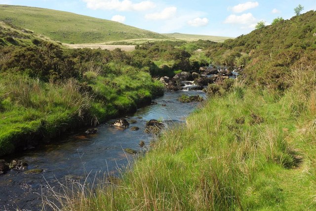
Sittaford Tor Images

Images are sourced within 2km of 50.631052/-3.934027 or Grid Reference SX6383. Thanks to Geograph Open Source API. All images are credited.

Beehive hut in Great Stannon Newtake Scale 1m <span class="nowrap"><a title="https://historicengland.org.uk/listing/the-list/list-entry/1019266?section=official-list-entry" rel="nofollow ugc noopener" href="https://historicengland.org.uk/listing/the-list/list-entry/1019266?section=official-list-entry">Link</a><img style="margin-left:2px;" alt="External link" title="External link - shift click to open in new window" src="https://s1.geograph.org.uk/img/external.png" width="10" height="10"/></span>
Beehive hut in Great Stannon Newtake
Scale 1m LinkExternal link
The Grey Wethers Stone Circle The southern of the two stone circles <span class="nowrap"><a title="https://historicengland.org.uk/listing/the-list/list-entry/1018707?section=official-list-entry" rel="nofollow ugc noopener" href="https://historicengland.org.uk/listing/the-list/list-entry/1018707?section=official-list-entry">Link</a><img style="margin-left:2px;" alt="External link" title="External link - shift click to open in new window" src="https://s1.geograph.org.uk/img/external.png" width="10" height="10"/></span>
The Grey Wethers Stone Circle
The southern of the two stone circles LinkExternal link
Fernworthy Forest
Fernworthy Forest
Fernworthy Forest
Fernworthy Forest
The Ruins of Teignhead Farm
Sittaford Recumbent Stone Circle <span class="nowrap"><a title="http://www.legendarydartmoor.co.uk/sittaford_circle.htm" rel="nofollow ugc noopener" href="http://www.legendarydartmoor.co.uk/sittaford_circle.htm">Link</a><img style="margin-left:2px;" alt="External link" title="External link - shift click to open in new window" src="https://s1.geograph.org.uk/img/external.png" width="10" height="10"/></span>
Sittaford Recumbent Stone Circle
Vitifer Leat The path of the disused Vitifer Mine leat crossing the edge of Winney's Down. Looking upstream towards the East Dart Waterfall above which the leat took its water.
Vitifer Leat
The path of the disused Vitifer Mine leat crossing the edge of Winney's Down. Looking upstream towards the East Dart Waterfall above which the leat took its water.
Beehive hut by Lade Hill Brook Sadly depleted compared with the images at <a href="https://www.geograph.org.uk/photo/1989015">SX6381 : Beehive hut</a> and <a href="https://www.geograph.org.uk/photo/15204">SX6381 : Beehive hut</a>; see also <a href="https://www.geograph.org.uk/photo/3782935">SX6381 : Tinners Beehive Hut</a> and <a href="https://www.geograph.org.uk/photo/1390857">SX6381 : Beehive hut</a>. The ancient monument is described at <span class="nowrap"><a title="https://www.historicengland.org.uk/listing/the-list/list-entry/1019266" rel="nofollow ugc noopener" href="https://www.historicengland.org.uk/listing/the-list/list-entry/1019266">Link</a><img style="margin-left:2px;" alt="External link" title="External link - shift click to open in new window" src="https://s1.geograph.org.uk/img/external.png" width="10" height="10"/></span> . "The tinners' building in Great Stannon Newtake ... survives very well and contains both environmental and structural information. This building is amongst the most visually impressive of the beehive huts on the Moor ... The hut is built within a disused streamwork tye and it is presumed that it was constructed by tinners, perhaps for storage purposes and as a shelter."
Beehive hut by Lade Hill Brook
Sadly depleted compared with the images at SX6381 : Beehive hut and SX6381 : Beehive hut; see also SX6381 : Tinners Beehive Hut and SX6381 : Beehive hut. The ancient monument is described at LinkExternal link . "The tinners' building in Great Stannon Newtake ... survives very well and contains both environmental and structural information. This building is amongst the most visually impressive of the beehive huts on the Moor ... The hut is built within a disused streamwork tye and it is presumed that it was constructed by tinners, perhaps for storage purposes and as a shelter."
Beehive hut by Lade Hill Brook Another view of <a href="https://www.geograph.org.uk/photo/5413619">SX6381 : Beehive hut by Lade Hill Brook</a> from a slightly different angle. <a title="https://www.geograph.org.uk/search.php?i=72347803" href="https://www.geograph.org.uk/search.php?i=72347803">Link</a> The ancient monument is described at <span class="nowrap"><a title="https://www.historicengland.org.uk/listing/the-list/list-entry/1019266" rel="nofollow ugc noopener" href="https://www.historicengland.org.uk/listing/the-list/list-entry/1019266">Link</a><img style="margin-left:2px;" alt="External link" title="External link - shift click to open in new window" src="https://s1.geograph.org.uk/img/external.png" width="10" height="10"/></span>
Beehive hut by Lade Hill Brook
Another view of SX6381 : Beehive hut by Lade Hill Brook from a slightly different angle. Link The ancient monument is described at LinkExternal link
Beehive hut by Lade Hill Brook A rear view of <a href="https://www.geograph.org.uk/photo/5413619">SX6381 : Beehive hut by Lade Hill Brook</a> / <a href="https://www.geograph.org.uk/photo/5413622">SX6381 : Beehive hut by Lade Hill Brook</a>, looking down the valley to the junction with the East Dart.
Beehive hut by Lade Hill Brook
A rear view of SX6381 : Beehive hut by Lade Hill Brook / SX6381 : Beehive hut by Lade Hill Brook, looking down the valley to the junction with the East Dart.
East Dart valley west of Stannon Tor A similar view to <a href="https://www.geograph.org.uk/photo/5413689">SX6381 : East Dart valley west of Stannon Tor</a>, taken a little further north, the valley turning west at the junction with the Lade Hill Brook. On the left across the valley is the prominent line of the Powder Mills Leat. <a href="https://www.geograph.org.uk/photo/5413770">SX6381 : East Dart valley west of Stannon Tor</a> looks left from here.
East Dart valley west of Stannon Tor
A similar view to SX6381 : East Dart valley west of Stannon Tor, taken a little further north, the valley turning west at the junction with the Lade Hill Brook. On the left across the valley is the prominent line of the Powder Mills Leat. SX6381 : East Dart valley west of Stannon Tor looks left from here.
East Dart River Looking upstream from where <a href="https://www.geograph.org.uk/photo/5413949">SX6381 : East Dart River</a> looks downstream.
East Dart River
Looking upstream from where SX6381 : East Dart River looks downstream.
Rocks on East Dart River Some providing a seat for a short rest. The rocks can be seen in <a href="https://www.geograph.org.uk/photo/5416378">SX6381 : East Dart River</a>.
Rocks on East Dart River
Some providing a seat for a short rest. The rocks can be seen in SX6381 : East Dart River.
East Dart River A little upstream from <a href="https://www.geograph.org.uk/photo/5416650">SX6381 : Rocks on East Dart River</a>, with the southeast slopes of Winney's Down ahead across the river beyond its upstream bend westwards.
East Dart River
A little upstream from SX6381 : Rocks on East Dart River, with the southeast slopes of Winney's Down ahead across the river beyond its upstream bend westwards.
East Dart River With large boulders in the river, and the small group of trees seen from downstream in <a href="https://www.geograph.org.uk/photo/5417397">SX6381 : East Dart River</a>.
East Dart River
With large boulders in the river, and the small group of trees seen from downstream in SX6381 : East Dart River.
East Dart River Looking right from the same position as <a href="https://www.geograph.org.uk/photo/5417412">SX6381 : East Dart River</a>, with a washout on the far bank.
East Dart River
Looking right from the same position as SX6381 : East Dart River, with a washout on the far bank.
Lade Hill Brook valley Close to its junction with the East Dart River.
Lade Hill Brook valley
Close to its junction with the East Dart River.
Lade Hill Brook valley As with <a href="https://www.geograph.org.uk/photo/5417700">SX6381 : Lade Hill Brook valley</a>, Winney's Down is in the background.
Lade Hill Brook valley
As with SX6381 : Lade Hill Brook valley, Winney's Down is in the background.
Show me another place!

Sittaford Tor is located at Grid Ref: SX6383 (Lat: 50.631052, Lng: -3.934027)

Administrative County: Devon

District: West Devon

Police Authority: Devon and Cornwall

What 3 Words

///compose.coping.lecturing. Near Chagford, Devon

Nearby Locations

Grey Wethers Sittaford Tor

Related Wikis

Grey Wethers

Grey Wethers consists of a pair of prehistoric stone circles, situated on grassy plateau to the north of Postbridge, Dartmoor, in the United Kingdom....

Hangingstone Hill

Hangingstone Hill is a hill in North Dartmoor in the southwest English county of Devon. At 603 metres high, it is the joint third highest peak in Devon...

Shovel Down

Shovel Down is an area of Dartmoor in Devon that is covered in megaliths including the remains of several stone rows, the Fourfold Stone Circle, and several...

Cranmere Pool

Cranmere Pool is a small depression within a peat bog in the northern half of Dartmoor, Devon, England, at grid reference SX604858. It lies 560 metres...

Nearby Amenities

Located within 500m of 50.631052,-3.934027
Sittaford Tor
Ele: 538
Natural: peak
Source: NPE
Lat/Long: 50.6309119/-3.9338787
Barrier: stile
Lat/Long: 50.6306599/-3.9339758
Barrier: stile
Lat/Long: 50.6312204/-3.9336314
Sittaford Tor stone circle
Historic: ruins
Historic Civilization: Bronze_Age
Lat/Long: 50.6288283/-3.9381768
The data included in this document is from www.openstreetmap.org. The data is made available under ODbL.

Have you been to Sittaford Tor?

Leave your review of Sittaford Tor below (or comments, questions and feedback).