Creag Dhubh

Hill, Mountain in Sutherland

Scotland

Creag Dhubh

Shieling hut below Sìdhean Achadh nan Eun, Sutherland This is one of a group of nine shieling huts which are still shown on OS maps with a scale of 1:25000 and larger.

Sìdhean Achadh nan Eun is the high ground on the left of the photo.
Shieling hut below Sìdhean Achadh nan Eun, Sutherland Credit: Claire Pegrum

Creag Dhubh is a prominent hill located in the county of Sutherland, in the Highland region of Scotland. Standing at an elevation of 505 meters (1,657 feet), it is classified as a Marilyn, which denotes a hill or mountain with a prominence of at least 150 meters (492 feet).

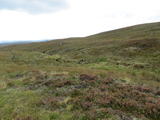
Situated near the village of Bettyhill, Creag Dhubh offers stunning panoramic views of the surrounding landscape. To the north, there is a sweeping vista of the rugged coastline along the North Atlantic Ocean, while to the south, the hill provides a picturesque view of the rolling hills and moorlands of Sutherland.

The ascent of Creag Dhubh is relatively moderate, making it an ideal hiking destination for individuals of varying fitness levels. The hill is accessible through a well-defined path that winds its way through heather-covered slopes, providing an enjoyable and scenic hike. It typically takes around two to three hours to complete the round trip.

At the summit of Creag Dhubh, walkers are rewarded with breathtaking views in all directions. On clear days, it is possible to see as far as the Dornoch Firth to the east and the mountains of Wester Ross to the south. The hill's summit also boasts a small cairn, providing a perfect spot for hikers to rest, take in the surroundings, and enjoy a picnic.

Overall, Creag Dhubh is a captivating hill in Sutherland, offering outdoor enthusiasts a rewarding and picturesque experience with its accessible ascent and stunning views.

If you have any feedback on the listing, please let us know in the comments section below.

Creag Dhubh Images

Images are sourced within 2km of 58.067007/-4.3228597 or Grid Reference NC6311. Thanks to Geograph Open Source API. All images are credited.

Shieling hut below Sìdhean Achadh nan Eun, Sutherland This is one of a group of nine shieling huts which are still shown on OS maps with a scale of 1:25000 and larger.

Sìdhean Achadh nan Eun is the high ground on the left of the photo.
Shieling hut below Sìdhean Achadh nan Eun, Sutherland
This is one of a group of nine shieling huts which are still shown on OS maps with a scale of 1:25000 and larger. Sìdhean Achadh nan Eun is the high ground on the left of the photo.
Trig on Meall a'Chaise View across the moors of central Sutherland to Ben Klibreck. Below is the very remote inhabited house Dalnessie, on the upper Brora.
Trig on Meall a'Chaise
View across the moors of central Sutherland to Ben Klibreck. Below is the very remote inhabited house Dalnessie, on the upper Brora.
On Creag Dhubh Creag Dhubh, the black crag is a rather grand name for a gentle heather ridge (foreground) The view is over vast sitka/lodgepole plantations and Loch Tigh na Creige.
On Creag Dhubh
Creag Dhubh, the black crag is a rather grand name for a gentle heather ridge (foreground) The view is over vast sitka/lodgepole plantations and Loch Tigh na Creige.
Dalchork Wood A view from the Forest Road.
Dalchork Wood
A view from the Forest Road.
Dalchork Wood A sharp bend in the road.
Dalchork Wood
A sharp bend in the road.
Dalchork Wood A view from the road.
Dalchork Wood
A view from the road.
Side of track Couple of nice trees by the side of the forest track
Side of track
Couple of nice trees by the side of the forest track
Clearing by path Small clearing by side of track in Dalchork Woods
Clearing by path
Small clearing by side of track in Dalchork Woods
Edge of the forest The woods stop at this eastern edge and the open moorland and there is not much else after this in this part of Sutherland.
Edge of the forest
The woods stop at this eastern edge and the open moorland and there is not much else after this in this part of Sutherland.
Trig point on Meall a' Chàise The trig point on Meall a' Chàise which is not on the summit.
Trig point on Meall a' Chàise
The trig point on Meall a' Chàise which is not on the summit.
Ruin near Tighcreag, Sutherland
Moorland near Tighcreag, Sutherland
Ruin beside the track to Tighcreag Shown on the 1873 25" map without annotation but is annotated as a sheepfold on the 1908 6" sheet. It is depicted on the current map but not annotated. A rather grand affair with fireplace and chimney, no doubt to provide warmth 'while the shepherds watched their flocks by night'. 

Loch Tigh na Creige is just visible. Older maps show a track heading south around the eastern edge of the loch, providing a shortened route down to Lairg. That appears to not now exist, having been blocked by the forestry, and the distance to Lairg is far greater, requiring egress onto the A836 road.
Ruin beside the track to Tighcreag
Shown on the 1873 25" map without annotation but is annotated as a sheepfold on the 1908 6" sheet. It is depicted on the current map but not annotated. A rather grand affair with fireplace and chimney, no doubt to provide warmth 'while the shepherds watched their flocks by night'. Loch Tigh na Creige is just visible. Older maps show a track heading south around the eastern edge of the loch, providing a shortened route down to Lairg. That appears to not now exist, having been blocked by the forestry, and the distance to Lairg is far greater, requiring egress onto the A836 road.
Track leading to Tighcreag The track to Tighcreag <a href="https://www.geograph.org.uk/gridref/NC62830986">NC62830986</a> now overgrown and boggy in places. Tighcreag was a substantial farmstead. Current maps show that it remains as a roofed building but it is now unoccupied.
Track leading to Tighcreag
The track to Tighcreag NC62830986 now overgrown and boggy in places. Tighcreag was a substantial farmstead. Current maps show that it remains as a roofed building but it is now unoccupied.
Path leading to Tighcreag Somewhat overgrown and boggy in places with signs of quad-bike use, but not of late.
Path leading to Tighcreag
Somewhat overgrown and boggy in places with signs of quad-bike use, but not of late.
Trig point on Meall a' Chaise, 366m
Fenceline on the moor protecting the regeneration of natural woodland
Course of Allt Achadh Tom a' Leine
Show me another place!

Creag Dhubh is located at Grid Ref: NC6311 (Lat: 58.067007, Lng: -4.3228597)

Unitary Authority: Highland

Police Authority: Highlands and Islands

What 3 Words

///mobile.widely.dividers. Near Lairg, Highland

Related Wikis

Saval

Saval (Scottish Gaelic: Sàbhal) is a small remote hamlet, surrounded by Dalchork Wood, 1.5 miles northeast of the village of Lairg, in Sutherland, Scottish...

A839 road

The A839 road is in Sutherland, in the Highland area of Scotland. It runs generally west from the A9 at The Mound near Golspie, via Rogart and Lairg, to...

West Langwell

West Langwell is a small crofting settlement in Rogart, Sutherland is in the Scottish council area of Highland within the Scottish Highlands. The village...

Achfrish

Achfrish is a hamlet situated towards the southeastern part of Loch Shin on the north side of the Loch in Highland, Scotland. It is also part of the wider...

Have you been to Creag Dhubh?

Leave your review of Creag Dhubh below (or comments, questions and feedback).