Mackilston Hill
Hill, Mountain in Kirkcudbrightshire
Scotland
Mackilston Hill

Mackilston Hill is a prominent landmark situated in the region of Kirkcudbrightshire in southwestern Scotland. This hill, also known as a mountain due to its significant elevation, is part of the wider Galloway Hills range. It stands at a height of approximately 525 meters (1,722 feet) above sea level, offering breathtaking panoramic views of the surrounding countryside.
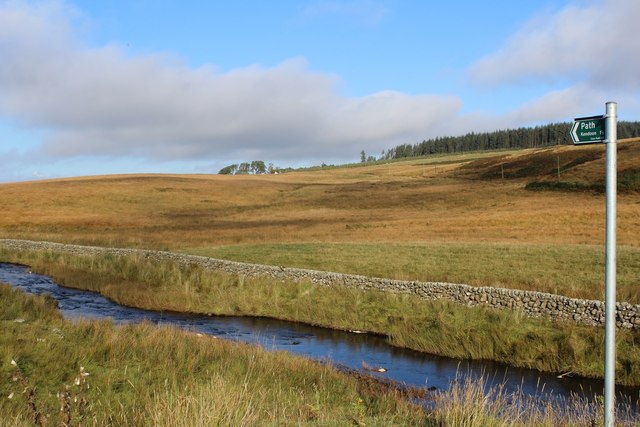
The hill is characterized by its rugged terrain, featuring steep slopes and rocky outcrops. Its summit is marked by a trig point, which serves as a navigational aid for hikers and mountaineers. The ascent to the top can be challenging but rewarding, with stunning vistas of the nearby Loch Ken and the rolling hills of Galloway.
Mackilston Hill is a popular destination for outdoor enthusiasts and nature lovers. Its diverse flora and fauna make it an ideal spot for wildlife observation and photography. Visitors may encounter various bird species, such as red kites and buzzards, along with small mammals like hares and deer.
The hill is also steeped in history, with remnants of ancient settlements and archaeological sites scattered across its slopes. These include prehistoric burial mounds and traces of Iron Age forts, adding an element of intrigue to the area's cultural heritage.
Overall, Mackilston Hill offers a memorable experience for those seeking adventure, natural beauty, and a glimpse into Scotland's rich history. Whether for hiking, photography, or exploration, this hill provides a captivating destination for all.
If you have any feedback on the listing, please let us know in the comments section below.
Mackilston Hill Images
Images are sourced within 2km of 55.165284/-4.1611288 or Grid Reference NX6287. Thanks to Geograph Open Source API. All images are credited.


Mackilston Hill is located at Grid Ref: NX6287 (Lat: 55.165284, Lng: -4.1611288)
Unitary Authority: Dumfries and Galloway
Police Authority: Dumfries and Galloway
What 3 Words
///defensive.hiking.engages. Near Bellsbank, East Ayrshire
Nearby Locations
Related Wikis

Earlstoun Castle
Earlstoun Castle, sometimes spelled Earlston Castle, is a derelict tower house near St John's Town of Dalry in Dumfries and Galloway, Scotland. Built in...

Polharrow Burn
Polharrow Burn is a small watercourse in Dumfries and Galloway, Scotland, in the historic county of Kirkcudbrightshire. It rises in Loch Harrow and flows...

Lochinvar
Lochinvar (or Lan Var) is a loch in the civil parish of Dalry in the historic county of Kirkcudbrightshire, Dumfries and Galloway Scotland. It is located...

Waukers Linn
Waukers Linn is a waterfall on Polharrow Burn in Dumfries and Galloway, Scotland. == See also == Waterfalls of Scotland == References ==

St John's Town of Dalry
St John's Town of Dalry (Scottish Gaelic: Clachan Eòin), usually referred to simply as Dalry (/dæl'raɪ/ / 'dal-RYE'), is a village in Dumfries and Galloway...

Barscobe Castle
Barscobe Castle is a 17th-century tower house in Balmaclellan, Kirkcudbrightshire, Scotland. It is a typical house of a country laird, and according to...

Carsphairn
Carsphairn (Scottish Gaelic: An Còrsa Feàrna) is a village in the historic county of Kirkcudbrightshire in Dumfries and Galloway, Scotland. It is located...

Loch Howie
Loch Howie is a small, narrow, upland freshwater loch on the north side of Blackcraig Hill, approximately 18 miles (29 km) west of Dumfries, Scotland....
Nearby Amenities
Located within 500m of 55.165284,-4.1611288Have you been to Mackilston Hill?
Leave your review of Mackilston Hill below (or comments, questions and feedback).