Llechwedd Melyn

Hill, Mountain in Merionethshire

Wales

Llechwedd Melyn

Ruined building near a disused mine
Ruined building near a disused mine Credit: Steven Brown

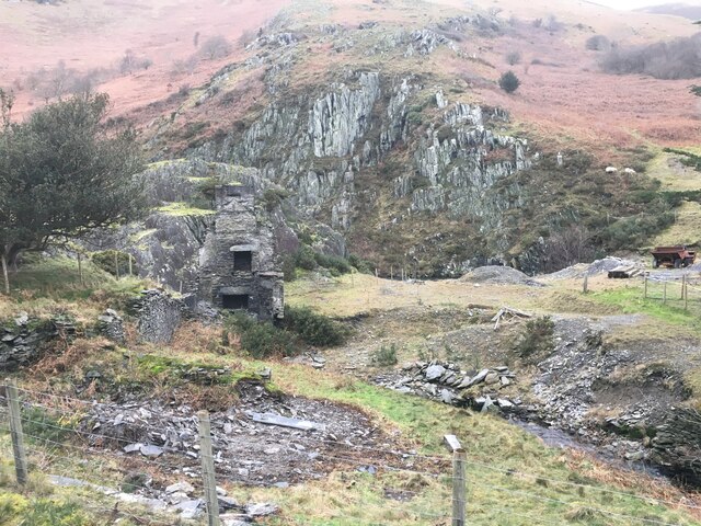
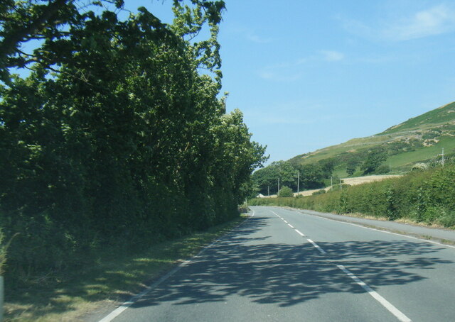
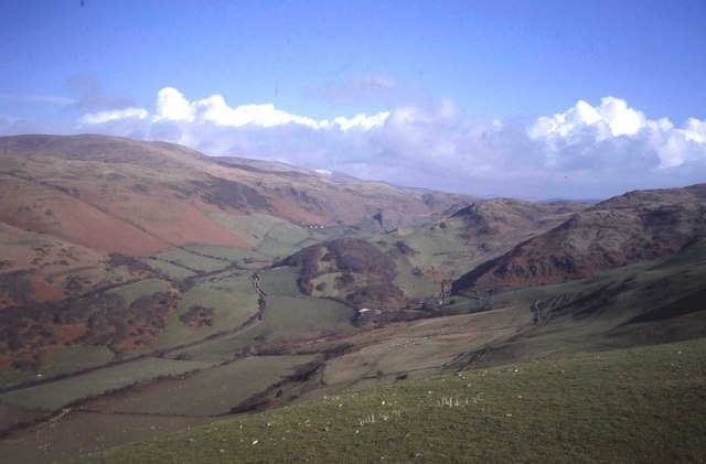
Llechwedd Melyn is a hill located in Merionethshire, Wales. It is part of the Snowdonia National Park and offers stunning views of the surrounding countryside. The hill is characterized by its gentle slopes and lush green vegetation, making it a popular destination for hikers and nature enthusiasts.

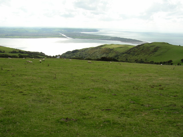
Llechwedd Melyn stands at an elevation of approximately 500 meters above sea level, making it a moderate challenge for those looking to climb to the summit. From the top of the hill, visitors can enjoy panoramic views of the Snowdonia mountain range, as well as the nearby lakes and valleys.

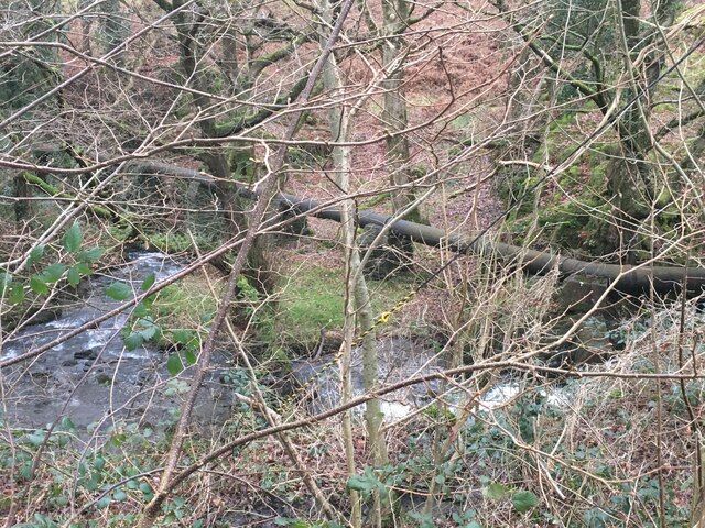
The hill is home to a variety of plant and animal species, including rare orchids and birds of prey. It is also known for its rich history, with evidence of ancient settlements and mining activities dating back centuries.

Overall, Llechwedd Melyn offers a peaceful and scenic escape for those looking to explore the natural beauty of Merionethshire. With its diverse flora and fauna, breathtaking views, and historical significance, it is a must-visit destination for anyone traveling to the area.

If you have any feedback on the listing, please let us know in the comments section below.

Llechwedd Melyn Images

Images are sourced within 2km of 52.569031/-4.0431155 or Grid Reference SN6198. Thanks to Geograph Open Source API. All images are credited.

Ruined building near a disused mine
Disused water pipeline near Happy Valley
A493 at Riverslea
A493 at Riverslea
Shallow valley at Dyffryn-glyn-cul
The A493 south of Tywyn A reasonably good road on this bit which connects Aberdyfi and Tywyn
The A493 south of Tywyn
A reasonably good road on this bit which connects Aberdyfi and Tywyn
Farmland by Caethle Farm With the slopes of Corlan Fraith forming the backdrop.
Farmland by Caethle Farm
With the slopes of Corlan Fraith forming the backdrop.
Cairn atop Corlan Fraith Cairn that incorporates an amount of concrete at the high point on Corlan Fraith. Not too sure why, perhaps an observation post.
Cairn atop Corlan Fraith
Cairn that incorporates an amount of concrete at the high point on Corlan Fraith. Not too sure why, perhaps an observation post.
Chapel in Cwm Maethlon Cwm Maethlon is also known as Happy Valley. The chapel is apparently still in use. Notice also the surviving red telephone kiosk.
Chapel in Cwm Maethlon
Cwm Maethlon is also known as Happy Valley. The chapel is apparently still in use. Notice also the surviving red telephone kiosk.
Entrance to Nantycynnog In the very north east corner of the square. Viewed from the road through Cwm Maethlon.
Entrance to Nantycynnog
In the very north east corner of the square. Viewed from the road through Cwm Maethlon.
Ruined house by an old mine Viewed from the road through Cwm Maethlon. The property is now called Gwynfan but I'm not sure if that was the original name of the mine or what was mined here. A 1960's map shows that it had shafts.
Ruined house by an old mine
Viewed from the road through Cwm Maethlon. The property is now called Gwynfan but I'm not sure if that was the original name of the mine or what was mined here. A 1960's map shows that it had shafts.
Entrance to Erw Porthor Chalet Park (Maes Cabanau) Near Tywyn in Cwm Maethlon (Happey Valley). The chalet park provides self catering holiday chalets. Details can be found here: <span class="nowrap"><a title="http://www.erwporthor.com/" rel="nofollow ugc noopener" href="http://www.erwporthor.com/">Link</a><img style="margin-left:2px;" alt="External link" title="External link - shift click to open in new window" src="https://s1.geograph.org.uk/img/external.png" width="10" height="10"/></span>
Entrance to Erw Porthor Chalet Park (Maes Cabanau)
Near Tywyn in Cwm Maethlon (Happey Valley). The chalet park provides self catering holiday chalets. Details can be found here: LinkExternal link
Track leading to Cwm Maethlon. This track, a footpath, was badly damaged by 4x4's in the past, sadly causing certain sections to flood in the winter.
Track leading to Cwm Maethlon.
This track, a footpath, was badly damaged by 4x4's in the past, sadly causing certain sections to flood in the winter.
Weed-choked  lake Presumably a mill pond for the nearby Dyffryn Glyn-cul (narrow valley) farm, this pond has been chocked up badly by floating weed.
Weed-choked lake
Presumably a mill pond for the nearby Dyffryn Glyn-cul (narrow valley) farm, this pond has been chocked up badly by floating weed.
Bwlchgwyn Chalet Park.
Hill Grazing. The sheep keep the grass cropped very short here. 
View down Allt Goch with Borth and the River Leri in the background.
Hill Grazing.
The sheep keep the grass cropped very short here. View down Allt Goch with Borth and the River Leri in the background.
View of Happy Valley from Llechwedd Ffridd yr Ychen on the right.
View of Happy Valley from Llechwedd
Ffridd yr Ychen on the right.
Llechwedd Looking north-east towards Happy Valley.
Llechwedd
Looking north-east towards Happy Valley.
Sunset from Cathle campsite
Show me another place!

Llechwedd Melyn is located at Grid Ref: SN6198 (Lat: 52.569031, Lng: -4.0431155)

Unitary Authority: Gwynedd

Police Authority: North Wales

What 3 Words

///newsreel.rotate.roadblock. Near Tywyn, Gwynedd

Nearby Locations

Llechwedd Melyn

Related Wikis

Hen Dyffryn Gwyn

Hen Dyffryn Gwyn is a Grade II* listed building in Tywyn, Gwynedd. The house has been dated to 1640 and is listed for being a well-preserved example of...

Penhelig railway station

Penhelig railway station (Welsh: Penhelyg) serves the eastern outskirts of the seaside resort of Aberdyfi in Gwynedd, Wales. It was opened by the Great...

Aberdyfi

Aberdyfi (Welsh pronunciation: [abɛrˈdəvi]), also known as Aberdovey ( a-bər-DUH-vee), is a village and community in Gwynedd, Wales, located on the northern...

Aberdovey Lifeboat Station

Aberdovey Lifeboat Station (Welsh: Gorsaf Bad Achub Aberdyfi) is an RNLI lifeboat station in the coastal village of Aberdyfi, Gwynedd, West Wales, on the...

Nearby Amenities

Located within 500m of 52.569031,-4.0431155
Direction: SW
Generator Method: photovoltaic
Generator Output Electricity: yes
Generator Solar Modules: 12
Generator Source: solar
Generator Type: solar_photovoltaic_panel
Location: roof
Power: generator
Lat/Long: 52.5729081/-4.0417443
Direction: SW
Generator Method: photovoltaic
Generator Output Electricity: yes
Generator Solar Modules: 16
Generator Source: solar
Generator Type: solar_photovoltaic_panel
Location: roof
Power: generator
Lat/Long: 52.5727968/-4.0415941
Llechwedd Melyn
Ele: 196
Natural: peak
Lat/Long: 52.5690376/-4.0431312
The data included in this document is from www.openstreetmap.org. The data is made available under ODbL.

Have you been to Llechwedd Melyn?

Leave your review of Llechwedd Melyn below (or comments, questions and feedback).