Banc Beili-Tew

Hill, Mountain in Carmarthenshire

Wales

Banc Beili-Tew

Banc Beili-Tew Started from track opposite Chapel Cemetery. Then grass - last 300-400m bracken but ways through and sheep grazing.

Name:Banc Beili-Tew
Hill number:5243
Height:278m / 912ft
Area:31C: South-West Wales
Class:Hu
Grid ref:SN 61606 34625
Summit feature:trig point: OS measurement
Drop:120m
Col:158m SN601350
Banc Beili-Tew Credit: Rude Health

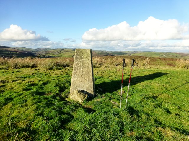
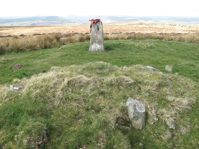
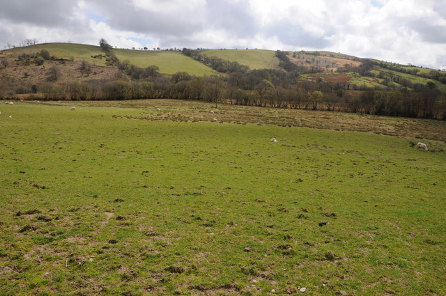
Banc Beili-Tew, located in Carmarthenshire, Wales, is a prominent hill/mountain that stands at an approximate height of 231 meters (758 feet) above sea level. It is situated within the Brechfa Forest, which is renowned for its picturesque landscapes and rich biodiversity.

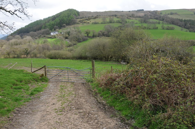
The hill/mountain forms part of the Brechfa Forest Range and offers breathtaking views of the surrounding countryside. Its summit is accessible via well-marked footpaths, making it a popular destination for hikers, walkers, and nature enthusiasts. The terrain consists of rolling hills, lush green meadows, and dense woodlands, adding to the area's charm.

Banc Beili-Tew is known for its diverse flora and fauna, with a variety of plant species that thrive in the area's mild climate. The hill/mountain is home to a range of wildlife, including numerous bird species, small mammals, and insects.

Visitors to Banc Beili-Tew can enjoy a range of outdoor activities, such as hiking, birdwatching, and photography. The hill/mountain offers a tranquil and serene environment, providing an escape from the hustle and bustle of daily life.

Overall, Banc Beili-Tew in Carmarthenshire is a scenic and serene hill/mountain that attracts outdoor enthusiasts and nature lovers alike. Its beautiful landscapes, abundant wildlife, and accessibility make it a must-visit destination for anyone seeking a peaceful retreat in the heart of nature.

If you have any feedback on the listing, please let us know in the comments section below.

Banc Beili-Tew Images

Images are sourced within 2km of 51.992734/-4.0170886 or Grid Reference SN6134. Thanks to Geograph Open Source API. All images are credited.

Banc Beili-Tew Started from track opposite Chapel Cemetery. Then grass - last 300-400m bracken but ways through and sheep grazing.

Name:Banc Beili-Tew
Hill number:5243
Height:278m / 912ft
Area:31C: South-West Wales
Class:Hu
Grid ref:SN 61606 34625
Summit feature:trig point: OS measurement
Drop:120m
Col:158m SN601350
Banc Beili-Tew
Started from track opposite Chapel Cemetery. Then grass - last 300-400m bracken but ways through and sheep grazing. Name:Banc Beili-Tew Hill number:5243 Height:278m / 912ft Area:31C: South-West Wales Class:Hu Grid ref:SN 61606 34625 Summit feature:trig point: OS measurement Drop:120m Col:158m SN601350
Shiloh Welsh CM Chapel, Lampeter Started from track opposite Chapel Cemetery for HuMP Beili-Tewthen, down farm track, turn left passed farm house and along track, then over bridge and the rest is easy.

Shiloh Welsh CM chapel, Lampeter            SN5747448169        Started 1743; chapel built 1775, rebuilt 1806 & 1874, modified 1892; school & vestry added early C20th.   Members; 158 in 1902     Still in use 1998    
Seats 400   1910
Shiloh Welsh CM Chapel, Lampeter
Started from track opposite Chapel Cemetery for HuMP Beili-Tewthen, down farm track, turn left passed farm house and along track, then over bridge and the rest is easy. Shiloh Welsh CM chapel, Lampeter SN5747448169 Started 1743; chapel built 1775, rebuilt 1806 & 1874, modified 1892; school & vestry added early C20th. Members; 158 in 1902 Still in use 1998 Seats 400 1910
Mynydd Cynros Parked at Cilyllynfawr Farm and used right of way to reach the plantationon the east of the hill. Still dry and sunny for Mother's Day.
Name: Mynydd Cynros
Hill number: 2219
Height: 329m / 1079ft
Area: 31C: South-West Wales
Class: Ma
Grid ref: SN 62059 32690
Summit feature: ground within 3m of trig point
Drop: 221m
Col: 108m  SN633328
Mynydd Cynros
Parked at Cilyllynfawr Farm and used right of way to reach the plantationon the east of the hill. Still dry and sunny for Mother's Day. Name: Mynydd Cynros Hill number: 2219 Height: 329m / 1079ft Area: 31C: South-West Wales Class: Ma Grid ref: SN 62059 32690 Summit feature: ground within 3m of trig point Drop: 221m Col: 108m SN633328
View to Pen-y-gareg View across the valley to Pen-y-gareg near Talley.
View to Pen-y-gareg
View across the valley to Pen-y-gareg near Talley.
Valley near Talley View down the valley to the north of Talley.
Valley near Talley
View down the valley to the north of Talley.
Country road near Talley Country road off the B4302 to the north of Talley, this road contours round this valley with a no through road branching off to the west.
Country road near Talley
Country road off the B4302 to the north of Talley, this road contours round this valley with a no through road branching off to the west.
Afon Cothi Afon Cothi viewed from the bridge carrying the B4337 at Edwinsford.
Afon Cothi
Afon Cothi viewed from the bridge carrying the B4337 at Edwinsford.
Farmland in the Cothi valley Farmland in the Cothi valley near Edwinsford.
Farmland in the Cothi valley
Farmland in the Cothi valley near Edwinsford.
The B4337 to Llanswel The B4337 between Edwinsford and Llanswel.
The B4337 to Llanswel
The B4337 between Edwinsford and Llanswel.
Drive to Tyncwm Entrance and driveway to Tyncwm near Edwinsford.
Drive to Tyncwm
Entrance and driveway to Tyncwm near Edwinsford.
Pen y Ddinas Pen y Ddinas is marked on the map as a disused quarry but its profile has the appearance of a hill fort.
Pen y Ddinas
Pen y Ddinas is marked on the map as a disused quarry but its profile has the appearance of a hill fort.
View to Llethr-llwyd View to Llethr-llwyd to the south of Llansawel.
View to Llethr-llwyd
View to Llethr-llwyd to the south of Llansawel.
Llansawel church The tower of St Sawyl's Church, Llansawel.
Llansawel church
The tower of St Sawyl's Church, Llansawel.
Llansawel church St Sawyl's Church, Llansawel viewed from the south-east.
Llansawel church
St Sawyl's Church, Llansawel viewed from the south-east.
The village of Llansawel House on the road into Llansawel.
The village of Llansawel
House on the road into Llansawel.
Angel Inn, Llansawel The Angel Inn in Llansawel is a traditional village pub.
Angel Inn, Llansawel
The Angel Inn in Llansawel is a traditional village pub.
Black Lion Hotel, Llansawel The Black Lion Hotel in the village of Llansawel.
Black Lion Hotel, Llansawel
The Black Lion Hotel in the village of Llansawel.
Llansawel Houses in the village of Llansawel.
Llansawel
Houses in the village of Llansawel.
Show me another place!

Banc Beili-Tew is located at Grid Ref: SN6134 (Lat: 51.992734, Lng: -4.0170886)

Unitary Authority: Carmarthenshire

Police Authority: Dyfed Powys

What 3 Words

///madness.mentioned.garlic. Near Llansawel, Carmarthenshire

Related Wikis

Edwinsford

Edwinsford is a small hamlet situated about the historic Edwinsford Estate and fishery on the river Cothi, a tributary of the River Tywi, in Carmarthenshire...

Llansawel

Llansawel is a village and community in Carmarthenshire, Wales, about ten miles north of Llandeilo. It covers an area of 4,079 hectares (15.75 sq mi)....

Talley Lakes

Upper Talley Lake (Welsh: Llyn Talyllychau Uchaf) and Lower Talley Lake (Welsh: Llyn Talyllychau Isaf) are two small lakes immediately north of the village...

Llansawel transmitting station

The Llansawel television relay station is sited on high ground to the north of the village of Llansawel in Carmarthenshire, South Wales. It was originally...
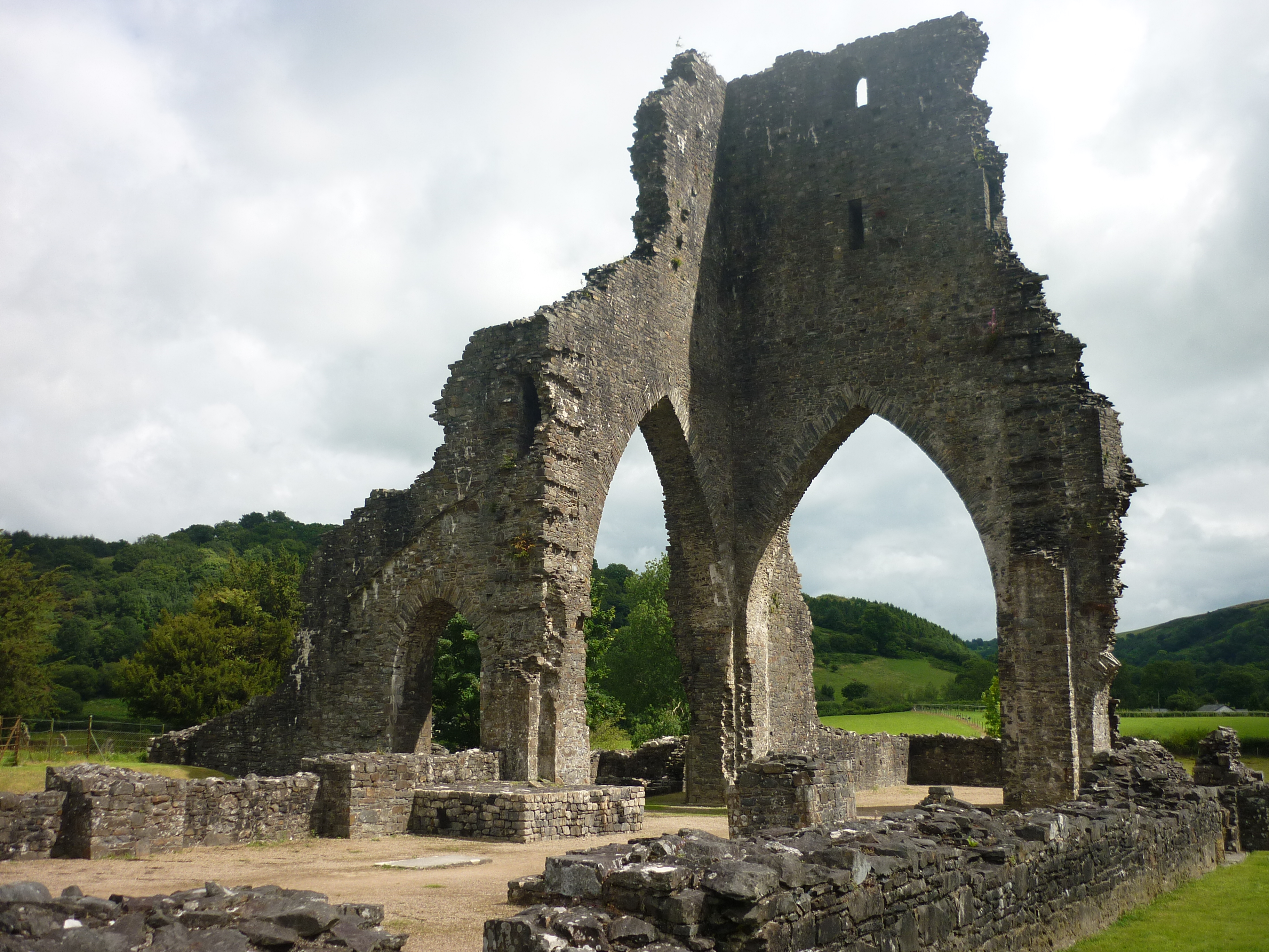
Talley Abbey

Talley Abbey (Welsh: Abaty Talyllychau) is a ruined former monastery of the Premonstratensians ("White Canons") in the village of Talley in Carmarthenshire...

Talley

Talley (Welsh: Talyllychau, historically Tal y Llychau) is a village and community in Carmarthenshire, Wales.The population taken at the 2011 census was...

Talley transmitting station

The Talley television relay station is sited on high ground to the north of the village of Talley in Carmarthenshire. It was originally built in 1986 as...

Afon Annell

Afon Annell (River Annell) is a small river in Carmarthenshire, Wales. It is a tributary of the Afon Cothi.Some of the waters of the Annell were previously...

Have you been to Banc Beili-Tew?

Leave your review of Banc Beili-Tew below (or comments, questions and feedback).