Dechrode

Hill, Mountain in Stirlingshire

Scotland

Dechrode

Gate above Balglass Gateway on the Campsie Fells, below the wide open spaces of rough grazing that make up this square.
Gate above Balglass Credit: Richard Webb

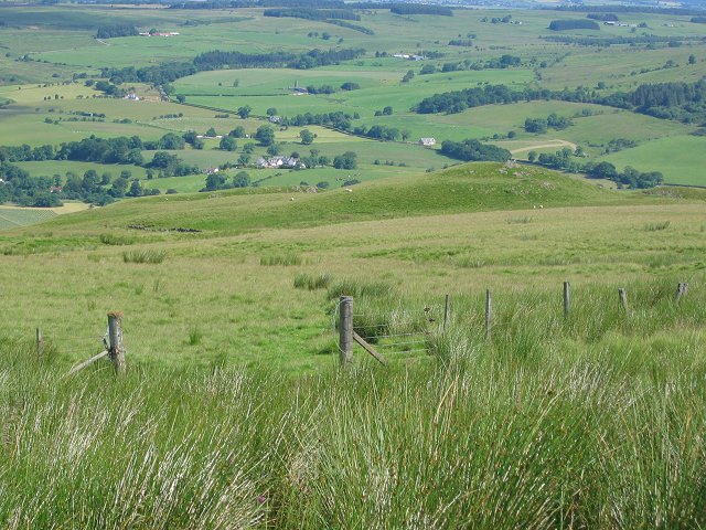
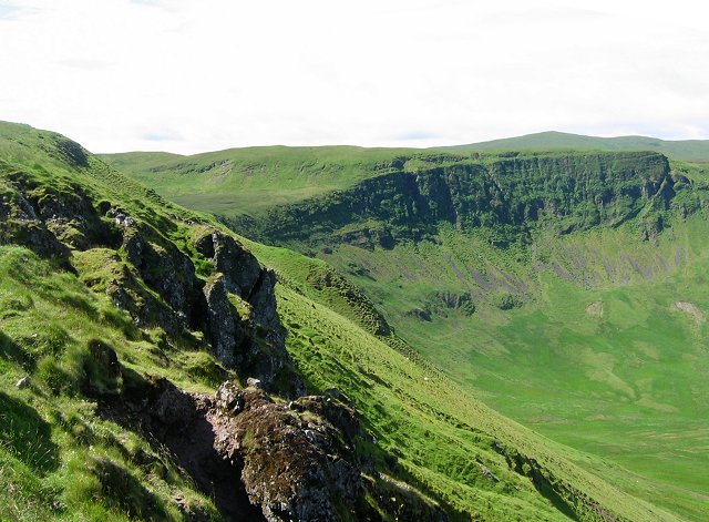
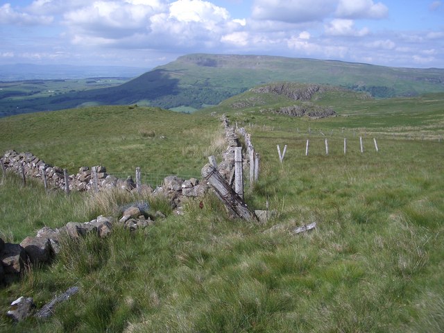
Dechrode is a prominent hill located in Stirlingshire, Scotland. It is situated approximately 5 miles northwest of the town of Callander and stands at an impressive height of 1,684 feet (513 meters). The hill is part of the southern extension of the Grampian Mountains, which are renowned for their scenic beauty and rugged landscapes.

Dechrode is characterized by its distinctive conical shape and is a popular destination for hikers and outdoor enthusiasts. The ascent to the summit can be challenging but offers rewarding panoramic views of the surrounding countryside. On a clear day, visitors can glimpse the magnificent peaks of Ben Lomond and Ben Ledi to the west, as well as the picturesque Trossachs National Park to the east.

The hill is covered in heather and grasses, providing a vibrant and diverse habitat for wildlife. It is not uncommon to encounter various species of birds, including buzzards and kestrels, soaring overhead. Additionally, Dechrode is home to several small mammals, such as hares and rabbits, which can often be spotted darting through the undergrowth.

Dechrode is easily accessible from nearby towns and villages, with well-marked paths leading to its summit. The hill offers a peaceful and tranquil setting, making it an ideal location for nature lovers and those seeking a break from the hustle and bustle of everyday life. Whether it's for a challenging hike or simply a leisurely stroll, Dechrode promises an unforgettable experience for all who venture to its peak.

If you have any feedback on the listing, please let us know in the comments section below.

Dechrode Images

Images are sourced within 2km of 56.042177/-4.2336257 or Grid Reference NS6085. Thanks to Geograph Open Source API. All images are credited.

Gate above Balglass Gateway on the Campsie Fells, below the wide open spaces of rough grazing that make up this square.
Gate above Balglass
Gateway on the Campsie Fells, below the wide open spaces of rough grazing that make up this square.
Coire of Balglass The Campsie Fell's big attraction - only I doubt many come here. A big bowl with exposed trap crags. The crags are heavily vegetated.
Coire of Balglass
The Campsie Fell's big attraction - only I doubt many come here. A big bowl with exposed trap crags. The crags are heavily vegetated.
Walls and fences Crumbling dry stone walls have been replaced by fences which are now showing their age.
A view to Dunmore and Stronend.
Walls and fences
Crumbling dry stone walls have been replaced by fences which are now showing their age. A view to Dunmore and Stronend.
Crag, Corrie of Balglass Distinctive crag on the eastern side of the Corrie of Balglass.
Crag, Corrie of Balglass
Distinctive crag on the eastern side of the Corrie of Balglass.
Corrie of Balglass A view from near the highpoint on the eastern side of the Corrie.
Corrie of Balglass
A view from near the highpoint on the eastern side of the Corrie.
Fintry Youth Hostel by Endrick Water, Stirling North of the Campsie Fells, this was one of Scotland's earliest hostels, opening in 1935. It was popular with weekenders from Glasgow. The hostel closed in 1981 being by then structurally unsound, and was demolished. (Details from John Martin)

Scanned from an Agfa colour slide, circa mid 1970s in August. It may not be 1975.
Fintry Youth Hostel by Endrick Water, Stirling
North of the Campsie Fells, this was one of Scotland's earliest hostels, opening in 1935. It was popular with weekenders from Glasgow. The hostel closed in 1981 being by then structurally unsound, and was demolished. (Details from John Martin) Scanned from an Agfa colour slide, circa mid 1970s in August. It may not be 1975.
Driveway, Knockraich Knockraich is home to a very good cafe.
Driveway, Knockraich
Knockraich is home to a very good cafe.
Fintry Kirk Photo taken circa 1990 (Fuji Velvia 35mm film)
Fintry Kirk
Photo taken circa 1990 (Fuji Velvia 35mm film)
The Campsie Fells and Loch Lomond from the air Balfron can be seen on the right.
The Campsie Fells and Loch Lomond from the air
Balfron can be seen on the right.
Crags and scree in the Corrie of Balglass Descending slightly from the rim of the corrie gives a good view which contrasts the rocky corrie with the low farmlands in Strath Endrick. Some of the hills of the southern Highlands can be seen in the distance.
Crags and scree in the Corrie of Balglass
Descending slightly from the rim of the corrie gives a good view which contrasts the rocky corrie with the low farmlands in Strath Endrick. Some of the hills of the southern Highlands can be seen in the distance.
Looking into Corrie of Balglass From just below the corrie rim.
Looking into Corrie of Balglass
From just below the corrie rim.
Drystane dyke in the Corrie of Balglass The farm of Head of Balglass lies beyond.
Drystane dyke in the Corrie of Balglass
The farm of Head of Balglass lies beyond.
Scree on the hillside, Corrie of Balglass The corrie offers more varied scenery than is typical for the Campsie Fells, which are largely high moorland plateaux.
Scree on the hillside, Corrie of Balglass
The corrie offers more varied scenery than is typical for the Campsie Fells, which are largely high moorland plateaux.
Bogside under Skiddaw Flat land in Strathendrick contrasts with the trap hills  of the Fintry-Gargunnock hills.  Skiddaw is the profile of one of the horizontal lava beds.
Bogside under Skiddaw
Flat land in Strathendrick contrasts with the trap hills of the Fintry-Gargunnock hills. Skiddaw is the profile of one of the horizontal lava beds.
Fintry Westward along Main Street.  Unusually there was some evidence of jubilee celebrations here.
Fintry
Westward along Main Street. Unusually there was some evidence of jubilee celebrations here.
Farmland in Strathendrick Flat grassland west of Fintry.
Farmland in Strathendrick
Flat grassland west of Fintry.
Glenboig Wood Birch woods near Fintry. Birch woods without very old trees are often former farmland.
Glenboig Wood
Birch woods near Fintry. Birch woods without very old trees are often former farmland.
Fintry Road Junction Looking along the B822, the Crow Road from Lennoxtown towards the junction where the B822 continues to the right to Kippen and the B818 leads straight on to Killearn and Balfron.
Fintry Road Junction
Looking along the B822, the Crow Road from Lennoxtown towards the junction where the B822 continues to the right to Kippen and the B818 leads straight on to Killearn and Balfron.
Show me another place!

Dechrode is located at Grid Ref: NS6085 (Lat: 56.042177, Lng: -4.2336257)

Unitary Authority: Stirling

Police Authority: Forth Valley

What 3 Words

///harmless.puncture.scarves. Near Balfron, Stirling

Nearby Locations

Dechrode Monach Moss

Related Wikis

Fintry

Fintry is a small riverside village in Stirlingshire, central Scotland. It is located 16 miles (26 km) south-west of Stirling and around 19 miles (31 km...
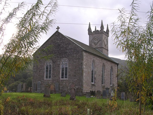
Fintry Kirk

Fintry Kirk is in the village of Fintry in Stirlingshire, Scotland. Fintry is a Church of Scotland Parish in the Presbytery of Stirling. The kirk is located...

Culcreuch Castle

Culcreuch Castle is a Scottish castle close to the village of Fintry, near Loch Lomond. It had been the home of the Barons of Culcreuch since 1699. In...

Campsie, East Dunbartonshire

Campsie is a civil parish in East Dunbartonshire, Scotland. The parish was formerly part of Stirlingshire. == Settlements == Auchenreoch Clachan of Campsie...

Have you been to Dechrode?

Leave your review of Dechrode below (or comments, questions and feedback).