Flat Tor

Hill, Mountain in Devon West Devon

England

Flat Tor

Cut Hill prehistoric stone row A single prehistoric stone row measuring at least 215m long, including 9 recumbent large-sized stones situated at the summit of Cut Hill.  A hilltop location is unusual for a stone row. The row is orientated north east to south west and is associated with a possible barrow. <span class="nowrap"><a title="https://stonerows.wordpress.com/gazetteer/region/dartmoor/cut-hill/" rel="nofollow ugc noopener" href="https://stonerows.wordpress.com/gazetteer/region/dartmoor/cut-hill/">Link</a><img style="margin-left:2px;" alt="External link" title="External link - shift click to open in new window" src="https://s1.geograph.org.uk/img/external.png" width="10" height="10"/></span>
Cut Hill prehistoric stone row Credit: Sandy Gerrard

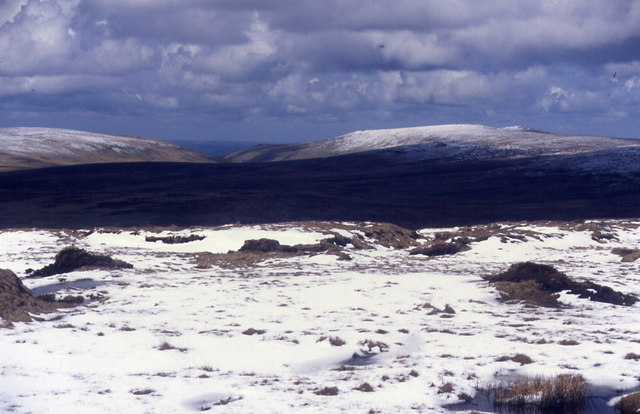
Flat Tor is a prominent hill located in the county of Devon, England. Situated in the Dartmoor National Park, it forms part of a picturesque landscape that is renowned for its natural beauty and diverse wildlife. Despite its name, Flat Tor is not entirely flat but rather displays a gently rounded summit, offering visitors stunning panoramic views of the surrounding moorland.

Standing at an elevation of approximately 398 meters (1,306 feet), Flat Tor attracts hikers, nature enthusiasts, and photographers alike. Its accessibility and moderate difficulty level make it a popular destination for outdoor activities. The hill features a well-defined footpath that leads to the summit, ensuring a pleasant and safe trek for visitors.

The vegetation on Flat Tor mainly consists of grasses, heather, and gorse, interspersed with granite outcrops that add to its rugged charm. The area is home to a variety of bird species, including the iconic Dartford warbler, as well as other wildlife such as deer and ponies, which can often be spotted grazing on the lower slopes.

Flat Tor offers a sense of tranquility and solitude, providing an ideal escape from the hustle and bustle of daily life. The hill's natural beauty, combined with its historical significance, attracts visitors seeking a deeper connection with nature and a glimpse into the region's past.

In summary, Flat Tor is a beautiful hill in Devon's Dartmoor National Park, offering breathtaking views, varied flora and fauna, and a peaceful retreat for those seeking solace in nature.

If you have any feedback on the listing, please let us know in the comments section below.
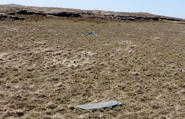
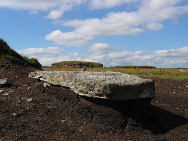
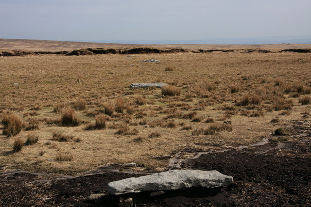
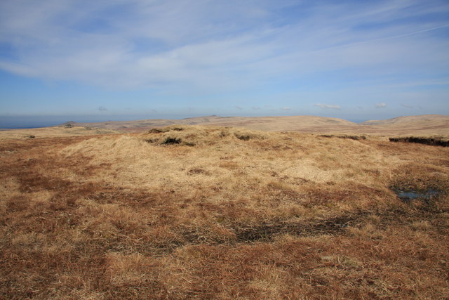
Flat Tor Images

Images are sourced within 2km of 50.617023/-3.9677602 or Grid Reference SX6081. Thanks to Geograph Open Source API. All images are credited.

Cut Hill prehistoric stone row A single prehistoric stone row measuring at least 215m long, including 9 recumbent large-sized stones situated at the summit of Cut Hill.  A hilltop location is unusual for a stone row. The row is orientated north east to south west and is associated with a possible barrow. <span class="nowrap"><a title="https://stonerows.wordpress.com/gazetteer/region/dartmoor/cut-hill/" rel="nofollow ugc noopener" href="https://stonerows.wordpress.com/gazetteer/region/dartmoor/cut-hill/">Link</a><img style="margin-left:2px;" alt="External link" title="External link - shift click to open in new window" src="https://s1.geograph.org.uk/img/external.png" width="10" height="10"/></span>
Cut Hill prehistoric stone row
A single prehistoric stone row measuring at least 215m long, including 9 recumbent large-sized stones situated at the summit of Cut Hill. A hilltop location is unusual for a stone row. The row is orientated north east to south west and is associated with a possible barrow. LinkExternal link
Cut Hill Cut Hill is in North Dartmoor. It is one of the most isolated places of Dartmoor. The panoramic views from the summit are among the best that Dartmoor offers. Cut Hill is largely surrounded by wet and tussocky ground. The high fen is not far away. The word Cut derives from an old drovers' track - Cut Lane - which cuts through the fen that separates the Dart and Tavy valleys and thus allowed the more easy passage of livestock across the moor.
Cut Hill
Cut Hill is in North Dartmoor. It is one of the most isolated places of Dartmoor. The panoramic views from the summit are among the best that Dartmoor offers. Cut Hill is largely surrounded by wet and tussocky ground. The high fen is not far away. The word Cut derives from an old drovers' track - Cut Lane - which cuts through the fen that separates the Dart and Tavy valleys and thus allowed the more easy passage of livestock across the moor.
Rainbow near Tavy Head An odd picture of a rainbow's end. This is a very isolated and windswept part of Dartmoor where strange things can happen!
Rainbow near Tavy Head
An odd picture of a rainbow's end. This is a very isolated and windswept part of Dartmoor where strange things can happen!
Cowsic Head - Dartmoor A small peat hag above Cowsic Head. Great Mis Tor on the horizon.
Cowsic Head - Dartmoor
A small peat hag above Cowsic Head. Great Mis Tor on the horizon.
Commemorative Stone - NW Passage There are more than one of these stones with the same inscription. Strangely they are sited close together.  NW passage is cut into the peat south of Cut Hill.
Commemorative Stone - NW Passage
There are more than one of these stones with the same inscription. Strangely they are sited close together. NW passage is cut into the peat south of Cut Hill.
Cut Hill Here is the roof of Dartmoor, from the top you can see right all across Dartmoor. Here are the peat cuts which make cut hill
Cut Hill
Here is the roof of Dartmoor, from the top you can see right all across Dartmoor. Here are the peat cuts which make cut hill
Granite "Erratic" Stone Row Here is the roof of Dartmoor, from the top you can see right all across Dartmoor. In the picture is a piece of granite probably Megalithic in age and is in a series of stones running along the top of this hill. This row is unique within dartmoor as it the only one with equal spacing within the row and above 600m, 100m above any other row in Dartmoor. The peat has washed away from around the stone but not from underneath, meaning the granite sticks out above the ground.
<span class="nowrap"><a title="http://www.megalithic.co.uk/article.php?sid=2146411899" rel="nofollow ugc noopener" href="http://www.megalithic.co.uk/article.php?sid=2146411899">Link</a><img style="margin-left:2px;" alt="External link" title="External link - shift click to open in new window" src="https://s1.geograph.org.uk/img/external.png" width="10" height="10"/></span>
Thanks to Murray for the website
Granite "Erratic" Stone Row
Here is the roof of Dartmoor, from the top you can see right all across Dartmoor. In the picture is a piece of granite probably Megalithic in age and is in a series of stones running along the top of this hill. This row is unique within dartmoor as it the only one with equal spacing within the row and above 600m, 100m above any other row in Dartmoor. The peat has washed away from around the stone but not from underneath, meaning the granite sticks out above the ground. LinkExternal link Thanks to Murray for the website
Cut Hill Here is the roof of Dartmoor, from the top you can see right all across Dartmoor, it is also estimated that here is the highest concentration of letterboxes, plugged into the sides of the cut.
Cut Hill
Here is the roof of Dartmoor, from the top you can see right all across Dartmoor, it is also estimated that here is the highest concentration of letterboxes, plugged into the sides of the cut.
Standing stone north of Cut Hill This stone, which appears to be unmarked, stands out in an otherwise bleak landscape.
Standing stone north of Cut Hill
This stone, which appears to be unmarked, stands out in an otherwise bleak landscape.
Remains of tinner's hut Marked on the OS 1:25000 map but almost unrecognisable on the ground.
Remains of tinner's hut
Marked on the OS 1:25000 map but almost unrecognisable on the ground.
Towards Tavy Head Looking north towards the source of the Tavy.
Towards Tavy Head
Looking north towards the source of the Tavy.
Stone Row Cut Hill Looking north-east along the recumbent stones; for information see <a href="https://www.geograph.org.uk/photo/778080">SX5982 : Granite "Erratic" Stone Row</a>.
Stone Row Cut Hill
Looking north-east along the recumbent stones; for information see SX5982 : Granite "Erratic" Stone Row.
Cut Hill 603 metres The summit of Cut Hill, the highest bit left by the peat cutters.
Cut Hill 603 metres
The summit of Cut Hill, the highest bit left by the peat cutters.
River Tavy About one kilometre below Tavy Head.
River Tavy
About one kilometre below Tavy Head.
Spot height 563 Looking northwards across featureless peat moorland, Fur Tor is just visible on the horizon.
Spot height 563
Looking northwards across featureless peat moorland, Fur Tor is just visible on the horizon.
Cowsic Head The source of the River Cowsic, after a period of dry weather.
Cowsic Head
The source of the River Cowsic, after a period of dry weather.
Cut Hill High Willhays and Yes Tor in far distance
Cut Hill
High Willhays and Yes Tor in far distance
Slumping on Broad Down I ought to know what causes this, but I don't.  It is where the peat appears to have slumped, probably by water erosion underneath, causing a lip and a bare area below which is wet probably due to it now being flatter than the surrounding area and therefore not draining.  Someone correct me please.
The good news is that the feature is easy to find on Where's the path.
Slumping on Broad Down
I ought to know what causes this, but I don't. It is where the peat appears to have slumped, probably by water erosion underneath, causing a lip and a bare area below which is wet probably due to it now being flatter than the surrounding area and therefore not draining. Someone correct me please. The good news is that the feature is easy to find on Where's the path.
Show me another place!

Flat Tor is located at Grid Ref: SX6081 (Lat: 50.617023, Lng: -3.9677602)

Administrative County: Devon

District: West Devon

Police Authority: Devon and Cornwall

What 3 Words

///leaned.tinny.meant. Near Princetown, Devon

Nearby Locations

Flat Tor

Related Wikis

Dartmoor Forest

Dartmoor Forest is a civil parish in Devon, England. It was formed in 1987 by the splitting of the former parish of Lydford. It covers about 56,000 acres...

Roman Catholic Diocese of Plymouth

The Diocese of Plymouth(Latin: Dioecesis Plymuthensis) is a Latin Church diocese of the Catholic Church in England. The episcopal see is in the city of...
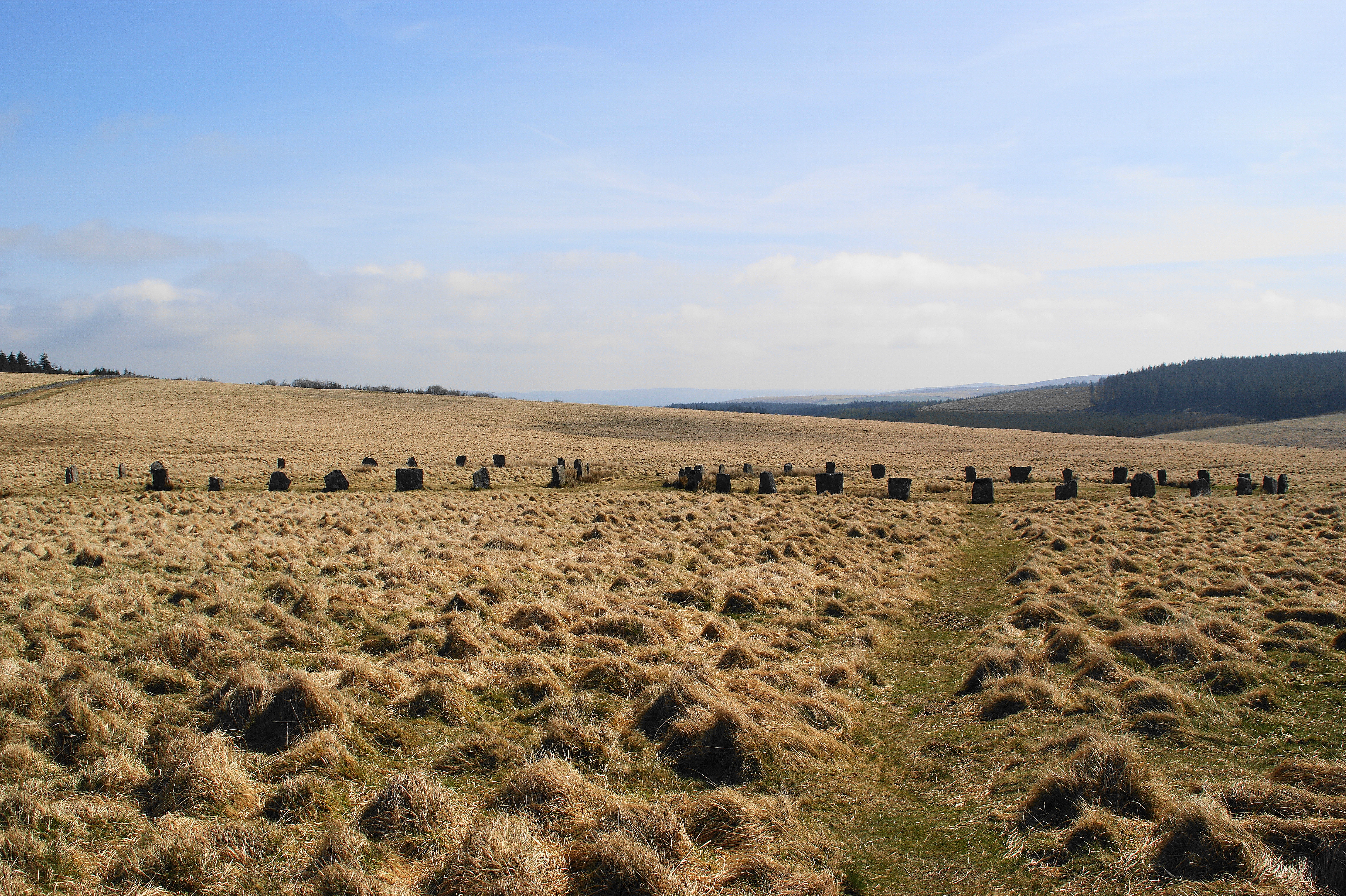
Grey Wethers

Grey Wethers consists of a pair of prehistoric stone circles, situated on grassy plateau to the north of Postbridge, Dartmoor, in the United Kingdom....

Devonport Leat

The Devonport Leat is a leat in Devon constructed in the 1790s to carry fresh drinking water from the high ground of Dartmoor to the expanding dockyards...

Nearby Amenities

Located within 500m of 50.617023,-3.9677602
Flat Tor
Ele: 540
Natural: peak
Lat/Long: 50.616848/-3.9674335
Sea Vixen Crash Site
Aircraft Type: military
Historic: aircraft
Note: An RN Sea Vixen crashed here with no casualties (the explosion dug the pond at this location) in 1965. Some of the wreckage including part of the main undercarriage is visible in the water. Not sure if correctly tagged though.
Ruins: yes
Website: http://www.davebellamy.co.uk/index.php?MF=Views/photo.php?Ref=26127981314225
Lat/Long: 50.6147729/-3.9622404
Range Notice Board
Information: board
Operator: Ministry of Defence
Tourism: information
Lat/Long: 50.6174057/-3.9669014
The data included in this document is from www.openstreetmap.org. The data is made available under ODbL.

Have you been to Flat Tor?

Leave your review of Flat Tor below (or comments, questions and feedback).