Loudoun Hill

Hill, Mountain in Ayrshire

Scotland

Loudoun Hill

Loudoun Hill summit and triangulation pillar The summit of Loudoun Hill (316m) offers a fine view over this part of East Ayrshire.  Darvel can be noted in the distance.

This photograph was taken during the Coronavirus (COVID-19) pandemic of 2020/21/22.
Loudoun Hill summit and triangulation pillar Credit: James T M Towill

The requested URL returned error: 429 Too Many Requests

If you have any feedback on the listing, please let us know in the comments section below.
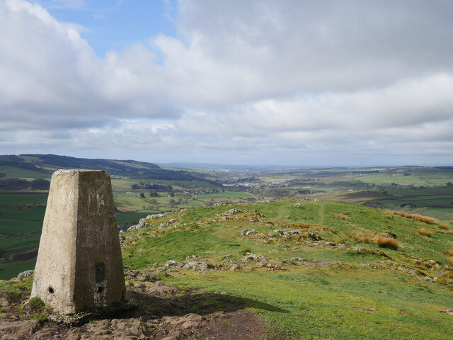
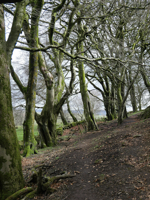
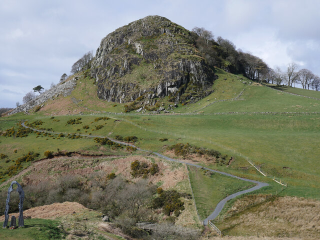
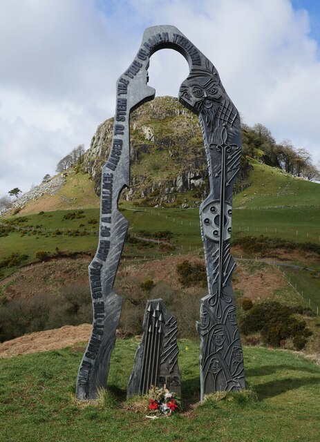
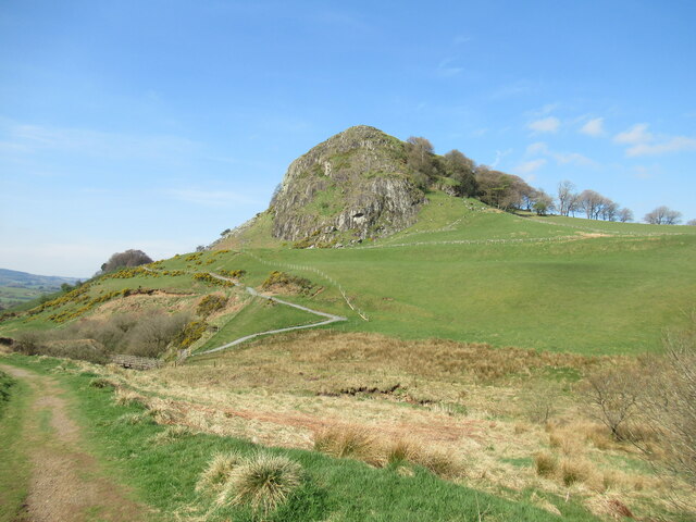
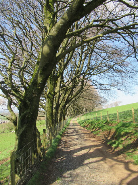
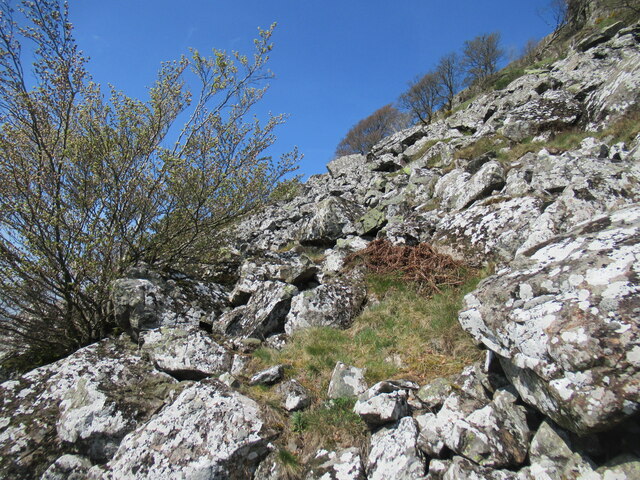
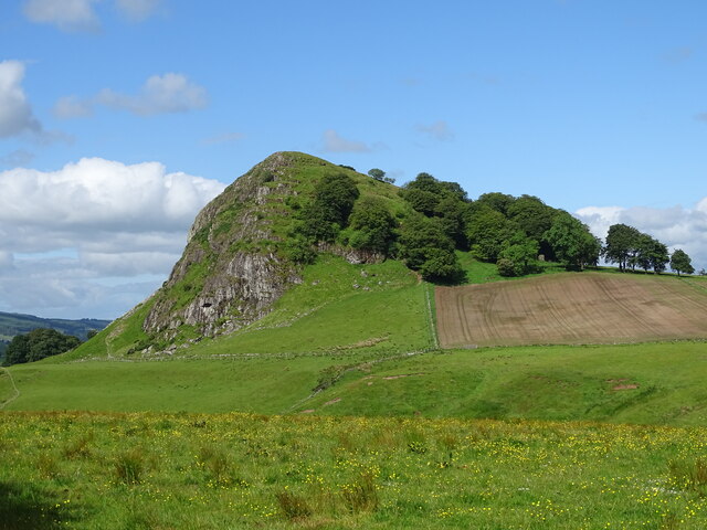
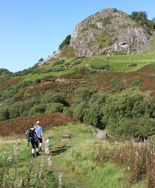
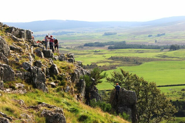
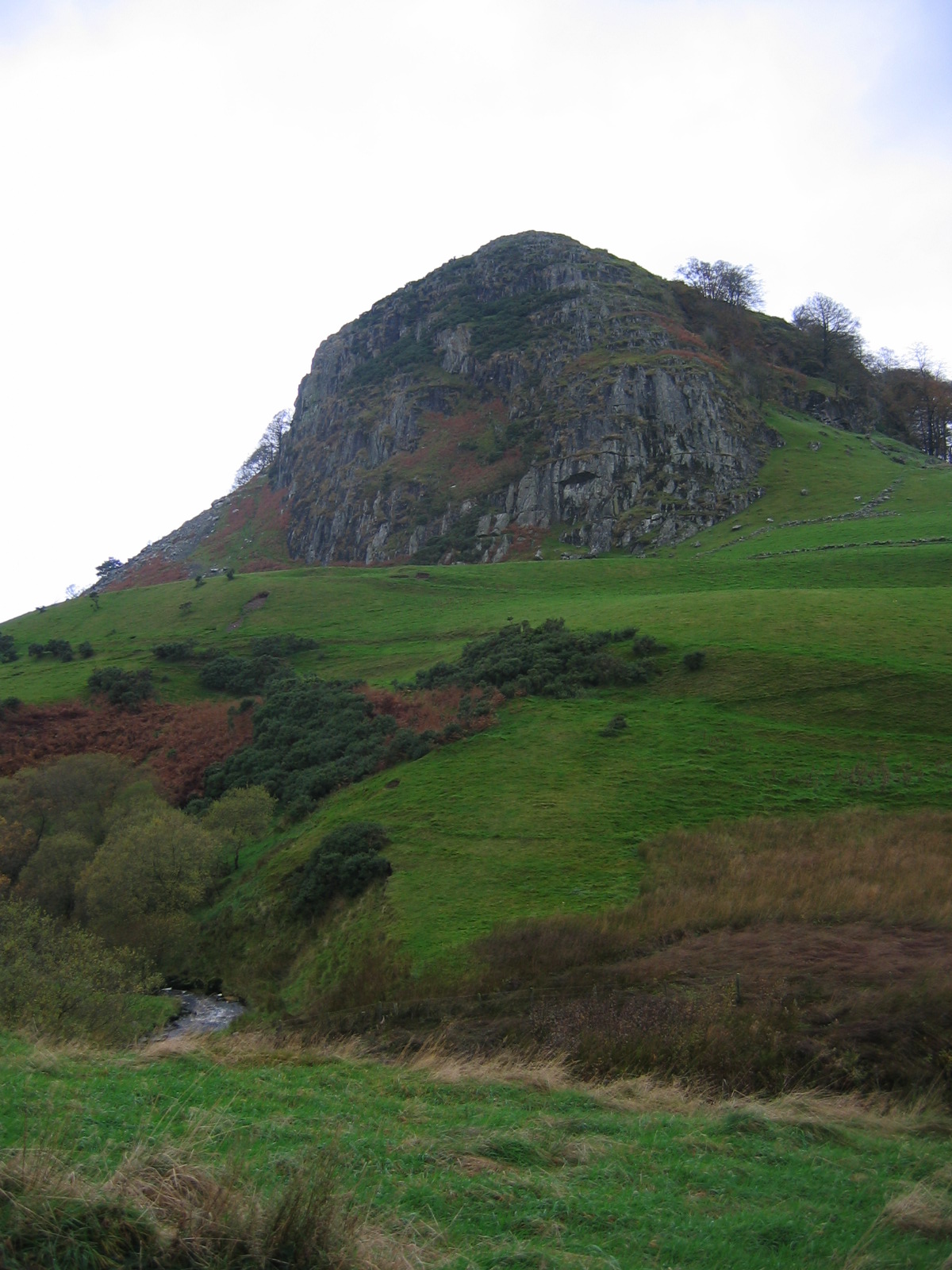
Loudoun Hill Images

Images are sourced within 2km of 55.61498/-4.2106141 or Grid Reference NS6037. Thanks to Geograph Open Source API. All images are credited.

Loudoun Hill summit and triangulation pillar The summit of Loudoun Hill (316m) offers a fine view over this part of East Ayrshire.  Darvel can be noted in the distance.

This photograph was taken during the Coronavirus (COVID-19) pandemic of 2020/21/22.
Loudoun Hill summit and triangulation pillar
The summit of Loudoun Hill (316m) offers a fine view over this part of East Ayrshire. Darvel can be noted in the distance. This photograph was taken during the Coronavirus (COVID-19) pandemic of 2020/21/22.
A muddy track through the woods at Loudoun Hill Beech woodland on the northern slopes of Loudoun Hill.

This photograph was taken during the Coronavirus (COVID-19) pandemic of 2020/21/22.
A muddy track through the woods at Loudoun Hill
Beech woodland on the northern slopes of Loudoun Hill. This photograph was taken during the Coronavirus (COVID-19) pandemic of 2020/21/22.
Spirit of Scotland sculpture, a crossing of the River Irvine and Loudoun Hill Plenty of interest in this far east corner of East Ayrshire.  The footbridge crossing the River Irvine is at the bottom middle of shot.

This photograph was taken during the Coronavirus (COVID-19) pandemic of 2020/21/22.
Spirit of Scotland sculpture, a crossing of the River Irvine and Loudoun Hill
Plenty of interest in this far east corner of East Ayrshire. The footbridge crossing the River Irvine is at the bottom middle of shot. This photograph was taken during the Coronavirus (COVID-19) pandemic of 2020/21/22.
Spirit of Scotland sculpture Created by sculptor Richard Price, the artwork was unveiled in 2004.  The sculpture is seen here with Loudoun Hill in the background on a showery April morning.  See <span class="nowrap"><a title="http://news.bbc.co.uk/1/hi/scotland/3660918.stm" rel="nofollow ugc noopener" href="http://news.bbc.co.uk/1/hi/scotland/3660918.stm">Link</a><img style="margin-left:2px;" alt="External link" title="External link - shift click to open in new window" src="https://s1.geograph.org.uk/img/external.png" width="10" height="10"/></span> for further information.

This photograph was taken during the Coronavirus (COVID-19) pandemic of 2020/21/22.
Spirit of Scotland sculpture
Created by sculptor Richard Price, the artwork was unveiled in 2004. The sculpture is seen here with Loudoun Hill in the background on a showery April morning. See LinkExternal link for further information. This photograph was taken during the Coronavirus (COVID-19) pandemic of 2020/21/22.
Remains of farm buildings at Roughhazie The name of this long-abandoned farm seems to bear a resemblance to Ruchazie, a district of north-east Glasgow.
Remains of farm buildings at Roughhazie
The name of this long-abandoned farm seems to bear a resemblance to Ruchazie, a district of north-east Glasgow.
Rocks by abandoned farm buildings at Roughhazie The steep volcanic plug of Loudoun Hill is visible in the background.
Rocks by abandoned farm buildings at Roughhazie
The steep volcanic plug of Loudoun Hill is visible in the background.
Ruined farm building at Roughhazie The interior of a once quite substantial building, with fireplace and doorways visible.

The name of this long-abandoned farm seems to bear a resemblance to Ruchazie, a district of north-east Glasgow.
Ruined farm building at Roughhazie
The interior of a once quite substantial building, with fireplace and doorways visible. The name of this long-abandoned farm seems to bear a resemblance to Ruchazie, a district of north-east Glasgow.
Ruined farm building at Roughhazie The name of this long-abandoned farm seems to bear a resemblance to Ruchazie, a district of north-east Glasgow.
Ruined farm building at Roughhazie
The name of this long-abandoned farm seems to bear a resemblance to Ruchazie, a district of north-east Glasgow.
Ruined farmhouse at Roughhazie The name of this long-abandoned farm seems to bear a resemblance to Ruchazie, a district of north-east Glasgow.
Ruined farmhouse at Roughhazie
The name of this long-abandoned farm seems to bear a resemblance to Ruchazie, a district of north-east Glasgow.
View across pasture near Drumboy Some of the turbines of the massive Whitelee Wind Farm can be seen in the distance.

There were some sheep grazing here, but none made it into this shot. Curlews could be heard calling from somewhere nearby.
View across pasture near Drumboy
Some of the turbines of the massive Whitelee Wind Farm can be seen in the distance. There were some sheep grazing here, but none made it into this shot. Curlews could be heard calling from somewhere nearby.
Loudoun Hill on a spring morning Loudoun Hill is a volcanic plug, visible for many miles as a landmark rising over the farmland close to where Ayrshire meets Lanarkshire.
Loudoun Hill on a spring morning
Loudoun Hill is a volcanic plug, visible for many miles as a landmark rising over the farmland close to where Ayrshire meets Lanarkshire.
Beech-lined track below Loudoun Hill Formerly the access road for Underhill, a now-ruined farm that lies right beneath the hill, behind the photographer here.
Beech-lined track below Loudoun Hill
Formerly the access road for Underhill, a now-ruined farm that lies right beneath the hill, behind the photographer here.
Lichen-covered boulders on Loudoun Hill A close-up view of the rock-strewn southern flank of the hill.
Lichen-covered boulders on Loudoun Hill
A close-up view of the rock-strewn southern flank of the hill.
Ruins of Mosside Limekilns The ruins of one of the kilns at Mosside.
This photo was taken on the 19th June 2022.
Ruins of Mosside Limekilns
The ruins of one of the kilns at Mosside. This photo was taken on the 19th June 2022.
Loudon Hill Loudon Hill from the east.
This photo was taken on the 19th June 2022.
Loudon Hill
Loudon Hill from the east. This photo was taken on the 19th June 2022.
Bridge on a minor country road This single-track road heads west from near Drumboy, eventually meeting the A71 near Priestland. Here we look along the road at a bridge over a burn, with Loudoun Hill prominent beyond.
Bridge on a minor country road
This single-track road heads west from near Drumboy, eventually meeting the A71 near Priestland. Here we look along the road at a bridge over a burn, with Loudoun Hill prominent beyond.
A wander up Loudoun Hill
Climbers on Loudoun Hill
Show me another place!

Loudoun Hill is located at Grid Ref: NS6037 (Lat: 55.61498, Lng: -4.2106141)

Unitary Authority: East Ayrshire

Police Authority: Ayrshire

What 3 Words

///factor.essays.synthetic. Near Darvel, East Ayrshire

Nearby Locations

Loudoun Hill

Related Wikis

Loudoun Hill

Loudoun Hill (Scottish Gaelic: Beinn Lùghdain; also commonly Loudounhill) is a volcanic plug in East Ayrshire, Scotland. It is located near the head of...

Battle of Loudoun Hill

The Battle of Loudoun Hill was fought on 10 May 1307, between a Scots force led by King Robert the Bruce and the English commanded by Aymer de Valence...

Loudounhill railway station

Loudounhill (NS 60268 37191) was a railway station on the Darvel and Strathaven Railway serving a rural area that included the landmark of Loudoun Hill...

Loch Gate

Loch Gate (NS 62389 37170), previously known as Loch Gait, was a freshwater loch, partly in the East Ayrshire Council Area and partly in South Lanarkshire...

Nearby Amenities

Located within 500m of 55.61498,-4.2106141
Loudoun Hill
Corbett: no
Donald: no
Ele: 316
Graham: no
Munro: no
Natural: peak
Source: survey/local
Wikidata: Q4588903
Wikipedia: en:Loudoun Hill
Lat/Long: 55.614746/-4.2105203
Parking
Lat/Long: 55.6182519/-4.2144843
Spirit of Scotland
Artist Name: Richard Price
Artwork Subject: William Wallace
Artwork Type: sculpture
Historic: memorial
Inscription: "Thou saw'st the strong arm of a Wallace raised to stem the tide of alien tyranny."
Lat/Long: 55.6137192/-4.2058625
Power: pole
Lat/Long: 55.6165648/-4.2178641
Bench
Backrest: yes
Lat/Long: 55.613884/-4.2041258
Bench
Backrest: no
Lat/Long: 55.6137877/-4.2045899
Bench
Lat/Long: 55.6137536/-4.2050603
Bench
Backrest: no
Lat/Long: 55.6137818/-4.2060941
Bench
Backrest: no
Lat/Long: 55.6139603/-4.2040292
The data included in this document is from www.openstreetmap.org. The data is made available under ODbL.

Have you been to Loudoun Hill?

Leave your review of Loudoun Hill below (or comments, questions and feedback).