Cnoc Fyrish
Hill, Mountain in Ross-shire
Scotland
Cnoc Fyrish

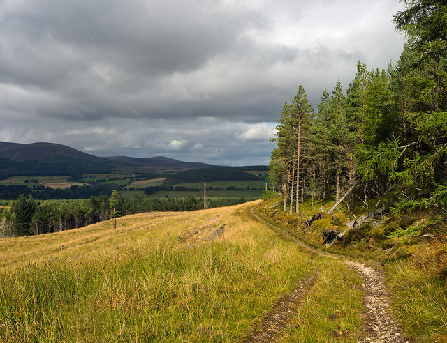
Cnoc Fyrish is a prominent hill located in Ross-shire, a county in the Highland region of Scotland. Rising to an elevation of 397 meters (1,302 feet), it is often referred to as Fyrish Hill. The hill is situated near the towns of Evanton and Alness, just northeast of the Cromarty Firth.
One of the distinguishing features of Cnoc Fyrish is the Fyrish Monument, also known as the Fyrish Obelisk, which stands at its summit. The monument was constructed in 1782 by Sir Hector Munro, a local landowner, and general in the British Army. It was built as a replica of the gates of Negapatam in India, which Munro had successfully captured during his military service. The Fyrish Monument serves as a testament to Munro's achievements and as a local landmark.
Cnoc Fyrish offers stunning panoramic views of the surrounding landscape, including the Cromarty Firth, the Black Isle, and the mountains of the Scottish Highlands. Hiking to the summit of the hill is a popular activity for outdoor enthusiasts, with well-marked trails leading to the top. The path is relatively moderate, making it accessible for walkers of various fitness levels.
The area around Cnoc Fyrish is rich in natural beauty, with diverse flora and fauna. It is not uncommon to spot various bird species and native wildlife during the ascent. The hill is also steeped in history, providing a glimpse into the past through the presence of the Fyrish Monument and the surrounding ancient woodland. Overall, Cnoc Fyrish is a captivating destination that combines natural beauty, historical significance, and outdoor exploration.
If you have any feedback on the listing, please let us know in the comments section below.
Cnoc Fyrish Images
Images are sourced within 2km of 57.696169/-4.3380957 or Grid Reference NH6069. Thanks to Geograph Open Source API. All images are credited.


Cnoc Fyrish is located at Grid Ref: NH6069 (Lat: 57.696169, Lng: -4.3380957)
Unitary Authority: Highland
Police Authority: Highlands and Islands
What 3 Words
///minivans.daydream.lowest. Near Evanton, Highland
Nearby Locations
Related Wikis
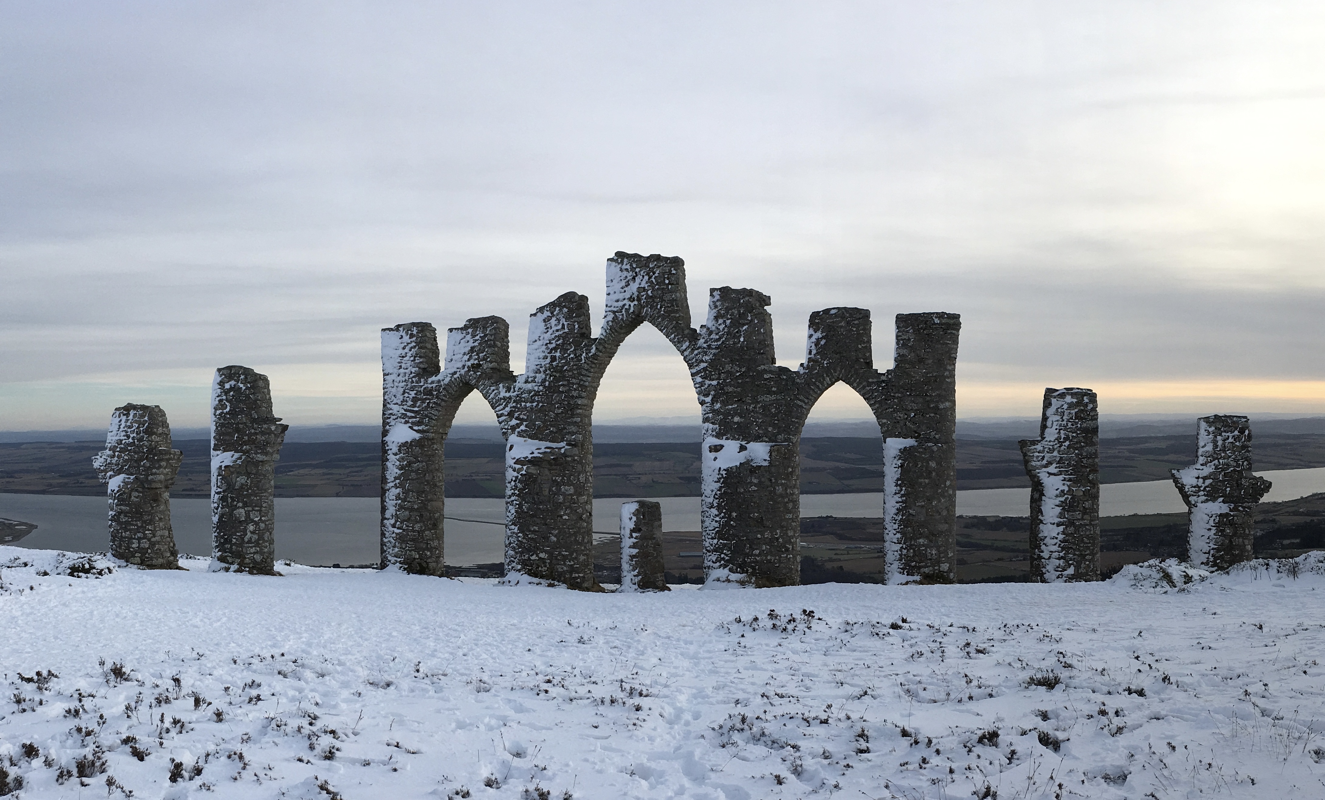
Fyrish Monument
The Fyrish Monument is a monument built in 1782 on Fyrish Hill (Scottish Gaelic: Cnoc Fhaoighris), in Fyrish in Evanton, near Alness, Easter Ross, Scotland...

Fyrish
Fyrish is the name given to an ancient area of land found just north of Evanton, Ross-shire, Scotland. The lands of Fyrish are now part of the Novar Estate...
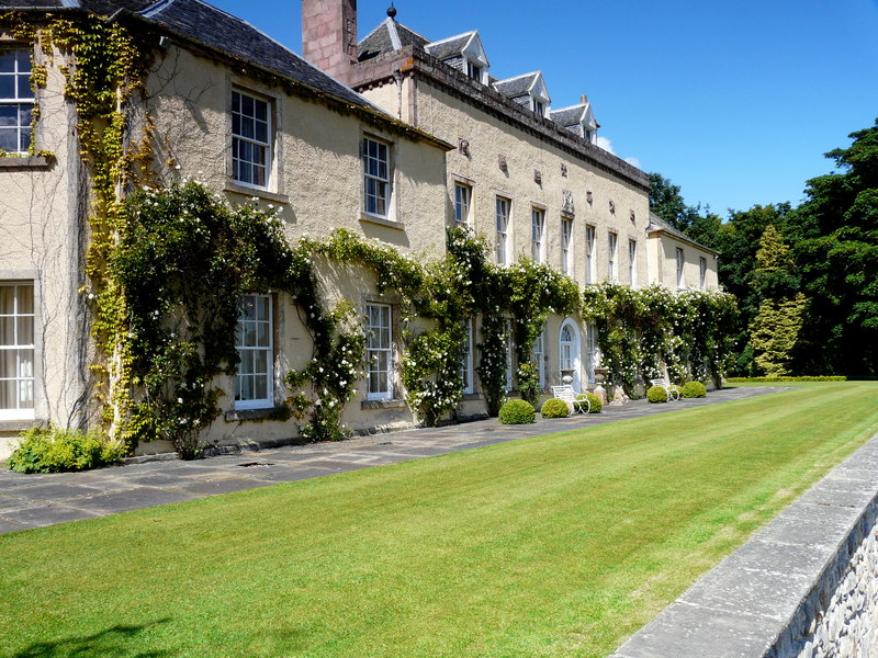
Novar House
Novar House is an 18th-century building, located 0.7 miles north of the village of Evanton in Ross, Scotland. It is built on the site of an earlier castle...

Contullich Castle
Contullich Castle was a castle located a few miles north-west of the town of Alness, on the eastern side of the county of Ross-shire, Scotland. The castle...
Nearby Amenities
Located within 500m of 57.696169,-4.3380957Have you been to Cnoc Fyrish?
Leave your review of Cnoc Fyrish below (or comments, questions and feedback).