Meall nan Eun

Hill, Mountain in Perthshire

Scotland

Meall nan Eun

Minor road near Loch na Lairige
Minor road near Loch na Lairige Credit: Steven Brown

The requested URL returned error: 429 Too Many Requests

If you have any feedback on the listing, please let us know in the comments section below.

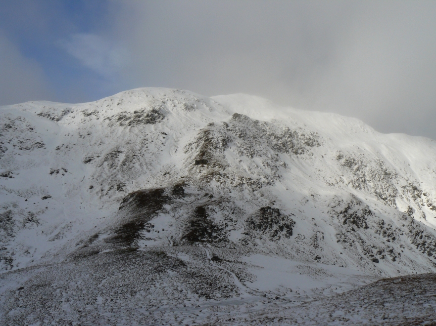
Meall nan Eun Images

Images are sourced within 2km of 56.54965/-4.2892607 or Grid Reference NN5942. Thanks to Geograph Open Source API. All images are credited.

Minor road near Loch na Lairige
Minor road to Glen Lyon
Path near Meall nan Eun
Old Shooting Hut?
Old Shooting Hut?
Path following the fence line up Meall Corranaich
Path above Allt Gleann Da-Eig
Allt Gleann Da-Eig
Allt Gleann Da-Eig
Lochan na Lairige The head of the lochan which is actually a reservoir.
Lochan na Lairige
The head of the lochan which is actually a reservoir.
Peat hags at Meall nan Eun Extremely boggy area of moorland with the lower slopes of Meall nam Maigheach in the distance.
Peat hags at Meall nan Eun
Extremely boggy area of moorland with the lower slopes of Meall nam Maigheach in the distance.
Moorland above Lochan Na Lairige reservoir From the A827 on the northern side of Loch Tay a single track road takes you into the Ben Lawers National Nature Reserve, past Lochan na Lairige and onto open moorland
Moorland above Lochan Na Lairige reservoir
From the A827 on the northern side of Loch Tay a single track road takes you into the Ben Lawers National Nature Reserve, past Lochan na Lairige and onto open moorland
Road looking southeast
Lochan na Lairige
Lochan na Lairige
Hut and ruin A landmark on the Lairig an Lochain, near the summit of the pass.
Hut and ruin
A landmark on the Lairig an Lochain, near the summit of the pass.
Burn, Lairig an Lochain A tributary of Allt Baile a' Mhuilinn which flows into Glen Lyon. Looking up at a cloud covered Tarmachan range.
Burn, Lairig an Lochain
A tributary of Allt Baile a' Mhuilinn which flows into Glen Lyon. Looking up at a cloud covered Tarmachan range.
Coire Buidhe, Meall nam Maigheach A very gentle corrie above the Lairig an Lochain. Coire Buidhes are often gentle, they are named after the dun coloured grasses and are usually popular with deer.
Coire Buidhe, Meall nam Maigheach
A very gentle corrie above the Lairig an Lochain. Coire Buidhes are often gentle, they are named after the dun coloured grasses and are usually popular with deer.
Allt Baile a' Mhuilinn The Lyon side of the Lairig an Lochain.  The burn descends to the Lyon near Bridge of Balgie with Ben Meggernie in the background.
Allt Baile a' Mhuilinn
The Lyon side of the Lairig an Lochain. The burn descends to the Lyon near Bridge of Balgie with Ben Meggernie in the background.
Show me another place!

Meall nan Eun is located at Grid Ref: NN5942 (Lat: 56.54965, Lng: -4.2892607)

Unitary Authority: Perth and Kinross

Police Authority: Tayside

What 3 Words

///crusher.skirt.entrusted. Near Pubil, Perth & Kinross

Nearby Locations

Meall nan Eun

Related Wikis

Meall Corranaich

Meall Corranaich (Scottish Gaelic: Meall Choire Inich) is a mountain with a height of 1,069 metres (3,507 ft) in the Grampian Mountains of Scotland. It...

Meall nan Tarmachan

Meall nan Tarmachan (Scottish Gaelic: [ˈmjaul̪ˠ nən̪ˠ ˈt̪aɾaməxan]) is a mountain in the Southern Highlands of Scotland near Killin just west of Ben Lawers...

Beinn Ghlas

Beinn Ghlas is a mountain in the Breadalbane region of the Scottish Highlands. It lies on the north shore of Loch Tay and is part of the Ben Lawers Range...

Ben Lawers

Ben Lawers (Scottish Gaelic: Beinn Labhair) is the highest mountain in the Breadalbane region of the Scottish Highlands. It lies north of Loch Tay and...

Nearby Amenities

Located within 500m of 56.54965,-4.2892607
Man Made: cairn
Lat/Long: 56.5453753/-4.2890439
Passing Place
Lat/Long: 56.5458642/-4.2928179
The data included in this document is from www.openstreetmap.org. The data is made available under ODbL.

Have you been to Meall nan Eun?

Leave your review of Meall nan Eun below (or comments, questions and feedback).