Creag an Lochain
Hill, Mountain in Perthshire
Scotland
Creag an Lochain

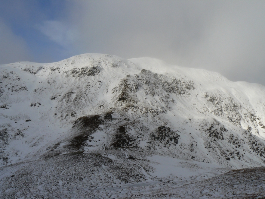
Creag an Lochain is a prominent hill located in Perthshire, Scotland. It is part of the Grampian Mountains and stands at an elevation of approximately 650 meters (2,133 feet). The hill is situated within the Loch Rannoch and Glen Lyon National Scenic Area, surrounded by stunning natural beauty.
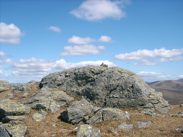
The terrain of Creag an Lochain is rugged and rocky, typical of the Scottish Highlands. The hill offers breathtaking panoramic views of the surrounding landscape, including Loch Rannoch and the nearby peaks of Schiehallion and Ben Lawers. On a clear day, it is even possible to spot the vast expanse of Rannoch Moor.
The ascent to the summit of Creag an Lochain can be challenging, with steep slopes and scree fields to navigate. However, the reward is worth the effort, as the view from the top is truly awe-inspiring. The hill is a popular destination for hikers, mountaineers, and nature enthusiasts, providing an opportunity to immerse oneself in the untouched wilderness of the Scottish Highlands.
Wildlife is abundant in the area, with red deer, golden eagles, and ptarmigan being commonly spotted. The hillside is also adorned with heather and wildflowers during the summer months, adding a splash of color to the landscape.
Creag an Lochain offers a serene and peaceful escape from the hustle and bustle of everyday life, allowing visitors to connect with nature and experience the untamed beauty of Perthshire's mountainous region.
If you have any feedback on the listing, please let us know in the comments section below.
Creag an Lochain Images
Images are sourced within 2km of 56.533293/-4.2932011 or Grid Reference NN5940. Thanks to Geograph Open Source API. All images are credited.


Creag an Lochain is located at Grid Ref: NN5940 (Lat: 56.533293, Lng: -4.2932011)
Unitary Authority: Perth and Kinross
Police Authority: Tayside
What 3 Words
///countries.plotter.prelude. Near Pubil, Perth & Kinross
Nearby Locations
Related Wikis
Meall nan Tarmachan
Meall nan Tarmachan (Scottish Gaelic: [ˈmjaul̪ˠ nən̪ˠ ˈt̪aɾaməxan]) is a mountain in the Southern Highlands of Scotland near Killin just west of Ben Lawers...

Meall Corranaich
Meall Corranaich (Scottish Gaelic: Meall Choire Inich) is a mountain with a height of 1,069 metres (3,507 ft) in the Grampian Mountains of Scotland. It...

Beinn Ghlas
Beinn Ghlas is a mountain in the Breadalbane region of the Scottish Highlands. It lies on the north shore of Loch Tay and is part of the Ben Lawers Range...

Ben Lawers
Ben Lawers (Scottish Gaelic: Beinn Labhair) is the highest mountain in the Breadalbane region of the Scottish Highlands. It lies north of Loch Tay and...
Beinn nan Oighreag
Beinn nan Oighreag (910 m) is a mountain in the Grampian Mountains of Scotland. It lies between Glen Lyon and Glen Lochay, on the border of Perthshire...

River Dochart
The River Dochart (Scottish Gaelic: Dochard) is in Perthshire, Scotland. Coming from Ben Lui, it flows east out of Loch Dochart and through the glen of...

An Stùc
An Stùc, meaning "The Peak" in Gaelic, is a conically shaped Scottish mountain in the Ben Lawers range to the north of Loch Tay. It has been listed as...
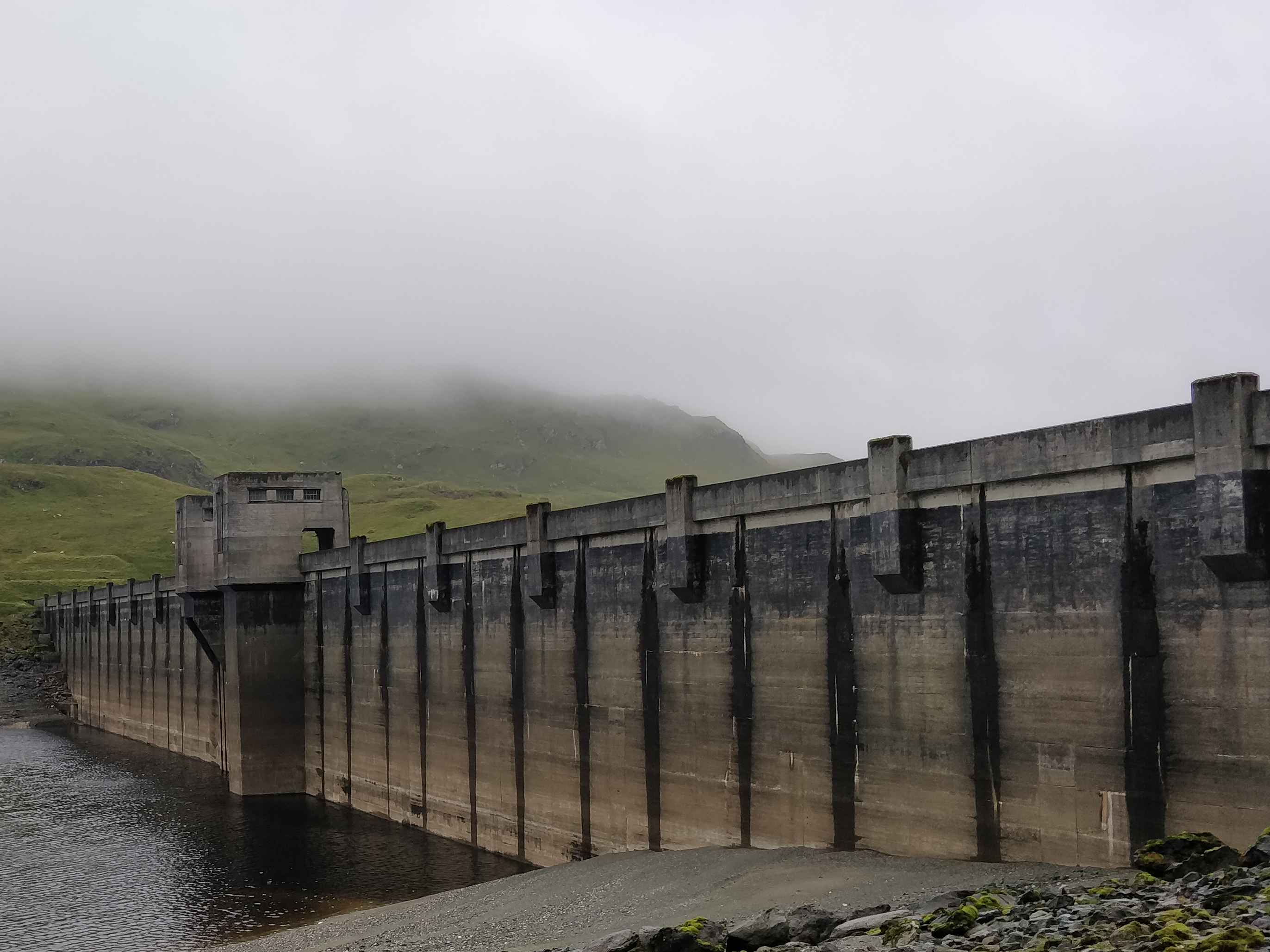
Breadalbane Hydro-Electric Scheme
The Breadalbane Hydro-Electric Scheme is a hydroelectric scheme in the Breadalbane area of Perthshire, Scotland. It comprises seven power stations which...
Nearby Amenities
Located within 500m of 56.533293,-4.2932011Have you been to Creag an Lochain?
Leave your review of Creag an Lochain below (or comments, questions and feedback).