Creag Ruadh
Hill, Mountain in Ross-shire
Scotland
Creag Ruadh

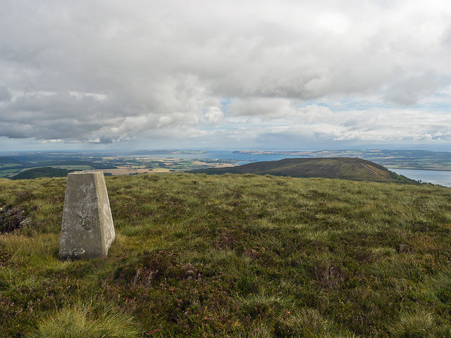
Creag Ruadh is a hill located in Ross-shire, Scotland. It stands at a height of 493 meters (1,617 feet) above sea level and is known for its stunning panoramic views of the surrounding landscape. The hill is part of the larger Ben Wyvis range and is a popular destination for hikers and outdoor enthusiasts.
Creag Ruadh is characterized by its rugged terrain, with steep slopes and rocky outcrops that provide a challenging yet rewarding climb for those who make the journey to its summit. The hill is covered in heather and grasses, and is home to a variety of wildlife including deer, birds of prey, and other mountain-dwelling creatures.
The summit of Creag Ruadh offers breathtaking views of the surrounding countryside, including the Cromarty Firth and the Black Isle. On a clear day, it is possible to see all the way to the Moray Firth and the distant peaks of the Cairngorms.
Overall, Creag Ruadh is a beautiful and impressive hill that offers a great outdoor experience for those looking to explore the Scottish Highlands.
If you have any feedback on the listing, please let us know in the comments section below.
Creag Ruadh Images
Images are sourced within 2km of 57.688812/-4.3683927 or Grid Reference NH5869. Thanks to Geograph Open Source API. All images are credited.


Creag Ruadh is located at Grid Ref: NH5869 (Lat: 57.688812, Lng: -4.3683927)
Unitary Authority: Highland
Police Authority: Highlands and Islands
What 3 Words
///mass.followers.cubed. Near Evanton, Highland
Nearby Locations
Related Wikis
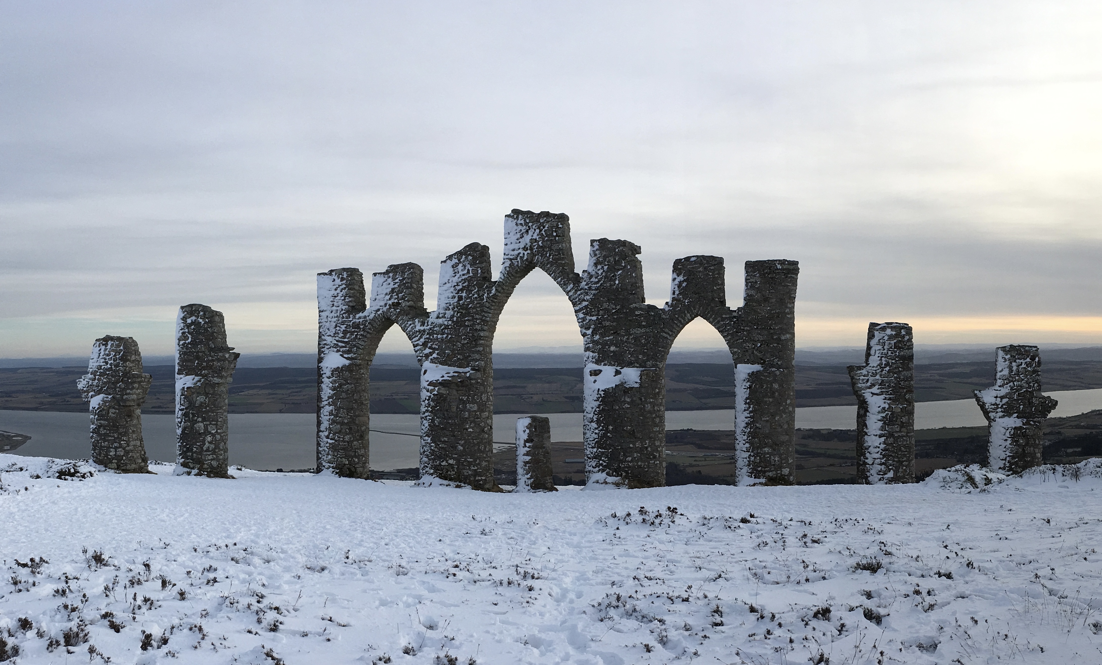
Fyrish Monument
The Fyrish Monument is a monument built in 1782 on Fyrish Hill (Scottish Gaelic: Cnoc Fhaoighris), in Fyrish in Evanton, near Alness, Easter Ross, Scotland...
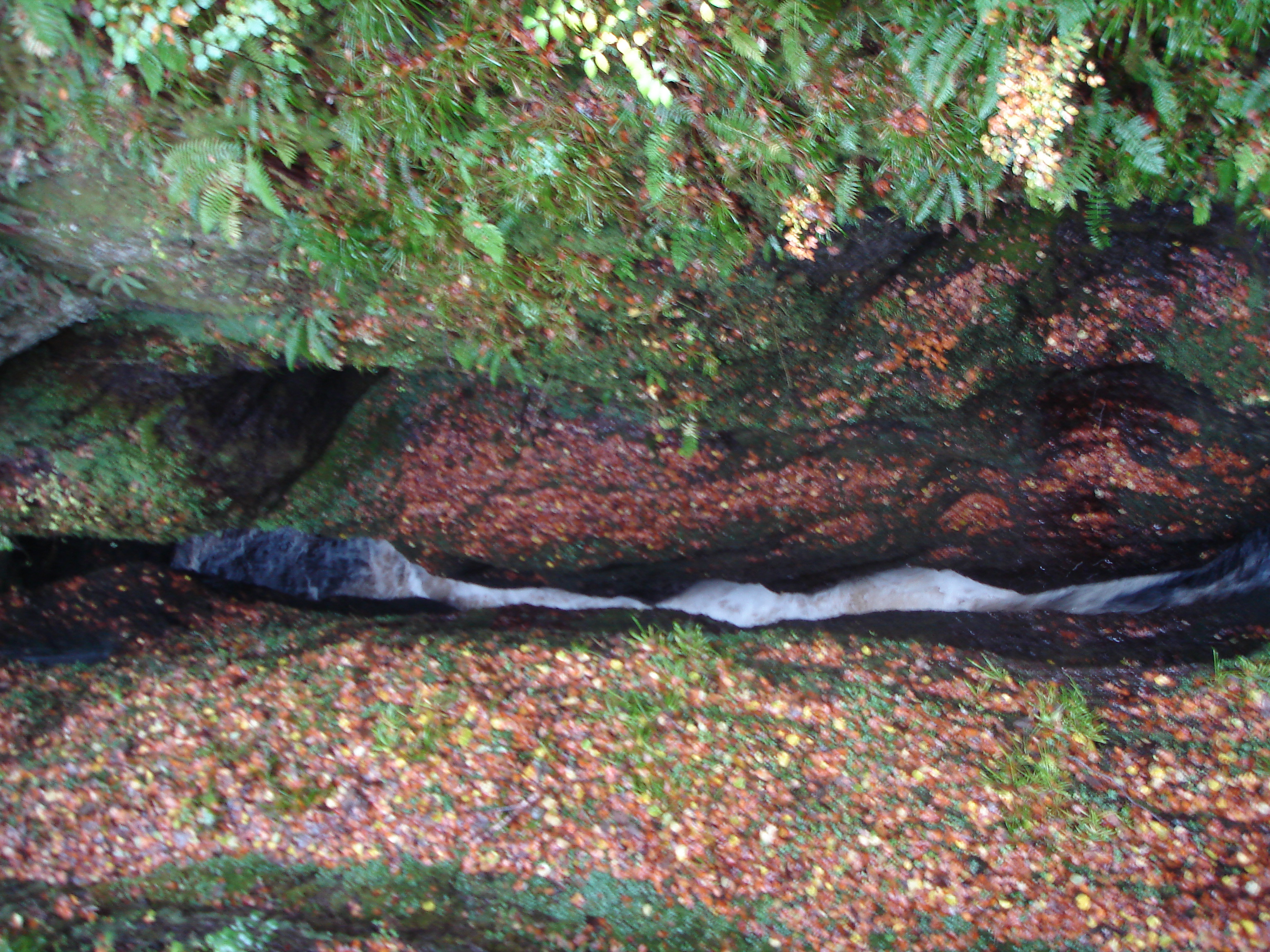
Black Rock Gorge
Black Rock Gorge is a deep and narrow cleft in Old Red Sandstone conglomerate through which the Allt Graad (also known as the 'River Glass') flows in Easter...
Allt Graad
The Allt Graad (Scottish Gaelic: Allt Grànnda: Ugly Stream) or River Glass is a river in Easter Ross, Highland, Scotland. It is named on Ordnance Survey...
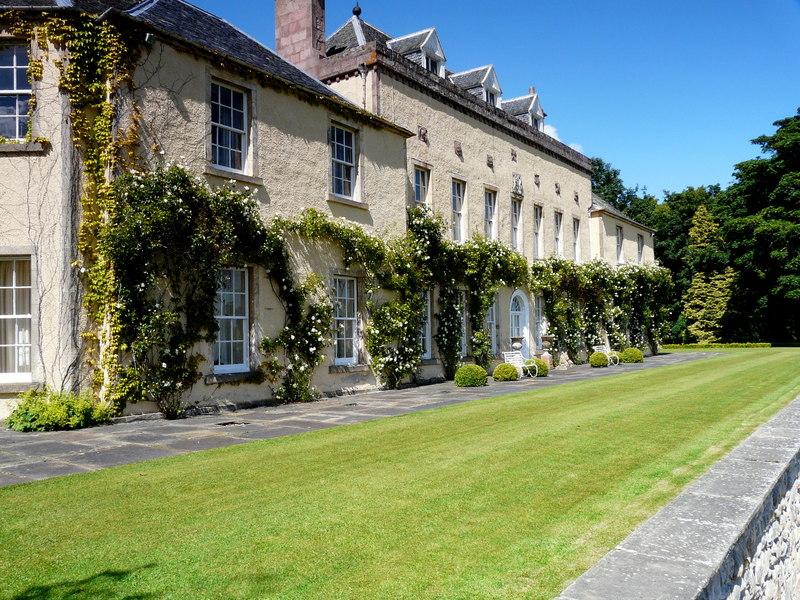
Novar House
Novar House is an 18th-century building, located 0.7 miles north of the village of Evanton in Ross, Scotland. It is built on the site of an earlier castle...
Have you been to Creag Ruadh?
Leave your review of Creag Ruadh below (or comments, questions and feedback).